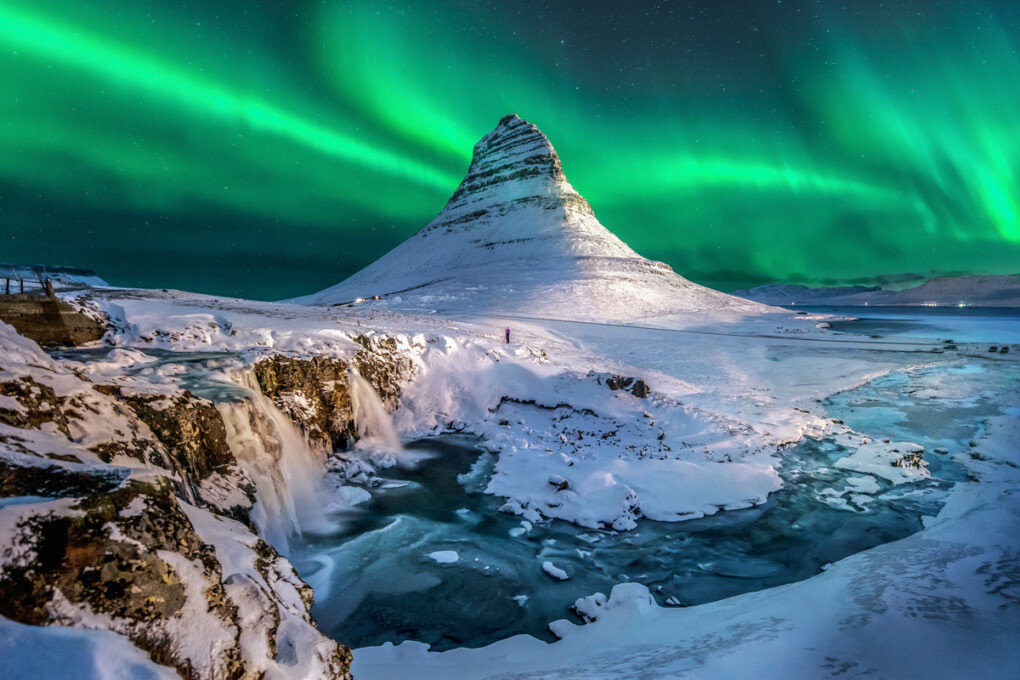
Volcanic Winter
-
Posts
1,332 -
Joined
-
Last visited
Content Type
Profiles
Blogs
Forums
American Weather
Media Demo
Store
Gallery
Posts posted by Volcanic Winter
-
-
Unreal! So jealous, but so pumped for you guys!
-
 1
1
-
-
Think I’m going to be extremely lucky to snag even a half inch, have to laugh. Looks like a persistent dry slot right over northern Ocean. It’s barely moved from this area lol.
I suppose this is penance for doing well in the Jan storms.
-
2
-
-
5 minutes ago, Will - Rutgers said:
Congrats dude!
-
1
-
 2
2
-
-
5 minutes ago, Monmouth_County_Jacpot said:
lol you ain’t lying no snow here in Howell
Same, got absolutely nothing so far lol.
-
Very light snow starting in inland TR / Manchester area. Temperature creeped up to 34/25, was below freezing. Should cool down as it picks up.
-
1 minute ago, Allsnow said:
Very heavy snow under this band. 3-4 already
Yeah that band looks insane. Congrats.
-
2
-
-
Not snowing yet down here, went from being in a good spot to probably being in a screw zone. Is what it is, probably going to be up to see what falls as I’m having some insomnia tonight anyway. May as well stay up and see the (hopeful) snow.
-
1
-
-
9 minutes ago, donsutherland1 said:
Its low temperature is 14°. If that holds, it would be the warmest such minimum temperature on record. The record of 13° was set during Winter 2001-02. 2019-20 had a winter minimum reading of 12°.
The winter mean temperature through February 15th is 36.9°, which is tied with 2022-23 for 4th highest through February 15th. The warmest winter was 2001-02 with a mean temperature of 37.9°. The current winter will become the seventh winter with a mean temperature of 36° or above. Six of those winters will have occurred since 2000. Winter 1932-33 is the lone exception.
You’re a treasure Don, thank you.
-
1
-
-
What is Boston’s low temperature on the winter, Don? Seems like they’ve been in the same boat with temperatures, maybe even a bit more-so than I would’ve anticipated. My winter low is only 17, average at the end of Jan is 20… Absolute struggle to even get near it.
Also what is Boston’s DJF average thus far?
Thanks, much appreciated!
-
Nice little event (hopefully). Should get me into double digits on the season.
-
2
-
-
1 hour ago, Nibor said:
It's fine, once the AMOC stops all you have to do is survive the ecological disaster and then we'll have more snow in North America again.
The AMOC shutting down abruptly would wildly disrupt monsoon cycles and lead to major agricultural failure. Whatever the actual acute temperature impacts on North America (lesser) and Europe (greater), it would be a catastrophe for many other reasons.
There was a concerning paper last year stating collapse could occur between 2025 and 2090 which is considerably sped up from timelines running on older data. Doesn’t mean they’re inherently correct, but it’s concerning (IMHO).
-
1 hour ago, bluewave said:
You can quote my whole post from above if you like. But I don’t want to get misquoted in one of our other regional forums.
I have seen you, in general, be misquoted and have statements attributed to you that I’ve not seen you make in various other subforums this year. So you’re not wrong, I’ve seen it.
-
20 minutes ago, mattinpa said:
I will say he has a lot of weather knowledge. I used to think he just wanted to put down snow lovers, but lately he has been showing more that he does want us to enjoy our snow. He can just be uncomfortably honest.
He’s a bit cheeky.
We all have our quirks lol.
-
1
-
-
Just now, LibertyBell said:
4:1 to 6:1
when you went inland it was more like 8:1
Man, if this were a 10:1 event…
-
1
-
-
Snowman has been a great poster this year, I followed him over in the El Niño thread and he had some excellent insight and general contribution.
-
4
-
-
5 minutes ago, Brian5671 said:
Shows you how awful it's been. Our last good pattern was 3 yrs ago. (no, I don't consider Jan 2024 good-it was an 8-9 day island in a sea of torch.)
Jan 22 was good, but unfortunately not uniformly so for everyone. I rate it higher though not just because of 1/29 but also the relatively sustained NN - BN temps.
It’s admittedly a perspective and opinion thing because I actually appreciate cold in winter even if it’s not served with significant snowfall.
-
20 minutes ago, JenkinsJinkies said:
They were seen in 2021, the volcano was 2022.
and @Maestrobjwa
Volcanic climate forcing can be anywhere from 2-4 years with some trailing effects for bigger (or more gaseous) eruptions. The primary constituent of HTHH’s mesosphere-reaching eruption column was water vapor, an anomaly for eruptions at borderline VEI 5/6 level (typically the size needed for impacts).
With that said, the sulfur output was low and water vapor was high relative to the norm. There have been a few papers published about the water vapor and potential effects; I genuinely can’t answer for how much influence or disruption it may have had or is still currently having.
I do believe it’s fair to say there is a real possibility of some continued impact, especially as papers I’ve reviewed suggest water vapor lingers longer than traditional volcanic aerosols.
Unfortunately I believe the most insight will be gained with retrospective analysis as there is no modern, recorded analogue to Hunga Tonga Hunga Ha’apai’s eruptive style + size (roughly Pinatubo size but with enormously different constituent gas makeup).
-
3
-
-
3 minutes ago, NEG NAO said:
yes in that range lower in some areas
Suggests that yesterday’s event was close to a major storm, if it were only a tad slower and a bit colder.
Still, it worked out for many of you up north substantially and I’m thrilled that was the case.
-
Just now, NEG NAO said:
This probably doesn't fully take into account the higher snow ratios this time around - just like yesterdays clown map output doesn't take into account the lower ratio's this storm will have at least 12:1 ratio and possibly as high as 15:1 in some areas
What was the ratio in NNJ / NY state for yesterday’s storm? Something like 8:1?
-
I’d like to crack double digits so I’d take this happily. Hoping we end up with a legit chance for something in that 22nd-ish window.
-
1
-
-
I’m an 9 on the season, infinitely better than last year.
-
3 hours ago, SnowGoose69 said:
Decent chance if this makes a direct hit many places would do marginally better than they did today
Yeah, haven’t posted much about it because this was a great event for the northern tier of the metro, but today stunk for me given the runs yesterday and 2-5 WWA I was under. Barely got an inch that melted as it was falling. I wasn’t expecting anything from this anyway until the great model gesundheit yesterday which lured me in.
Regardless, tough for me to do well in a marginal set up - no doubt. This was a great event for the metro and I’m thrilled for everyone who got a great snowfall out of it.
Onto the next!
-
Always difficult to transition back to reality after tracking a nice event. Really hoping we can do this one more time with what remains of winter, at least. Regardless of results. Thrill of the chase.
-
4 minutes ago, NittanyWx said:
The winner ended up being that merritt/287/91/84 box after all. The loser is me for bitching out about it last night after the HRRR. Shoulda stuck with original call.
This was a tough one, didn’t envy the meteorologists making calls yesterday. What do you do when the models show sudden drastic shifts, almost completely in unison? Yeah, tough one.
Refresher snow & obs between ~midnight and Noon Sat Feb 17 2024
in New York City Metro
Posted
Makes tons of sense, thanks for the explanation. I couldn’t even believe my eyes when I saw that band set up shop on radar. Was just blisteringly apparent that was real deal snowfall and would likely be the main event.
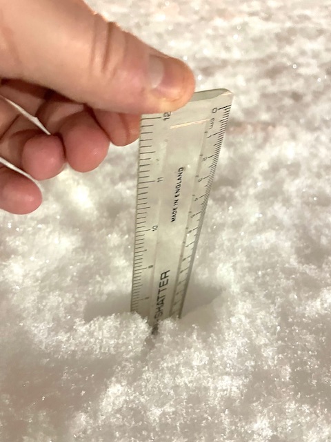
Still no accumulation here outside a few flakes on grass with very low rates.
Living vicariously through these insane pics so keep em coming!
@Allsnowwhat you got man? Share a pic!