Volcanic Winter
-
Posts
1,332 -
Joined
-
Last visited
Content Type
Profiles
Blogs
Forums
American Weather
Media Demo
Store
Gallery
Posts posted by Volcanic Winter
-
-
10 hours ago, LibertyBell said:
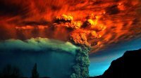
1784: Ice floes were spotted in the Gulf of Mexico after passing out the Mississippi River in February 1784. Ice blocked the river in New Orleans, Louisiana. The ice in New Orleans is one of two times that this occurred during the Great Arctic Outbreak of 1899. The eruption of Laki in Iceland from June 8, 1783, through February 7, 1784, is the likely cause for the severe winter of 1783 - 1784.
1899 - Texas and the eastern plains experienced their coldest morning of modern record. The mercury dipped to 8 degrees below zero at Fort Worth TX, and to 22 degrees below zero at Kansas City MO. The temperature at Camp Clarke NE plunged to 47 degrees below zero to establish a record for the state. In the eastern U.S., Washington D.C. hit 15 degrees below zero, while Charleston SC received a record four inches of snow. (David Ludlum)
1899: The bitter cold outbreak of February 1899 continued across the southern Plains, Texas, and the Deep South. The mercury dipped to 8 degrees below zero at Fort Worth, Texas, and 22 degrees below zero at Kansas City, Missouri. Nebraska’s temperature at Camp Clarke plunged to 47 degrees below zero to establish a state record. The all-time record low for Oklahoma City was set when the temperature fell to a frigid 17 degrees below zero, breaking the previous record low of 12 below zero, set on the previous day. Washington D.C. hit 15 degrees below zero, while Charleston, SC, received a record four inches of snow. Snow was also reported in Fort Myers, Tampa, and Tallahassee in Florida. Click the links for additional information from the National Centers for Environmental Information and Florida Memory.
Wow it's interesting that a volcano in Iceland named Laki is listed as the reason behind the very severe winter of 1783-84. I wonder why the volcanoes that erupt in Iceland now don't have that kind of effect? And why do people say we need volcanoes in the tropics do it when Laki quite clearly was not and had a much larger effect than volcanoes like Tambora, El Chichon and Pinatubo?
Also what caused the extreme arctic cold of 1898-1899, 1917-1918 and 1933-1934?
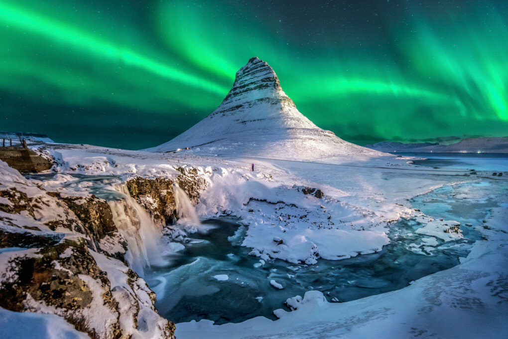
Laki was an effusive mega drain-out of the Grímsvötn subglacial volcano within the Vatnajökull icecap. The same volcano that erupted explosively in 2011 to VEI 4 level (was actually fairly close to borderline VEI 5 level; it was a large event).
The Laki eruption was an *enormous* rifting fissure eruption southwest of the icecap, it poured out 15 cubic kilometers of extremely sulfurous magma and had explosive components. The total sulfur output was like 120Tg’s (compared to 20 for Pinatubo). Not all of it reached the stratosphere due to it being predominantly effusive, but a lot did likely on intense thermal updrafts, and the eruption did have some explosive components mixed in. The fissure system for this eruption was over 80km in length…
It was the third biggest effusive rift eruption in postglacial Iceland. A cloud of sulfur gas stuck in the troposphere was swept over to Europe and caused a lot of illness and death. In Iceland it was catastrophic for the local population. Can’t overestimate how substantial this event was, in terms of both local and global impact. And yes, there were known climatological impacts from this event.
-
Monmouth Co getting shellacked right now.
-
 2
2
-
-
Finally have moderate to heavy snow down here, temps at 32 the past 45 min or so. Sticking nicely and starting to pile up. Good returns nearby, should make up some ground the next couple hours. I’ll be very pumped for a few inches here with this. (Not at work up north today, been off since last week - home for this).
-
1
-
-
39/37 here with some light rain beginning. Temps started decreasing a bit.
-
Just now, Allsnow said:
Positive snow depth change on the HRRR

Sold, I’ll take it.
Enjoy your snow dude.
-
2
-
-
1 minute ago, milleand said:
Winter storm warning issued for Monmouth County
Yeah. Finally shifted things south and threw me a WWA.
I’ll be very happy to receive 2-4 here. I’m 10 miles inland from the ocean so usually in a decent spot for the area.
-
1
-
-
WWA for Ocean finally and WSW for Monmouth. Got the alert just as I checked out for a bit lol.
-
Enjoy the snow guys, they’re still forecasting basically all rain to me so I’m going to nope out instead of letting myself ride this into disappointment.
So happy this is breaking right for the city at least!
-
2
-
-
1 minute ago, MJO812 said:
Agree
Enjoy it dude. Well earned.
-
1
-
-
3 minutes ago, Allsnow said:
Haha. Idk
3-6 is a good forecast for NYC
What do you think for me in interior northern Ocean? Models have been kind but officially it’s all rain. Thermals will for sure be an inhibitor. 1-3 on grass realistic? Not sure what to expect at this point.
-
I’m still officially forecasted for nothing but rain, it’s frustrating. Trying to be realistic but every model has me getting something, absolutely not expecting big totals in northern Ocean regardless of what any model shows, but a nice 2-4 would go down easily this winter.
-
Looks like Monmouth in a WWA now, still nothing for Ocean. 2-4. If Monmouth gets 2-4 I can’t see northern ocean getting nothing. We’ll see what happens for those of us at the southern extent of the metro.
-
Just now, MJO812 said:
Post more and agree.
I like 3-6 for NYC with the lower amounts in southern sections of the area.
Good luck man, hope this works out decently for the city.
-
2
-
-
Just now, Stormlover74 said:

Thank you, not rooting for this because it screws literally everyone else. I’d take and be ecstatic with 1-3/2-4 and I’m still not convinced that’s truly in the cards. Would feel better to see that reflected in an official AFD.
But FWIW this reads “out to lunch” IMO.
-
1
-
 1
1
-
-
1 minute ago, MJO812 said:
Euro south again
Map me good sir, unable to check at the moment.
-
6 minutes ago, EastonSN+ said:
Looks like UKIE nudged south again.
Lmao congrats me, nah that’s a sell.
-
1
-
-
Looks like they’re being very cautious expanding the WSW / WWA’s southward which suggests low confidence in the models depicting a great CNJ - NYC hit and or just a very conservative approach until right before game time given the shifts. Curious ultimately how hard they bite in the next few hours.
-
GFS mauls me.
Not doing it, not getting roped in. Enjoy the snow!
-
1
-
-
4 minutes ago, RU848789 said:
Think TWC forecast is the best I've seen and they've really gotten much better the past several years (remember, they were the only ones who nailed Jan-2015) with some very good mets and model discussions these days. I think the NWS adustments at 4 am were in the right direction, but not enough, especially towards 276/195 and the coast, where I think TWC is likely to be better. We'll see of course.

The southern edge of that is probably too optimistic. Don’t think I’m seeing 1-3 here (TR / Manchester border).
-
3 minutes ago, weatherpruf said:
So....who wants to bet Freehold ends up with the jackpot?
I don’t think so, I think you guys are set. Monmouth / northern Ocean going to be too marginal temp wise, at least from the soundings I was looking at.
If I see a couple flakes on the grass I’ll consider it a win. Hoping you guys get the goods though, positive changes for sure.
If only the airmass was a bit less crap this woulda been fun for me too, but oh well. It’s been extremely warm, not unexpected. All the more if most of you see a significant storm out of this it’s a massive win with how things have been going.
-
1 minute ago, MJO812 said:
Hrdps
Cut some but still a nice storm


I’d take that all day down here, but I just don’t see it happening (for me, you guys hopefully rock this one).
-
Look at me down here with my 7-8 on the season
 , I can’t believe NYC didn’t do better that week. FWIW I think the bit of latitude NYC has on me will help the rest of the season because I do not see the remaining couple weeks as a suppression risk. In my personal opinion with the block trending weaker and the tendency of so many storms to cut or favor northern areas, I still think it’s less likely I accumulate anything or much else, but that NYC still has a chance (could be wrong, just my thoughts at a glance as I haven’t been following things too closely right now).
This season probably should’ve been a bit better for all of us regardless of the super / strong Niño but was thwarted by Pac warmth / MJO activity and the overpowering jet. How many systems now would’ve performed for all of us were it simply colder (including VDay coming up)? So frustrating.
Regardless I’m still hoping the city breaks double digits. I’d like my patented work storm / snow commute (I’m the odd lunatic that enjoys driving in snow, and a lot of my favorite storms I experienced at work just west of the city).
-
32 minutes ago, LibertyBell said:
Why is the enthusiasm so low though?
Is everyone taking a wait and see approach?
Looking to see how much multimodel support there is for this.
Can only speak for myself but I’m just worn out, and right now focusing on my little bday trip tomorrow to VT.
If any of these really end up locking in and we’re staring down a legit MECS, I’ll be over the moon. Until then I’m remaining cautious.
Everything is still very far out there in time, as has been the case for a while tracking this pattern shift. So my comfort won’t increase until we’re into the middle of next week and staring down similar runs.
-
1
-
-
49 minutes ago, Allsnow said:
Still think early next week is for NNE. As of now, I like the President Day Weekend threat.
I’m going to be in Stowe Friday - Tuesday, of course I timed it perfectly for a massive thermal spike
 . Consolation prize would be some kind of snow before we head home, should that work out for up there. It does look like the worst of the heat spike avoids as far north as Stowe is, thankfully.
Supposed to be hiking / snowshoeing, and definitely hitting The Alchemist brewery (which works regardless of the weather, a nice bday present!).
-
1
-


2/13 Significant/Major Winter Storm Discussion & Observations
in New York City Metro
Posted
Have a super low ratio inch down here, still snowing nicely but having trouble sticking. Temps ticked up to 33 from about 32.5 earlier this morning.
Considering prior to the great model gesundheit of yesterday I wasn’t even expecting to really see flakes, I’ll take it. My property is all white and pretty, which is what we’re here for. This would put me at like 8-9 on the season, hopefully grab another inch or two before it exits but we’ll see.
Glad this really worked out for many!