SolidIcewx
-
Posts
1,577 -
Joined
-
Last visited
Content Type
Profiles
Blogs
Forums
American Weather
Media Demo
Store
Gallery
Everything posted by SolidIcewx
-

-
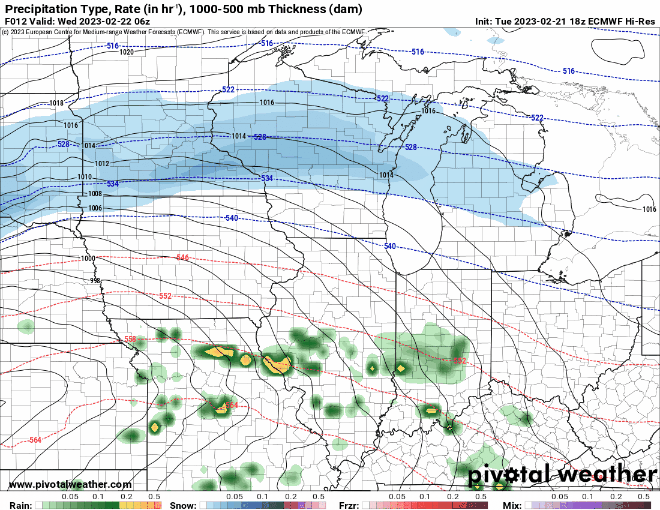
On the wish list is a thunder ice storm. Wonder if the rain switch over will verify
-
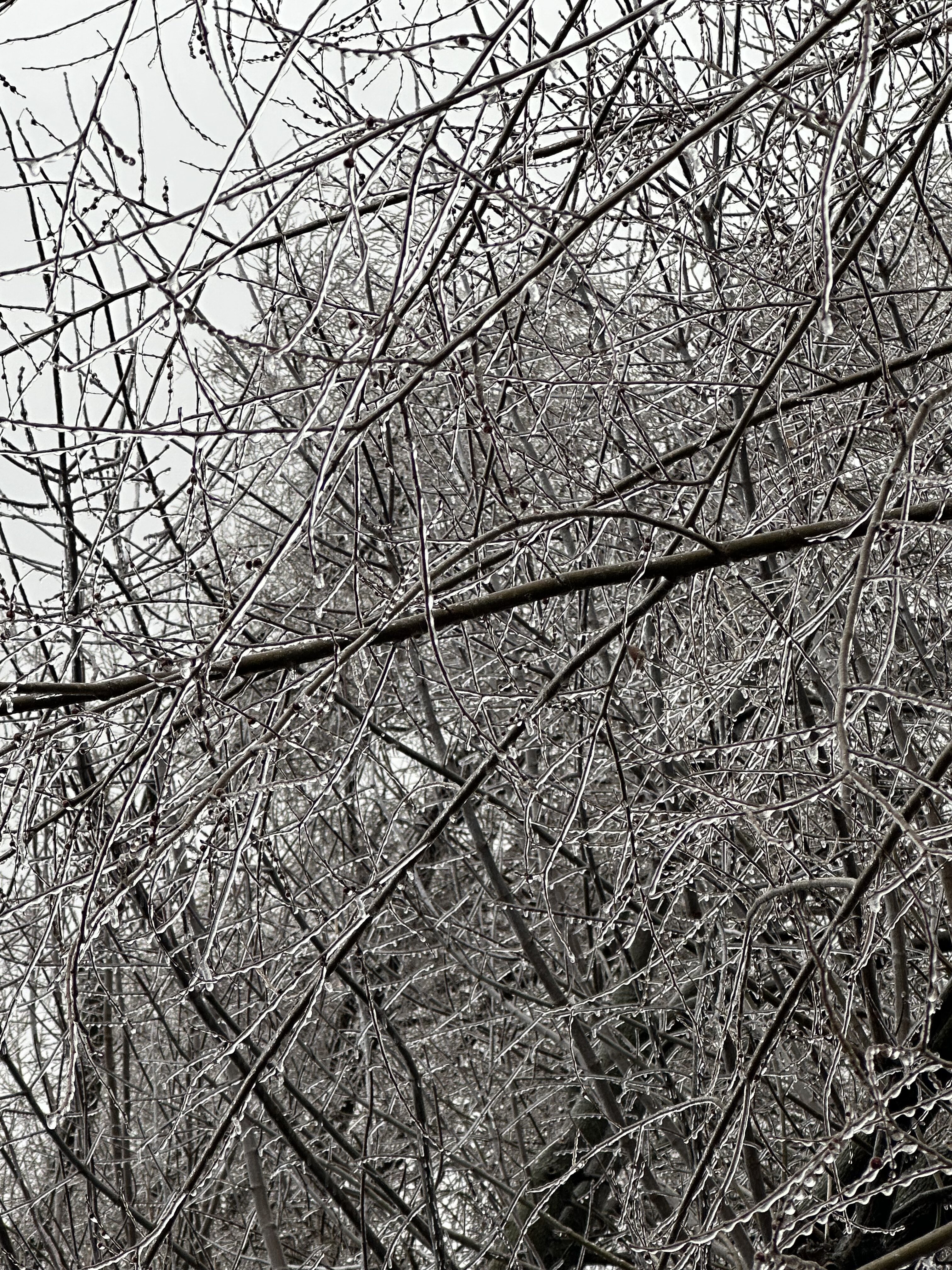
Pic might not do justice but definitely .2 roughly so far. Trees really creaking with the ice
-
31/28 here in canton as I sit here waiting for the ice storm warning
-
Dew points still hovering around 27. Kinda interesting their still low
-
freezing rain here trees looking shiny
-
Could be on a planet where it’s 2000C and it’s raining molten iron
-
I’m terms of ice potential what set of models do better the global or short range?
-
That dry a lot could help the situation a bit but If it’s just drizzle then we will have more issues
-
Hourly shows temps in canton around 29 that’s some trouble
-
I’ve been siding with global models just due to sheer consistency since last weekend.
-
Got the first flakes let’s see how long it stays around
-
Colder this morning by 2 degrees at 29 imby and noticing the hourly has it mostly at 30. Going to be an interesting day for sure . I’ll be raining out unless I get called to storm work
-
Looks like it’s time to pay our taxes due
-
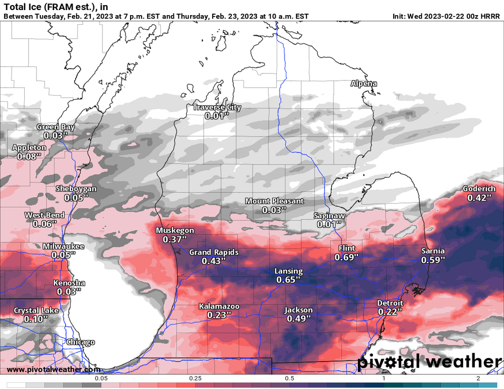
Then you get Euro crushing I94 if temps hold down
-
Sun shines on the dogs ass once in awhile
-
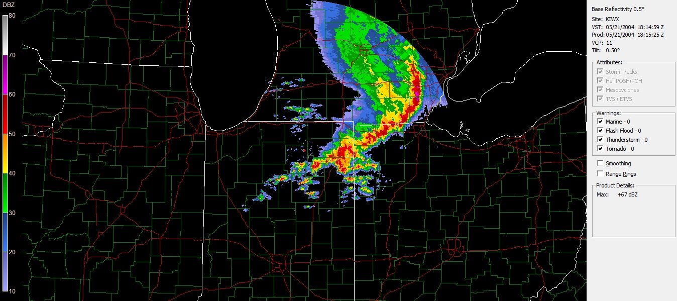
00z Hrrr now has ice amounts flirting with warning territory for Wayne county
-
that’s on my mind too Thursday morning if cooler trends prevail
-
Let’s get the ice skates out
-
Lol WWA for Wayne county
-
I’d be okay with some ice as long as it melts off fast before major accretion occurs. Makes for some pretty pics at least
-
Folks in southern lower Michigan including myself.

-
DTX going with nam solutions in their WSW it seems
-
On the plus side for I94 folks and north is that it goes to rain and warms into the upper 40s before it drops again Thursday night
-
That was quite the read. Interesting language they are using. I work for a power company in SE mich and how some of our power lines look and some of the 60 year old poles we have. The area would be in for some deep trouble if current forecasts hold