SolidIcewx
-
Posts
1,577 -
Joined
-
Last visited
Content Type
Profiles
Blogs
Forums
American Weather
Media Demo
Store
Gallery
Everything posted by SolidIcewx
-
Or distribution lines and service drops downed
-
Even cactus are dying. Heat island effect is not allowing the cacti to transpire at night for their photosynthesis cycles because of the constant heat. Crazy honestly
-

2023 Short/Medium Range Severe Weather Discussion
SolidIcewx replied to Chicago Storm's topic in Lakes/Ohio Valley
It’s definitely pure jet fuel that’s for sure. I’ll be back home tomorrow so hope for a good storm at least even tho the area has taken a beating as of late. 00Z is Hawt -
Yeah he is by the looks of it. Supercell in Ontario still going strong and warned on. Long track supercells that far north are intriguing as hell
-
2023 Short/Medium Range Severe Weather Discussion
SolidIcewx replied to Chicago Storm's topic in Lakes/Ohio Valley
May 8th 2009 style? -
2023 Short/Medium Range Severe Weather Discussion
SolidIcewx replied to Chicago Storm's topic in Lakes/Ohio Valley
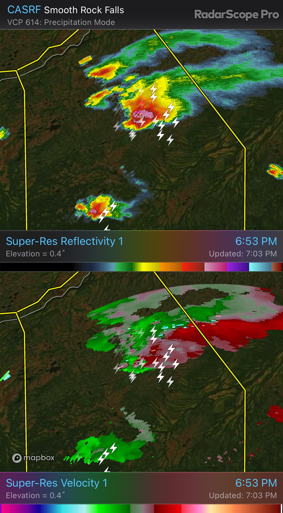
I know this is northern Ontario but damn that’s one hell of a storm probably supercell up there way in the boondocks.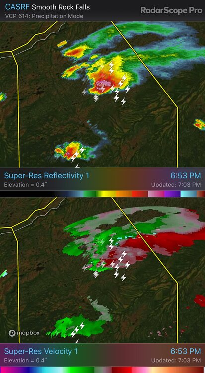
-
@Lightning if your still up there looks like your about to have another round of fun
-
Went to Lake Huron last weekend and it was really warm. Especially the surface water was quite surprised and I have been going to that lake for awhile now
-
Someone needs to point the blow torch towards alek
-
91/71/99 here practically cooked outside. Been awhile since I needed to change clothes on the job. Wonder what that 82 degree dew feels like sweet baby Jesus that more moist than the air in a locker room with a sauna
-
80/74/86 now at my current location. Already soaked and the sun is strong. No clouds in sight either Edit: they want us to wear class 3 high vis but I’m being a rebel with a class 2 vest. A bit cooler
-
You in a tent? Hopefully got your tarp out latched down lol. Looks like a good storm glad you get some action!
-
76/73 right now the start of a fun work day outside. Hopefully some clouds come in to block the sun a bit
-
Hoping it sinks to Lima will make for some good sleepin
-
Set up looks nice for some nocturnal thunder and lightning tho
-

-
88/72/96 here with cape values about 2500j/kg let’s see what can get going. Air really chunky like soup now
-
Back to sunny here in Lima hope it helps destabilize
-
I wonder if me having only showers sets me up good for later
-
That’s what I’m hearing from coworkers up there with DTE and tree crews I’ve worked with
-
Got some cloud cover out of the showers I’m happy with that since I work outside till 530
-
FaceTimed with my fiancé as it was rolling in. Power was flickering at home even before the shelf rolled in. Got lucky again this time
-
Don’t know what this rain shower bullshit is out to my west but it can kick rocks. If there is no thunder I don’t want it
-
Hotter than a hookers door knob on a Friday night in Vegas eh?
-
2023 Short/Medium Range Severe Weather Discussion
SolidIcewx replied to Chicago Storm's topic in Lakes/Ohio Valley
It’s like pulling power ball numbers when it comes to what your gonna get this time of year. Been a fun past couple weeks