-
Posts
70,760 -
Joined
-
Last visited
Content Type
Profiles
Blogs
Forums
American Weather
Media Demo
Store
Gallery
Posts posted by MJO812
-
-
-
Just now, WinterWolf said:
Interesting….block, and convection/or lack there of causing changes?
Convection always gives the models headaches.
-
 1
1
-
-
1 minute ago, WinterWolf said:
Still trending…right up to go time, seems to be a trend this year.
Feeling the block
Last minute south bumps
Enjoy the snow
-
 1
1
-
-
Nam is coming in south
-
 1
1
-
-
Damn no one knows what today is

-
 1
1
-
-
Huge Blizzard for DC northward next week. Get ready.
I'm buying a shovel and salt
-
 1
1
-
 2
2
-
-
Huge Blizzard for DC northward next week. Get ready.
I'm buying a shovel and salt
-
 1
1
-
 1
1
-
 3
3
-
 4
4
-
-
-
Congrats Rooster country
-
Just now, ariof said:
NAM runs the low straight up the Connecticut River Valley like the GFS did at 18Z.
Great run for Adirondacks northward.
-
Nam is more NW
-
 1
1
-
-
15 minutes ago, 40/70 Benchmark said:
Zzzzzzzzzz
This storm is weaker on the models until it gets to New England. A nothing burger for the majority.
-
 1
1
-
-
Just now, 40/70 Benchmark said:
It seems like every event we get a lecture about how it would have been through Montreal without it, but instead its 34 and rain. I think frankly I am all set with it.
Welcome to my climo

-
2 minutes ago, LibertyBell said:
and of course snowman19. He was actually more gungho about February and he ended up being right about the one decent snowfall we did get, which was in February.
But snowman19 also forecasts no snow so is that a compliment?
-
1 minute ago, Brian5671 said:
The warning signs were there early this year
1. December warmth was much more widespread that many predicted
2. The pattern change delay into mid Jan. And even at that, you could see modeling returning the warmth very quickly-so it was only 8-9 days
3. The Feb pattern change was more of the same-a couple days of cold then back to the torch.
It was really over before it began this year and we were lucky to get the snow we got given a +5 Dec, +3 Jan +2 Feb and +5 March
Many forecasts were for a warm and snowless winter but there were hope from the weeklies which never materialized.
-
7 minutes ago, 40/70 Benchmark said:
Amazing how the trend that we do not want is what always prevails these past few seasons. Just unreal.
It's amazing even with the blocking. Usually we will have a weaker primary and a transfer further south but in these past winters nothing at all.
-
1 minute ago, LibertyBell said:
this is the south based block Chris has been talking about
Chris has received alot of weenies this past winter but he did a great job when everyone including myself was hard on him for being a warnista.
Same can be said for Allsnow. I think frustrations are setting in for many snow enthusiasts.
-
 3
3
-
-
Just now, JetsPens87 said:
It's not the worst model but I don't see it as a leading tool.
These days the only option is a blend of everything and especially favoring ensembles.
Good way to go
Every model has its days
-
Just now, JetsPens87 said:
The stronger blocking is only good when it doesn't link up with the WAR which has been forcing these systems further NW.
This one is allowed to escape up the Wrn edge of the block all the way to Lale Huron before transferring. That's never going to work out for us down here.
In the past 2 winters we have been screwed even with a negative nao because it has linked up with the WAR.
-
 1
1
-
-
1 minute ago, JetsPens87 said:
A stronger WAR in recent history hasn't helped.
Bluewave is likely right about it being fueled by ever warmer SSTs
Bingo
The recent uptick in the water temps us making the SE ridge stronger. Usually with a strong block the primary will not go this far north and transfer further south .
-
 2
2
-
-
21 minutes ago, JetsPens87 said:
Real Meteorologist Typhoon Tip also said he likes CMC in Neg NAO and AO episodes but in this instance an ensemble blend is best to use.
CMC is erroneously seeing something (but trending away from) the earlier transfer idea.
Walt Dragg also uses the CMC for his forecasting.
-
 1
1
-
-
34 minutes ago, NEG NAO said:
it wasn't obvious but shows it has been showing this for several days now.........and a real Meteorologist Typhoon Tip likes how the model is handling this setup.....
The CMC kept showing the primary further south than the other models which showed a favorable transfer and a solution for our area while the other models were showing the opposite.
I thought we had a small chance with the strong blocking but nothing has been working out for us.
This is a NNE snowstorm
-
 1
1
-
-
6 minutes ago, Rtd208 said:
No one here should have been tracking this storm for snow. It was always for heavy rain and strong winds. Not even sure how that will play out now.
The storm bombs out further north now on the models. Expect a dreary week.
-
 1
1
-
-


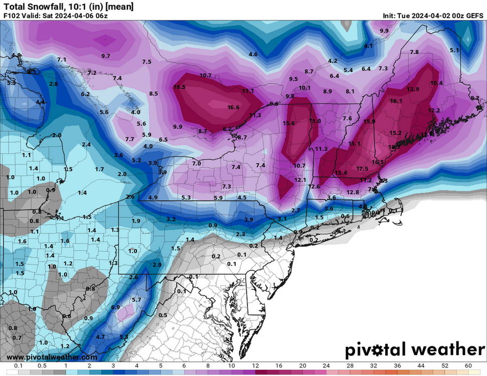
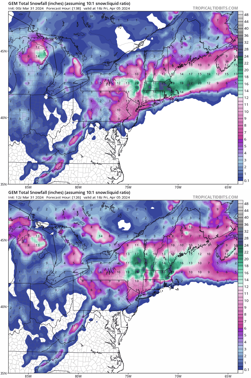
Significant Miller B Nor'easter watch, Apr 3rd-4th
in New England
Posted
Bring it down here
Enjoy