.jpg.949052775cf13715749e9bd3740a4bd3.jpg)
Bigbald
-
Posts
174 -
Joined
-
Last visited
Content Type
Profiles
Blogs
Forums
American Weather
Media Demo
Store
Gallery
Posts posted by Bigbald
-
-
6 minutes ago, Carvers Gap said:
I mean we could always strike out. But getting some BN temps into the region during January along with normal precip.....we take.
Sounds like a great time. Is Big Bald right there near Sam's Gap - sort of north of it on the AT?
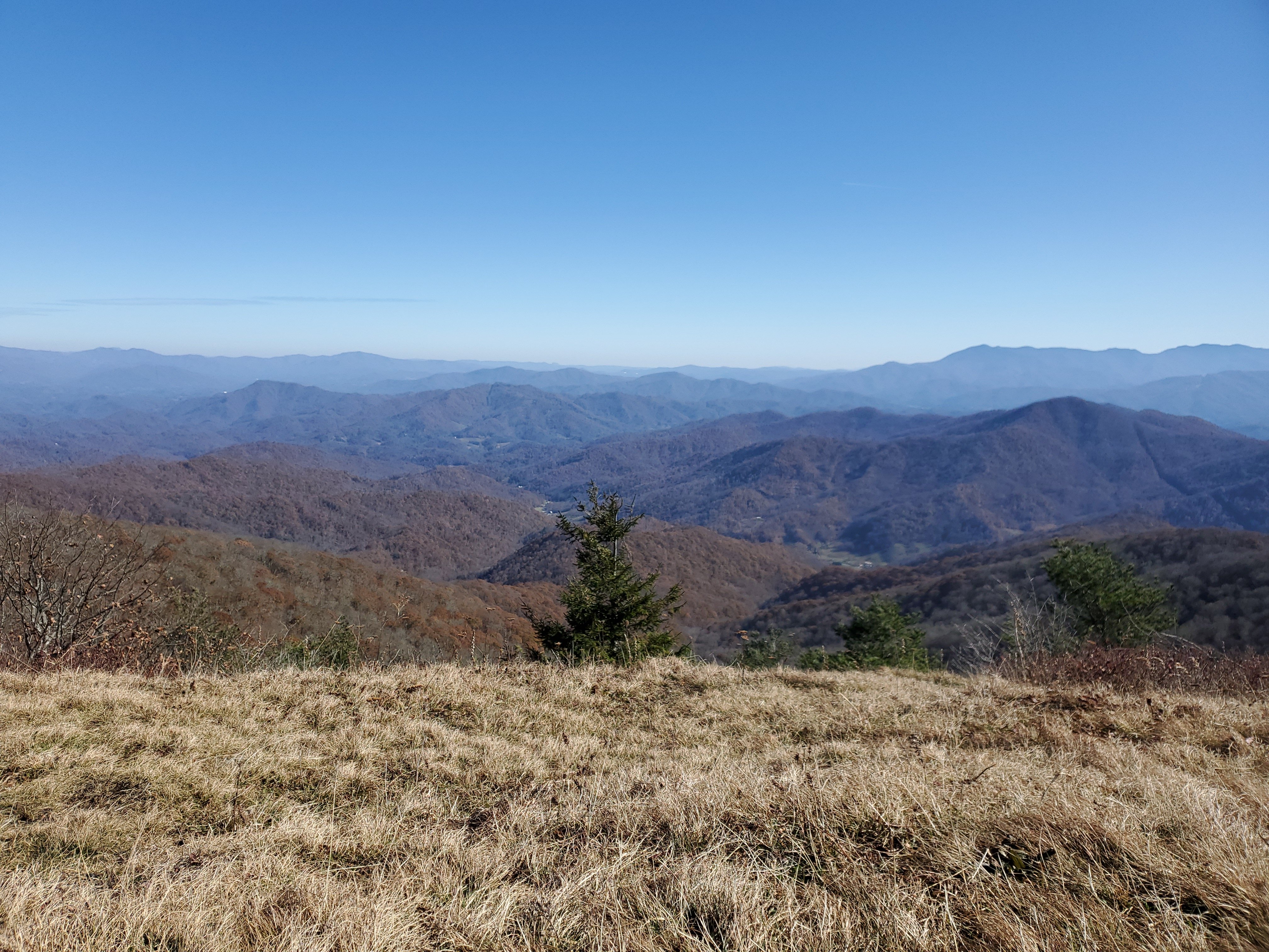
Pretty much, you can get there via the AT at Sam's Gap, about a 7 or 8 mile one way trip. Or you can go in from the other side at Spivey Gap...both are pack a lunch type hikes/runs with some hefty gain. Or one can stay at Wolf Ridge and basically walk right up to it after maybe a half mile. All that home development in the shadow of BB is unfortunate but its here to stay at this point.
-
 1
1
-
-
2 hours ago, Carvers Gap said:
Looks like the 12z GFS wants to go with a couple of light wintery events next week. We will see. For whatever reason, I like the look of the Jan 7 system.
Really hard not to be excited about the next 2 weeks +, the warms up look more/less seasonal to me, at least on the 12z Cmc and 12z gfs, although the latter has a couple warmer days in the Jan 12ish range before meeting another really cold front.
I've lucked into booking a cabin in Wolf Ridge with the right cabin weather, located just under Big Bald next weekend. It looks like I might get some snow showers and definite cold.
-
3
-
-
Selfishly speaking, would gladly take a blend of the 0z CMc low and 0z GFS low placement for a solid KTRi score on early next week storm.
-
2
-
-
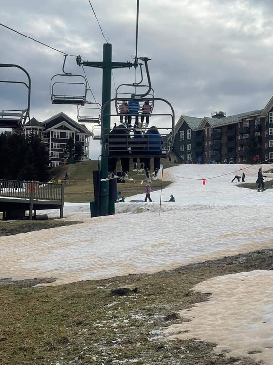
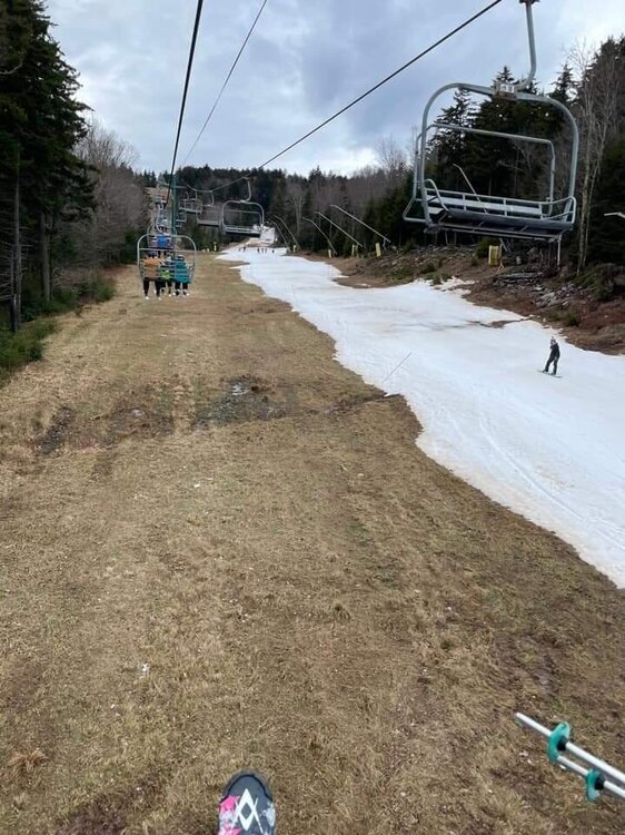
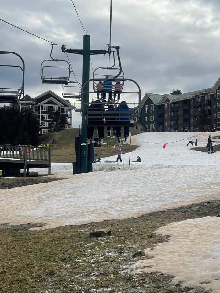
Saw these on Facebook Snowshoe today. I was up there Dec 21-22 and they had a 30 inch base. I am no snowshoe expert but I wonder if they've ever had to shut completely down in the month of January.
-
 1
1
-
-
A good learning opportunity for me and potentially others. Depicted below is the 2nd front on both 12z cmc and gfs at roughly the same time. Cmc does not drive the front through the apps but seems to hang up. 12z gfs pushes it past the Apps and results in a much colder look. What's the difference? The angle of the front on cmc driving more south/southwest (texas) (?).
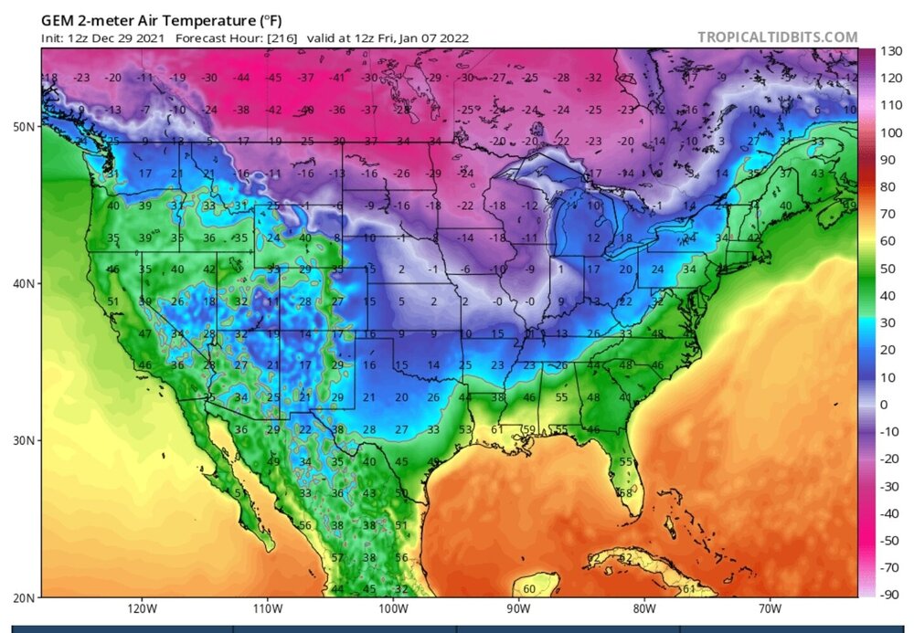
-
Hopefully the 12z comes to fruition through 250, lots of single digit lows in there several days post front. Hopefully this can give the ski industry a chance to play catch up, which is taking an absolute drumming right now even as far north as places like Snowshoe.
-
2
-
-
7 minutes ago, tnweathernut said:
Winter threats for the 2nd and for the 7th are still there on the 12z GFS. Good to see large highs crashing the upper midwest and systems developing across the south. Will be hard to time one up, but the ducks look like they are on the pond the first week or so of January.
Downright frigid through 240
-
2
-
-
Have no idea if the Canadian is right but that would be some high ratio snow with some single digits that follow for east tn after Jan 3rd. Glad to see that cold is back on the table for Jan.
-
2
-
-
7 minutes ago, Carvers Gap said:
0z GFS commentary(will update this post as it runs):
@162 winter storm incoming/underway
Great storm for New England, some big totals.
-
2
-
-
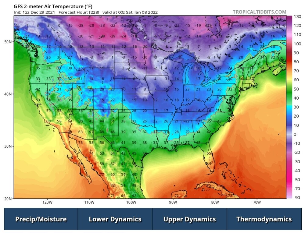
18z gfs looks overall very chilly, with really only a 2-3 day warm up jan 7-9, followed by another stout cold front dropping.
-
3
-
-
Sobering forecast. Where does this December rank in terms of all time warmth, its got to be up there for Ktri, especially by the end of the month.
-
38 minutes ago, beavis1729 said:
I don’t intend to speak for everyone…but I think part of it is the simple desire for “seasons in seasons”, and the fact that the shortest days plus the holidays are in December. You know - Currier and Ives snowfalls, It’s a Wonderful Life winter scenes, etc.
In JJA, you can always count on consistent summer-like weather. It would be nice to be able to count on consistent winter-like weather in DJF. Unfortunately, reality isn’t so kind.

Of course everything is relative…but I live in far NE IL, and I get furious and anxious every year when we don’t start building a snowpack early in December, to take advantage of the low sun angle. I actually have to step away from my love of winter for awhile each year, because I get so worked up about it.
We get good stretches of cold and snow each winter, but not consistent enough like 45N or north in the Midwest and Plains. As I like to say, we are on the wrong side of the extreme Midwest winter gradient.To me, winter is about consistency - the beauty, like a mindset and a calm and peaceful way of life…not just single events/storms.
I plan to move to the upper Midwest when I retire…hopefully soon.

Hope you don’t mind my comments here…I definitely enjoy the good people and discussion in this sub-forum.
Similiar thoughts here, winter means alot to me. I will schedule most every free minute sking, hiking, or chasing a cold snowy setting. My expectations probably differ from those in the forum in that I can get to 4000' plus elevation across multiple states with about an hour drive, something i try to take advantage of.
I definitely don't like to punt the month of December for the high mountains, meteorological winter or not. I am pretty sure I haven't read anyone post winter cancel either (?).
-
2
-
-
Seems to be pretty strong agreement with 0z gem and 6z gfs for extreme warmth in the 7-12 day territory. Not feeling great about this winter when we start eating into January.
-
4
-
-
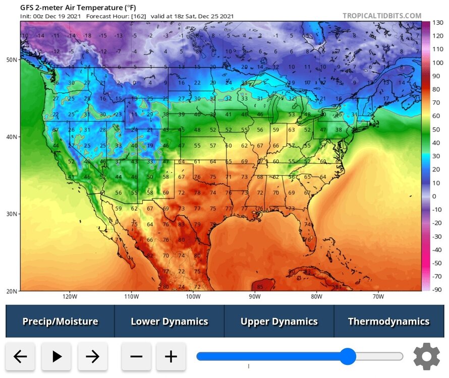
Merry Torchmas. I don't see how Wolf Ridge and some of these smaller ski resorts stay in business. It's hard for to see sustained snow making opportunities before January by the looks of the last few runs of the GFS and Canadian, its really balmy the week after xmas. I am trying to remember if Wolf has been closed the entire month of December before (?).


-
1 hour ago, John1122 said:
18z GFS

In normal starving times I'd be glued to this storm, almost all the 12z suites had it in some form or fashion, some more a bit north. I believe we must be collectively burned out ha
-
4
-
-
4 minutes ago, ShawnEastTN said:
Here is the image to go with Jax Storm Prediction Center Heavy Snow outlook.

Sent from my SM-G965U using Tapatalk
Be a hard one to swallow if SWVA misses along that cusp again. NAM suites have played around with this depiction alot it the last 96 hours. Afraid it might be right for mby
-
1
-
1
-
-
25 minutes ago, Carvers Gap said:
From the MRX evening disco...Time to put the bat signal up for @Math/Met. Good set-up?
The aforementioned S Plains mid/upper shortwave will eject ENE
across the MS Valley into the TN and OH Valleys during this period
while becoming slightly negatively tilted. This along with a 150+ kt
upper jet will deepen the surface low as it lifts through the
vicinity of the Appalachians and eastern OH Valley. Forcing from the
strong upper jet will lead to a strong, southerly low-level jet Wed
night that will pump strong moisture transport into the S
Appalachians region. This strong moisture transport, isentropic
upglide, and additional dynamic forcing as the surface low
approaches will lead to widespread precip developing north of an
advancing warm front Wed night. Deterministic and ensemble guidance
still differ regarding the exact track of the low and resultant
thermal fields (as is usually the case in the winter), so precip
type at the onset Wed night is low confidence. The GFS is the
coldest solution, the NAM is the warmest, and the GEFS/Euro/CMC
ensemble means are in the middle. Leaned heavily on the ensemble
means and NBM for temps and precip type Wed night into Thurs morning
which suggests a period of snow, sleet, and freezing rain possible
from the Plateau through the N Valley into SW VA, so generally N of
I-40 and W of I-81. Forecast soundings support this idea with a
gradually descending warm nose as the warm front lifts N, but as
mentioned, precip type and location confidence is low. This will be
fine tuned as new guidance arrives over the next 48 hours. One thing
that is certain is that a high end mountain wave will occur across
the E TN mountains and foothills Wed night through Thurs morning
since the low-level jet will be favorably oriented perpendicular to
the terrain, it will be a very strong low-level jet of 60-80 kts,
and an inversion will be in place below 850 mb leading to ducting
values over 20. This will likely lead to 80+ mph gusts downsloping
into the foothills such as Camp Creek. As the mid/upper shortwave
and surface low lift NE Thurs, a strong cold front will cross the
region. We could see a dry slot part of the morning, but expect
precip to quickly return as the strong upper jet maintains strong
frontogenetic forcing ahead of the cold front with continued strong
low-level moisture transport ahead of the boundary. PWATS will be
above the 90th percentile with some elevated instability, so periods
of heavy rain are possible. Warmer air advecting in ahead of the
front will allow any mixed precip in northern areas Thurs morning to
quickly change to rain for the afternoon.
Wow, 80 mph gusts. Those suckers aren't the easiest things to chase since they can come in on the cusp of bad weather. I tried chasing the last one up camp creek bald, only to encounter snow and ice, and than I worried getting off the mtn without tree debree killing me. Have decided it's best to hunker down in place in an area without trees. I've just not prepped enough to ride one out, but on the bucket list
-
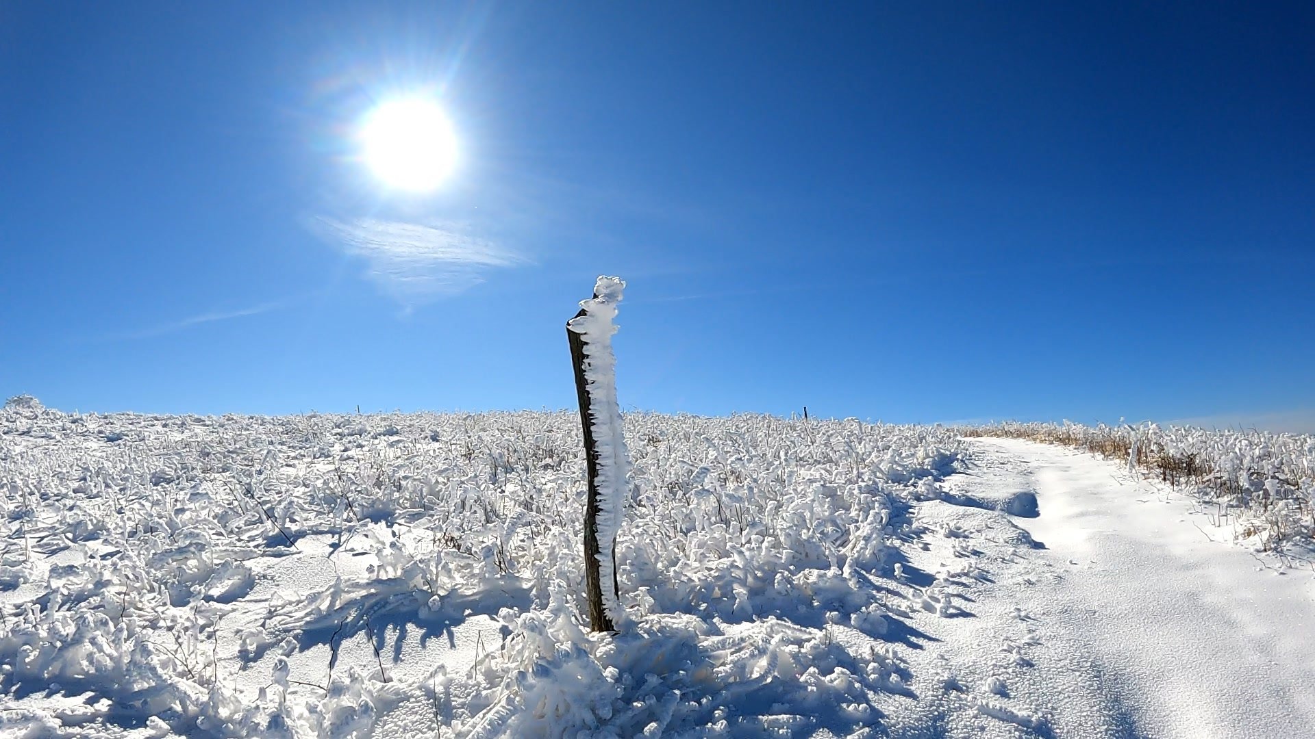
Any takers on directional rime ice forms?
Shown is a picture of some rime ice following a a storm on big bald from a few weeks back. The wind was really heavy from the south face of the mtn. A buddy of mine suggested that what is giving the rime ice the distinctive directional look was that the moisture hits the bare side of the post and the wind is wrapping it around the backside, accumulating over time in the protected backside area. But this was a random guess. We're we wrong?

-
1
-
 2
2
-
-
12 minutes ago, Blue Moon said:
I'll spill the beans: looks good if you're anywhere in Tennessee. It's farther SE and brings more snow to everyone. Only downside is that it brings more ice to our eastern areas.
Talking about this???

-
1
-
-
45 minutes ago, Carvers Gap said:
The 6z GFS had a light mix/icing event Tuesday re: NE TN. And for the record, the multi-day overrunning event is likely going to verify for this subforum - just not the NE corner...yet. Let’s see the trend on modeling for next week before pronouncing E TN out of the picture. I am not even sure I want any part of an ice storm. That said, the boundary has slowly pressed eastward for Tuesday. This is how much modeling has missed the current system regarding SE positioning...I am 4 miles from the latest ice advisory area.
Echo this, there has been some dramatic easterly shifts on the gfs suites. It went from running the low west of the apps, to the spine (transfer to asheville), to the 6z that looks just east of the apps to me. It still looks like ktri need the cold to push further east (still our downfall?) but interesting. Is there a mechanism that can extend the cold east by 100 miles or so?
-
3 minutes ago, Holston_River_Rambler said:
I just always wanted to post that,
Decadal storm
-
1
-
-
12z downright gaudy for you middle and west folks
Edit: this would be the frame to the wall depiction
-
1
-
-
11 hours ago, dwagner88 said:
I have a feeling this one is going to be very frustrating to watch for those of us East of the Plateau. That SE ridge just isn’t going to allow the cold air into the valley.
And this sentiment has not changed much through 160....great looking 12z gfs for Memphis
-
3
-
-
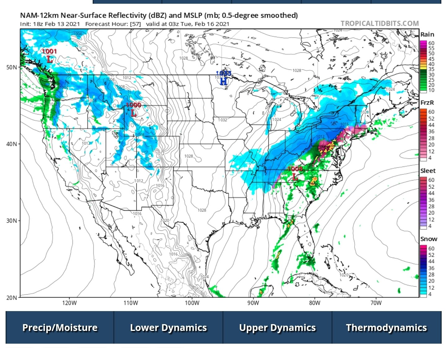
Some of these meso scale models have been slowly walking the ice south and east along the swva border with Kentucky, about 1-5 miles a run it seems like. Really interested to see how geophysics play out on some of the mountains of swva.


TIMS model verification, December 31, 2021 - January 3, 2022
in Tennessee Valley
Posted
What follows on the next front ain't bad either (Jan 7). One of the best op runs in the last 3 years for east tn, even if pure fantasy ha!