Owensnow
-
Posts
134 -
Joined
-
Last visited
Content Type
Profiles
Blogs
Forums
American Weather
Media Demo
Store
Gallery
Everything posted by Owensnow
-
Damnit why did you go and do that 850's are right on the line here. .99qpf of 1.5 is at risk of being all rain vs at YQG to my NW is 1.5ish with all +SN
-
Yep I think I am done Rainer and maybe 2 inches of slush going NW so not too impressive for me
-
00Z HRRR going north 975mb
-
But looks like I am screwed here XHA
-
I meant to say Detroit City or DET I guess, looking more rainy now
-
Looks like a rainer for DTX and DTW and myself Will see what happens
-
Looking like yet another rain event right on the heels of the sloppy 4 inches we just got sigh.
-
Midwest/Ohio Valley/Great Lakes Snow January 24-26
Owensnow replied to Baum's topic in Lakes/Ohio Valley
Same here, Kingsville, Ontario. Snowing hard but too warm. 3-4 will max this storm out. Very far from 6-8 -
Pre-Christmas (Dec 21-23rd) Winter Storm Part 2
Owensnow replied to Chicago Storm's topic in Lakes/Ohio Valley
-
Pre-Christmas (Dec 21-23rd) Winter Storm Part 2
Owensnow replied to Chicago Storm's topic in Lakes/Ohio Valley
Amazing watching the map just tilt… Cranking low pressure -
Pre-Christmas (Dec 21-23rd) Winter Storm Part 2
Owensnow replied to Chicago Storm's topic in Lakes/Ohio Valley
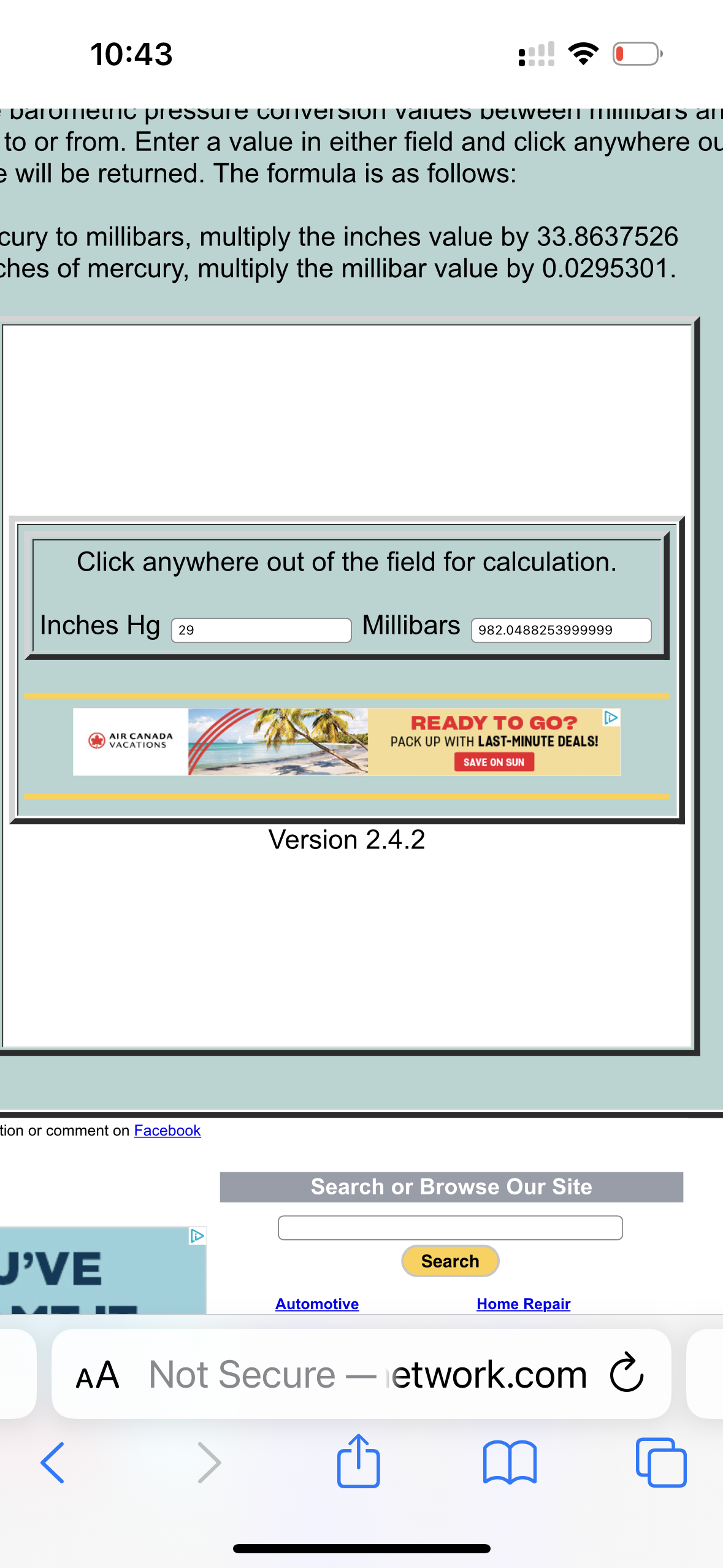
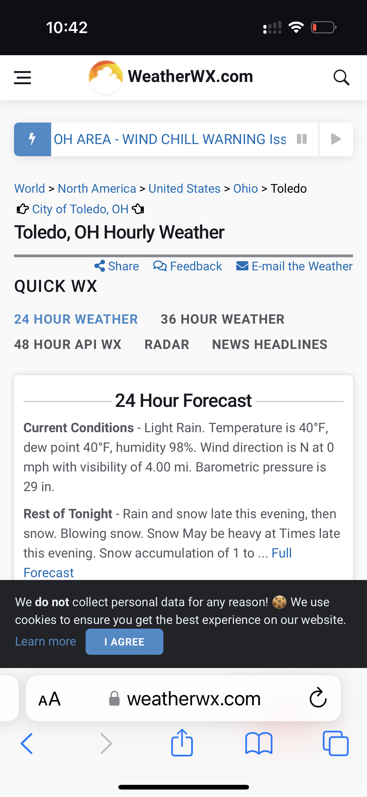
Cannot be 982 at TOL SPC has 996 right now -
Pre-Christmas (Dec 21-23rd) Winter Storm Part 2
Owensnow replied to Chicago Storm's topic in Lakes/Ohio Valley

-
Pre-Christmas (Dec 21-23rd) Winter Storm Part 2
Owensnow replied to Chicago Storm's topic in Lakes/Ohio Valley
-
Pre-Christmas (Dec 21-23rd) Winter Storm Part 2
Owensnow replied to Chicago Storm's topic in Lakes/Ohio Valley
pretty sure the low is stronger than modeled right now in TOL down to 982mb there already? -
Pre-Christmas (Dec 21-23rd) Winter Storm Part 2
Owensnow replied to Chicago Storm's topic in Lakes/Ohio Valley
it seriously looks like we’re going to get the worst of the bruising down here in the south east corner of Michigan and southwestern Ontario across the lake into Toledo and northern OH I mean apart from the lake effect on the west side of Michigan -
Pre-Christmas (Dec 21-23rd) Winter Storm Part 2
Owensnow replied to Chicago Storm's topic in Lakes/Ohio Valley
it has been well modeled by at least three different models? -
Pre-Christmas (Dec 21-23rd) Winter Storm Part 2
Owensnow replied to Chicago Storm's topic in Lakes/Ohio Valley
not really 3am to 5pm or so -
Pre-Christmas (Dec 21-23rd) Winter Storm Part 2
Owensnow replied to Chicago Storm's topic in Lakes/Ohio Valley
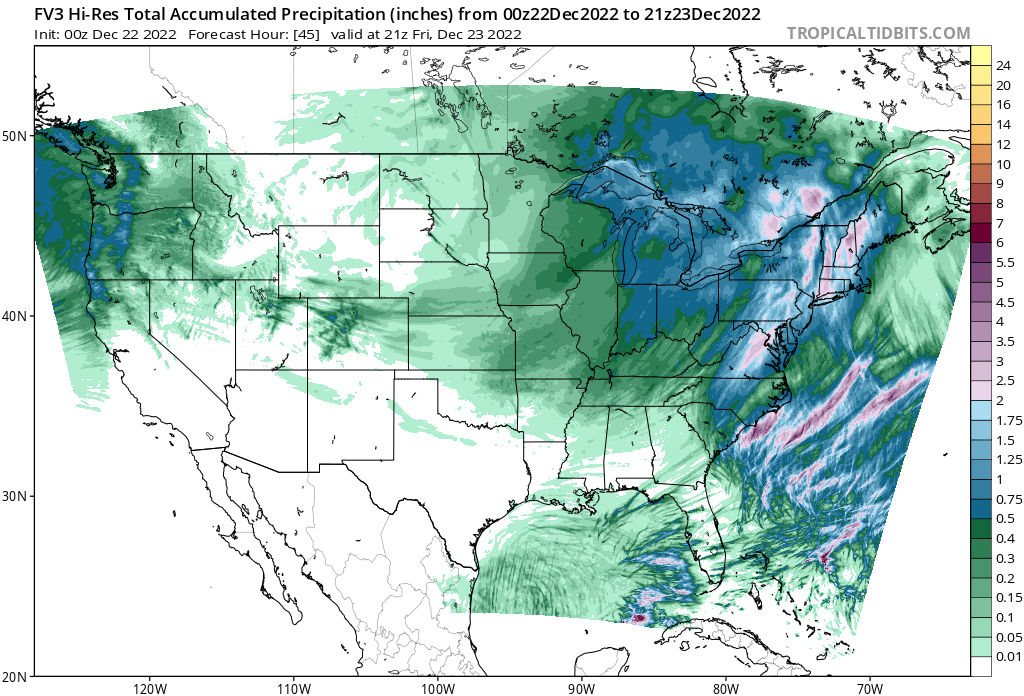
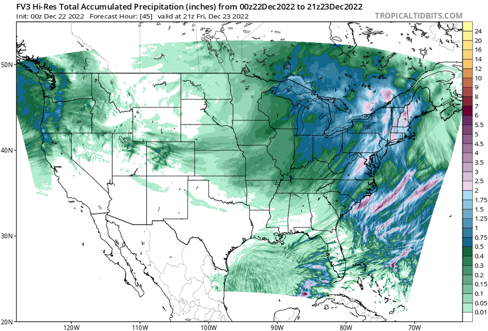
Latest GFS and FV3 and RGEM have a good deal for SEMI and SW Ontario 5-9 inches likely on .75- 1 qpf -
Pre-Christmas (Dec 21-23rd) Winter Storm Part 2
Owensnow replied to Chicago Storm's topic in Lakes/Ohio Valley
-
Pre-Christmas (Dec 21-23rd) Winter Storm Part 2
Owensnow replied to Chicago Storm's topic in Lakes/Ohio Valley
Northern IN, SEMI, Part of OH and SW Ontario get clobbered there. FV3 go! -
Pre-Christmas (Dec 21-23rd) Winter Storm Part 2
Owensnow replied to Chicago Storm's topic in Lakes/Ohio Valley
looks a lot more like the ensembles -
Pre-Christmas (Dec 21-23rd) Winter Storm Part 2
Owensnow replied to Chicago Storm's topic in Lakes/Ohio Valley
Yes, I’m not sure what the models are looking at because the ensembles show the best moisture actually from middle lower, Michigan and eastward into Ontario. they actually have the low track much further east than any of the models? -
Pre-Christmas (Dec 21-23rd) Winter Storm
Owensnow replied to Chicago Storm's topic in Lakes/Ohio Valley
Plenty of talk of further east shift from the local morning disco Detroit NWS -
Final -1" here Models did horribly with the placement of the banding vs qpf and plumes. Plumes and qpf were over .35 here. Ended with less than one inch. Spring is coming
-
QPF output clearly shows 2-5 inches from metro south