

MDSnowyWxTracker
-
Posts
85 -
Joined
-
Last visited
Content Type
Profiles
Blogs
Forums
American Weather
Media Demo
Store
Gallery
Everything posted by MDSnowyWxTracker
-
1/19 - The Roulette Wheel 29 Black Storm - OBS
MDSnowyWxTracker replied to DDweatherman's topic in Mid Atlantic
I wanted to report earlier but didn't get a chance. I am just north of Frederick/south of Walkersville. It started out around 9AM(35.5degrees) as a fair amount of white rain, probably lost about close to a half in or more to that. Thought for sure it was going to dud. But kicked in turned into snow by about 11am(32.4degrees) with accumulation. Then went to alternating heavy bands until about 12-5. Ended up with about 4.2in. Definitely ended up with a few good bands over me. Here are some of the pics toward the end..thumb.jpg.93a38c9c015324ca29a8ddb59b26ab2f.jpg)
.thumb.jpg.4c431d86f97ad0bbc072ed8290a8c595.jpg)
.thumb.jpg.6151cea340fbb2ddab8def080fa9ba1b.jpg)
.thumb.jpg.46723e2472f6e0708eb68885819be23a.jpg)
-
Presidents' Day Storm of 1979 -- Most Memorable Snowstorm Ever
MDSnowyWxTracker replied to RodneyS's topic in Mid Atlantic
I was 5 years old then. I don't remember much of this storm but I do remember living in Baltimore then. I remember a city transit bus getting stuck in the middle of the storm on Charles Street in South Baltimore. I guess cause of the crazy rates of that storm. I wish I was old enough then to really appreciate the magnitude of that storm. -
The Weekend Rule? Saturday 2/17 - The Icon Storm
MDSnowyWxTracker replied to DDweatherman's topic in Mid Atlantic
Just south of Walkersville, rates pretty heavy brought temps down 33.7 from 38 in 20 min. covering asphalt and sidewalks now. -
The Weekend Rule? Saturday 2/17 - The Icon Storm
MDSnowyWxTracker replied to DDweatherman's topic in Mid Atlantic
Kind of wild went from flurries to pretty steady heavy snow real quick. -
The Weekend Rule? Saturday 2/17 - The Icon Storm
MDSnowyWxTracker replied to DDweatherman's topic in Mid Atlantic
Finally something happening. Flurries and temp finally dropping 36.6/30.2. Pretty steady dropping in temp. -
The Weekend Rule? Saturday 2/17 - The Icon Storm
MDSnowyWxTracker replied to DDweatherman's topic in Mid Atlantic
Holding at 38.5/21.6 just south of Walkersville. -
The Weekend Rule? Saturday 2/17 - The Icon Storm
MDSnowyWxTracker replied to DDweatherman's topic in Mid Atlantic
Yeah this storm has more potential than most of the storms we dealt with this year. Coming at night, somewhat of a decent cold air supply at the right time(even if a hit and run), decent precip shield and the track. This reminds me a lot of 2013-2014 storms we encountered. The track especially, if I were to guess, once over VA mountains we could see a nice intensifying of the storm. I do think this likely could be a general 4-8 for many as we get even closer but I will differ to the better posters on that. -
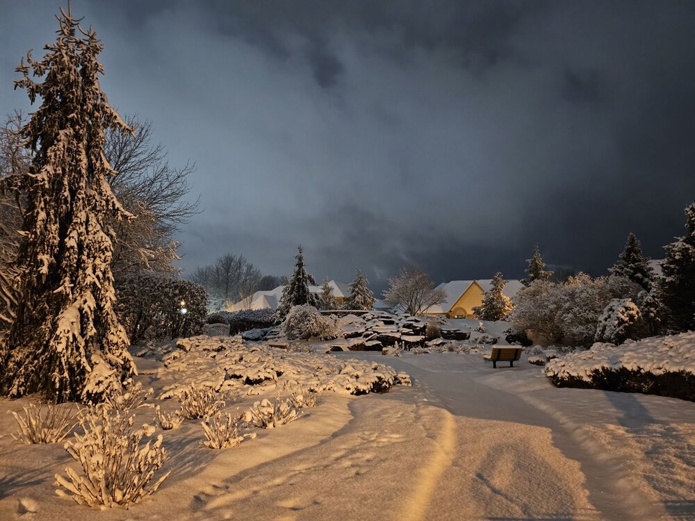
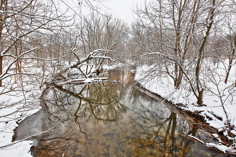
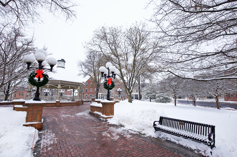
Combining two of my favorite things, winter weather/snow and photography. Here are some of the ones from yesterday wandering around getting shots for day and nighttime.

-
Man I'm guessing this is the streamers mentioned, picked up prob an inch and half within the hour so. Still snowing heavier but not as intense.. Definitely improved my totals overall.
-
Some of the heaviest flakes I've seen all day near between Frederick and Walkersville. 29.2/26.6
-
28.8/24.8 Looks like close to 2.5in just south of Walkersville.
-
Jan 15-16 Storm Thread 3: Obs and Disco
MDSnowyWxTracker replied to stormtracker's topic in Mid Atlantic
It was quite the nice event. Just over 4inches here just south of Walkerville. Had about another 1/8th of inch that swung through mid morning. -
Jan 15-16 Storm Thread 3: Obs and Disco
MDSnowyWxTracker replied to stormtracker's topic in Mid Atlantic
Man absolutely ripping out there. 25.4 and looks like a snow globe. Love the trending in duration. -
Jan 15-16 Storm Thread 3: Obs and Disco
MDSnowyWxTracker replied to stormtracker's topic in Mid Atlantic
25.9/23.7 nice returns now. Just over an inch now. -
Jan 15-16 Storm Thread 3: Obs and Disco
MDSnowyWxTracker replied to stormtracker's topic in Mid Atlantic
26.3/22 up here. Very light snow, maybe about half inch. -
Jan 15-16 Storm Thread 3: Obs and Disco
MDSnowyWxTracker replied to stormtracker's topic in Mid Atlantic
26.4 just south of Walkersville. Light pixie dust. -
29.6/27 just north of 26. Moderate snow coming down.
-
28.8/24.3 sleet here at the moment.
-
Yes it looks like the 850s and 925 held till about 3 or 4pm in much of western areas.
-
So far holding 25.3/20.4. Dew point up a little but dropping again, some high clouds but still fairly clear.
-
In between Walkersville and Frederick 24/19.
-
Agree, I am just north of Frederick above Rt26, we were forecast to that temp as well. We are sitting at 37 now, doubt I get much more than 38. This morning low temps were off by 3degrees(forecasted 22, actual 19). If those 3 degree temp differences hold through the night and morning. That front end thump of snow could be much more than advertised.
-
Started about 15 min ago in Walkersville/Frederick area. Mixed in with sleet at times, coating colder surfaces. Not too impressive but snow is snow at this point.
-
December 22-23, 2022: Warm Rain to Arctic Chill
MDSnowyWxTracker replied to WxUSAF's topic in Mid Atlantic
30/27 Frederick -
Started the morning at 17 degrees here in the Walkersville area. A bit colder than I thought it would be this morning. Current 36/23
.jpg.c6f678e7328357fb20bc3654fc5d5d6a.jpg)
.jpg.7b2d88bb6adfdd87bb61386fef9ba4d1.jpg)
.jpg.dba5d3e25aad70cba8ff57f716d992b8.jpg)
.jpg.4788db8376c6688ab8a963c1e444b6a2.jpg)

