

Jt17
-
Posts
363 -
Joined
-
Last visited
Content Type
Profiles
Blogs
Forums
American Weather
Media Demo
Store
Gallery
Posts posted by Jt17
-
-
2 minutes ago, PhineasC said:
EPS also shifted east, but I meant more if it continues into 00z. I expected this thing to shift back east somewhat all long and many hit me with weenie tags. We'll see. The envelope of solutions remains fairly wide, IMO. I think those saying a whiff is totally off the table are wrong.
EPS shifted east? Says who. Doesn't look like it to me.
-
2 minutes ago, the_other_guy said:
Insanity is doing the same thing over and over and expecting different results.
Dont diminish seasonal precedent of trending east with a fast flow. Especially if it starts to show again
This is too far out to get excited
And it is certainly too far out to dismiss another out to sea possibility
Not the definition of insanity
")
-
Wow I'm so proud of the lack of freaking out in here! Well done forum
-
 1
1
-
-
Just now, jm1220 said:
For Boston or anywhere I’d just say “chance at a significant coastal storm for Saturday” and not mention precip types. Still a few days before worrying about rain or snow. Euro is a very nice solution but gets going a hair too late for the huge totals in our area. It might be holding back a little too much energy in the SW which might mean it gets going faster.
It's more about it's track then it getting going too late, but as others have said, it's in a good spot, especially since the Euro tends to trend west late in the game.
-
1
-
-
CMC/GFSish track with the Euro's intensity would be amazing. Nice trend on the Euro though
-
1
-
-
2 minutes ago, CPcantmeasuresnow said:
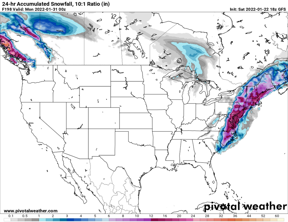
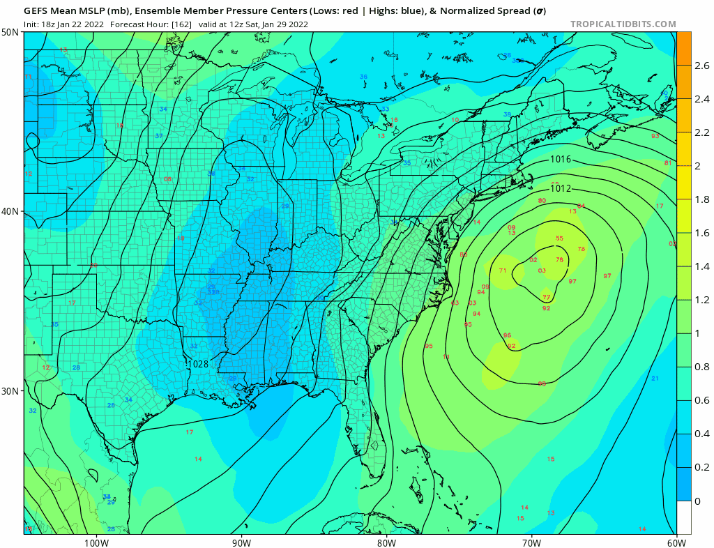
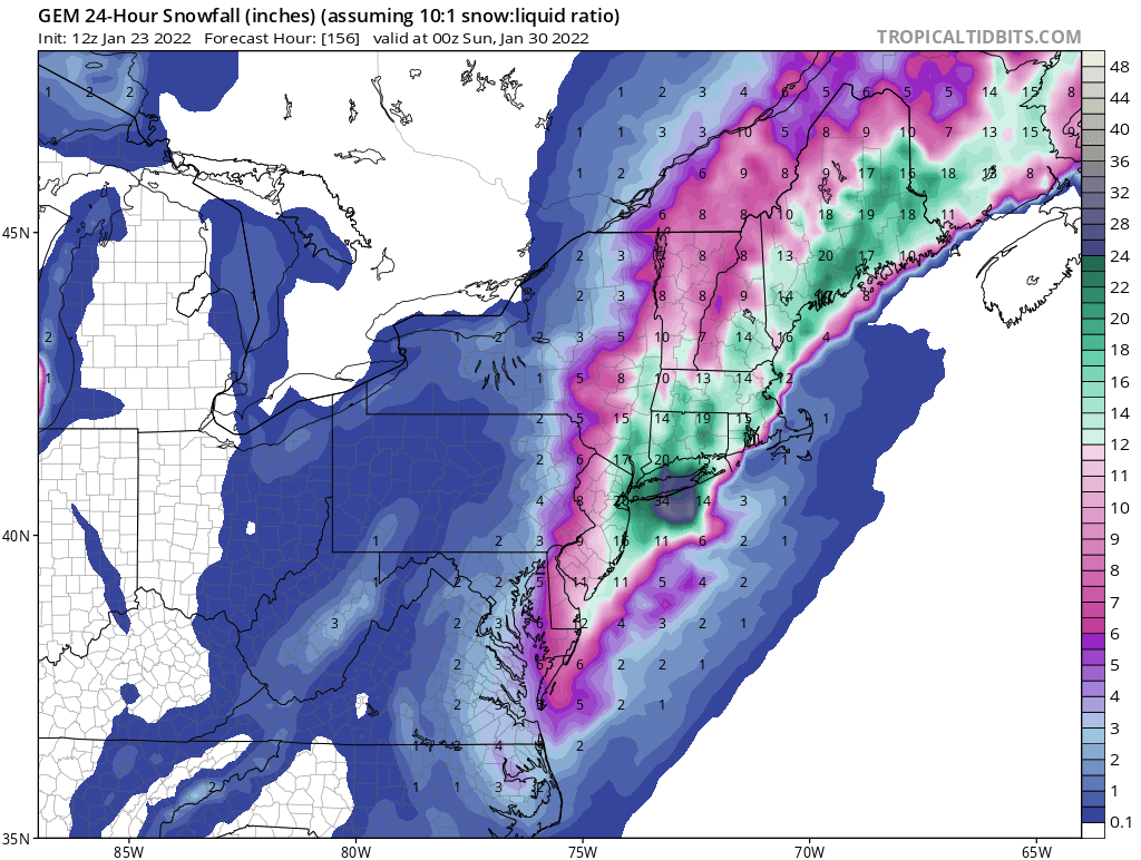
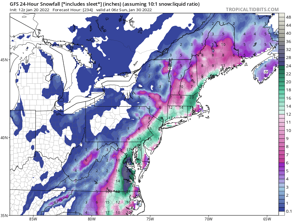
This is the CMC snow equiv map. The problem is it runs through Feb 3 but I believe most if not all of this is snow for Friday through Sunday. If I could I would freeze that right where it is. Most likely this will waver a lot between now and Friday but I'm okay if it doesn't I love when SE New England gets rain, especially living in the HV.
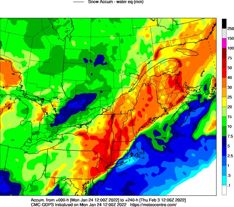
lol 2 ft for the NYC metro area and north - a boy can dream
-
1
-
-
3 minutes ago, HVSnowLover said:
Ukie is way east of CMC/GFS
Yes but it's west of the last Ukie run
-
1
-
-
4 minutes ago, HVSnowLover said:
If it develops 12-18 hours earlier I think NYC Metro might be bringing out umbrellas but yes I could see why you'd want that up there lol.
Agreed, I think NYC metros best chance for HECs more depends on a deeper low developing like some of the guidance has hinted at.
-
 1
1
-
-
Just now, Franklin0529 said:
Let's see if the cmc stays the course.... maybe better
So far it's been leading the way
-
1
-
-
Just now, Gravity Wave said:
The timing of the phase and the axis tilt is really key. Had the latter happened a tad earlier on the GFS we go from MECS to HECS.
Yep, I wouldn't be surprised to see a decent number of ensemble members to show something like that. Lots of sub-970 lows popping up on the ensembles
-
1
-
-
-
Let's see what tomorrow brings!
-
Euro trending towards CMC
now:
12z:

-
 1
1
-
-
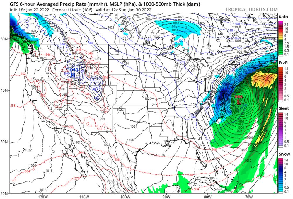
2 minutes ago, Rjay said:
The ukie was an absolute bomb just east of the bm (which is not really our bm)
This run:
Last run:
-
Ukie 50mb deeper this run around our latitude and decently west compared to the last run. Still looks pretty far out, but the trend is our friend...
-
1
-
-
1 minute ago, Rjay said:
Last 6 runs of the gefs
I'd say that's the right direction!
-
Just now, Rjay said:
Strung out disaster vs this run.
Lol I deleted my comment cuz you beat me to it. Def happy with some of the progress on the models today
-
Hopefully the GEFS shifts even further west and we get an idea of who is following who exactly...
-
Well the CFS moved 600 miles west, so lock it in boys and girls.
") (What is the CFS anyway?)
(What is the CFS anyway?)
-
1
-
-
16 minutes ago, CPcantmeasuresnow said:
CMC snow map from 12Z today for the 30th, and the GFS snow map for the 30th from three days ago. Very similar for the northeast, it probably doesn't mean a lot but certainly worth monitoring.


GFS from yesterday too:
-
39 minutes ago, MJO812 said:

Was wondering why there were 25 posts since I checked on the GFS run 45 min ago lol
-
2
-
-
23 minutes ago, lee59 said:
This is not the first time a model or models show a 970 low off our shores a week or 10 days out. So far none have materialized.
Well now it's 6.5 days out so we should be good
-
15 minutes ago, cleetussnow said:
My only problem with it...it wiggled 200 miles since 12 z.
Sure, but it looks a lot like some runs yesterday and last night. Which is why when this inevitably looks worse on some future runs, people shouldn't get all out of sorts that the storm is dead like they did at 12z
-
-
1
-
 1
1
-
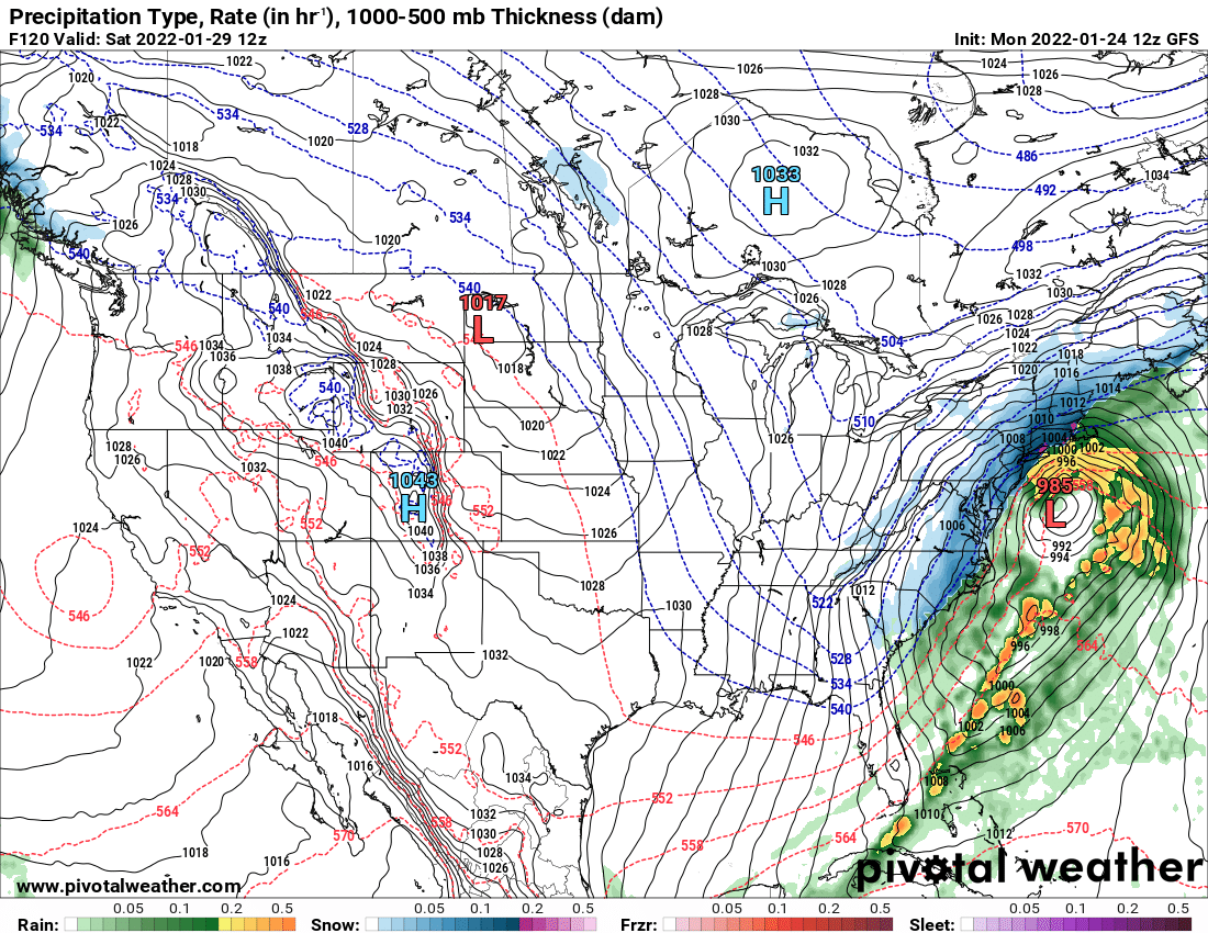
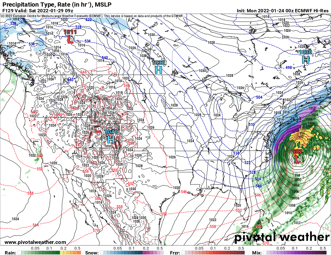
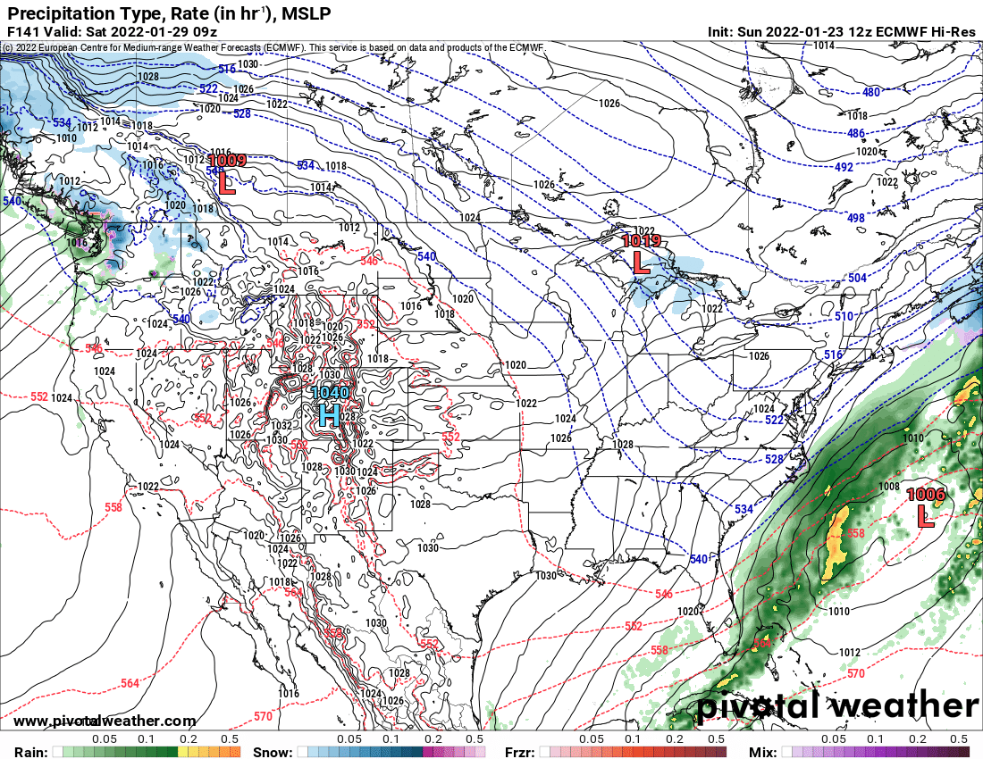

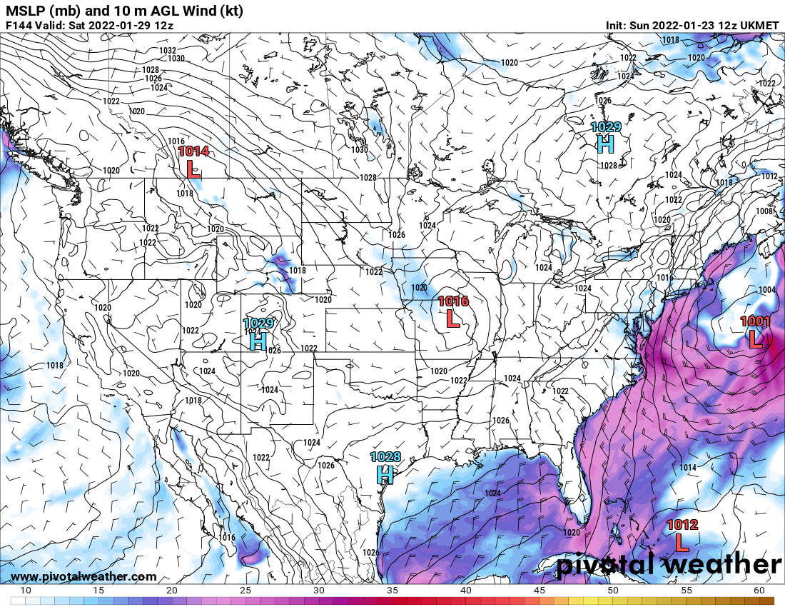


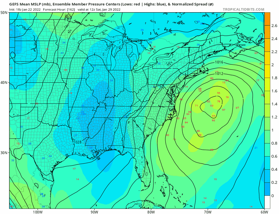
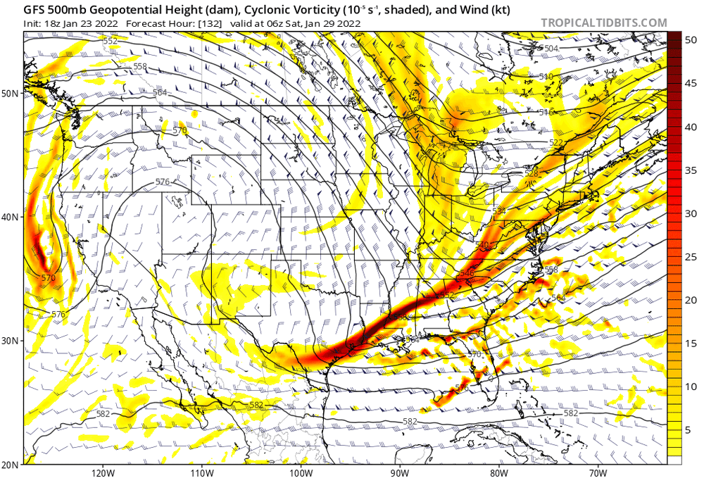
Powerful Multi-regional/ multi-faceted east coastal storm now above medium confidence: Jan 29 -30th, MA to NE, with snow and mix combining high wind, and tides. Unusual early confidence ...
in New England
Posted
I still don't agree, I'm not seeing that.