
Ephesians2
-
Posts
554 -
Joined
Content Type
Profiles
Blogs
Forums
American Weather
Media Demo
Store
Gallery
Everything posted by Ephesians2
-
I'm by no means an expert, but my understanding is that snow depth is generally too low except in highly marginal events.
-
SN+, winds picking up...
-
Probably would set a record of some kind
-
Huge flakes coming down in Fredericksburg! Everything coated.
-
Almost certainly all snow, as we just flipped to all snow in Fredericksburg.
-
Finally! Over to mostly snow and instantly sticking thanks to the coating of sleet.
-
Heavy sleet, starting to slush up everything including roads
-
It's a shame this band isn't all snow. Sleet/snow mix, mostly sleet right now
-
50/50 snow and sleet ... no accumulation yet
-
Same. Would love to see that but feel like we're getting 6-8" -- of course the middle range of that would still be the best since 2016 here and this is pretty much a surprise event
-
52/39 ... subjectively, feels like something approaching winter for the first time in a week or so
-
61/60 https://www.wunderground.com/dashboard/pws/KVAHENRI32
-
The trajectory of this system vaguely reminds me of January 2019
-
Looks like the Euro has the late week potential too far north and west
-
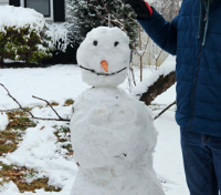
Beautiful
-
Yeah definitely understand the position they are in, they don't want another March 2013. I would not want to be a TV meteorologist right now
-
yeah, possibly, but if there is significant snow people are not really going to understand the model uncertainty and situation. Also think they implied nothing elsewhere
-
if this even comes close to verifying, DC radio will probably get a lot of public criticism ... just heard WTOP say "a few flurries north and west" Monday morning
-
Nahhh like it just the way it is
-
What would this system be described as?
-
Looks stronger/more precip as well Also that gradient is brutal... that small shift tripled snow for some places
-
13-14 and 14-15 weren't at least decent for you?
-
More than the last 3-4 winters here
-
GFS for the late week potential
-
GFS looks like multiple days of subfreezing highs and single digit lows next week, especially south and west of DC. I'm sure lots of that depends on the 6-12" of snow it projects being on the ground as well

