AnthonyEC
-
Posts
70 -
Joined
-
Last visited
Content Type
Profiles
Blogs
Forums
American Weather
Media Demo
Store
Gallery
Everything posted by AnthonyEC
-
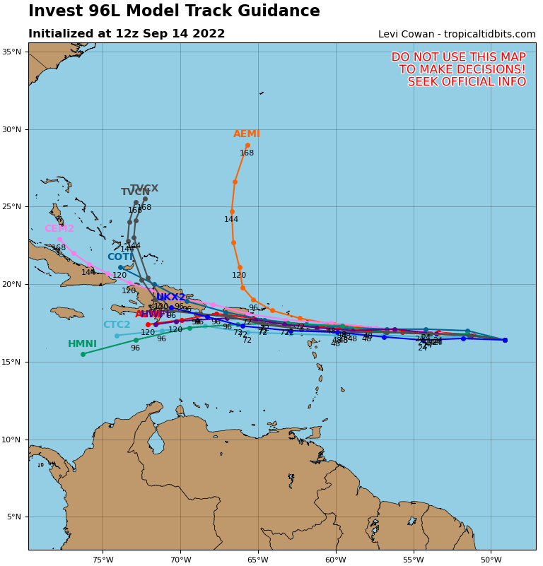
48-60 hours out and there are many solutions still on the table. No clue who will be correct.
-
That’s twice as much rain as the May 1979 flood.
-
CMC initialized 20mb higher than currently reported. Take it with a grain of salt.
-
Wouldn’t this cause the wind field to expand even larger? Loss of a little speed while increasing the eye size?
-
Hurricane Ian landfall location/intensity prediction thread
AnthonyEC replied to Hoosier's topic in Tropical Headquarters
Manasota Key - 130 -
https://en.m.wikipedia.org/wiki/Hot_tower
-
Tropical Storm Josephine in 1996. Would have probably been classified a hurricane by todays standards.
-
I agree, if you aren’t 10-15 feet above sea level, I would find a place that is.
-
Winds push the water and if the storm stalls as the 18Z GFS shows, it just piles up with no where to go.
-
At hour 66. Looks like it’s on the Tampa Bay express
-
GFS headed for the Big Bend
-
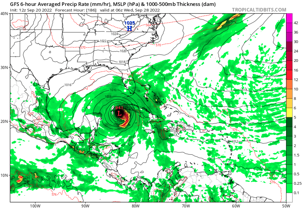
Weaker at 936??? And that model is a little old. Hope it verified anyway.
-
I was in Vero the night Jeanne came ashore after it had turned East then circled back west. No doubt it was 8-9 hours of 75mph+ winds. Learned my lesson not to stay through any storm.
-
Francis or Jeanne in 2004?
-
Like Ike, hit as a Cat 2 with Cat 4 storm surge. If this clears the Yucatán uprights (between Cuba and the peninsula, forgive the football analogy). The surge potential will be catastrophic. Nothing to slow down the wall of water.
-
GFS splits the Yucatán uprights and bombs away

-
Just wait until the Euro runs at 2PM
-
Getting closer to “Hurricane Phoenix”
-
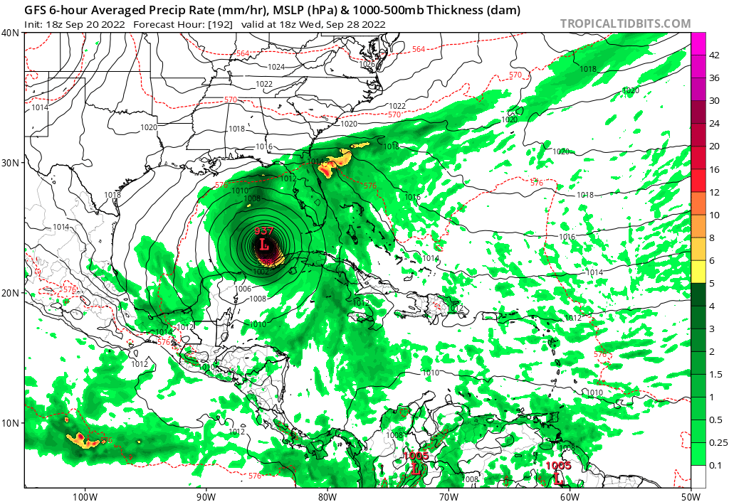
GFS at 186. 940mb over western Cuba
-
2022 Atlantic Hurricane season
AnthonyEC replied to StormchaserChuck!'s topic in Tropical Headquarters
GFS even developing an “I” storm in the western Caribbean after the “H”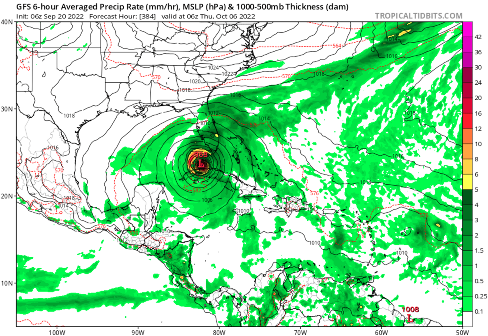
-
12Z windshield wiper effect

-
2022 Atlantic Hurricane season
AnthonyEC replied to StormchaserChuck!'s topic in Tropical Headquarters
At least the GFS is backing up it’s own fantasy.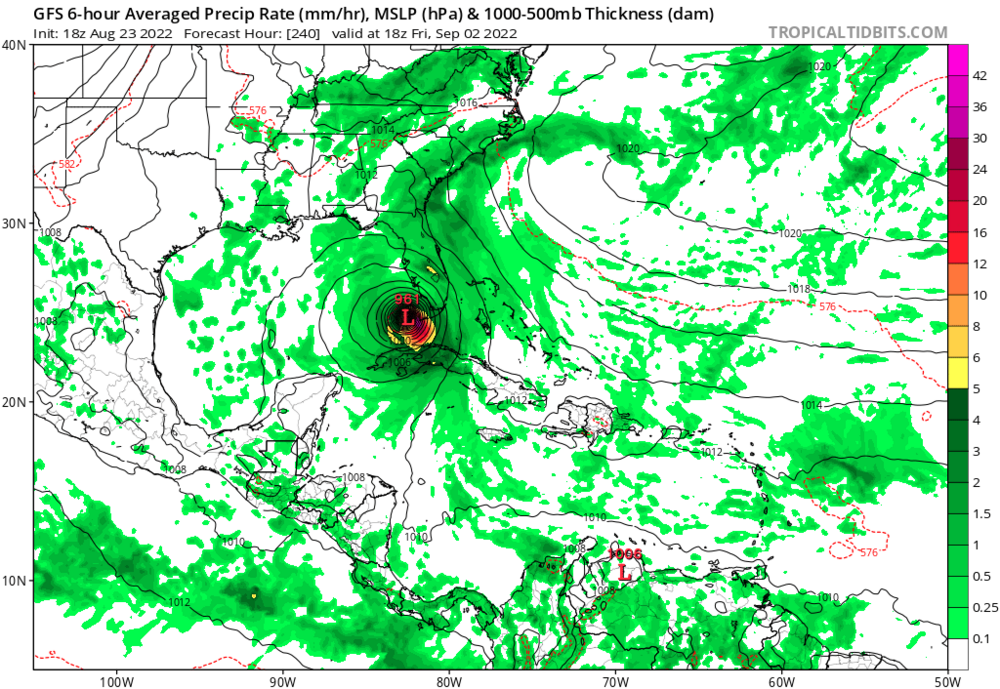
-
2022 Atlantic Hurricane season
AnthonyEC replied to StormchaserChuck!'s topic in Tropical Headquarters
Lemons oranges and cherries yellow orange and red -
2022 Atlantic Hurricane season
AnthonyEC replied to StormchaserChuck!'s topic in Tropical Headquarters
The 06Z GFS is on the sauce again… -
March 11th-13th Winter Weather Event. Winter's last gasp?
AnthonyEC replied to Windspeed's topic in Tennessee Valley
A solid 7-8” here in 41501 and still snowing