AnthonyEC
-
Posts
70 -
Joined
-
Last visited
Content Type
Profiles
Blogs
Forums
American Weather
Media Demo
Store
Gallery
Everything posted by AnthonyEC
-
Historic Christmas Cold & maybe snow?! Dec 23rd-30th
AnthonyEC replied to Wurbus's topic in Tennessee Valley
Really picking up now. I can hear it outside. Rain blowing in sideways like Forrest Gump. -
Historic Christmas Cold & maybe snow?! Dec 23rd-30th
AnthonyEC replied to Wurbus's topic in Tennessee Valley
Still 47 here in Pikeville, KY. We had some rain earlier. But nothing now. Temps should start dropping around 2-3AM. -
I’m Not sure there is enough time to get there or enough latent heat.
-
No chance. High pressure way too strong
-
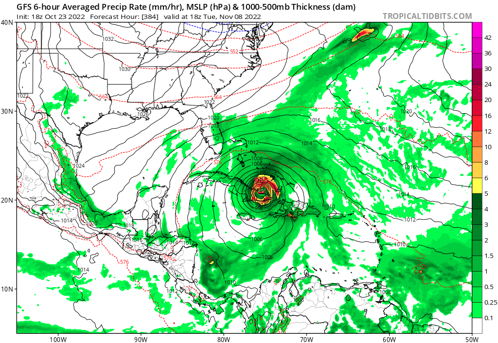
Overnight and morning models picking up strength with each run. Treasure Coast coming into play quickly.
-
2022 Atlantic Hurricane season
AnthonyEC replied to StormchaserChuck!'s topic in Tropical Headquarters
18Z GFS not giving up yet
-
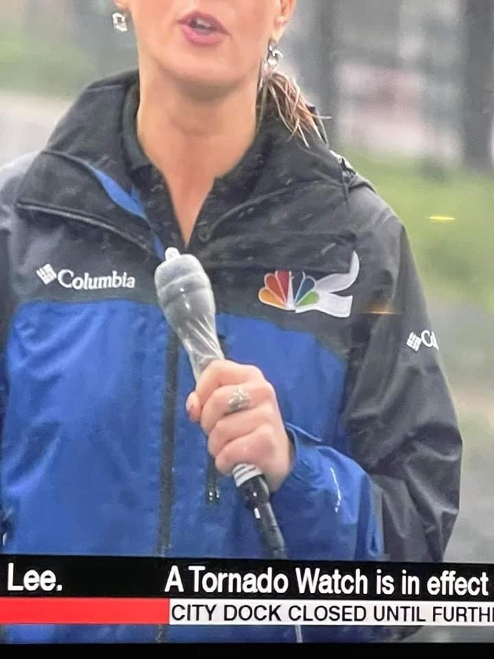
2 feet of flood waters in a house isn’t as photo worthy for the media
-
Large nor’easter
-
Gotta improvise sometimes

-
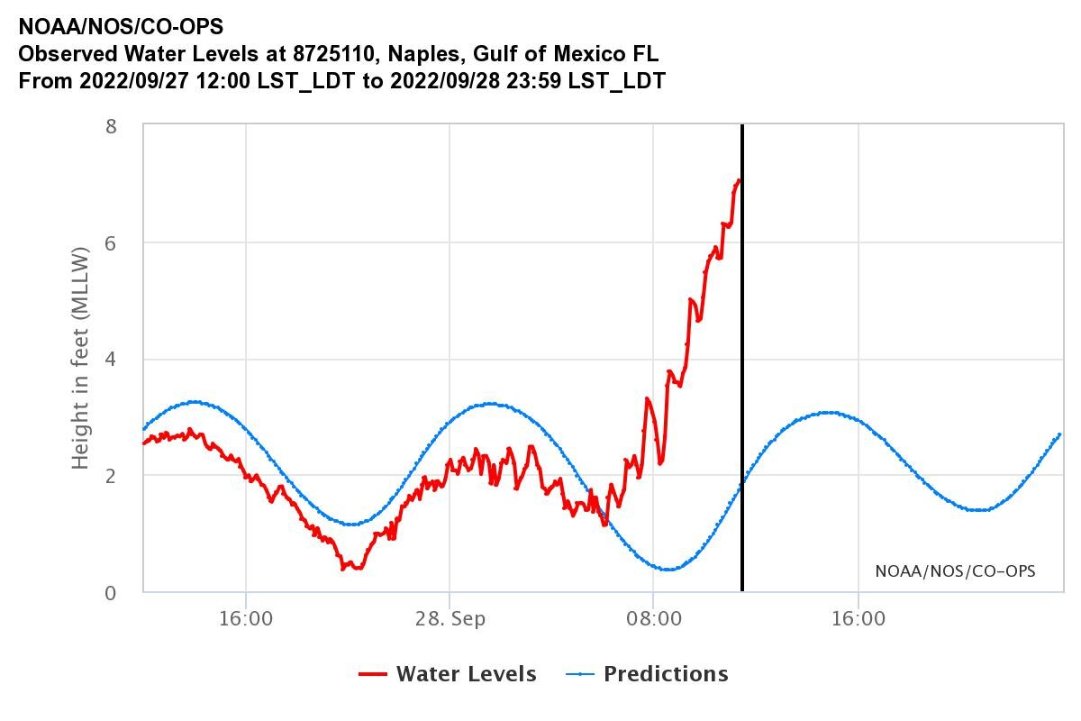
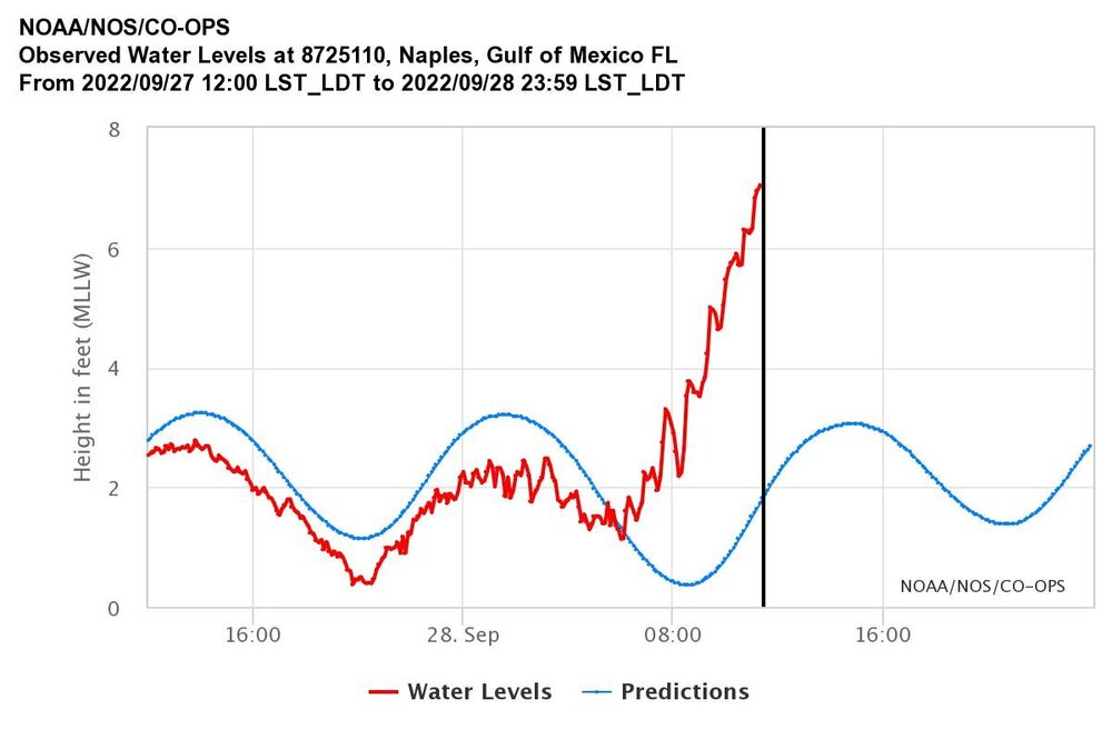
Think the gauge is broken. Quit updating
-
What’s the link?
-
Could be a gauge malfunction. the one in Naples stopped reporting about 1PM today.
-
And right back up.
-
Worse for Ft Myers south also. Bonita Springs, Naples, Marco, Pelican Bay.
-
Katrina, Sandy, Harvey in that order. This may fall as #4.
-
Naples at 7 feet now
-
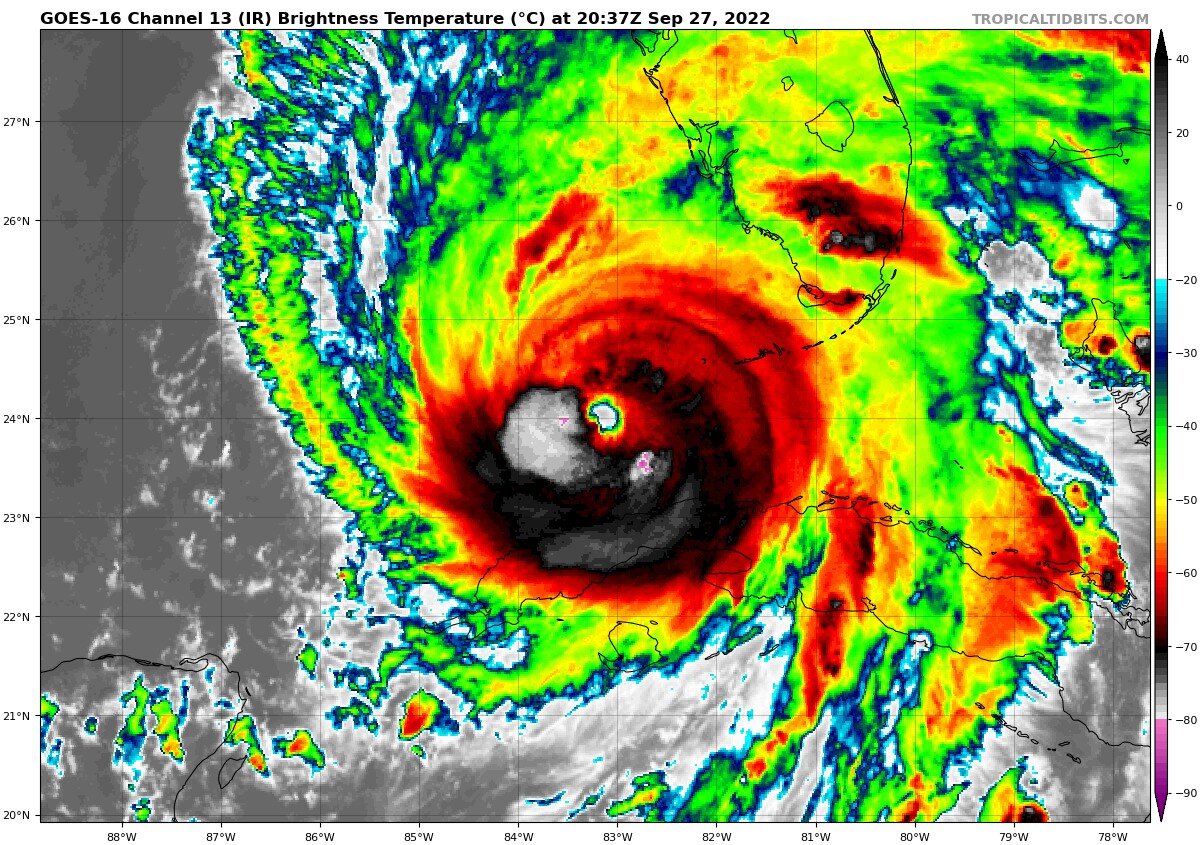
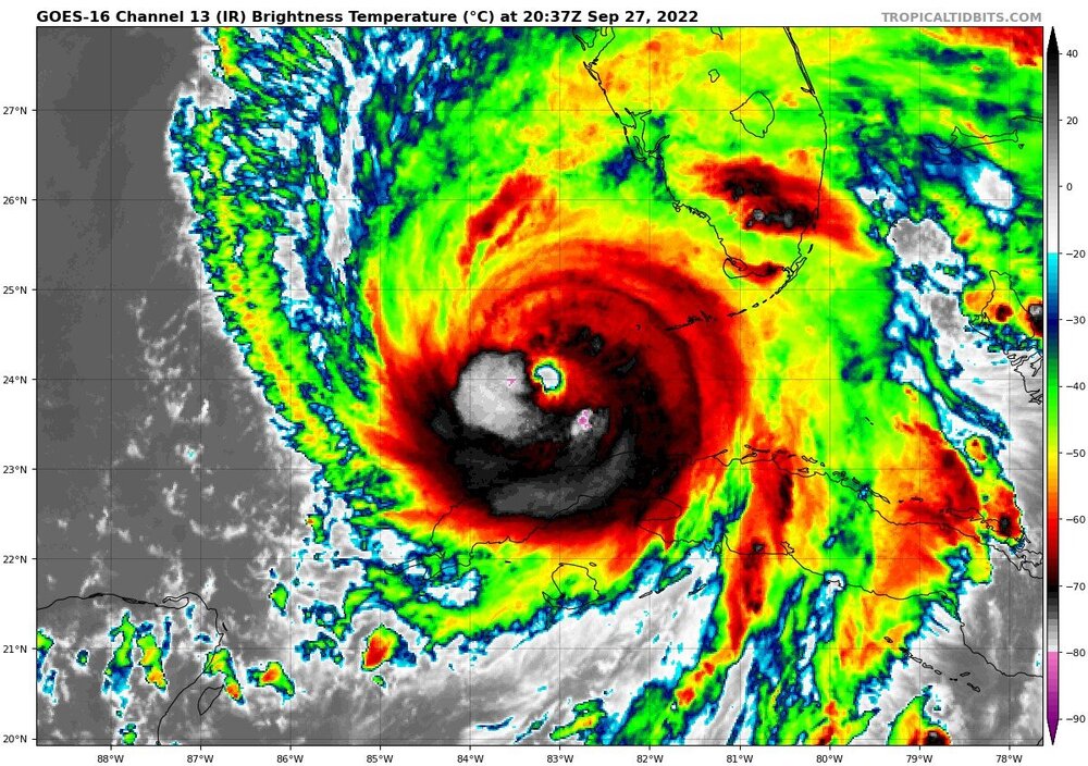
Maybe a 2nd ERC?
-
Is it just me or is it heading just west of north? It has been a long day and I may be seeing things. may be just directly north over the entire radar presentation.
-
Wasn’t out of the realm of possibility especially given the 0Z GFS. Landfall looks closer to Manasota Key now than Punta Gorda.
-
Eyeball replacement cycle occurred and you are worried about 5 knots when the storm surge just rose 2-4 feet in Marco Island? The IKE has increased and will continue to do so until landfall. I don’t think 7MPH means much now.
-
HWRF and HMON always seem to overdo pressure drops.
-
This has been shows in several models the last few days including the ICON, UKMET and JMA.
-
The EWRC while slowing the max winds will increase the surge potential dramatically by expanding the hurricane force wind field.
-
Maybe hot towers starting to set up an EWRC.
-
Didn’t happen with Charley. This is already feeling the trough.