Rmine1
-
Posts
1,053 -
Joined
-
Last visited
Content Type
Profiles
Blogs
Forums
American Weather
Media Demo
Store
Gallery
Everything posted by Rmine1
-
Guess the front passed. Temp dropped 7* in 15 minutes. 39 and rain. Brightwaters
-
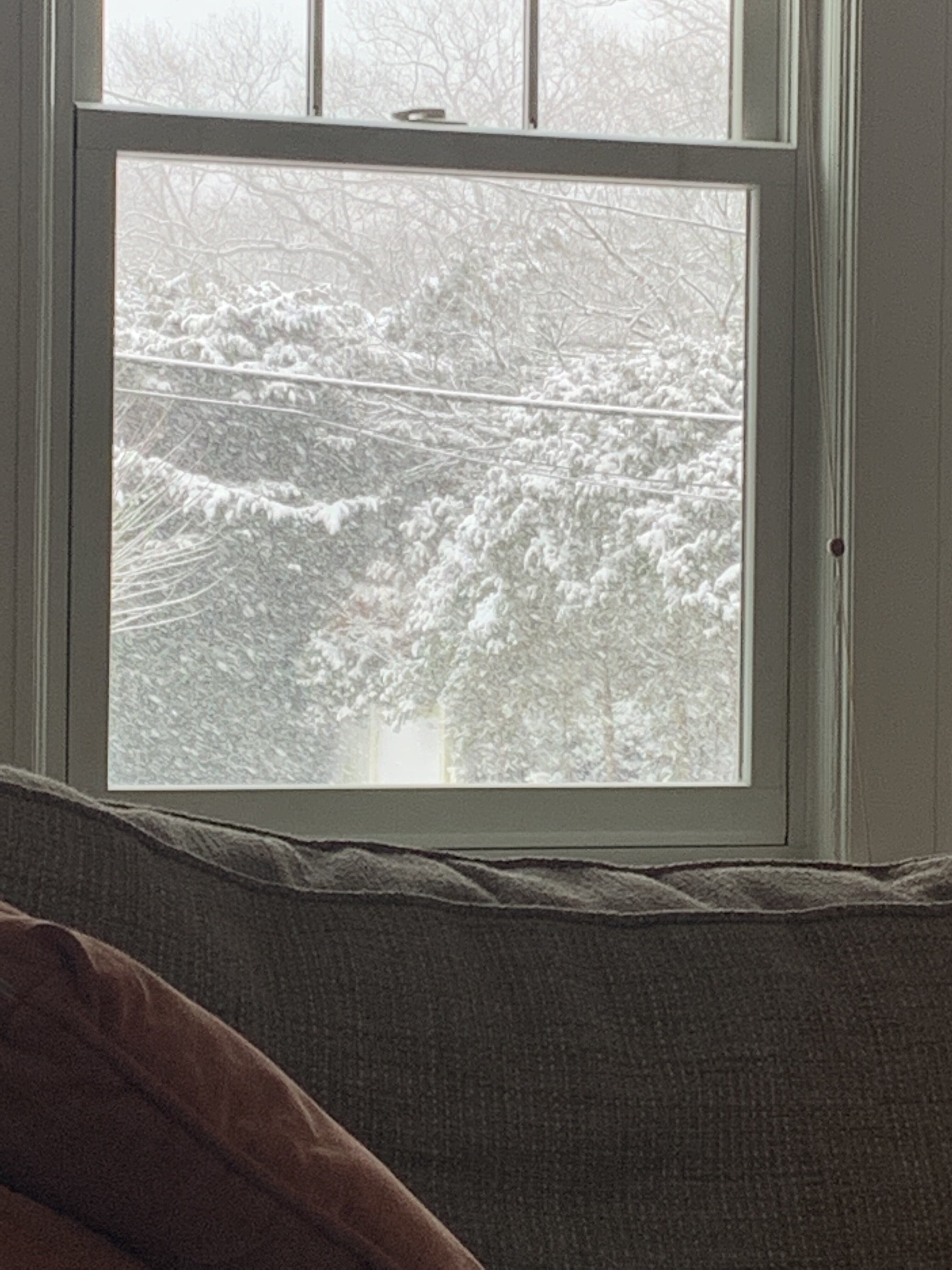
Very light snow, 32, Brightwaters
-
Don’t forget to wear a watch!
-
If you’re in CI, the squall line is still west of NYC
-
2/13 Light/Moderate Snowfall Nowcasting & Observations
Rmine1 replied to Northof78's topic in New York City Metro
Definitely exceeded expectations. Now it’s time to eat like it’s my last meal, and destroy my liver. -
2/13 Light/Moderate Snowfall Nowcasting & Observations
Rmine1 replied to Northof78's topic in New York City Metro
Back under decent band, not like earlier however. -
2/13 Light/Moderate Snowfall Nowcasting & Observations
Rmine1 replied to Northof78's topic in New York City Metro
My second home. Lol -
2/13 Light/Moderate Snowfall Nowcasting & Observations
Rmine1 replied to Northof78's topic in New York City Metro
Love it here. Grew up in WI, been in Brightwaters since ‘97 -
2/13 Light/Moderate Snowfall Nowcasting & Observations
Rmine1 replied to Northof78's topic in New York City Metro
Ha. Not my best moment! -
2/13 Light/Moderate Snowfall Nowcasting & Observations
Rmine1 replied to Northof78's topic in New York City Metro
Decent rates in Brightwaters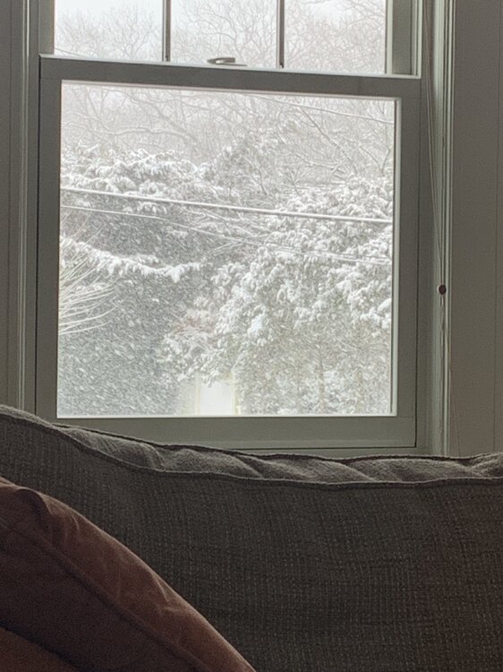
-
2/13 Light/Moderate Snowfall Nowcasting & Observations
Rmine1 replied to Northof78's topic in New York City Metro
Fat flake city here. -
2/13 Light/Moderate Snowfall Nowcasting & Observations
Rmine1 replied to Northof78's topic in New York City Metro
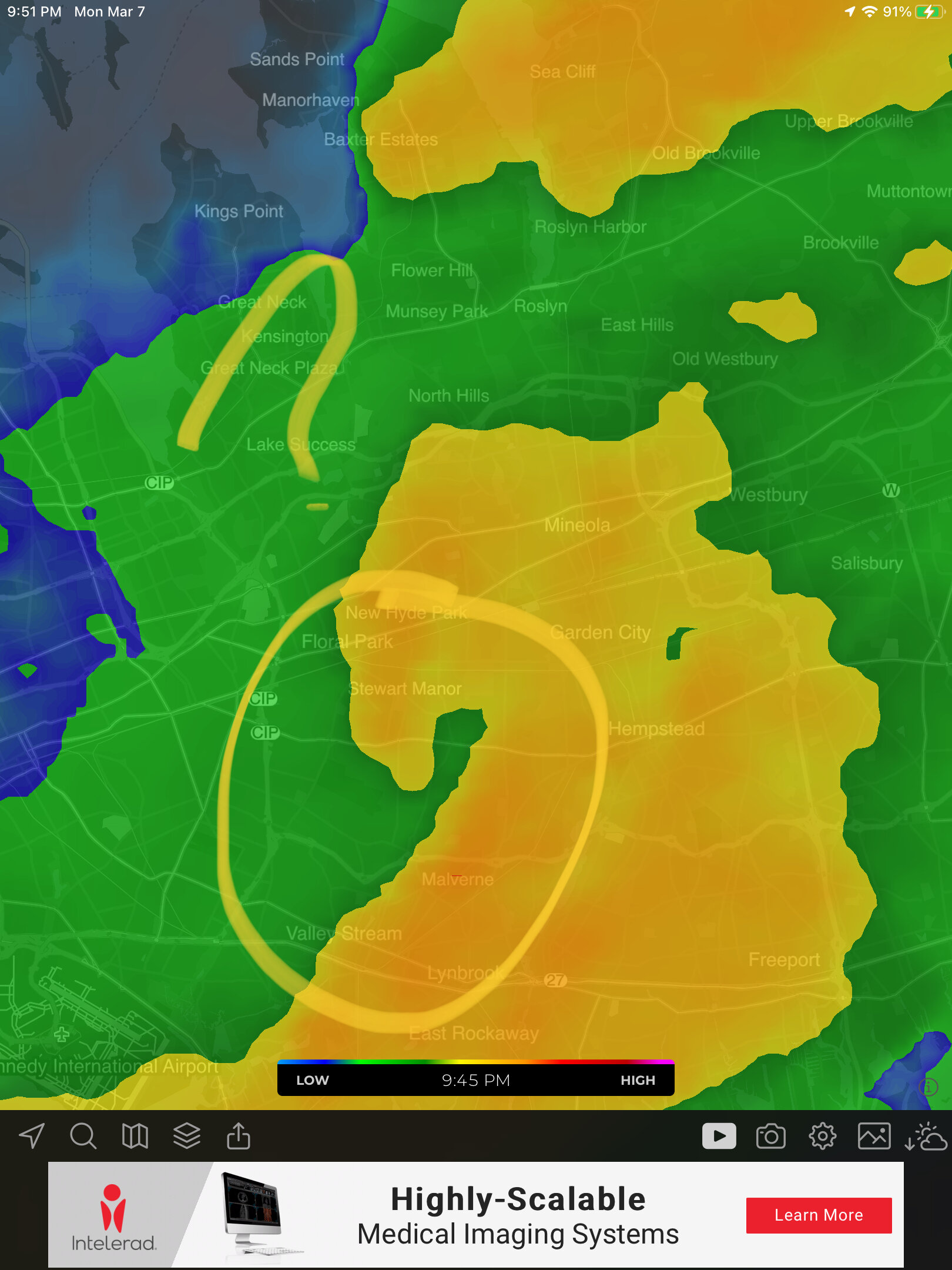
Moderate, borderline heavy snow. Temp dropped back to 30. Brightwaters, SW Suffolk -
2/13 Light/Moderate Snowfall Nowcasting & Observations
Rmine1 replied to Northof78's topic in New York City Metro
Down to flurries in SW Suffolk -
2/13 Light/Moderate Snowfall Nowcasting & Observations
Rmine1 replied to Northof78's topic in New York City Metro
2.5”, 32 degrees in SW Suffolk. Very light snow, looks like a break in the “action” incoming acc to radar. -
2/13 Light/Moderate Snowfall Nowcasting & Observations
Rmine1 replied to Northof78's topic in New York City Metro
As in basically sitting on a boat on the GSB -
2/13 Light/Moderate Snowfall Nowcasting & Observations
Rmine1 replied to Northof78's topic in New York City Metro
Low hopes for the immediate coast -
LI in for a quick surprise?
-
Me too. Small victory IMO
-
Plain rain in Brightwaters thankfully. Cheap ass thermometer been saying 44 degrees all day.
-
January 28/29 Blizzard Observations/Discussion/Nowcasting
Rmine1 replied to Northof78's topic in New York City Metro
Location dependent? Or could this have been the Sandy of blizzards if we had one consolidated low? But wouldn’t that have skunked half of our viewing audience? -
January 28/29 Blizzard Observations/Discussion/Nowcasting
Rmine1 replied to Northof78's topic in New York City Metro
Stupid question. Did that double barrel lows come to fruition? If so, maybe we should not be so quick to judge lol. Most of us busted high -
January 28/29 Blizzard Observations/Discussion/Nowcasting
Rmine1 replied to Northof78's topic in New York City Metro
I thought it was -
January 28/29 Blizzard Observations/Discussion/Nowcasting
Rmine1 replied to Northof78's topic in New York City Metro
Yeah I just made the mistake of looking out front. Front path covered again