NEILwxbo
-
Posts
161 -
Joined
-
Last visited
Content Type
Profiles
Blogs
Forums
American Weather
Media Demo
Store
Gallery
Everything posted by NEILwxbo
-
Day 8 of nasty symptoms for me, I’m only 20 and it’s been pretty awful. Started to feel better Saturday but then woke up Sunday with a horrible stomach flu type thing, have heard of that happening to a few people. Just praying tomorrow will be the start of feeling better.
-
Covid finally caught up to me, tested positive yesterday & feel like dog water today. Roommate’s gf likely gave it to us, oh well
-
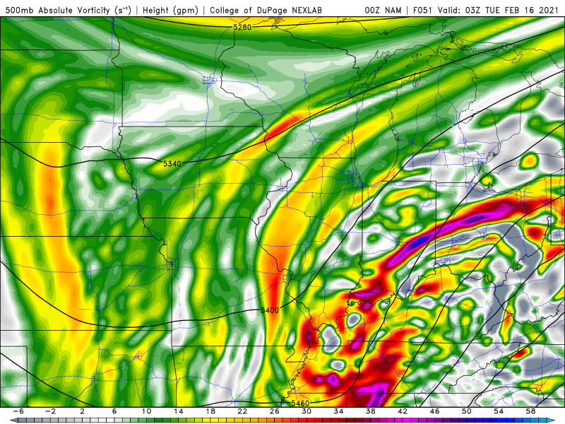
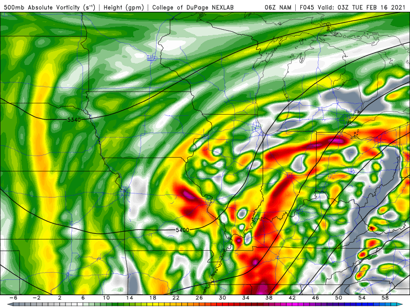
NAM a bump NW. 00z compared to 6z.
-
There’s been atleast 4” of SD here in DKB since December 30th. Not sure what SD records look like but feel like by the end of the month we might be getting close. I can’t remember a year we didn’t nuke the snowpack at some point in Jan-Feb
-
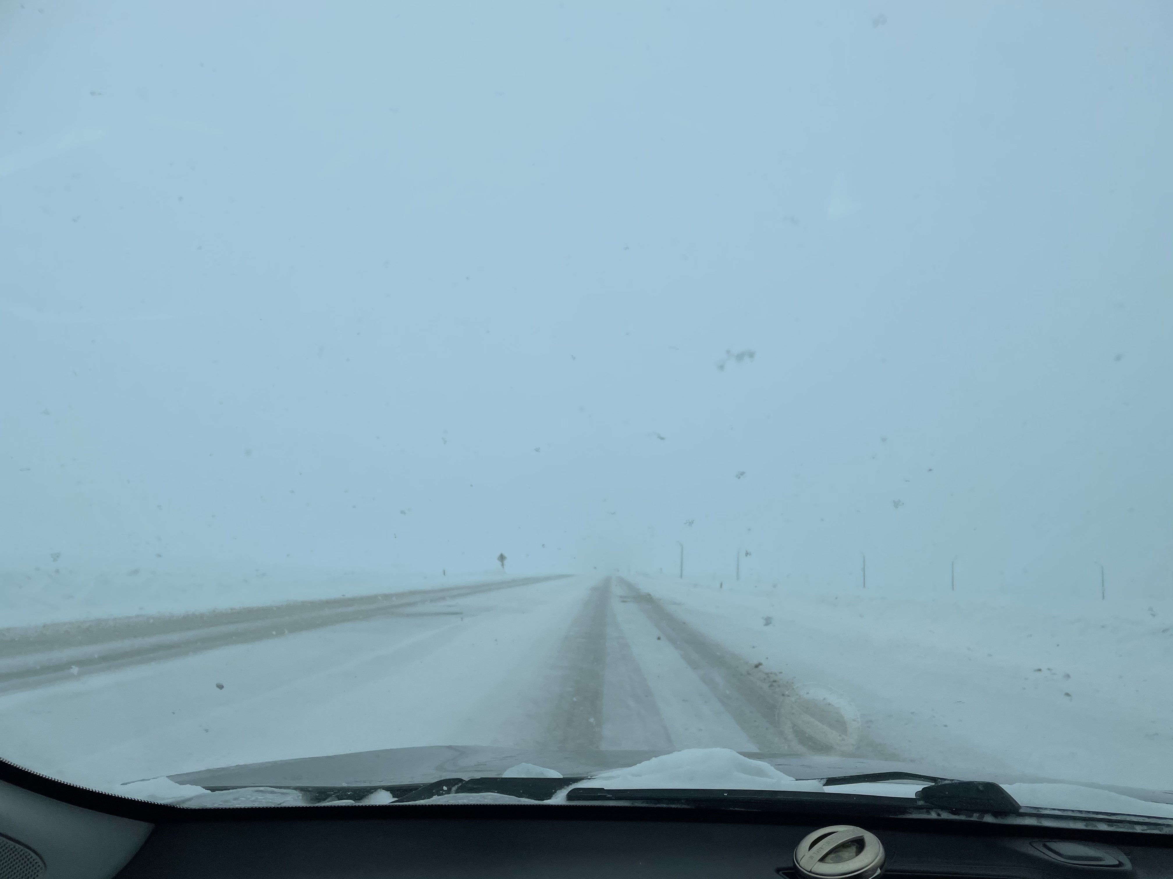
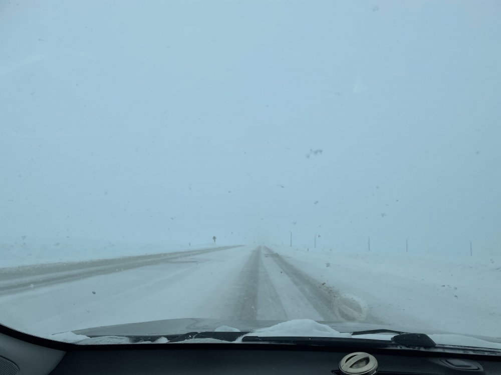
Hard to see on roads in DKB county due to the heavy snow rates
-
Last night overperformed further south so hoping today’s wave will have the same effect further north. Should be a fun day either way with fat flakes already falling
-
The things I would do to keep that band parked over us for several hours
-
The convective nature of this is obvious. Going from SN+ to nothing in 20 seconds between better banding
-
Downstream radar looks nice. Should be a fun afternoon
-
Just start throwing it in the drainage creeks like NIU is doing https://twitter.com/luke_8817/status/1356015413688197128?s=21
-
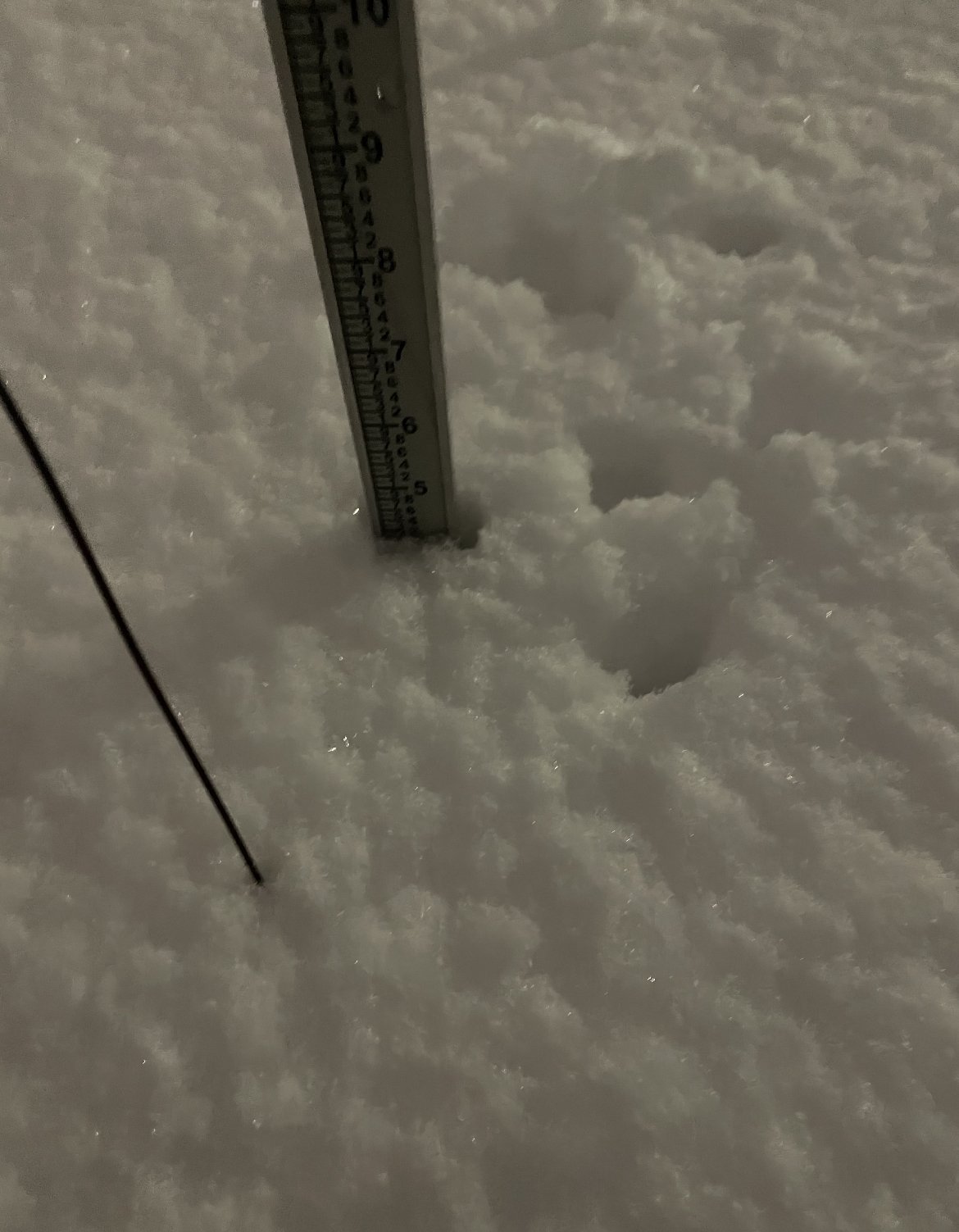
9.6” in DKB at of 4pm storm total. Trying to attach a pic but it won’t let me
-
7.6” in DKB at the 4am hour. Not bad.
-
Ripping in DKB now, definitely exceeding 1”/hr
-
Pouring sleet just south of you in DKB
-
Precipitation already being reported in Macomb. Let’s go.
-
The euro, NAM, GFS v16, are all in almost perfect agreement at this point. It’d be nice if that continues.
-
You could say that.
-
Euro is a bump north and __________ (fill in the blank) hint: starts with a d and ends in rier
-
Jan 25-26th Potential Something Part 3
NEILwxbo replied to Chicago Storm's topic in Lakes/Ohio Valley
Not sure how the hell that happened -
Jan 25-26th Potential Something Part 3
NEILwxbo replied to Chicago Storm's topic in Lakes/Ohio Valley
4.1” at DKB co op station. More than I thought we’d have at this point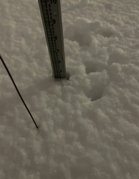
-
Jan 25-26th Potential Something Part 3
NEILwxbo replied to Chicago Storm's topic in Lakes/Ohio Valley
0.5” in DKB, ripping pretty nicely now. The hrrr had only 0.1” through another 2 hours -
Jan 24-26th Potential Something Part 2
NEILwxbo replied to Chicago Storm's topic in Lakes/Ohio Valley
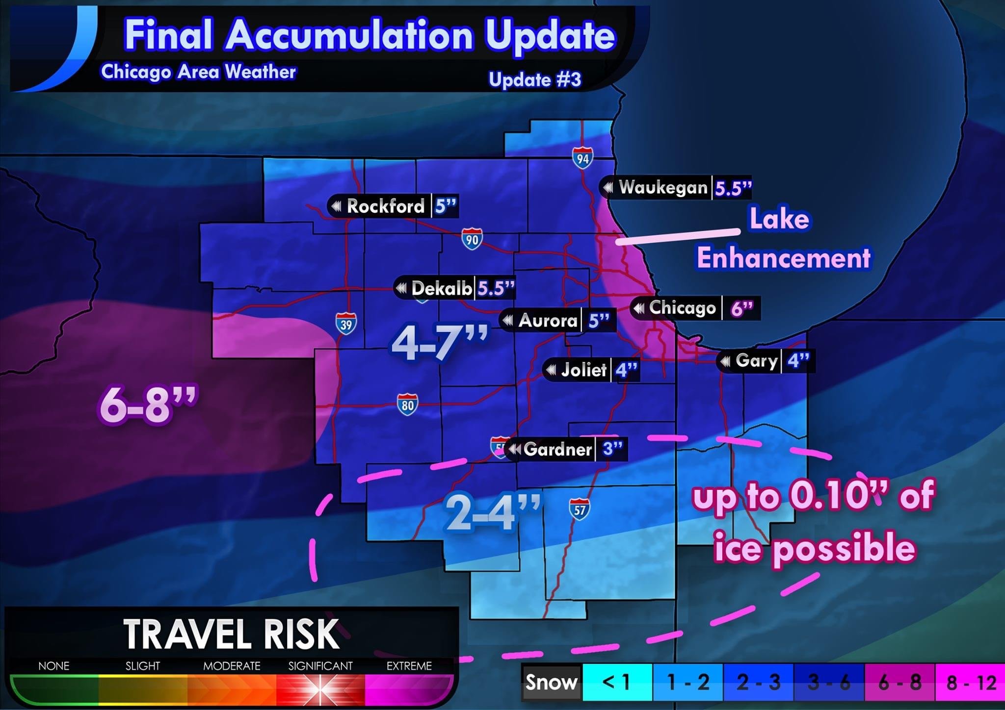
Cut back amounts some from last night. (Promise this’ll be the last one)
-
Jan 24-26th Potential Something Part 2
NEILwxbo replied to Chicago Storm's topic in Lakes/Ohio Valley
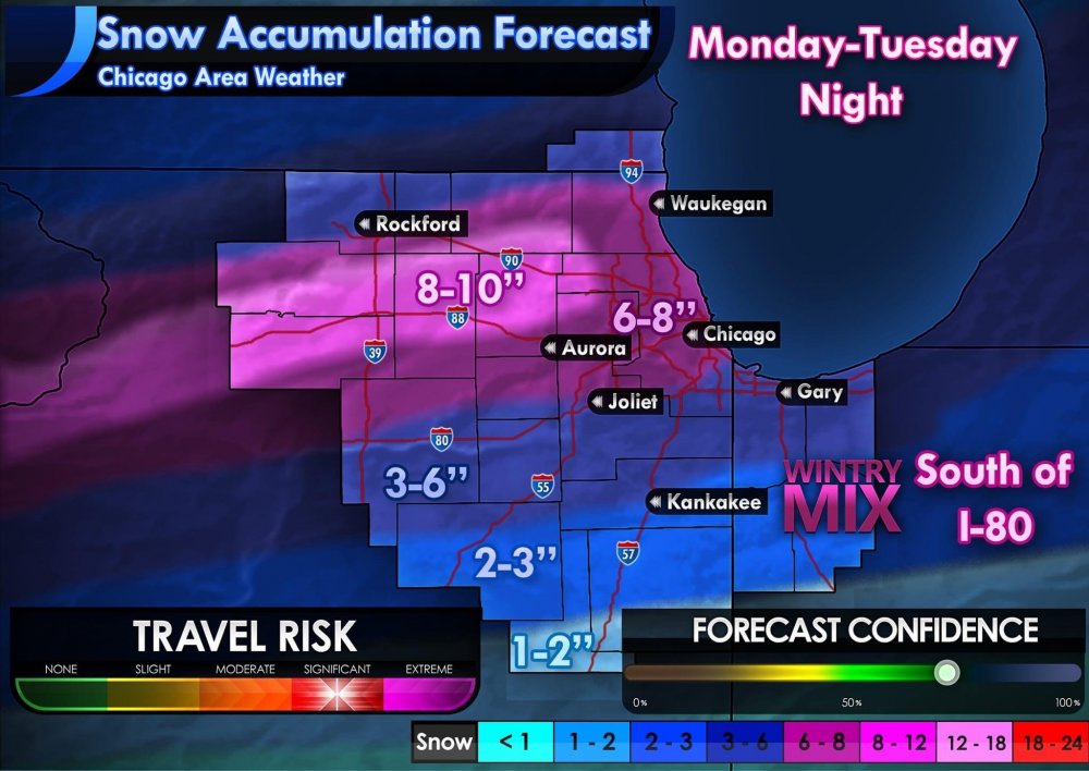
My updated thinking on snowfall amounts for N IL. I fear amounts may still be a bit too high in some spots but will wait till the morning to make more adjustments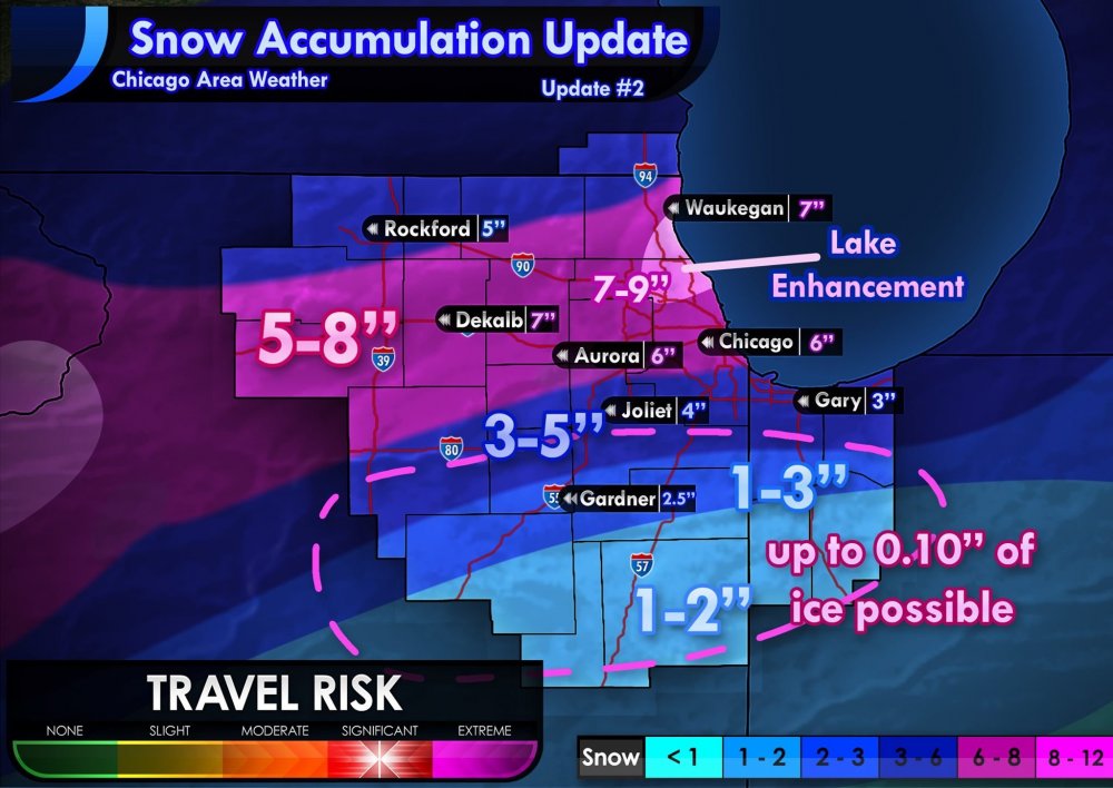
-
Jan 24-26th Potential Something Part 2
NEILwxbo replied to Chicago Storm's topic in Lakes/Ohio Valley
FWIW, 18z RAP is north and a touch wetter for LOT’s cwa through 32 hours -
Jan 24-26th Potential Something Part 2
NEILwxbo replied to Chicago Storm's topic in Lakes/Ohio Valley
First thoughts on accumulations for LOT area. Could change.