NEILwxbo
-
Posts
161 -
Joined
-
Last visited
Content Type
Profiles
Blogs
Forums
American Weather
Media Demo
Store
Gallery
Everything posted by NEILwxbo
-
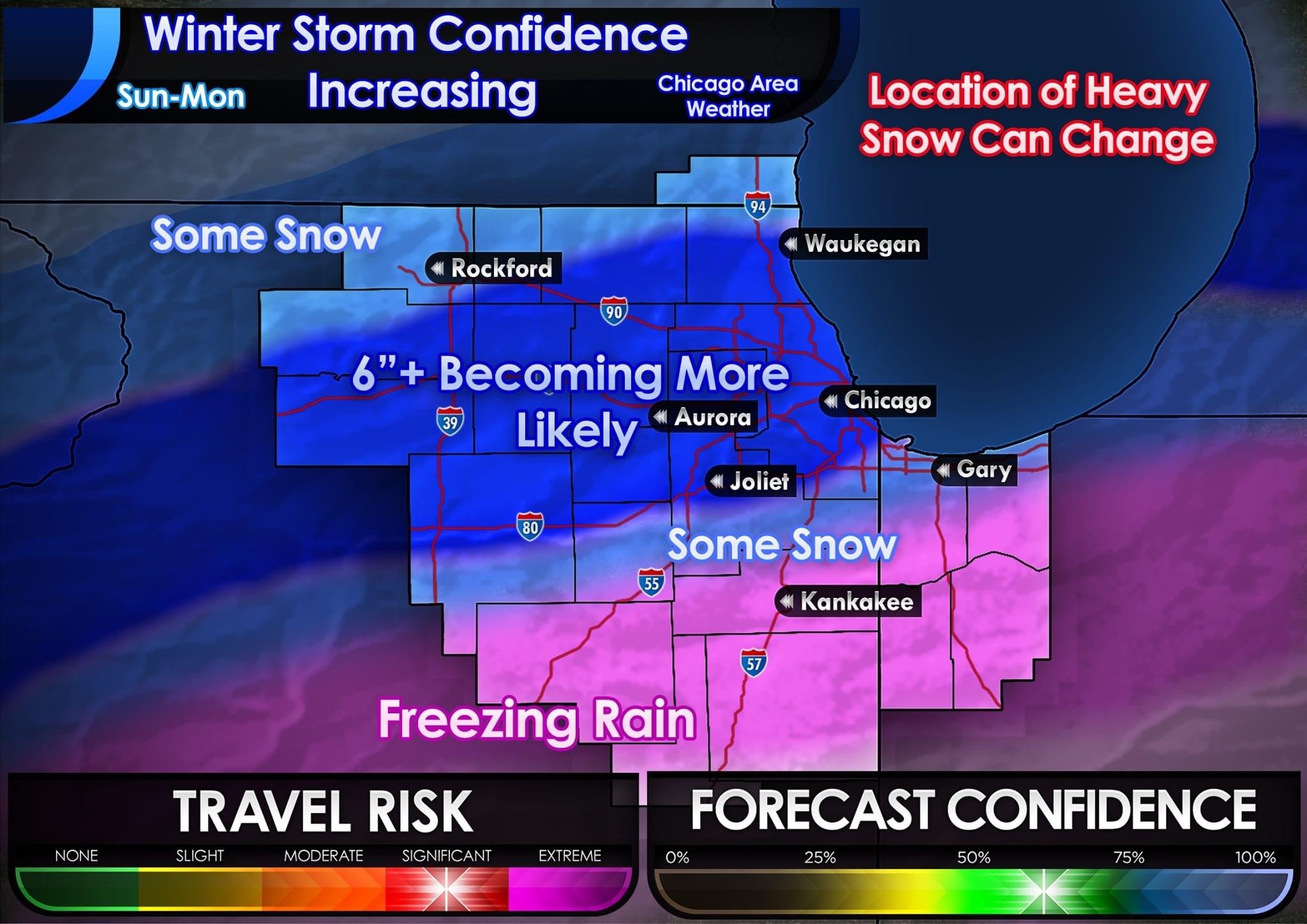
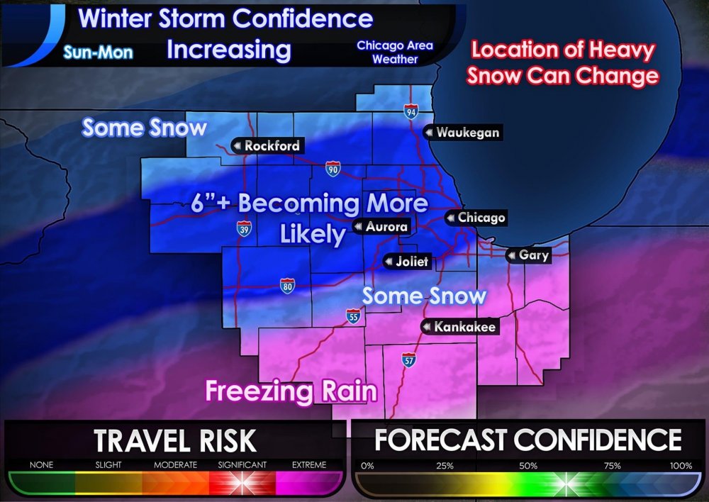
Current thinking for LOT cwa. Tomorrow should be a fun day
-
This. It could be in central IL by 00z tonight and the main weenie band band could still end up near the IL/WI border. Have seen that happen many times before
-
That’ll be 00z
-
This is the first storm in years you haven’t posted that in a storm thread I think....hence why this one is different
-
This one feels dare I say...different
-
Winter 2020-21 Medium/Long Range Discussion
NEILwxbo replied to Hoosier's topic in Lakes/Ohio Valley
Thanks for the reminder...that was painful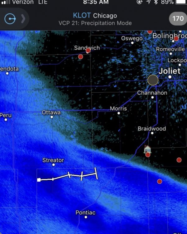
-
Winter 2020/2021 Short Range Discussion
NEILwxbo replied to Chicago Storm's topic in Lakes/Ohio Valley
Color me shocked -
Winter 2020/2021 Short Range Discussion
NEILwxbo replied to Chicago Storm's topic in Lakes/Ohio Valley
Slight north trend with banding placement for tomorrow among hi res guidance? -


-
Winter 2020/2021 Short Range Discussion
NEILwxbo replied to Chicago Storm's topic in Lakes/Ohio Valley
Eh wouldn’t be that jelly. It’s still 34 so I’m sure you can imagine how well it’s accumulating -
Winter 2020/2021 Short Range Discussion
NEILwxbo replied to Chicago Storm's topic in Lakes/Ohio Valley
Dusting on elevated surfaces in DKB. Puking large flakes for now -
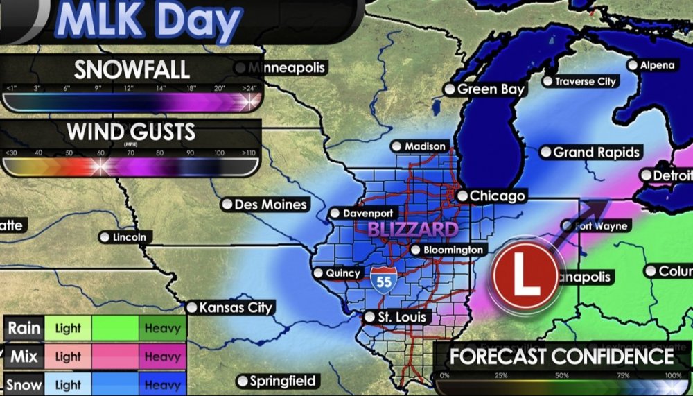
I don’t know how someone can look at this and say things are getting better
-
Here ya go! Even complete with the 100% forecast confidence, 24”+, & 60mph gusts
-
Winter 2020-21 Medium/Long Range Discussion
NEILwxbo replied to Hoosier's topic in Lakes/Ohio Valley
Midweek looks potentially interesting. -
Winter 2020/2021 Short Range Discussion
NEILwxbo replied to Chicago Storm's topic in Lakes/Ohio Valley
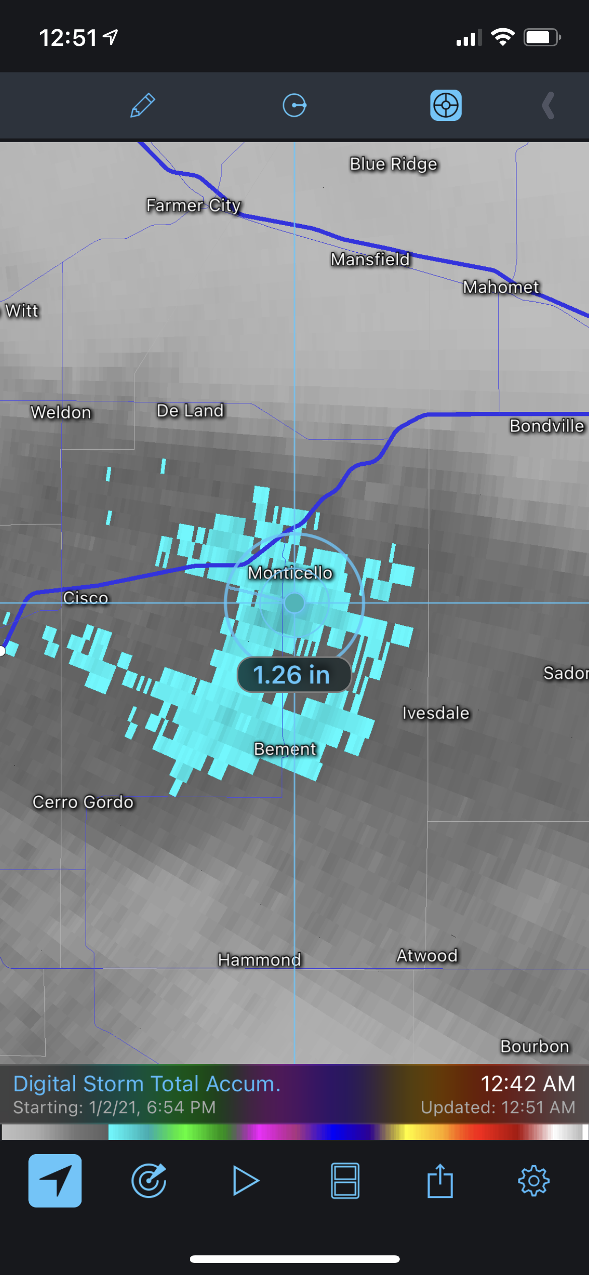
Not sure how accurate this is being 40 miles from the radar but wow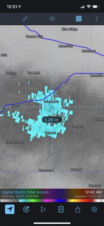
-
Winter 2020/2021 Short Range Discussion
NEILwxbo replied to Chicago Storm's topic in Lakes/Ohio Valley
Quite the weenie band near Monticello. Wouldn’t be surprised to see a 6” report from around there -
Here in Dekalb trees are not looking good with the ~.2” of ice leftover from Tuesday and whatever freezing rain we had today too. The 1-3” of wet snow this evening could bring some down for sure
-
In DKB there’s a lot of small branches down from the other night, still about 0.25” of ice on just about every surface. If any freezing rain gets that far north could be bad
-
0.2” of ice accretion in DKB
-
Moderate rain mixing with sleet with a temp at 26 in DKB here. Not good at all. Everything has became covered in ice pretty quickly
-
There is some filling that appears to be going on in NW IL, hopefully that expands east
-
As mentioned above, REALLY ripping under these heavier bands. 1.5-2”/hr rates for sure
-
They’ve been running around all day salting but it sure doesn’t look like it. The evening rush is going to be a disaster
-
Latest LOT afd thinks this could overperform, talks about expanding WSW southeast
-
Good to hear for us upstream