40westwx
-
Posts
629 -
Joined
-
Last visited
Content Type
Profiles
Blogs
Forums
American Weather
Media Demo
Store
Gallery
Everything posted by 40westwx
-
Its ten days away.. so its complete fantasy... but per the upper air pattern at day 7.. and the energy rolling in the west coast on day 5.. I would say that there is definitely potential.. lets see what the ensembles show..
-
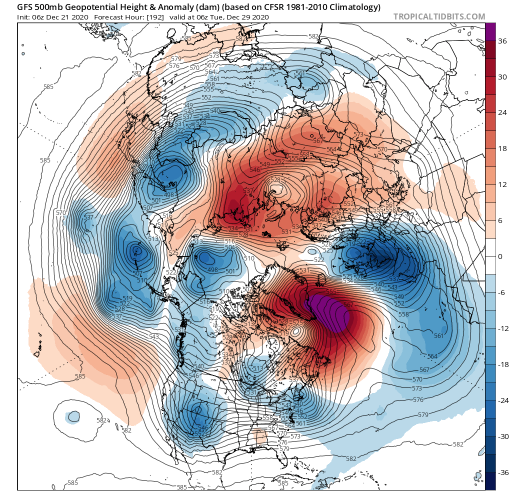
Might be a snow storm on the GFS.. looks locked and loaded at 192...
-
I remember when the Weather Channel was actually good and they did the "look ahead".. it was at 50 past the hour and it was obviously snow weenie stuff.. They would start out every one with the ten day progression of the jet stream.. without knowing any of this above, after a while I could recognize what the jet stream would look like when there would be a corresponding snow storm in our area.. I realize now that they were showing the jet stream because it was how they use pattern recognition to sniff out snow storms in the long range.. its the same thing we do now.. we just have a lot of fancy acronyms that end in O.
-
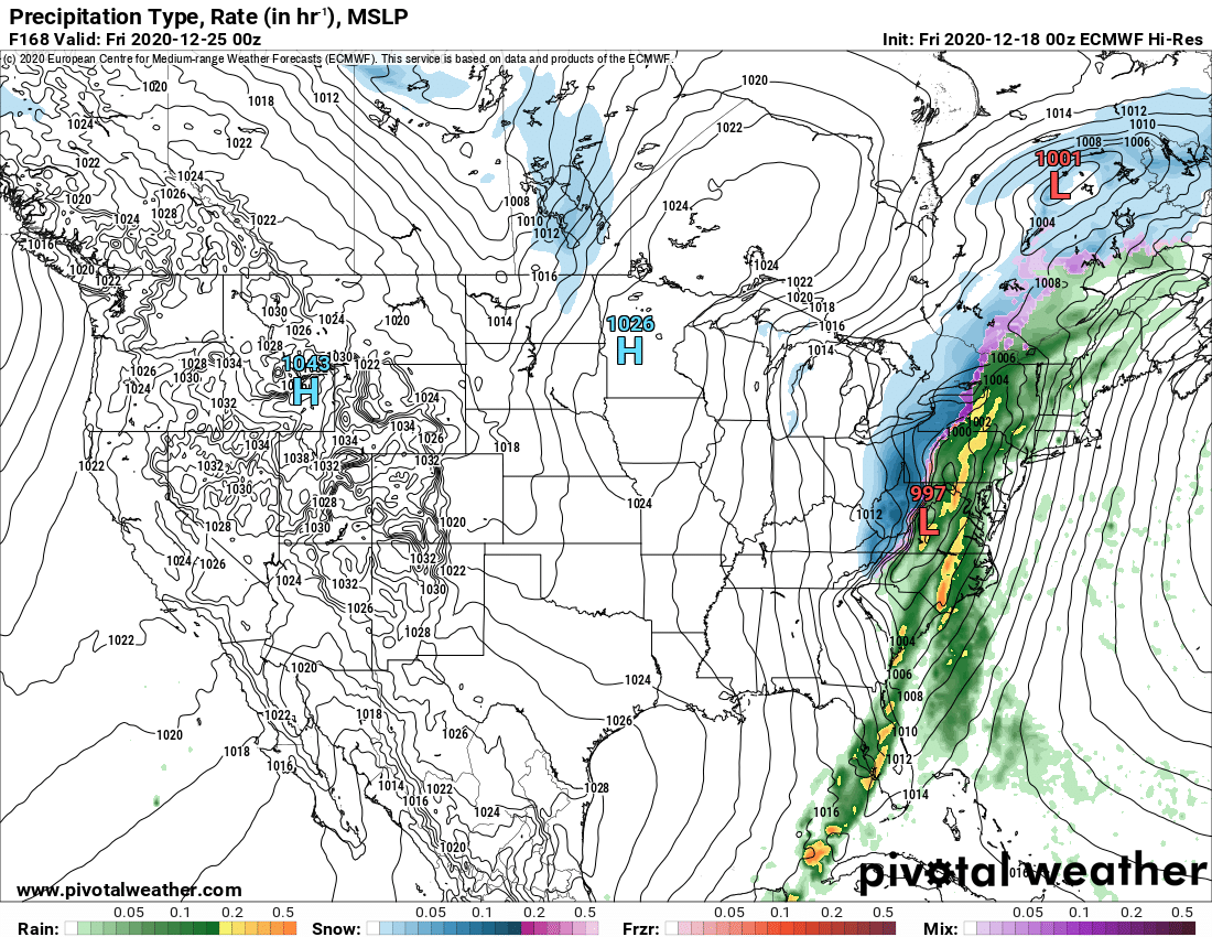
yeah I agree.. I am not getting too excited bout this one.. especially with the euro taking a step back... our best hope would be for the front to clear the area and then an upper level low comes bowling through spawning a snowstorm.. the anafront is not really a thing here I was just sayong 3-6 cause the HH GFS actually did show 3-6.. and its Christmas eve so..
-
Its 3-6
-
Are you saying that maybe the cutter on the 10 day gfs might not work out?
-
yeah.. the track of the new years storm doesnt really fit the pattern... there is clearly a massive Greenland block and a 50 50 low... I guess those features need to be a little further north and west.. but hey.. I will take it at this range
-
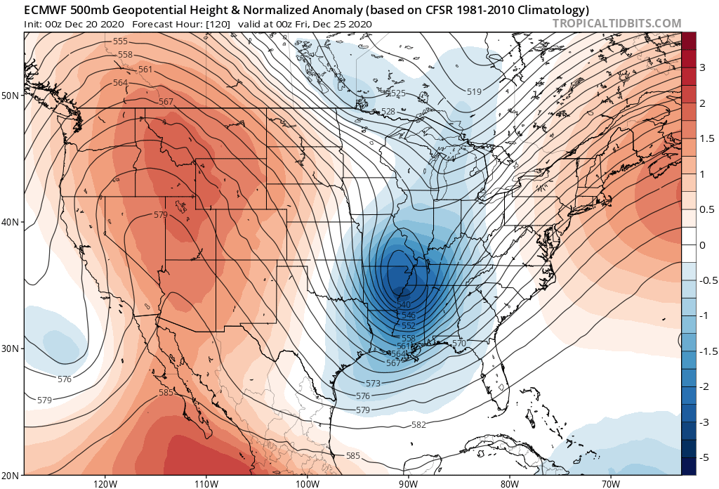
Every run of the euro gets better and better for Christmas. Last night: Two nights ago:
-
Think Ray Lewis
-
Talk about models picking up on the big ones early... 1993 was the first time I ever heard the word "computer model" during a weather broadcast.. it was the weather channel and it was either Bruce Edwards or John Hope geeking out about how they had major consensus in the global models 5 days out on the Super Storm.. they were saying that they had never seen model output like that before...
-
Apparently my son cried last episode cause Baby Yoda left with Luke.. its awesome that they have a hit TV show to keep the franchise going! I have watched it a little.. its made really well and really captures the magic of star wars!
-
I a couple of trends in the right direction and we are in the game
-
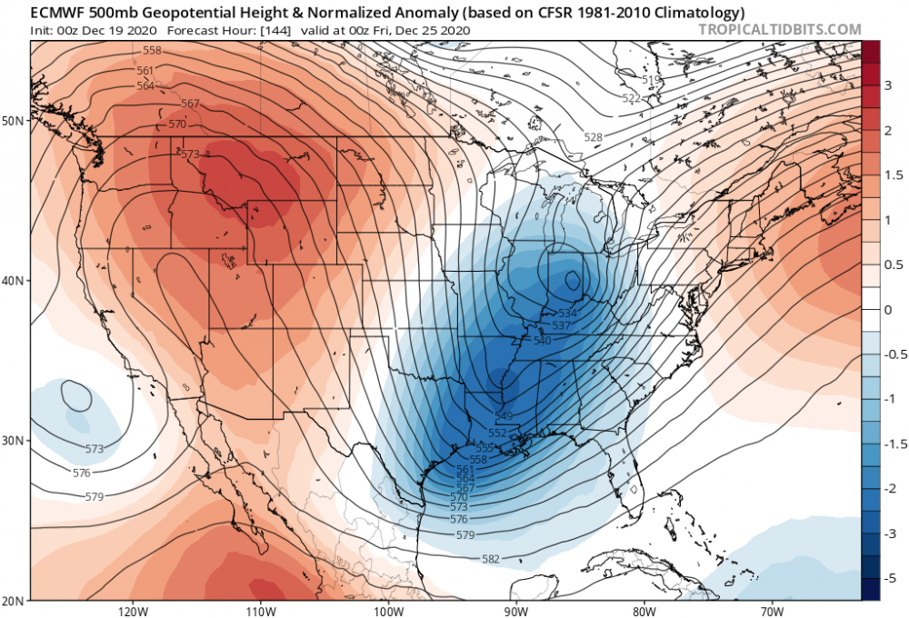
Thats huge difference from the previous run. That low develops as a trailing low on the front.. previous run it was just some anafront snow. I would keep an eye on this one...
-
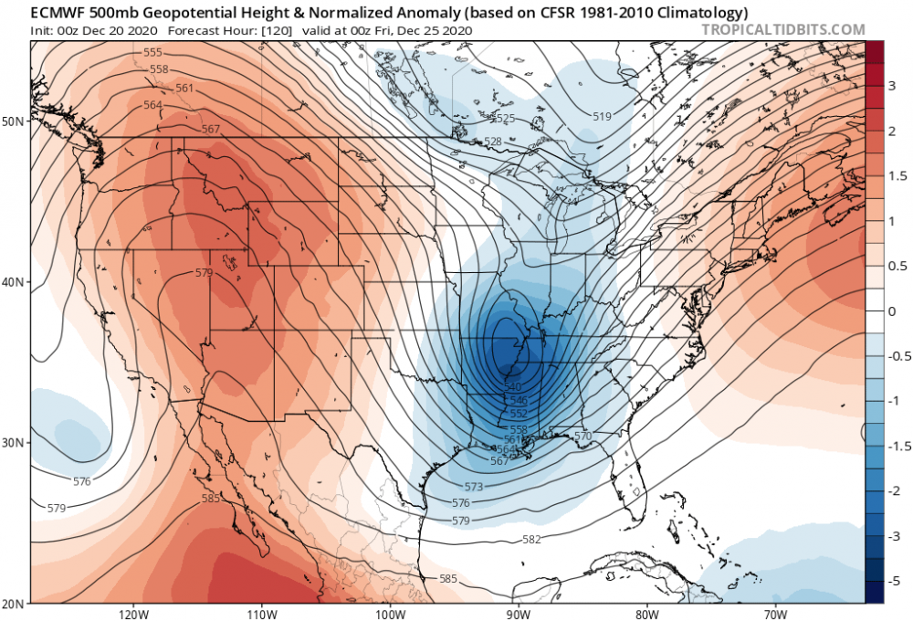
Thats an pretty anomalous look in the 500 MB set up for Christmas.... seems to me that that could evolve in to a vigorous storm coming north out of the gulf. I would keep an eye out on that... jeez
-
I bet they are gonna have the whole mountain open by New Years! I might head up tomorrow.
-
yea it was i still got 3 to 5 inches nice to see a decent storm for once
-
It does have it!!... just further west.

-
I was woken up by my neighbor sweeping the snow... what a great surprise.. I just looked at the GFS.. we arent done.
-
This will go down as the worst winter storm ever for me... I say this with a heavy heart.. earlier today my son took our Great Dane out to play in the snow... as he was galloping through the snow he collapsed and suddenly died.. he was extremely healthy.. it makes no sense.. I had to put him in the car in the front yard and take him to the vet to get him cremated.. It happened in front of all the neighbors... I feel like this isnt real or something...
-
yup.. my brotherinlaw just got his car stuck in Carrol County.. he is walking home
-
At least an hour.. I am still snowing
-
3 inches in Catonsville
-
so my expectations have just been exceeded. It is bonafide heavy snow with a more than an inch in the last 45 min. Catonsville!!!
-
Heavy snow in Catonsville, MD.. all is right in the world!!
-
wow thats awesome given your location