MN Transplant
-
Posts
17,625 -
Joined
-
Last visited
Content Type
Profiles
Blogs
Forums
American Weather
Media Demo
Store
Gallery
Everything posted by MN Transplant
-
2020 Mid-Atlantic Severe Weather - General Thread
MN Transplant replied to Kmlwx's topic in Mid Atlantic
25k w/o power in northern VA. Majority in Fairfax Co. -
2020 Mid-Atlantic Severe Weather - General Thread
MN Transplant replied to Kmlwx's topic in Mid Atlantic
Good storm. Not severe here, but good T&L, enough wind to make a racket in the treetops, and beneficial rain. -
2020 Mid-Atlantic Severe Weather - General Thread
MN Transplant replied to Kmlwx's topic in Mid Atlantic
Looking good in mattie’s area of Burke -
2020 Mid-Atlantic Severe Weather - General Thread
MN Transplant replied to Kmlwx's topic in Mid Atlantic
Warning for most of the DC Beltway area. Text is 60 mph gusts. TDCA has 50mph winds not far off the surface -
A nice cool stretch, and then the heat returns and we immediately obliterate a record high (95 at IAD vs the record of 89).
-
2020 Mid-Atlantic Severe Weather - General Thread
MN Transplant replied to Kmlwx's topic in Mid Atlantic
Yep, nice squall there. The camera shaking is making me dizzy. -
2020 Mid-Atlantic Severe Weather - General Thread
MN Transplant replied to Kmlwx's topic in Mid Atlantic
The big problem we have tomorrow is that it is dry. HRRR is putting the DPs in the 50s by later in the day. Kills the instability and the line dropping down. -
2020 Mid-Atlantic Severe Weather - General Thread
MN Transplant replied to Kmlwx's topic in Mid Atlantic
Forecast Tools > HREF > Storm Attributes has an assortment of these. -
Hot enough for you? -- the sequel (forecast contest)
MN Transplant replied to Roger Smith's topic in Mid Atlantic
BWI _ 99 DCA _ 98 IAD _ 98 RIC _ 99 -
If the NHL and NBA are going to do this summer conclusion to the season, are they going to delay the start of next season? They can't go right from the playoffs to a short break to the full next season. The sport calendar is going to be packed in Aug/Sept if this all works out.
-
We have dead oaks scattered throughout our neighborhood. Took one down in my yard last fall. Not widespread, but it is always notable when one of the big ones dies quickly.
-
2020 Mid-Atlantic Severe Weather - General Thread
MN Transplant replied to Kmlwx's topic in Mid Atlantic
Flash flood watch -
2020 Mid-Atlantic Severe Weather - General Thread
MN Transplant replied to Kmlwx's topic in Mid Atlantic
79/63 at DCA. Hit 77.4 here a bit ago. -
2020 Mid-Atlantic Severe Weather - General Thread
MN Transplant replied to Kmlwx's topic in Mid Atlantic
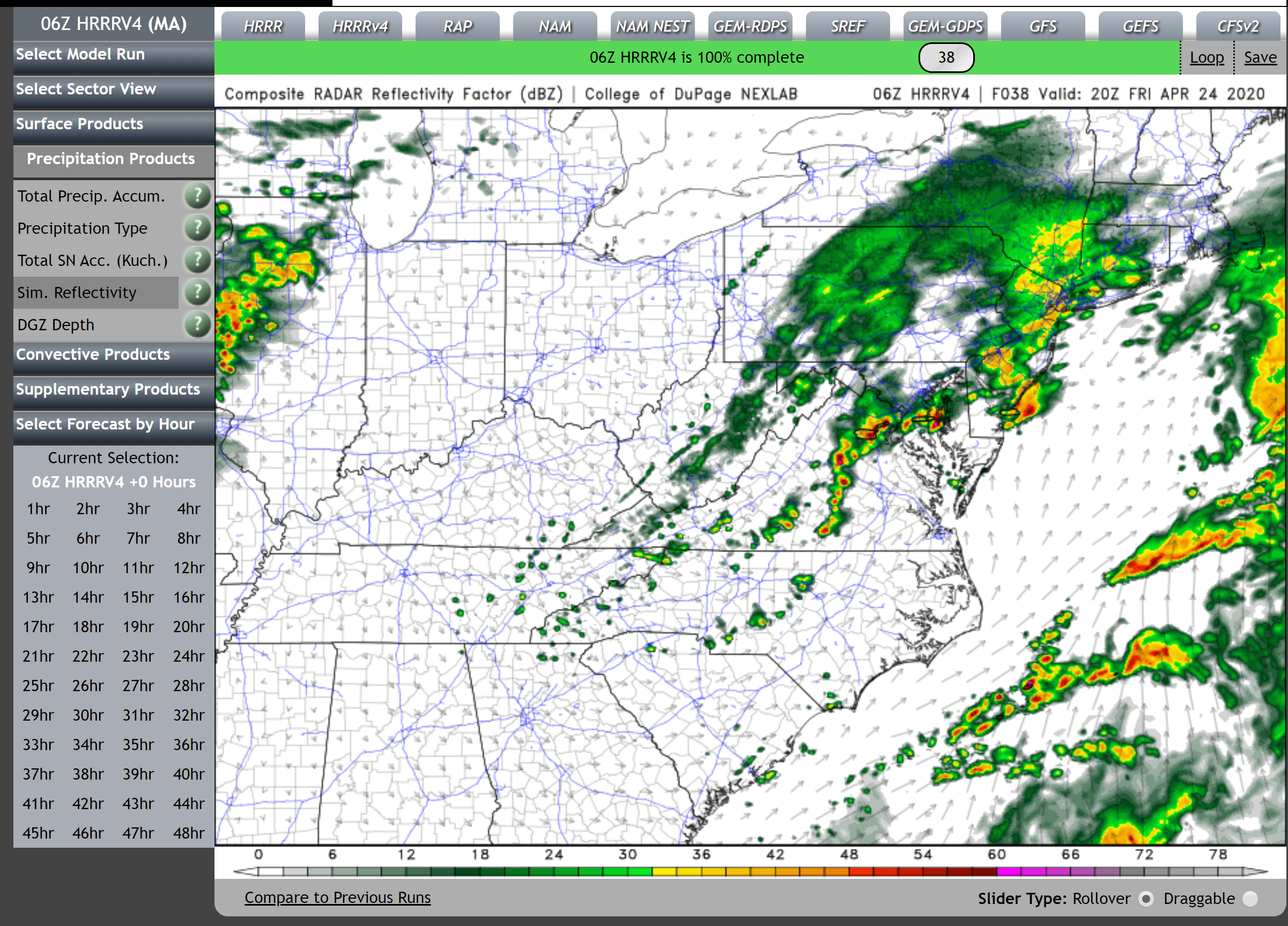
One thing that we seem to have going for us is that the NAM and HRRRs don't show a lot of impact from the mid-day remnants of the precip that is in WV/OH right now. A couple hundreths of an inch of rain and it rebounds to the upper 70s after. If that happens, we have a better chance as far north as DC. But, I'd still rather be between EZF and RIC. -
2020 Mid-Atlantic Severe Weather - General Thread
MN Transplant replied to Kmlwx's topic in Mid Atlantic
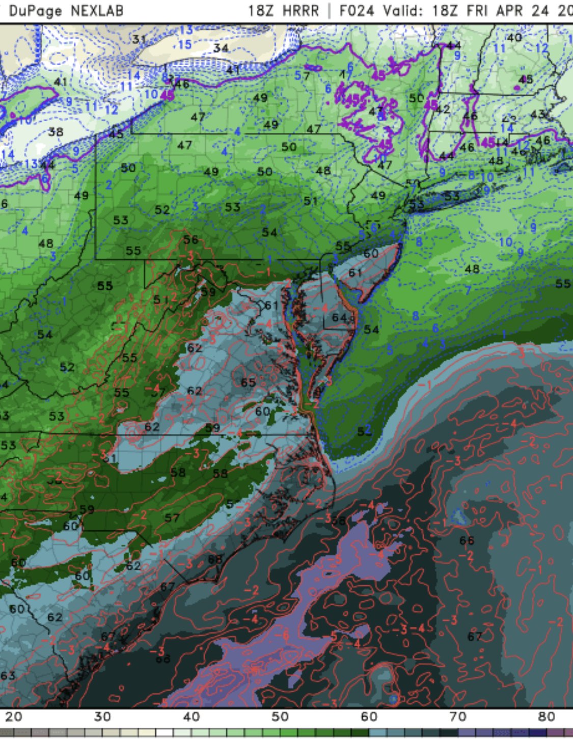
Nice cell rolling down 64 on the 00z HRRR. Unfortunately that does signal that it has caved to the NAM. -
2020 Mid-Atlantic Severe Weather - General Thread
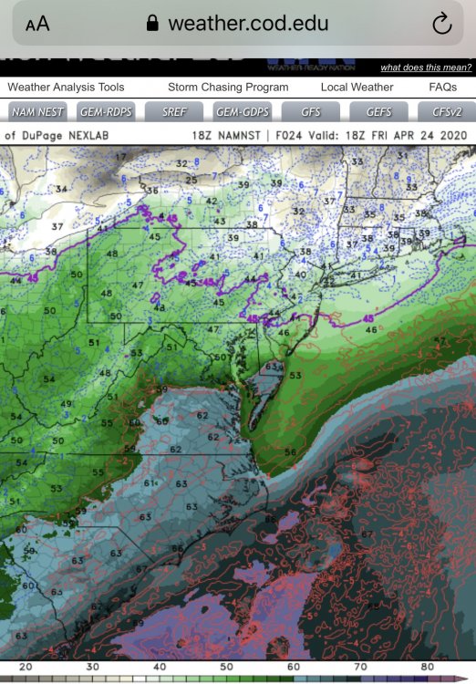
MN Transplant replied to Kmlwx's topic in Mid Atlantic
HRRR v NAM tomorrow afternoon.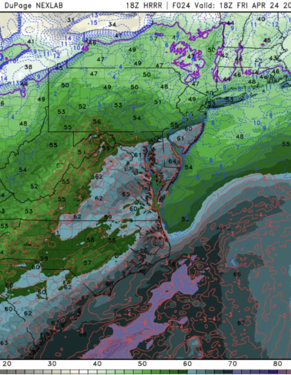
-
2020 Mid-Atlantic Severe Weather - General Thread
MN Transplant replied to Kmlwx's topic in Mid Atlantic
Equivalent to posting a random run of the ICON showing a snowstorm while everything else is bone dry. Friday afternoon:
-
2020 Mid-Atlantic Severe Weather - General Thread
MN Transplant replied to Kmlwx's topic in Mid Atlantic
Still have 0.00" in the rain gauge, but I'll mark it as a T since I felt some drops. -
2020 Mid-Atlantic Severe Weather - General Thread
MN Transplant replied to Kmlwx's topic in Mid Atlantic
I'm up to 66.1, but the dews are stuck in the upper 40s. IAD is ~65/43. -
2020 Mid-Atlantic Severe Weather - General Thread
MN Transplant replied to Kmlwx's topic in Mid Atlantic
Groan. Peak wind is 22mph today. Only about 45 mph less than what the Euro gave me.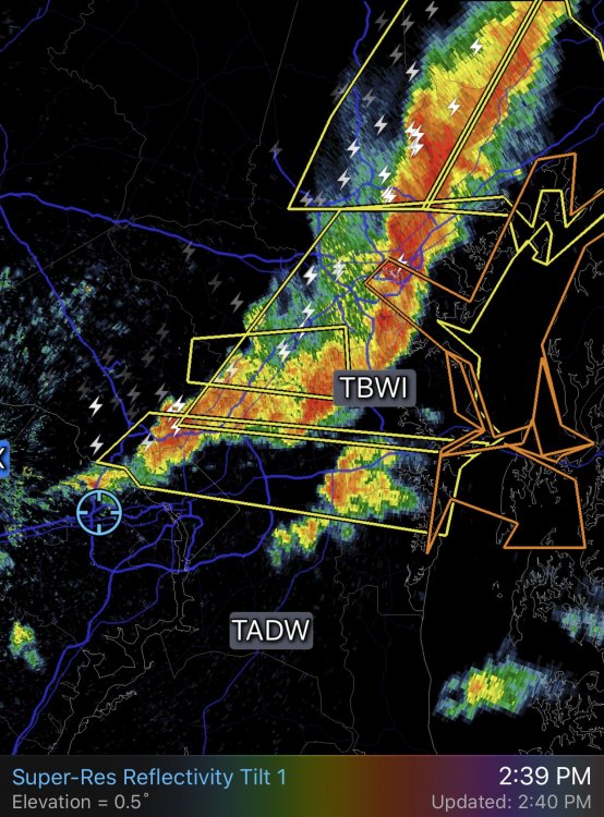
-
2020 Mid-Atlantic Severe Weather - General Thread
MN Transplant replied to Kmlwx's topic in Mid Atlantic
As an aside to the severe weather, just out the visible satellite to our west. W-E oriented horizontal rolls with N-S oriented terrain-induced gravity waves. Like a checkerboard. -
2020 Mid-Atlantic Severe Weather - General Thread
MN Transplant replied to Kmlwx's topic in Mid Atlantic
I like how the end of the line is laying flat enough to not reach down to 66. Ah, well, another day. -
2020 Mid-Atlantic Severe Weather - General Thread
MN Transplant replied to Kmlwx's topic in Mid Atlantic
I'm up to 76.1/70. Would like to see that Leesburg line build south, but not counting on it. -
2020 Mid-Atlantic Severe Weather - General Thread
MN Transplant replied to Kmlwx's topic in Mid Atlantic
Interesting cell out front of the line in MoCo. Keep an eye on that. -
2020 Mid-Atlantic Severe Weather - General Thread
MN Transplant replied to Kmlwx's topic in Mid Atlantic
And, sun ob.