

McHenrySnow
-
Posts
537 -
Joined
-
Last visited
Content Type
Profiles
Blogs
Forums
American Weather
Media Demo
Store
Gallery
Posts posted by McHenrySnow
-
-
Just now, beavis1729 said:
Yep, agree overall. With that said, I think it's natural to be on edge and worry before the storm...thinking more about what could go wrong vs. what is likely to occur.
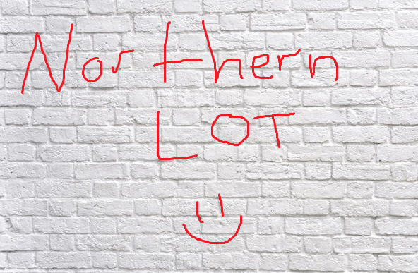
For northern LOT specifically...a couple days ago it looked like the initial/separate WAA snow tonight would be 2-3", now it may only be a dusting. So, that doesn't help. And, although I know op runs shoudl be taken with a grain of salt at range, there were a couple of op Euro runs showing close to 2 feet in northern LOT...which now is nowhere to be found. It's all relative.
")
Plus, if the storm really does weaken/shear out due to the effects of the block, it's likely to take a bit more southern route...which could favor the heart of the city instead of the northern areas. And, even if lake enhancement does occur, it may tend to favor the lakeside counties instead of McHenry and further west.
Again - all else being equal, I think there are still concerns in northern LOT, especially away from the lake...just like there are (different) concerns elsewhere in LOT and northern IN and into MI. That's why we need a true spread-the-wealth storm...so that everyone shares in the fun. I initially thought this storm might be it...but it appears to be transitioning to a narrow swath of heavier snowfall for a lucky few. And by heaviest, I mean 10"+. Not meant to complain...just human nature to be on edge a bit, given the snow drought that many of us have experienced over the last 2-3 years.
Be prepared to be piled on, but you’re used to it, I know.
-
 1
1
-
-
Just now, SchaumburgStormer said:
Do you read what you write? You clearly picked 2 models here...
Proving that have the degree does not necessarily make a good forecaster
He said no models substantiated what I had said and that was not true.
ive acknowledged a good trend, I’m just being cautious. I’m sorry I can’t lend myself to weenie forecasting that suits you.
-
2
-
-
There is a concern with shear and unlike lake and cook, inland counties won’t benefit much if at all from the lake. There is absolutely nothing wrong about this statement.
-
Just now, SchaumburgStormer said:
I’m not sure why you, as a meteorologist, are cherry picking models which are outliers of the growing consensus to minimize the storm. Yes there are failure modes, but the preponderance of the evidence is showing a substantial event for N IL.
Am I writing in a foreign language? Or do you guys not bother to read. Where did I say I’m choosing one model over the other. I’ve repeatedly said my expectations have increased and I’m not worried about getting completely shafted like I once was.
-
1
-
-
5 minutes ago, mimillman said:
I’m sorry, there is not a SINGLE piece of operational guidance that supports northern LOT underperforming to the degree you’re suggesting. You’ve been a harbinger of doom from the very start of this event, have refused to acknowledge trends opposed to your view, and quite frankly it’s getting tiring. I respect a Met tag and I’m sure you’re speaking from experience, but for the love of god back it up.
You must be unaware of the NAM or RGEM. You must also have poor reading comprehension as I have repeated acknowledged trends are looking better. I’m not responding to you from here on out, you’re a troll.
-
2
-
-
Just now, SchaumburgStormer said:
I think northern LOT is in a 6” floor, high ceiling scenario. If the low remains intact a bit longer, there will be some sig totals. W LOT could jackpot by catching both the initial heavier band and any redevelopment for a secondary low.
Rockford almost always manages to do well no matter. Several models show a lower area of totals over Boone and McHenry due to the low shearing out and then the lake compensating for Lake and Cook. I’d be very happy with 6”, and, as I said, I’m becoming cautiously optimistic.
-
4 minutes ago, mimillman said:
I’m not harassing you, I’m disagreeing with you. If you’re going to continue to post unsubstantiated claims, expect the disagreement to continue.
Nothing I said was unsubstantiated.
-
 1
1
-
-
Just now, mimillman said:

I’m really over your constant harassment.
-
1
-
-
Cautiously optimistic. Believe me, I would love to be proven wrong and northern LOT counties get at least 6", but I'm not sold. Lake County has the best shot, of course, thanks to lake enhancement/effect. I'd feel more comfortable if I lived 30 miles south.
-
 1
1
-
-
2 minutes ago, Hoosier said:
Gotta say I don't remember many big snowstorms that hit you hard and screwed me. Talking downtown Chicago area and not well west like ORD. If I end up getting screwed on precip type, chances are it will find a way to screw you too. You never know though. I had not remembered seeing a synoptic storm like 2/24/2016 with that hellacious gradient between my location and the city, and it happened.
Oh, that was a nightmare. Please don't ever speak of it again! ha
-
50 minutes ago, RCNYILWX said:
Good evening y'all, just got back from the office a bit ago. Fun shift. Would be happy to answer any LOT specific questions if anyone has any. Regarding who's working in the lead up, I'll be back on evenings with Ratzer tomorrow through Monday and I expect I'll probably be doing evening update AFDs. Our midnight crew is the same as last night (Carlaw and Kluber) and it'll be them through the event. Dayshifts will be MTF and Petr. We should be in good hands. Glad that we stayed the course with the most consistent guidance in terms of our forecast lean and messaging in light of guidance trends already for 18z cycle. Here's to a good 00z cycle.
Sent from my SM-G965U using Tapatalk
I graduated with Kluber. We lived on the same hall in our freshmen dorm and were pretty good friends.
-
4
-
-
-
14 minutes ago, mimillman said:
Sorry I had to. I'll stop now.
This has only been one-sided the entire time. Hope you got your rocks off now.
-
1
-
-
4 minutes ago, mimillman said:
@McHenrySnow I guess our little kerfuffle wasn't so bad compared to what it could be..
I have no desire to participate in AngrySummons-type antics.
-
4
-
-
Quote
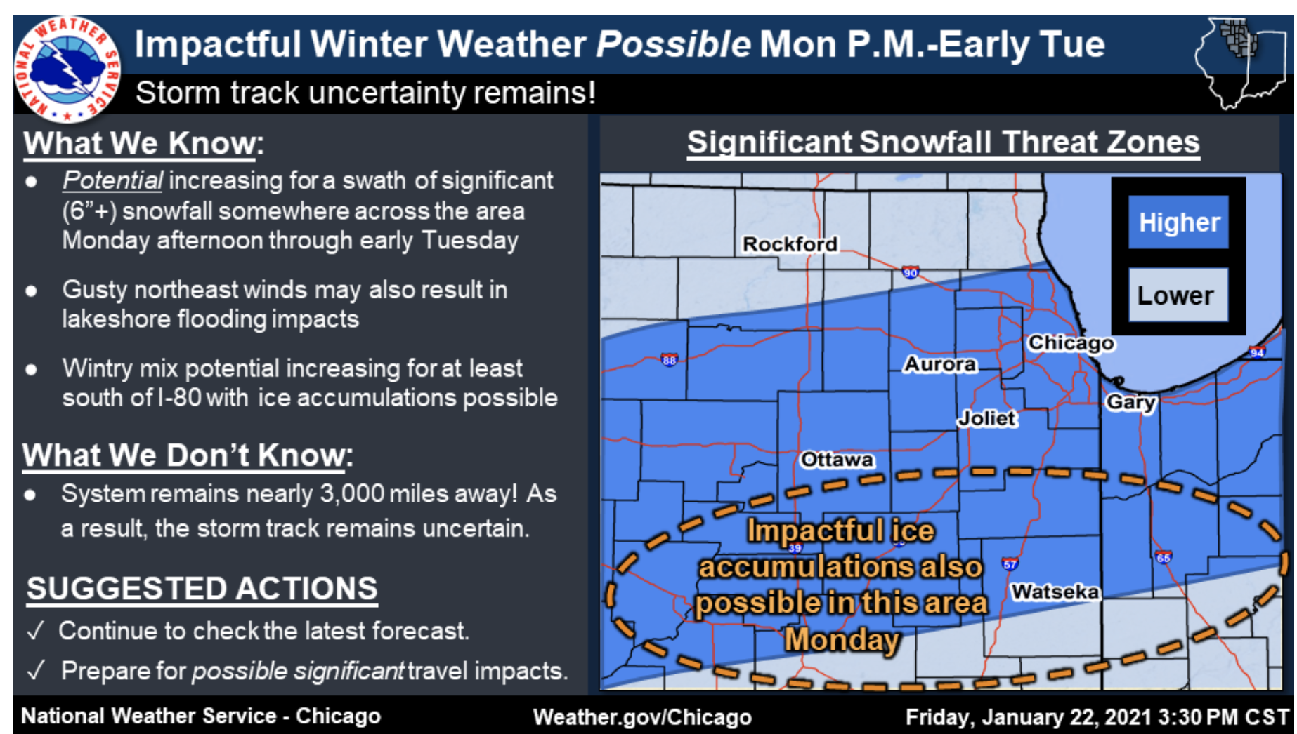
We`ll get a quick break Tuesday and Wednesday before the next wave
of interest zips into the area Wednesday night/Thursday. Guidance
is in pretty good agreement with this next disturbance, all things
considered, and the presence of rather cold air aloft would
support a region of fairly steep mid-level lapse rates with this
feature. Things look cold enough for all snow with this
disturbance, so this is another one we`ll be keeping an eye on.
The good news is this will be quite a bit more starved of moisture
than its predecessor and fast-moving enough to limit residence
time over our area.
I'm going to have to have a chat with Ricky. That is not good news. (next storm, I know)
-
1
-
1
-
-
Just now, ILSNOW said:
 '
'
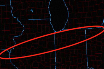
Hard to bet against a storm slamming Iowa this winter.
-
1
-
-
1 minute ago, purduewx80 said:
Based on 24 hour trends and 12Z guidance, I'd feel most comfortable in the area below for the swath of heaviest snow. If the block suppresses it any more, you can forget about any lake enhancement in IL. Some hints of colder air Monday night - Tuesday w/ a favorable fetch for true lake effect, but we'll see.
Agreed, though slightly further north. Chicago is definitely still in this, imo.
-
2
-
-
Just now, Baum said:
agreed. Couple of newbies got loose from pre school. Best not to engage. As I said two days ago...going to be a long slog.

That's fresh coming from you, but I agree, there's no reason to continue attacking posters simply because you disagree with their thoughts.
-
1
-
-
Just now, mimillman said:
What was the GFS? You were absent as that rolled out and only reappear to highlight runs that support this wall theory of yours.
I don't recall the GFS looking that great for the northern tier counties either. I have a job so I can't constantly follow your posts, forgive me.
-
Just now, mimillman said:
Is the writing back on the wall now? That wall must be getting very wordy
I'm not sure what your problem is, but yes, the Ukie is another strike against the far northern tier counties.
-
4 minutes ago, hawkeye_wx said:
12z UK is going to be south.
To say the least.
-
1
-
-
2 minutes ago, A-L-E-K said:
solid science
oh, is that what you've been trying?
-
1
-
 1
1
-
1
-
-
2 minutes ago, mimillman said:
I don't think they learn
I've learned not to get my hopes up. It's served me well.
-
1
-
-
Just now, ChiTownSnow said:
Keep in mind- this is long range for the NAM
Oh, yes, NAM certainly doesn't factor into my thoughts at all at this point. Writing has been on the wall for the far northern tier. Even LOT agrees, they removed the likely wording from our forecast.
-
1
-
Jan 24-26th Potential Something Part 2
in Lakes/Ohio Valley
Posted
Their harassment started long before my tag, but thanks for the input.