

Dsty2001
-
Posts
374 -
Joined
-
Last visited
Content Type
Profiles
Blogs
Forums
American Weather
Media Demo
Store
Gallery
Everything posted by Dsty2001
-
I still can't for the life of me figure out the placement for the LP. It goes all over the place and even goes back NW at one point
-
That map literally has me at 4" while just 15 miles away close to 8 lol
-
I just can't buy into the NAMs solution yet If it's still showing the same solution tomorrow night then might have to take another L
-
I've not watched WATE in ages, but I remember them being astronomically bad at weather forecasts.
-
I have noticed in Greene Co as well a huge discrepancy in how much snow can fall over short distances. I live on the western side closer to Morristown and have gotten several inches more/less than areas 10 miles away.
-
Very good explanation, so essentially we are threading a needle here.
-
I know this is totally newbie questions, but from my understanding is we want the LP to be further south but not TOO far south?
-
So Euro/Ukie are on one side and NAM/GFS are further north at this point? I'm wondering if any model will nail this as complex as the system seems to be, how often does a system come down from the upper midwest, hit the gulf and bounce NE?
-
I'll take that 6 inches and be happy
-
What I find funny is everybody around my area is convinced we are getting a 93 repeat, and all I can do is shake my head and ask where the heck they are getting that information from. Interesting enough a local news station was saying up to a foot is possible which threw me aback, the models don't seem to be in any agreement right now and honestly I don't think we will know for sure to right before the event starts
-
Any clue why the models are having so a hard time with this? Matter of fact, seems like they've been struggling for the last year or two
-
ohhh anybody have a clown map
-
Puking snow here in Greeneville
-
Did it just move through for you? Watching it on radar
-
The roads here in Greeneville are starting to ice over bad
-
Looks like a pretty heavy band extending from Knox co to Jefferson Co heading east
-
Moderate snow/graupel falling in Greeneville rn, roads are wet and temperature is falling fast. Definitely going to be some black ice issues tonight
-
Special Weather Statement National Weather Service Morristown TN 432 PM EST Thu Jan 6 2022 NCZ060-061-TNZ016-017-036-038>040-042-044-046-067>071-073-081>086- 098>102-071415- Cherokee-Clay-Hawkins-Sullivan-Anderson-Grainger-Hamblen- Northwest Cocke-Northwest Greene-Washington-Northwest Carter- Roane-Loudon-Knox-Jefferson-Northwest Blount-North Sevier- Sequatchie-Bledsoe-Rhea-Meigs-McMinn-Northwest Monroe-Marion- Hamilton-Bradley-West Polk-East Polk- Including the cities of Andrews, Marble, Topton, Hiawasse Dam, Murphy, Unaka, Violet, Shooting Creek, Brasstown, Hayesville, Tusquitee, Mooresburg, Kingsport, Bristol TN, South Holston Dam, Oak Ridge, Clinton, Bean Station, Alpha, Morristown, Russellville, Bybee, Newport, Greeneville, Johnson City, Elizabethton, Harriman, Eagle Furnace, Rockwood, Bradbury, Fairview, Kingston, Oliver Springs, Lenoir City, Loudon, Bearden, Knoxville, Lake Forest, Jefferson City, Strawberry Plains, Chestnut Hill, Dandridge, White Pine, Happy Valley, Maryville, Alcoa, Harrisburg, Kodak, McMahan, Sevierville, Seymour, Pigeon Forge, Cagle, Dunlap, Cartwright, Lone Oak, Old Cumberland, Palio, Melvine, Mount Crest, Pikeville, Brayton, Dayton, Evensville, Old Washington, Grandview, Spring City, Big Spring, Athens, Clear Water, Dentville, Etowah, Sweetwater, Madisonville, Bullet Creek, South Pittsburg, Haletown (Guild), Jasper, Martin Springs, Whitwell, Powells Crossroads, Monteagle, Chattanooga, Cleveland, Tasso, Conasauga, Archville, Benton, Parksville, Reliance, Big Frog Mountain, Ducktown, and Turtletown 432 PM EST Thu Jan 6 2022 /332 PM CST Thu Jan 6 2022/ ...Patchy Areas of Black Ice Overnight... Periods of snow showers are expected to continue to impact portions of the central and northern valley of East Tennessee. A dusting to 1 inch of snow is possible over the next couple of hours, north of I-40. With temperatures plummeting in the upper teens to 20s, any wet spots on roads will turn to patches of ice. This will create slippery conditions in some spots, especially on bridges and untreated secondary roads. Use caution if traveling overnight and Friday morning. Slow down and allow extra time to reach your destination, and do not assume that a well traveled roadway will be free of snow or black ice.
-
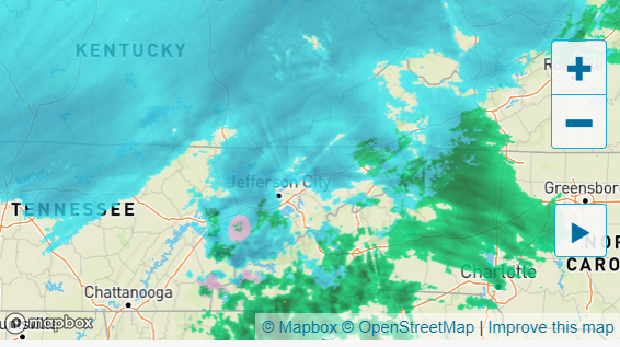
Forgive me if this radar is unreliable but it's depicting almost the same as WJHLs. That area around Knox/Jeff city and the further west snow was not as pronounced just 30 minutes ago. Funny enough, the WJHL future radar was hinting that this would fill back up. So maybe?
-
WTH? Since my last post the radar filled in nicely to my west LOL
-
Looking at latest radar trends, that looks to be about all she wrote folks
-
Oh well, the East TN curse just keeps on giving lol
-
Looks like the snow hole is trying to fill in some based on wunderground and wjhl radar
-
My eyes could be deceiving me but looks like the back end is filling up some
-
I don't believe the radar is picking up all of the snow, seeing areas reporting snow where there is a hole in the radar?


