ORH_wxman
-
Posts
93,092 -
Joined
-
Last visited
Content Type
Profiles
Blogs
Forums
American Weather
Media Demo
Store
Gallery
Everything posted by ORH_wxman
-
I’d be officially invested where you are now. I still need to see another bump to convince me but it’s looking more likely that even my area gets a little in the CCB.
-
18z NAM coming in colder but 12z was pretty torchy/north so not a shock. We’ll see just how far south it comes.
-
Yeah I’ll maybe bite if 00z big boy models keep trending that way. Literally trying to thread a needle without anything to guide the thread.
-
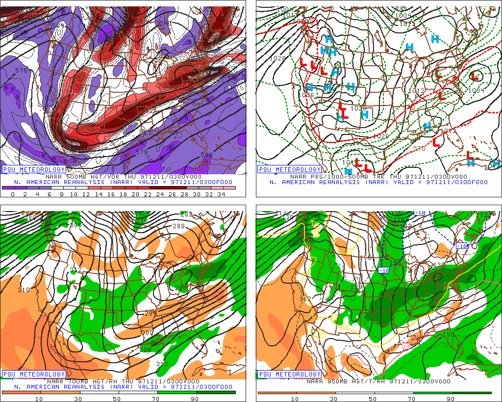
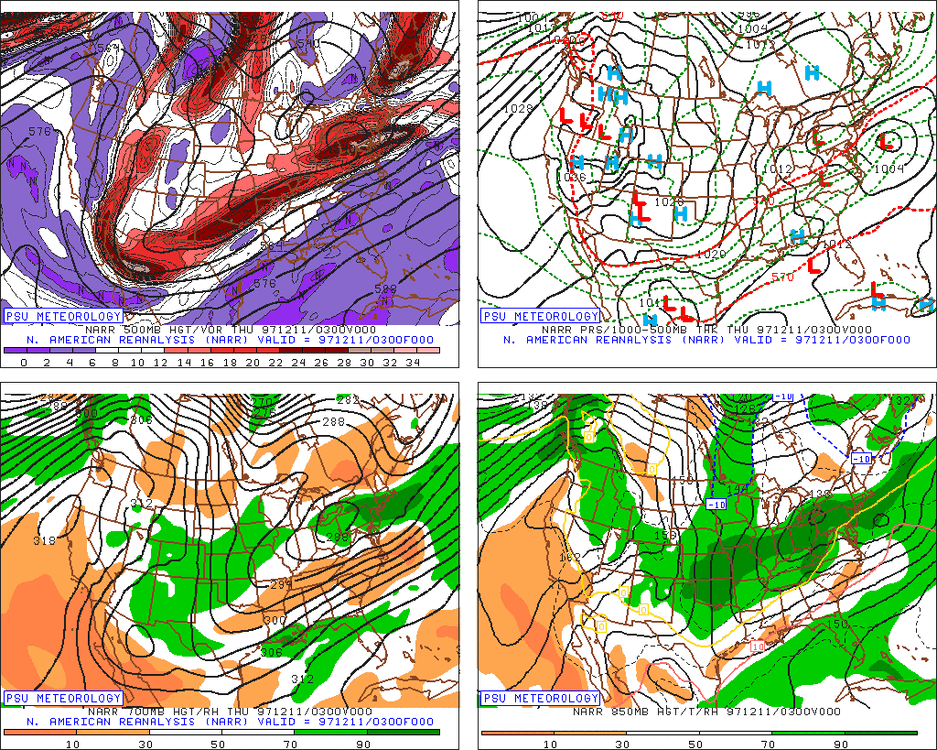
It was a system that got crunched south. We were forecasted to get like 2-4” in ORH and then at the last second they downgraded to 1-2” and we actually got zero…not a single flake. But about 10 miles south had 3” and there were some spots in CT that had 4-6”
-
Colder than the 12z run. Not buying them yet though. EPS also wasn’t really buying the OP run’s vicious ending…though it had a weaker version of it.
-
You didn’t get anything in the 12/11/97 event? Maybe Norwalk was barely on wrong side of R/S line
-
Yeah I’d agree. If rates/lift are robust, then it’s going to produce and lower level temps will respond. If they aren’t, then we get another “white rain” scenario outside of the higher terrain…maybe a couple of slushy inches on the grass but wet roads/driveways. The earlier closing off of the system would help too…You start the process of ageo drain and also blunt the northward extent of the low level WAA earlier than other scenarios. I’d have more confidence in snowier solutions over interior MA if we had a solid high but we’re working with a high in a terrible spot and relying on in-situ CAD and evaporational cooling on a flatter scenario.
-
925 temps are -2C during that crazy CCB so that is definitely going to be snow. But clearly it’s the type of thing where good accumulations would be rate-dependent. Esp lower elevations. Im fairly skeptical on a euro type evolution but we’ll see.
-
The short term mesos (HRRR/RAP) are really flat with tomorrow. Kind of weird as they are often amped on coastal systems.
-
There’s an ongoing thread for 1/23
-
That’s actually a really dynamic look on the euro. That’s what you want to see if you’re trying to flip this into something good further south. That trailing energy really goes to town before the baroclinic zone is too Far East.
-
Thick clouds all day so far has kind of led to a low grade temp bust. Was expecting the snow to be wiped out quickly but we’ve hovered around freezing so it still looks nice out there. You take the small victories in a winter like this
-
Yeah Ukie would be a paste job outside 495
-
GFS coming in a bit colder for 1/25 too. Nice SWFE look.
-
Getting deep snowpack is great for reinforcing good patterns. It’s not going to cause an awful pattern to shift but in otherwise marginal setups it can make them better….it basically helps refrigerates the lower atmosphere if you have wide scale snow pack in a region. We’ve had a huge dearth of pack this winter close by so that also makes mild patterns even warmer.
-
PV being near us in Canada…and yes, we should get an arctic intrusion or two I would think with it lurking so close by.
-
Reggie actually kind of led the way in the colder solutions for 1/19-20 though it was a smidge too cold. This is a little different though in that we have zero high pressure. It’s almost all reliant on what’s going on upstream.
-
Yes.
-
I’m still expecting nada here. I might start thinking more though if I was in ASH to N ORH county…at least for something on the back end. Maybe a little bit of front end thump too but the CCB stuff looks like it would have more potential there.
-
Nice Kraft ending for SNE that run too. That’s been on and off different runs.
-
Reggie coming in colder
-
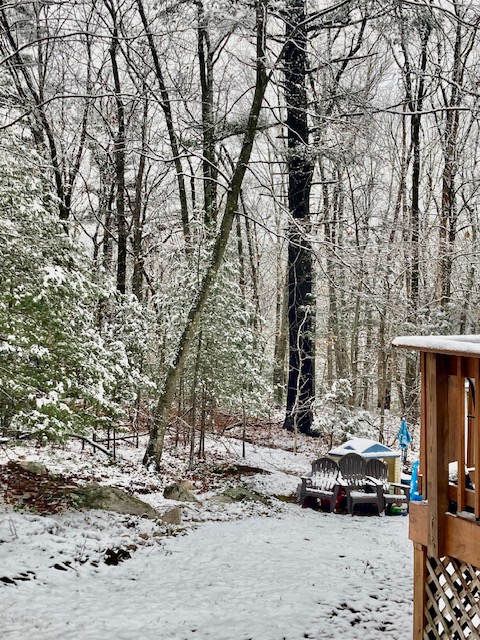
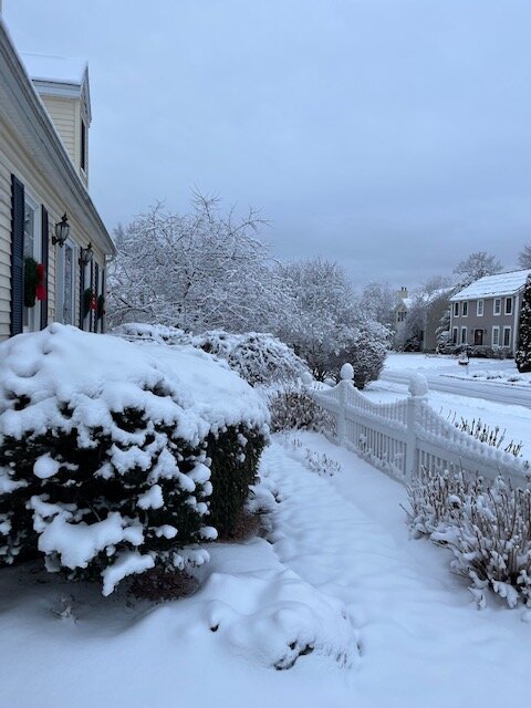
Winter hill in ORH this morning
-
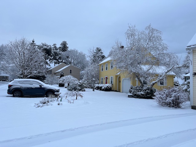
Yep. It looks like an excellent next 5 days up there. If both of those systems pan out like expected, an impressive turnaround would be underway for some spots there in CNE when you combine with Thursday/yesterdays storm.
-
Yeah 1/25 is all about the WCB stuff. CCB/deformation on that will be way up in Ontario/Quebec