ChasingFlakes
-
Posts
549 -
Joined
-
Last visited
Content Type
Profiles
Blogs
Forums
American Weather
Media Demo
Store
Gallery
Everything posted by ChasingFlakes
-
Wind wasn't anything too wild, really heavy precip for 3-5 mins, now just gusty and drizzling as the band passes to my east. Pea sized hail only lasted momentarily. Some nice lightning though.
-
Pea sized hail here. Dumping rain
-
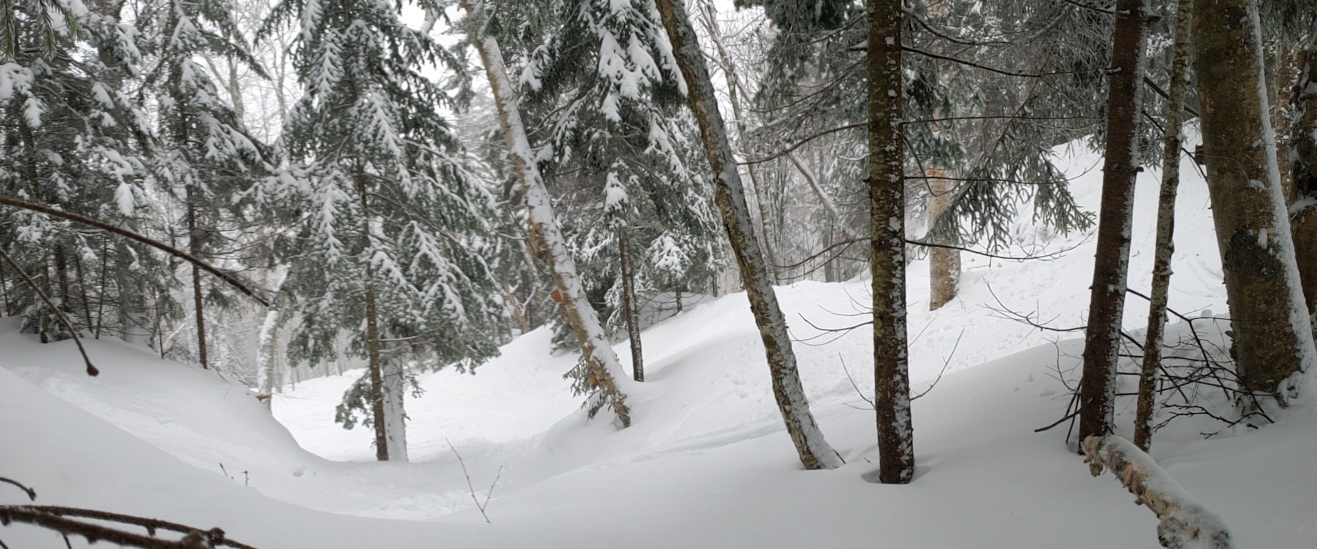
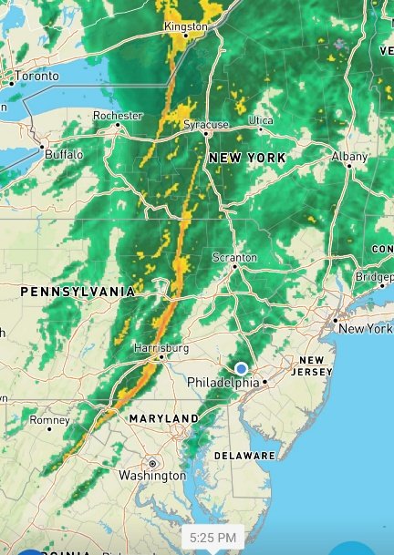
Precip just started here.. Looks like the squall line has consolidated well on radar. 18z NAM has it staying together all the way to the coast. Also it looks like Mt. Washington, whiteface and the northern green mountain spine are going to pull a couple feet from upslope and lake enhanced snow on the backside of this system.
-
How do they prove if you did a 14 day quarantine, either in your home state or in VT? Its not like they're going to know if you went to a grocery store in that time.. From a non-local perspective I'm sure many of us spend hundreds to thousands in Vermont's economy each winter due to skiing, it stinks for everyone involved to miss out on that. I pay for lodging, food, gas, beer and of course a lift ticket each time I visit in the winter. Across all of the visitors each winter, that adds up to a big loss. Granted an infected population doesn't help the economy much either, skiing is such an isolated sport already that I think they can find a better way to make it work in everyone's favor. Edit: “We have no metrics on who’s following our quarantine guidance" - Tracy Dolan, deputy commissioner of VTs Department of Health.
-
Some cool clouds out there this evening. Theres a wall cloud looking formation to my south that is running ENE to WSW nearly parallel with the setting sun. Not sure whats causing it as it is clear to my north but cool to see! Is it just a moisture band from NW flow not making it to the ground or radar?
-
Wind is howling. Think there's a chance for a stray flurry tomorrow?
-
Great pic PF. Stoked I finally pulled the trigger on a pass that includes Stowe. Never have owned a pass and have always gone where the most snow/best terrain will be. Not sure having a pass will change that, but I am excited to save some money on the "down" days.
-
Was at Knobles with friends this past weekend. Made it down to 31F at 6-7am on Saturday am. The awesome sunset Friday night gave way to beautiful clear skies all weekend, which coincided nicely with the new moon. Couldn't have asked for better weather.
-
That small isolated cell in north central chesco has been dumping rain for over 1hr 30 mins. Keeps backbuilding or something but I've been waiting to pack all the stuff from this jobsite into the truck for an hour but I might just have to bite the bullet and get myself and everything soaked. Mostly rain, no wind and some thunder. Temps feel great now.
-
Threw together this quick edit, hope you guys enjoy. This was super fun to make.
-
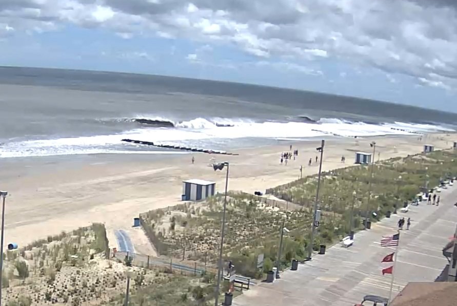
10ft+ classic south swell runner in front of Rehobeth, DE boardwalk around 1:30pm.
-
One gutter overflowed and flooded the window well/basement a bit. Managed that and then had an epic downhill skimboard session in the yard. Recorded it POV style with my gopro so ill try to post that at some point. Regretting not going to DE or Manasquan today.
-
You'll probably stay on the dryer side in the dry slot once that trailing band off the ocean (not sure if there's a name for that) passes over you. You'll feel some wind this afternoon forsure. I was debating shooting down to DE to chase the swell but I think I'm gonna just chill and maybe hitup Manasquan super early tomorrow. I slept like crap and I don't think it's gonna clean up nearly as well as Fay did, its moving too fast, too far inland and too late. If anything DE has the best shot of scoring this evening due to their ENE exposure and the predicted SW winds. Manasquan, NJ should be fun sized in the am with offshore winds though.
-
Nice pic, I was up in Dewey the week prior! I checked the surf around 9-10am and it was treacherous onshore storm surge conditions. Of course there was a young teenager in the water with his dad watching him.. recipe for disaster there. I took a video, I should have included it.
-
It was friday July 10th at around 1-2pm when those clips were filmed. The wind went offshore (W) as the surface level center of circulation went north overhead/just offshore at 12pm. Most of the time as a noreaster or low tracks north along the coast the winds on the southern half of the storm are in a westward orientation, which is ideal for surfing in the mid-atlantic. Most good swells come after a coastal storm, although we do get the occasional long period ground swell from hurricanes in the central North Atlantic. Water was super warm prior but the storm definitely brought some upwelling, nothing out of the ordinary. It was over 70f water temp.
-
Took some time this afternoon to throw a few clips together. Gotta love my girlfriend for standing in the wind-driven rain, just as the winds switched west, to film for 30 minutes. Only got a few on film, but holy crap I got so many amazing waves this day. 3+ second 6ft caverns just chugging along all day, it was so amazing that I stayed in the water for a total of 6 hours throughout the day. Clean overhead conditions in July are a rare treat. I only started bodyboarding in September 2018 during a hurricane swell, and have since bodyboarded Hurricane Humberto and Hurricane Lorenzo swells last fall in Manasquan, with 6-8ft conditions, so I felt comfortable paddling out in these peaky 6-7ft swells. These clips were filmed during high tide, but as the tide dropped an the swell eased, the sets cleaned up and became more hollow and I got totally shacked outta my mind brahs.
-
I remember seeing Hale-Bopp in 97 clearly with the naked eye, but I was real young so it's a faint memory. NEOWISE was very faintly visible to my naked eye but definitely no spectacle thats forsure. Comets definitely seem to be hard to predict the magnitude of. All depends on the amount of gas and dust being emitted and if it can even survive perihelion. Plus they're only visible when they are not in earth's shadow and it's dark enough, kind of like satellites. What do you guys think about the first fatal shark attack in Maine happening yesterday. Crazy we used to swim off the Cape all summer while I was growing up and now it's a death trap. Also I have some pics from bodyboarding Tropical Storm Fay in OCMD, I'll try to share them.
-
I got a good look at it Monday and Tuesday night. Had some nice binoculars and a 3 inch spotting lense that can magnify to 60x. The binoculars were easier/clearer for viewing the comet than the telescope, but Jupiter and Saturn were awesome through the scope. You could see 5 moons around Jupiter, even with binoculars, and the rings of Saturn on Monday night.
-
I've been down in Ocean City, MD the past week, and dewey the previous one. We got 4-6 inches of rain here last night, wind wasnt bad. Surf might turn on this afternoon as the wind switches west.
-
Guess I picked a good time to spend 2 weeks at the beach. Its rained for 10 minutes here since last Saturday and we had anywhere from a 2-4ft swell all last week. Cant ask for more in July in DE/MD.
-
PECO estimates power will be back Friday night at 11pm. I'll post some pics when I get a chance. Got hit dead center on that derecho and then round 2 was even more intense imo. It had higher wind gusts for a longer period of time and a lot more precipitation, caught me off guard as I wasn't paying much attention to radar. A derecho and a microburst in one stationary location must be pretty rare.
-
Filmed during the second round of storms. Possible microburst? Winds look straight line, so I doubt it was a tornado. Lots of tree damage around my house.
-
Saw some on the backside too. Trees down all over south of phoenixville, east of kimberton. A lot of cleanup to be done, that was the most intense storm I've seen in at least 10-15 years here. I remember one in the mid 2000s that took a bunch of trees and we didnt have power for 5 days. Hoping we get ours back sooner than that. Will post some pics/video
-
Holy shit round 2 is crazier than the first round 100%. Microburst conditions, possible tornado. I have about 5 trees down in the yard/across the street. Viz dropped below 50ft not even kidding holy shit
-
Yeah straight line winds out of the NW. I filmed the gust front come through from my front door facing North. I can upload it, if you guys dont mind the excited expletives.


