

Cary67
-
Posts
1,372 -
Joined
-
Last visited
Content Type
Profiles
Blogs
Forums
American Weather
Media Demo
Store
Gallery
Posts posted by Cary67
-
-
3 hours ago, Baum said:
Hydrangea and Begonia leaves torched black here from past two days.
Had the same problem with my hydrangea
-
2.1" rain this week with 1.4" Monday and 0.7" falling last night.
-
3 hours ago, roardog said:
Best climo?
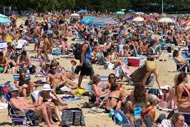
Beach just now clearing out in Duluth
-
 2
2
-
-
1 hour ago, A-L-E-K said:
got a beach party this afternoon for the last day of school at cps, conditions look ideal for being in the water
Still in school? My kids were out May 20th
-
Pounding rain here
-
9 minutes ago, cyclone77 said:
Think we have a great shot at hitting 100 not only Tue, but Wed now as well. Euro has backed off on the cloud potential Wed for this region, and it could end up being as hot as Tue. Dews look like they'll only be in the upper 60s/low 70s, which should make the run at 100 more doable. Tomorrow may have the highest heat index though, with 96-98 type temps, and dews AOA 75.
Interesting considering my family was cold in the shade at Guaranteed Rate field today. Temps in the 60s with a stiff NE wind. What a difference 48hrs will make here.
-
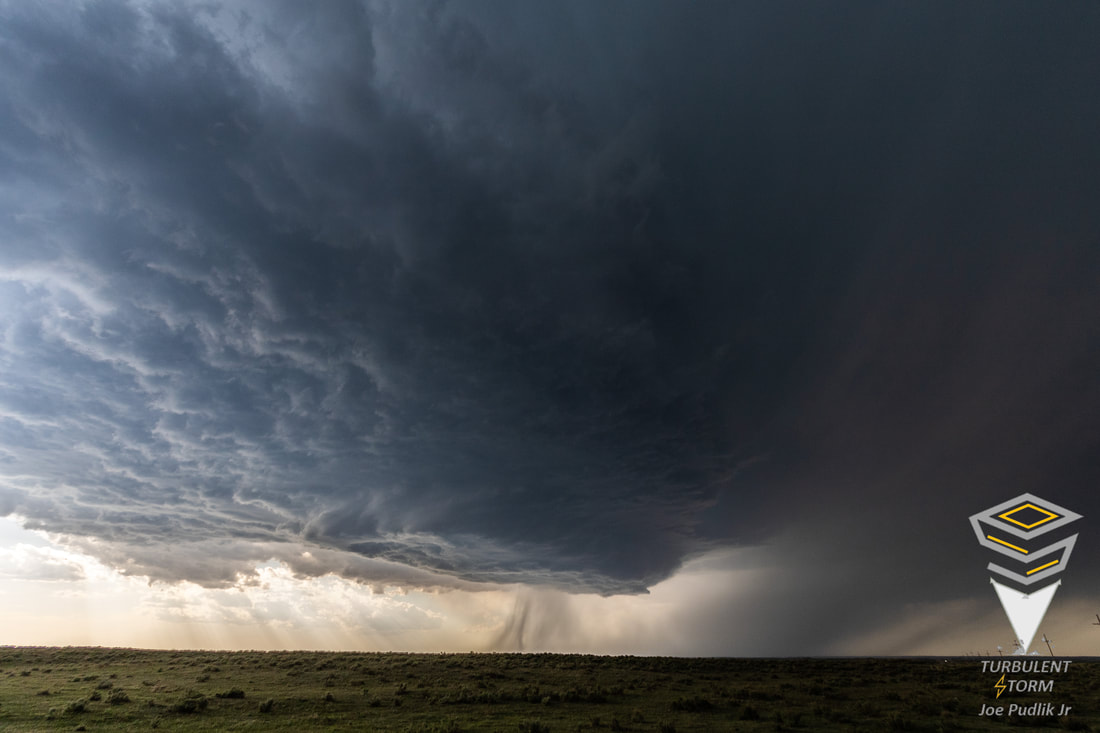
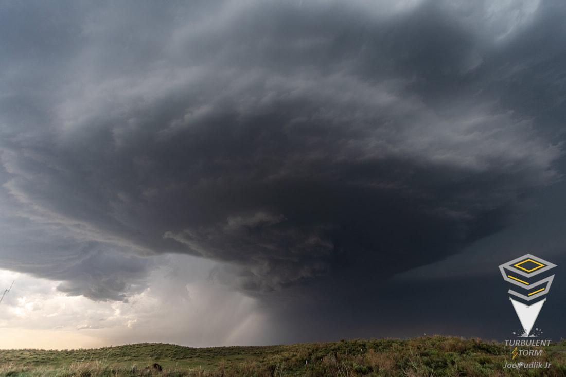
On 6/5/2022 at 8:22 PM, Chicago Storm said:
I helped guide a storm chasing tour back on May 8-16th. Here's a few of the better shots from the trip...
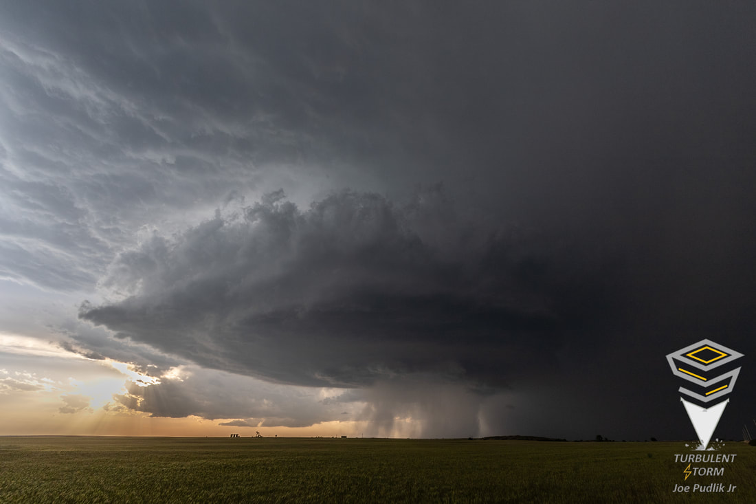
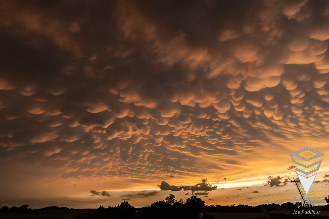
Nice mammatus. Always wanted to work that term into a conversation but seldom felt socially appropriate.
-
1
-
-
18 hours ago, Hoosier said:
Was looking outside and thinking how today is a true Torchageddon special. There is literally not a cloud in the sky. Can't wait to get out later.
Resembles March and April weather in AZ. Crystal blue skies with warm but comfortable daytime temps and beautiful cooler evenings as temps drop in the dry air. If only we had 3-4 more months each year with these conditions.
-
12 hours ago, A-L-E-K said:
Another top shelf day
Late May to mid June then September is our time.
-
7 minutes ago, sbnwx85 said:
First warning of the day:
BULLETIN - EAS ACTIVATION REQUESTED
Tornado Warning
National Weather Service Chicago/Romeoville
316 PM CDT Wed May 25 2022

The National Weather Service in Chicago has issued a

* Tornado Warning for...
  Northeastern Kane County in northeastern Illinois...

* Until 400 PM CDT.

* At 316 PM CDT, showers capable of producing tornadoes was located
  near Elburn, or near Campton Hills, moving north at 30 mph.

  HAZARD...Tornado.

  SOURCE...Radar indicated rotation.

  IMPACT...Flying debris will be dangerous to those caught without
           shelter. Mobile homes will be damaged or destroyed.
           Damage to roofs, windows, and vehicles will occur.  Tree
           damage is likely.

* Locations impacted include...
  Elgin, Carpentersville, St. Charles, Algonquin, Huntley, Geneva,
  Campton Hills, South Elgin, Pingree Grove, Gilberts, West Dundee,
  Hampshire, Elburn, Barrington Hills, Sleepy Hollow, East Dundee,
  Wayne, Valley View and Lily Lake.

This includes...  Elgin Community College.

Including the following interstate...
 I-90 between mile markers 45 and 56.

PRECAUTIONARY/PREPAREDNESS ACTIONS...

TAKE COVER NOW! Move to a basement or an interior room on the lowest
floor of a sturdy building. Avoid windows. If you are outdoors, in a
mobile home, or in a vehicle, move to the closest substantial shelter
and protect yourself from flying debris.

&&

LAT...LON 4207 8824 4207 8826 4188 8831 4188 8849
      4215 8847 4215 8824
TIME...MOT...LOC 2016Z 186DEG 27KT 4190 8841
Alert went off on phone and sirens going
-
 1
1
-
-
1 hour ago, Baum said:
nah. Spring was this past Friday(late February/Early March), Satruday (Late March/Early April), Sunday (April), Monday (May). And yes, today begins summer.
May get some spring like weather early next week. Highs back down in the 60s
-
Warm but annoyingly windy
-
2 hours ago, A-L-E-K said:
Ready 2 torch
SW winds right up to the beaches? That lake wants to push in an easterly breeze component this time of year.lol
-
23 hours ago, CheeselandSkies said:
1995 was a good summer as I recall in the Madison area, although I was only 9. Hot but active with frequent thunderstorms/severe threats. 2012 was just mind-numbingly boring wx-wise with nothing even to track from afar in the stretch between the 4/14 Plains outbreak, and Hurricane Sandy.
Camped out at Mirror Lake State Park in the heat wave in mid July 1995.
-
1
-
-
1 hour ago, A-L-E-K said:
Sorry about the upcoming freeze suburban friends
After glancing at the 8-14 day outlook won't be planting anything till Mother's Day.
-
1 hour ago, madwx said:
Bold of you to believe snow is over for both those cities
GRR 71" MKE 28.6" Lake effect cures all ailments
-
1
-
-
SN+ here now
-
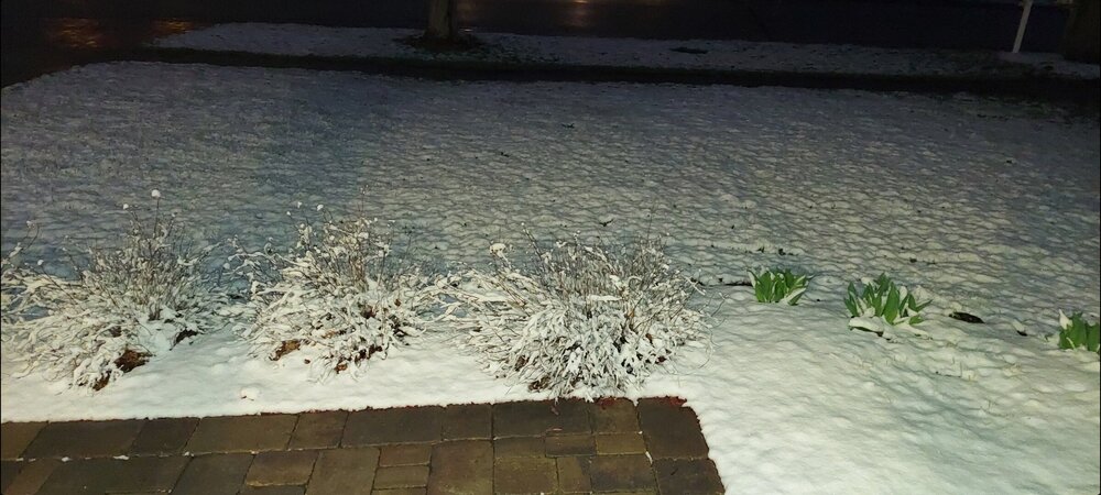 Lovely white blanket outside. The end of pseudo spring close..only a few days now.
-
3
-
-
1 hour ago, A-L-E-K said:
gfs popped a 968 to mke
Build back the snow pack for the siberian express. We're owed one December and the NW burbs hitting 30" the hard way
-
Pseudo spring in high gear. Hopefully start to see some sustained warmth late April into Mother's Day which would be typical.
-
1
-
-
5 minutes ago, Baum said:
lovely spring day. The frosted roof tops against the slate gray sky as the wind cuts you like a knife adds to the pleasantness.
Best climo
-
1
-
-
Looks like some classic pseudo spring weather settling in for awhile.
-
18 hours ago, Hoosier said:
Assuming no additional significant snowfalls, I guess I'll give the winter a C.
There were some things to like and some things to hate. As far as things to hate, it was yet another pathetic December in what has been a string of them. The two storms in February top the highlights, with a near footer and a very enjoyable 6" storm. If you look at a map of seasonal snowfall, I am actually in one of the better locations in the LOT cwa, so I'm fortunate in some ways.
NW of that C means a D for my area. Plenty of cold air in Jan and February but any systems consistently slid SE with limited phasing. 22" on the season which is quite a bit below average. Frustrating to see near normal snow avgs a 30-45 min drive just SE
-
20 minutes ago, ChiTownSnow said:
Midway pushing 40 yet?
I believe 41.7"

The 2022 Summer Solstice-ish Scorcher(s)
in Lakes/Ohio Valley
Posted
Must not have been R-22 refrigerant. Dreading AC tuneup telling me none is available to recharge mine