SnowDreamer
-
Posts
451 -
Joined
-
Last visited
Content Type
Profiles
Blogs
Forums
American Weather
Media Demo
Store
Gallery
Everything posted by SnowDreamer
-

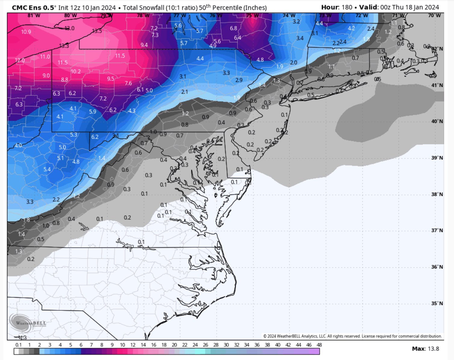
Jan Medium/Long Range Disco 2: Total Obliteration is Coming
SnowDreamer replied to Jebman's topic in Mid Atlantic
Kicker coming out of AK is weaker again. -
Jan Medium/Long Range Disco 2: Total Obliteration is Coming
SnowDreamer replied to Jebman's topic in Mid Atlantic
GEPS snowfall looks a lot better than 12Z... 3-4" region wide on the mean. The GEM looks like a warm outlier against its own ensemble. -
Jan Medium/Long Range Disco 2: Total Obliteration is Coming
SnowDreamer replied to Jebman's topic in Mid Atlantic
.gif.0646a69836edbd63086c930724975774.gif)
-
Jan Medium/Long Range Disco 2: Total Obliteration is Coming
SnowDreamer replied to Jebman's topic in Mid Atlantic
Also unsettled for the 7th storm. Was usually either the most or least snow of globals. -
Jan Medium/Long Range Disco 2: Total Obliteration is Coming
SnowDreamer replied to Jebman's topic in Mid Atlantic
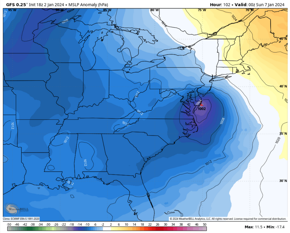
Beauty of a track. Straight up the coast with plenty of inland snow too. -
Jan Medium/Long Range Disco 2: Total Obliteration is Coming
SnowDreamer replied to Jebman's topic in Mid Atlantic
GEPS median took a massive leap forward at 00Z.
-
Jan Medium/Long Range Disco 2: Total Obliteration is Coming
SnowDreamer replied to Jebman's topic in Mid Atlantic
I vote this for the next storm thread title. -
Jan Medium/Long Range Disco: Winter is coming
SnowDreamer replied to stormtracker's topic in Mid Atlantic
Help me out here - trying to learn when things are calm. I see a huge West-based block, low heights around the great lakes, and a 50-50ish low at the start. The block breaks down, and I've heard many say that we often score our bigs ones when blocking regimes relax. The low heights around the great lakes move East, but seem kinda far North to me. What should I be keying in on here? -
Nearly .55" of rain in the last 2 hours brings my total to .76" - Sigh
-
Jan Medium/Long Range Disco: Winter is coming
SnowDreamer replied to stormtracker's topic in Mid Atlantic
GFS has a solid hit the 16th/17th -
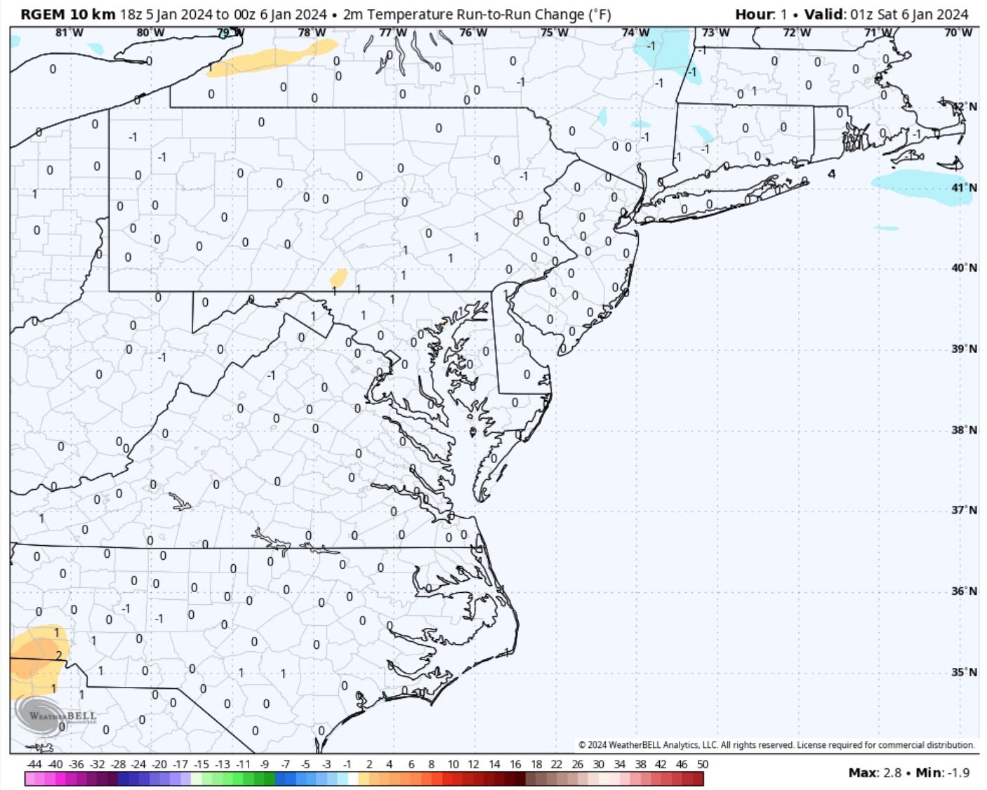
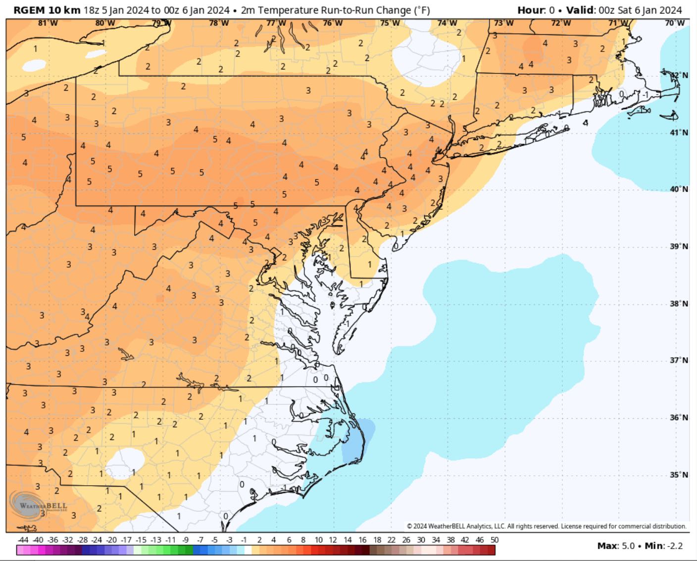
It is comically stubborn. I love that it initializes 3-5F warmer than the 18Z run at hour 0 and then INSTANTLY jumps to its old forecast at hour 1. "Nah, I was definitely right before"

-
Jan Medium/Long Range Disco: Winter is coming
SnowDreamer replied to stormtracker's topic in Mid Atlantic
This is so wholesome. -
I'm rooting for you Westerners!
-
Well **** me. Thanks lol
-
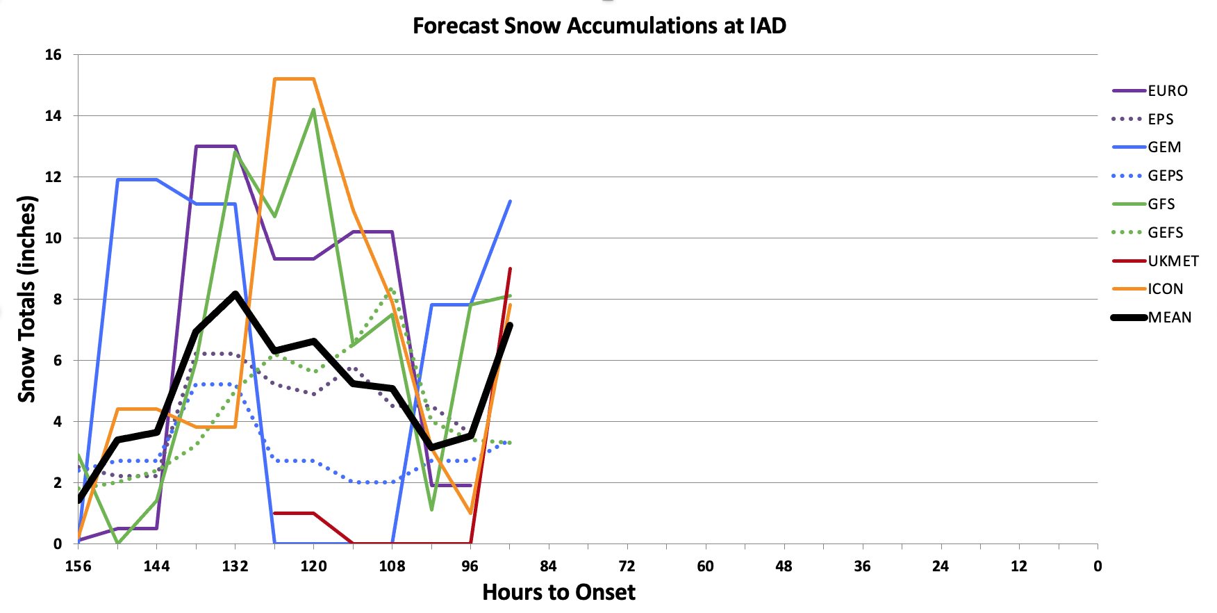
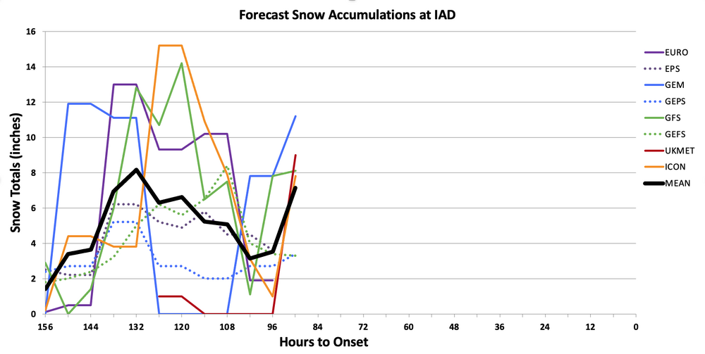
If the code that accumulates snow is inside the model and driven by physics, then why are snow accumulations so wildly different on different websites? Presumably they all use the exact same data from the model.
-
IDK man. The best thing about the 18Z suite so far is that the UKIE held from 12Z.
-
We are at nearly optimal range for a completely unrealistic NAM'ing tho
-
3 flakes and a single sleet pellet, final offer!
-
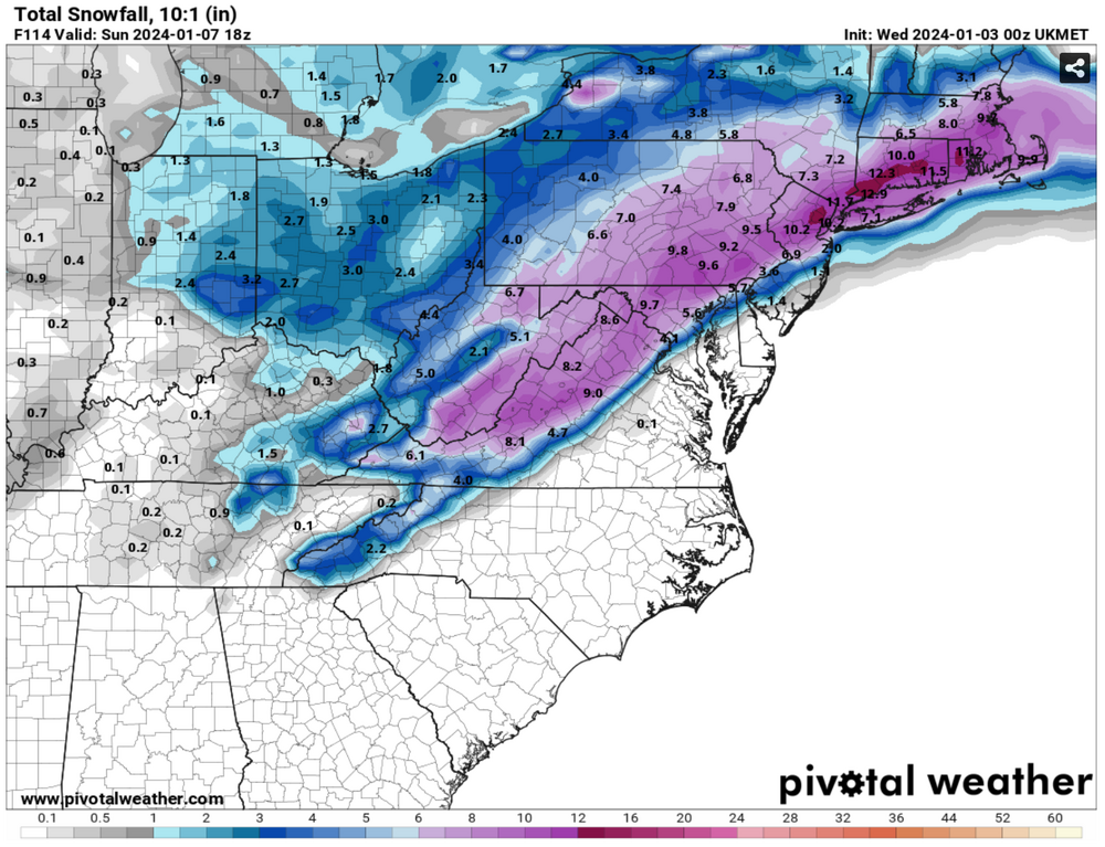
No EURO or EPS for most recent data obv, but tonight looks like a hell of a reversal so far.
-
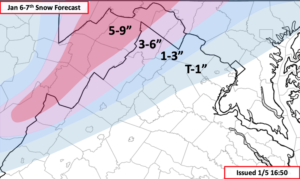
Yeah, big fold. R/S line moved like 50 miles Southeast
-
UKIE is a hit
-
GFS at Hr87 HP to the north noticeably stronger than 18Z
-
GFS also moves away from the LP transfer idea. Looks pretty different from the last several runs IMO.

-
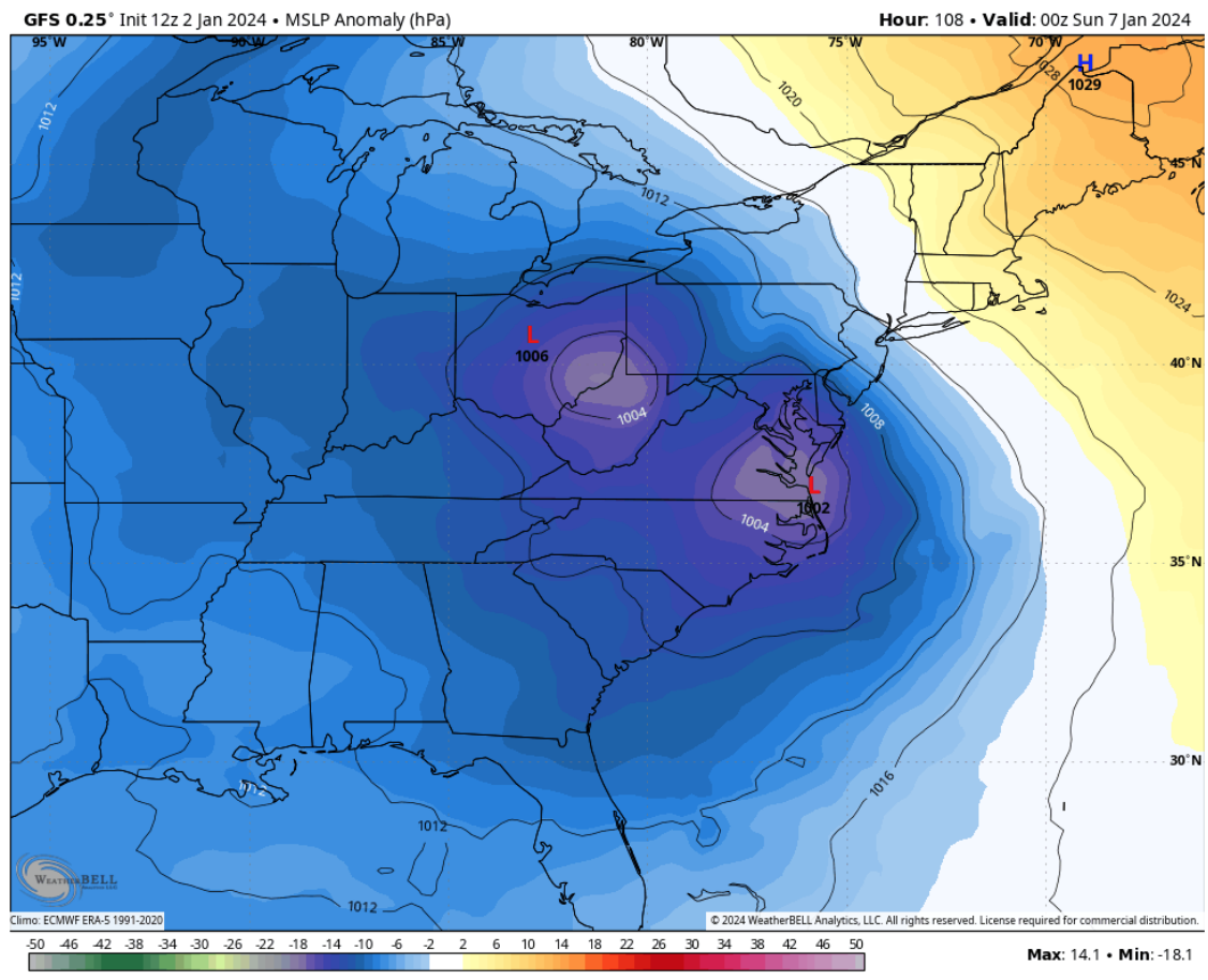
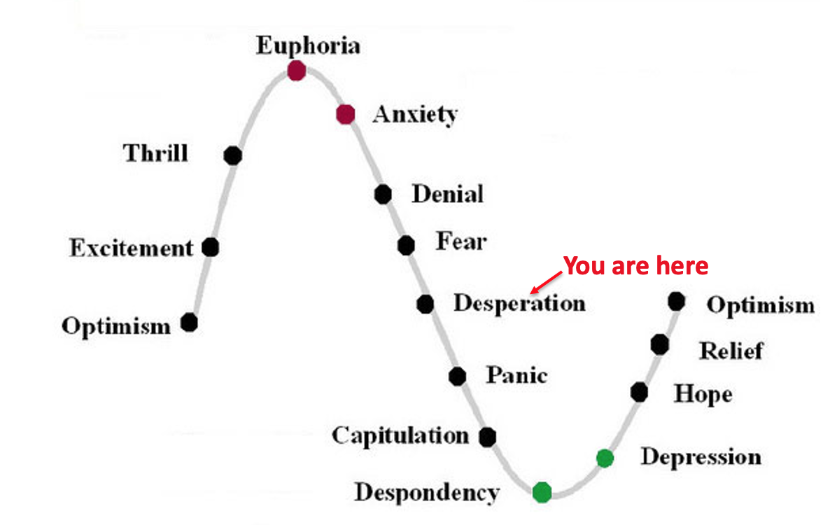
I see the 12Z EURO has pushed some of us right past denial and fear...

-
Still fully expecting a dead cat bounce tomorrow or Thursday and a NAM'ing some time on Friday.