Toekneeweather
-
Posts
107 -
Joined
-
Last visited
Content Type
Profiles
Blogs
Forums
American Weather
Media Demo
Store
Gallery
Everything posted by Toekneeweather
-
December 2018 General Discussion & Observations
Toekneeweather replied to Zelocita Weather's topic in New York City Metro
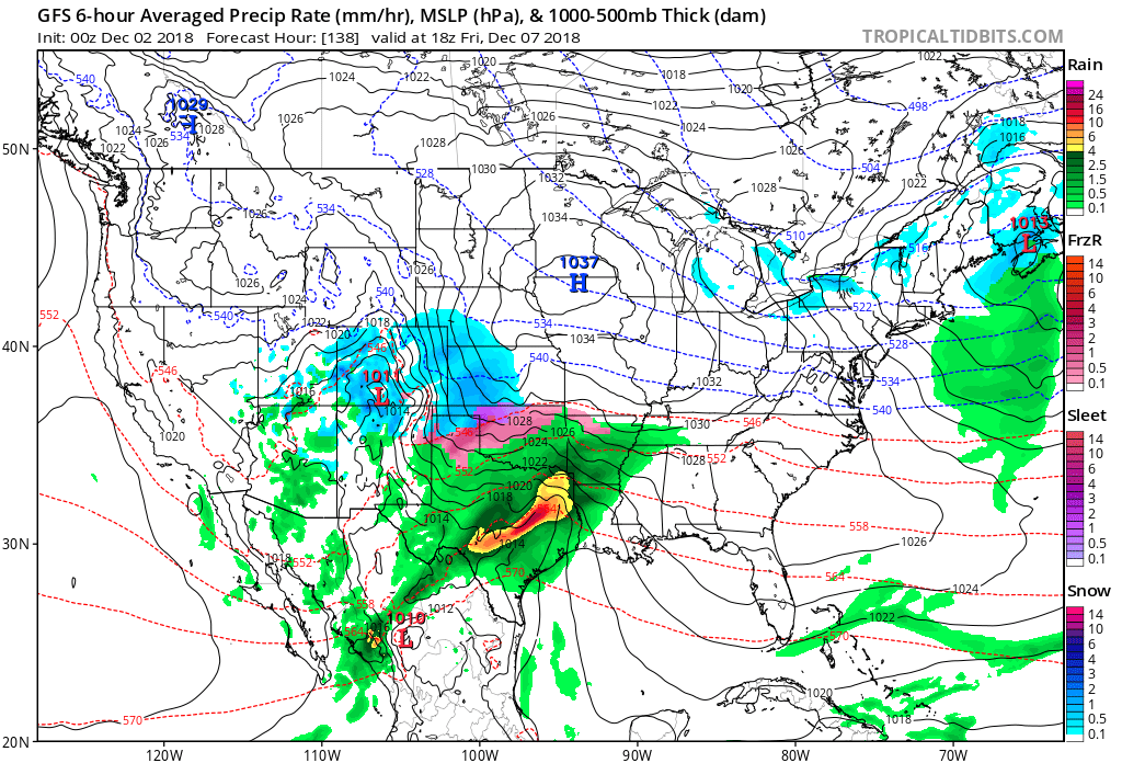
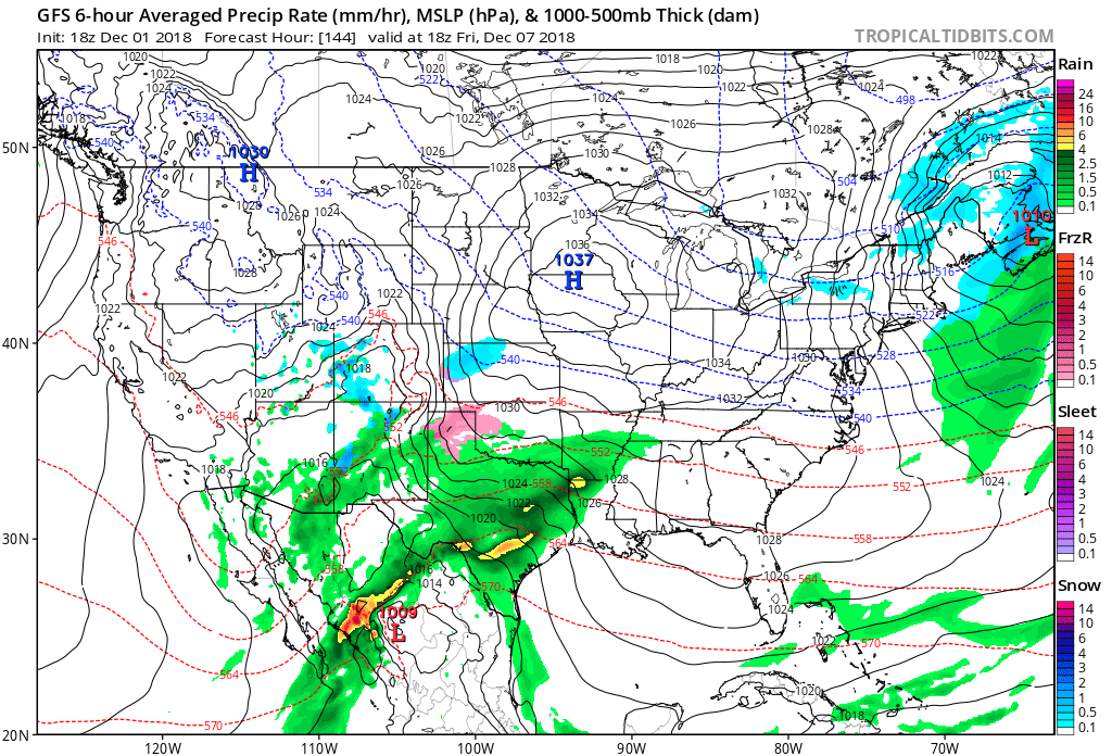
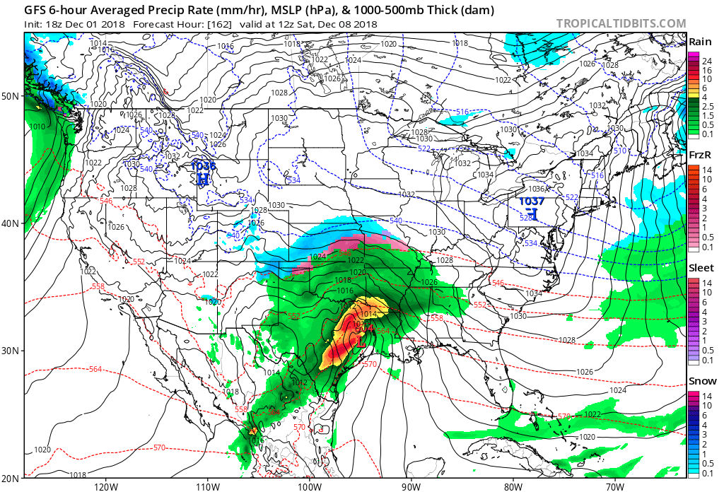
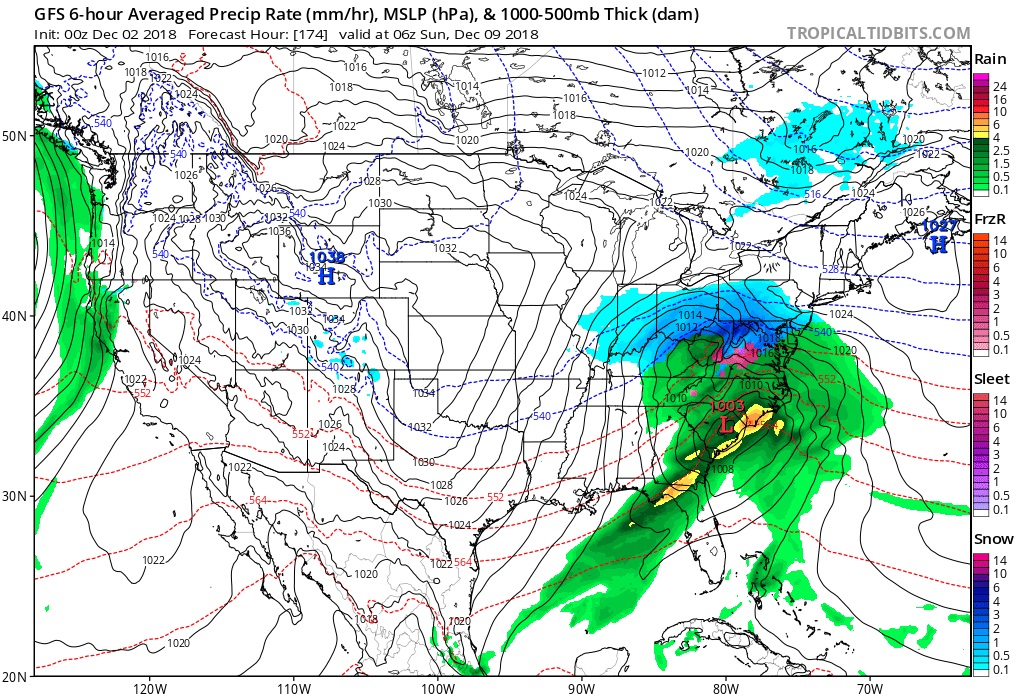
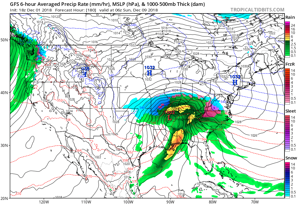
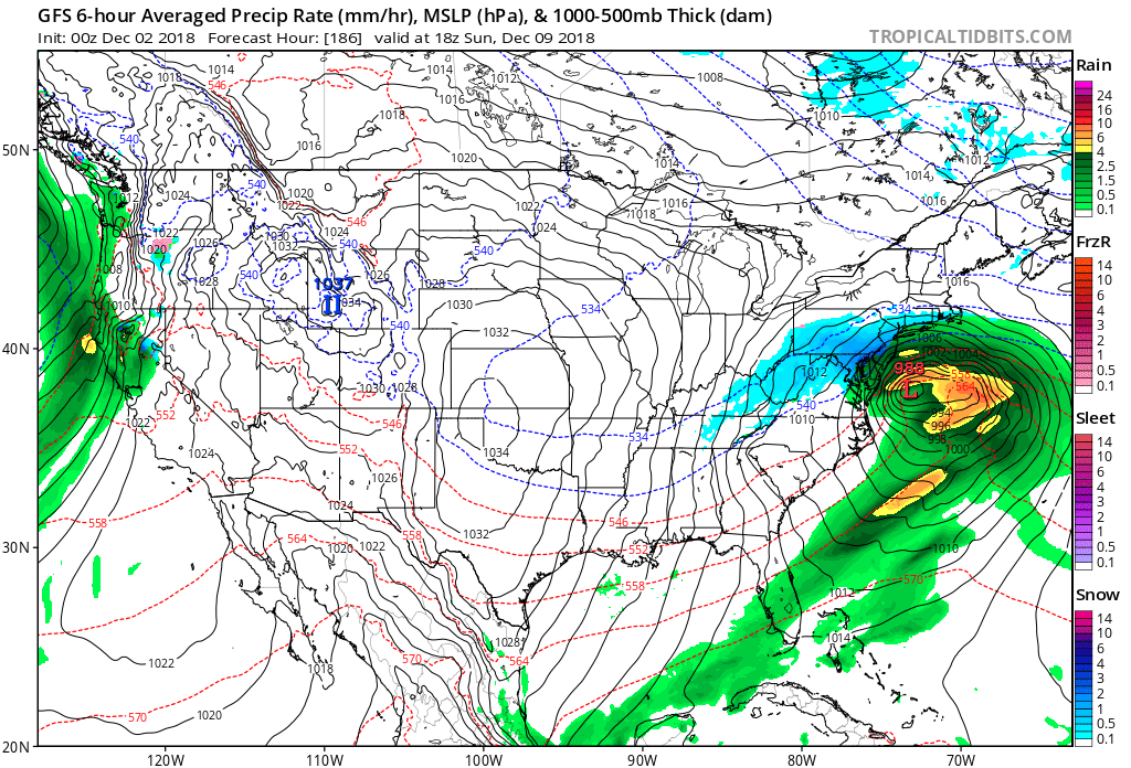
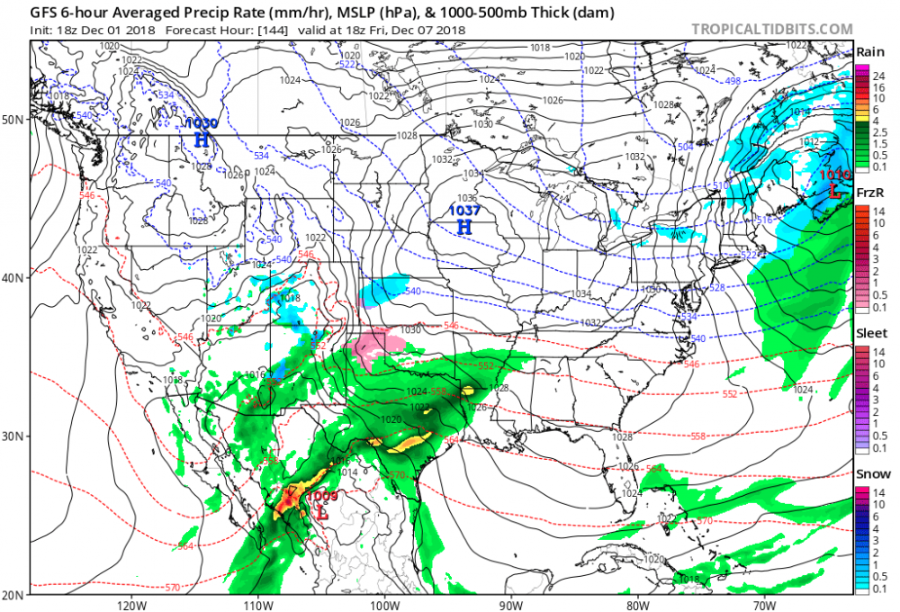
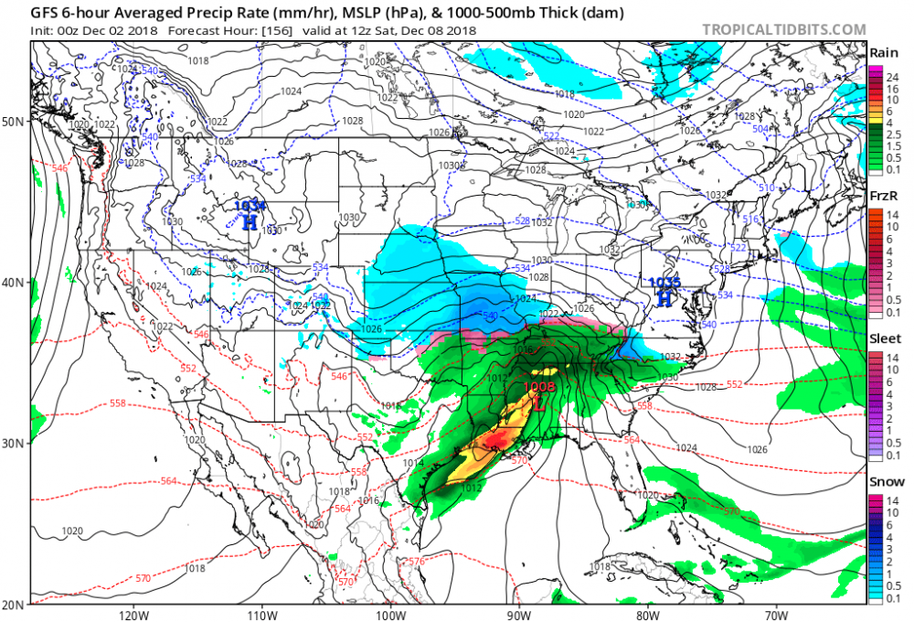
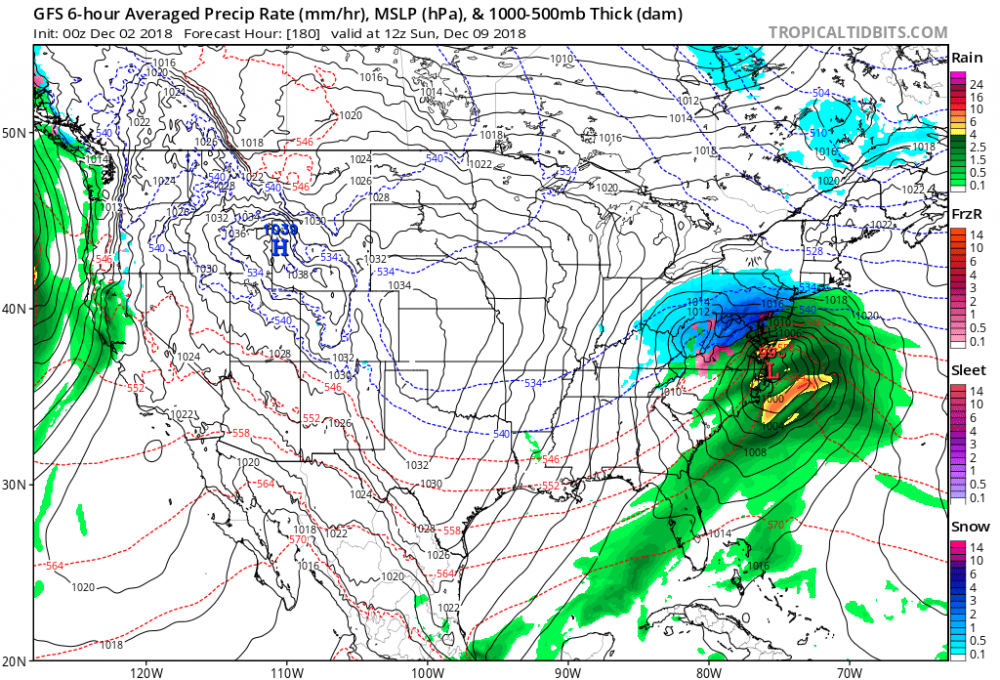
Gfs is definitely more amplified than its previous runs. top image: latest run 0z run bottom image: early evening 18z run 0z run 18z run Images courtesy www.tropicaltidbits.com Big hit incoming! In my opinion. Edit: 0z run 18z run Big hit happening next Sunday 7am! It has the look of January 23rd 2016 nam caught that perfect cause every model was suppressing it at the end everyone followed nam pulling up the coast and dumping 26 and change of snow in Central Park breaking the all time high for a 24 hrs snowstorm. Edit: GFS finishes a bit suppressed but it does snow decent here anyway. Philly is the bullseye. Last run was mostly rain but this could be a trend towards a more suppressed solution like the euro and cmc.


-
December 2018 General Discussion & Observations
Toekneeweather replied to Zelocita Weather's topic in New York City Metro
The GFS is the worst model in my opinion. It had rain the whole entire time for November 15th snowstorm. Gfs para was much better and I think that’s going to be the official gfs starting January. -
November 2018 Discussions & Observations Thread
Toekneeweather replied to Rtd208's topic in New York City Metro
You’re right I was wrong, it just needs to melt on the ground. So that means even a few flurries are a trace as long as they do reach the ground. -
November 2018 Discussions & Observations Thread
Toekneeweather replied to Rtd208's topic in New York City Metro
They have to wet the ground don’t you see it on the text that national weather service states. Today we had a trace of frozen stuff but longbeachsurf was talking about a few snow flurries that is not a trace. Flakes flying around and never really wetting the ground is not a trace. Maybe I’m wrong but I can picture a trace basically some white rain and boom it’s a trace -
November 2018 Discussions & Observations Thread
Toekneeweather replied to Rtd208's topic in New York City Metro
No it isn’t you can’t record a trace of snow if there are twenty flurries that don’t even hit the ground. You actually need more like a snow shower, we already went through this from national weather service Snow often melts as it lands. If snow continually melts as it lands, and the accumulation never reaches 0.1 inches on your measuring surface, snowfall should be recorded as a trace (T) and record in your remarks that the "snow melted as it landed -
November 2018 Discussions & Observations Thread
Toekneeweather replied to Rtd208's topic in New York City Metro
Next weekend looks good for a big storm. The midweek system disappeared unfortunately. Radar looks good for quick hitting snow showers mixed with sleet and rain for the next 3 hours. -
November 2018 Discussions & Observations Thread
Toekneeweather replied to Rtd208's topic in New York City Metro
There’s more coming later tonight especially north and west. -
November 2018 Discussions & Observations Thread
Toekneeweather replied to Rtd208's topic in New York City Metro
That’s a trace of snow -
November 2018 Discussions & Observations Thread
Toekneeweather replied to Rtd208's topic in New York City Metro
Trace of snow has to be at least “a wet/white ground not just a flurry”. -
November 2018 Discussions & Observations Thread
Toekneeweather replied to Rtd208's topic in New York City Metro
It may be late Tuesday night into Wednesday night but seems good for now, still very far away! -
November 2018 Discussions & Observations Thread
Toekneeweather replied to Rtd208's topic in New York City Metro
For sure a quick mover but could drop a few inches to start December. And keep in mind it’s very active after that too. currently cold and brisk with a temperature around 36 -
November 2018 Discussions & Observations Thread
Toekneeweather replied to Rtd208's topic in New York City Metro
GFS and its friend para GFS are both showing snow in the long term. Something to watch. -
November 2018 Discussions & Observations Thread
Toekneeweather replied to Rtd208's topic in New York City Metro
Gfs para 18z showed two possible wintry storms for next Tuesday and than again next Sunday. Far away obviously just something we can possibly track in the future. -
November 2018 Discussions & Observations Thread
Toekneeweather replied to Rtd208's topic in New York City Metro
Gfs para has 2 snowstorms for the next week and half. Looks cold after 3rd of December and stormy -
November 2018 Discussions & Observations Thread
Toekneeweather replied to Rtd208's topic in New York City Metro
I think December 5th and on are favorable but these cutters keep on giving for now. Let’s see how models handle the pattern next week. Models keep flipping each run! -
November 2018 Discussions & Observations Thread
Toekneeweather replied to Rtd208's topic in New York City Metro
Give it some time once the pattern reloads we will get our shot. You’ve gotta remember November and early December gets a lot of cutters. Besides I wouldn’t trust the models past 5 days. But the pattern is not terrible around December 4th and on! -
November 2018 Discussions & Observations Thread
Toekneeweather replied to Rtd208's topic in New York City Metro
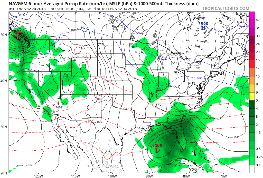
I like this look although it’s navgem it’s still a decent model. Looks like around 160hrs away or so we can have a low pressure that could overrun some cold air.

-
November 2018 Discussions & Observations Thread
Toekneeweather replied to Rtd208's topic in New York City Metro
Down to 20 in the Bronx, currently 24. Happy thanksgiving my boys -
November 2018 Discussions & Observations Thread
Toekneeweather replied to Rtd208's topic in New York City Metro
Slower and bigger storms. Definitely snowier and colder or drier and colder. -
November 2018 Discussions & Observations Thread
Toekneeweather replied to Rtd208's topic in New York City Metro
That’s so far why not pay attention to Tuesday’s system. It could trend 30-50 miles south and at least you’ll have white rain, possibly more if it develops stronger. -
Well it said it would be done by 3am Sunday. Also I may not be good at reading comprehension but I’m good at predicting snow that’s for sure! Lmao jk
-
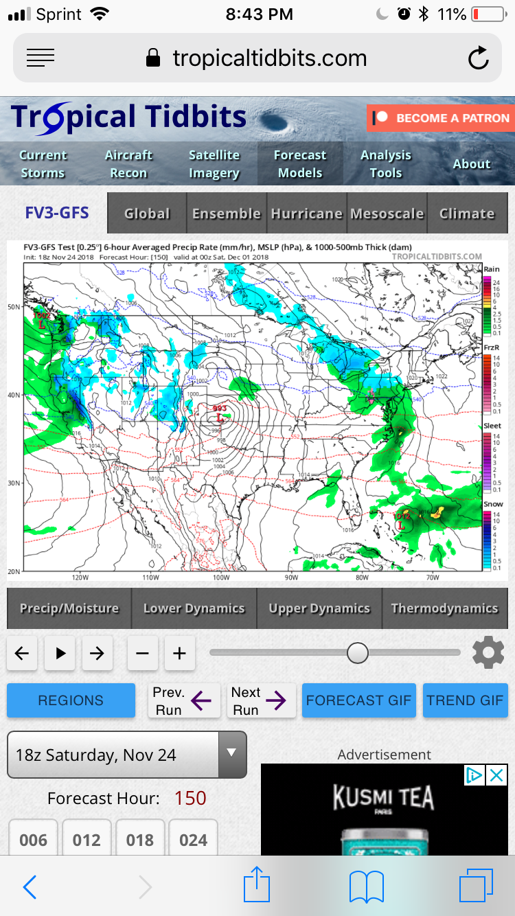
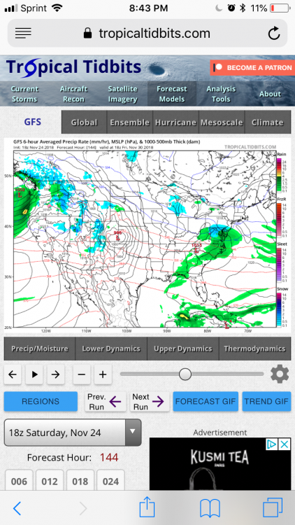
How come tropicaltidbits doesn’t load up the gfs and para? Anyone know where I can look at it
-
11/15-16 Coastal Storm/ULL Discussion
Toekneeweather replied to dmillz25's topic in New York City Metro
Was there any thundersnow with this storm? -
11/15-16 Coastal Storm/ULL Discussion
Toekneeweather replied to dmillz25's topic in New York City Metro
A picture from Central Park yesterday.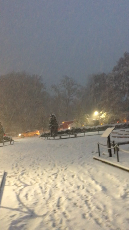
-
That was possibly the worst snowstorm I’ve ever been in traffic wise