fluoronium
-
Posts
219 -
Joined
-
Last visited
Content Type
Profiles
Blogs
Forums
American Weather
Media Demo
Store
Gallery
Everything posted by fluoronium
-
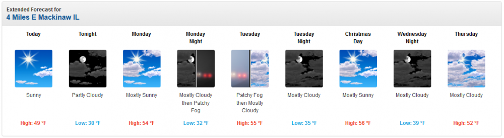
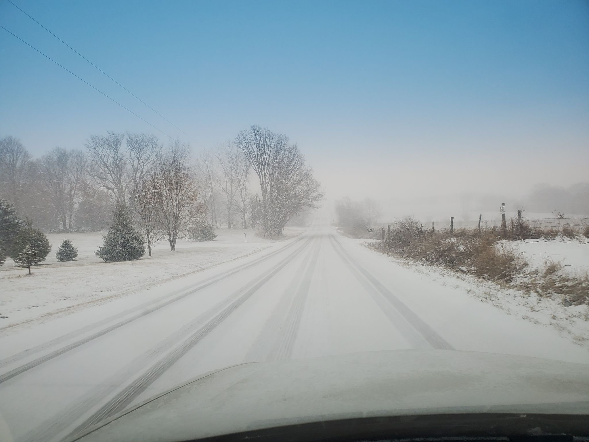
Started as snow here! Most guidance had at least a couple hours of rain before switching over so this is a good sign. Wind still coming from the south. not even a single report of rain nearby!! Awesome!

-
33F and rain in this blob
-
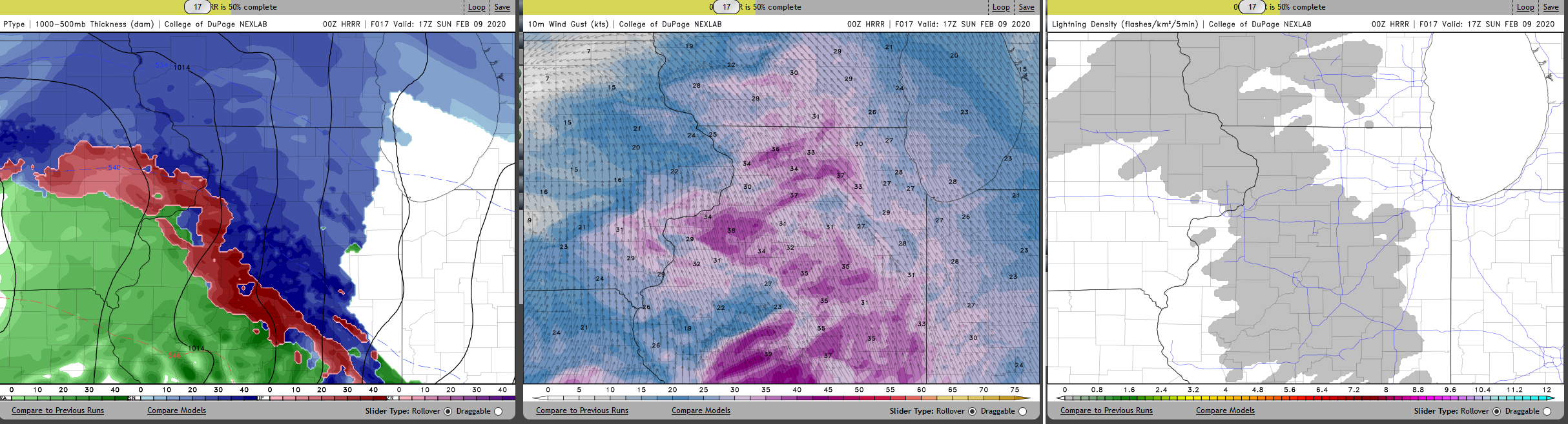
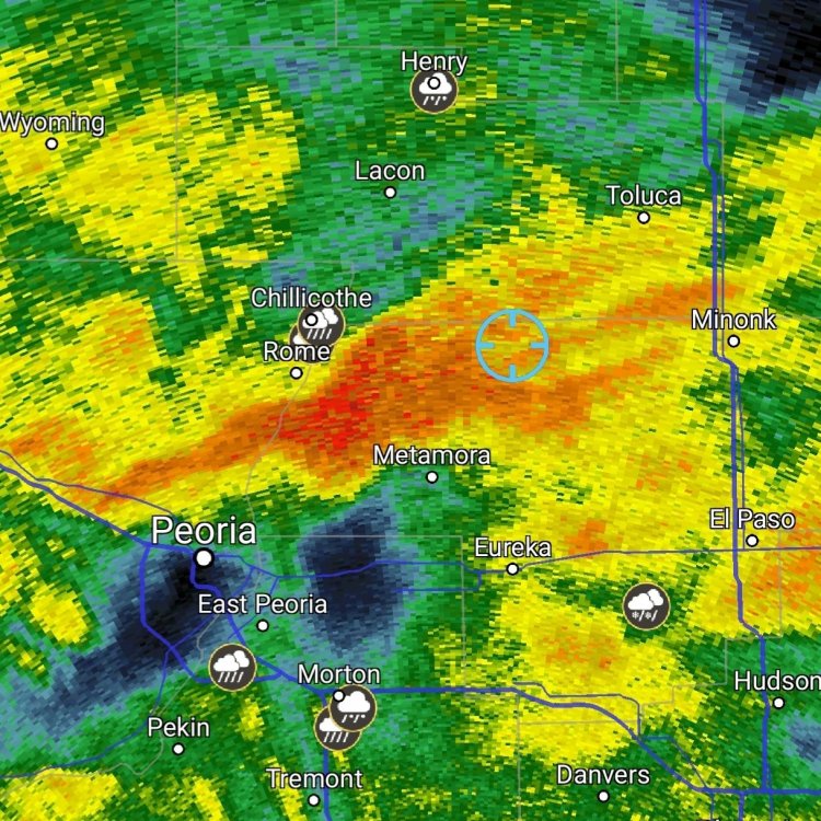
HRRR is showing some pretty intense snowfall rates with the initial band of precip before switching to rain, along with gusty winds and possible lightning. I don't even care about accumulations at this point, I'm just feeling the hype for even the slightest chance of thundersnow. If models are showing anything like this in the morning, I may drive a little to the NE for some snow chasing. I want to believe.

-

February 4th-7th Winter Storm Potential
fluoronium replied to Thundersnow12's topic in Lakes/Ohio Valley
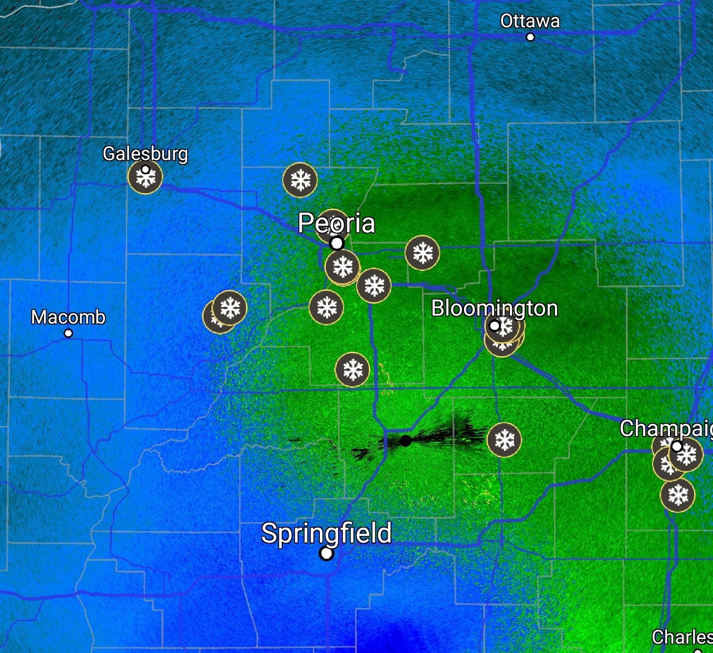
The thin dying band between Peoria and Bloomington managed to park over my backyard this past hour, so that's pretty nice! Looks like the snow is going to be fairly light from here on out though. I'm guessing there is about 2.5" on the ground now. Season's biggest snow is still Halloween here, so I wonder if there's a chance that will fall today.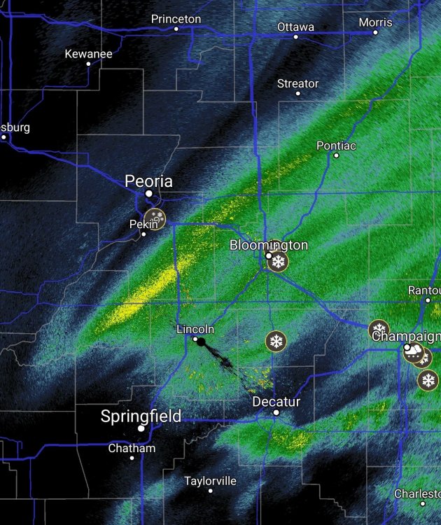

-
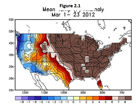
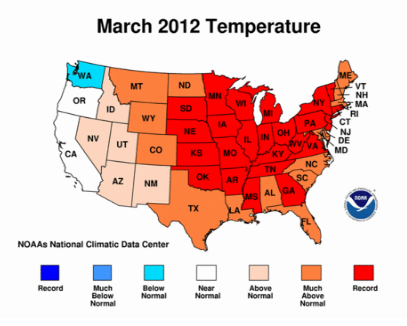
Hands down the event of the decade was Morch 2012. The incredible magnitude of temperature departures over a gigantic area and for an extended period of time was unbelievable. Some locations exceeded their all time April high temps in March! There were also daily low temps that exceeded record highs for the date, and Chicago had 10 consecutive days of breaking/tying temp records Some interesting bits from the Wikipedia article : ( https://en.wikipedia.org/wiki/March_2012_North_American_heat_wave ) In Traverse City, Michigan one day began with a low temperature (67 °F) that was higher than the previous record high for the day. An 84 °F (29 °C) high at Madison, Wisconsin in early March was 43 °F (24 °C) above average and followed an overnight low of 60 °F, 35 degrees above normal[16] the daily high being more than seven standard deviations above the mean. The absolute temperature and departure statistically would be equivalent to a mid-July high at that station in excess of 125 °F or more; the highest temperature recorded there was 107° at least once during the heat waves of the middle 1930s from Accuweather: ( https://www.accuweather.com/en/weather-news/amazing-stats-from-the-march-2-1/197377 ) 26 The number of inches of snow that melted over the course of just seven days in Caribou, Maine, from March 15 to March 22, thanks to the unusual warmth. Also, 18 inches of snow was still on the ground when the first record high fell on March 18 (64 degrees). 32 The gap, in degrees, between the old and new record high on March 21 in Marquette, Mich. The new record high was 81 degrees, obliterating the old record of 49 degrees. The margin of defeat was so great that the low temperature that day was even higher than the old record high temperature. from NWS: " In fact, the warm spell which occurred during the middle of the month is perhaps the most anomalous weather event in Michigan since climate records began 130 years ago. " https://www.weather.gov/dtx/unprecedentedmarchwarmth2012
-
Autumn/Winter 2019-2020 Banter/Complaint Thread
fluoronium replied to IWXwx's topic in Lakes/Ohio Valley
Torch it! I'm pretty stoked about this one as I can finally catch up on some long overdue yard work. The fact that it'll be fairly sunny with light winds really helps too. I think we'd all rather have a big snow at this time of the year but I'll take a torch over cold and dry any day.