sibbley
-
Posts
88 -
Joined
-
Last visited
Content Type
Profiles
Blogs
Forums
American Weather
Media Demo
Store
Gallery
Everything posted by sibbley
-
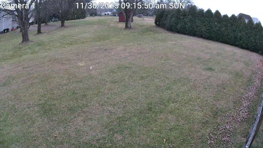
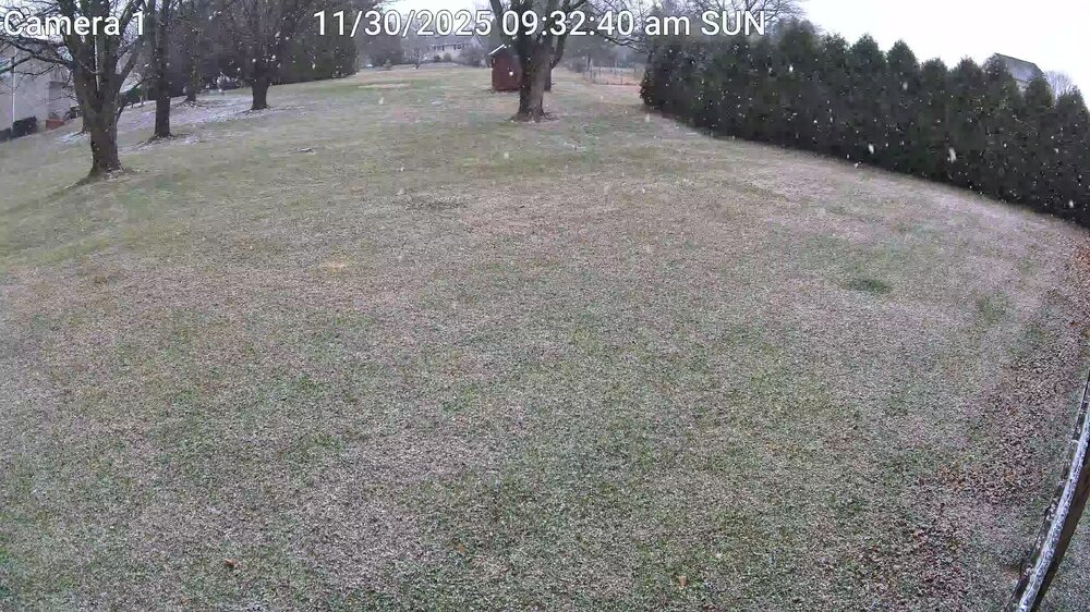
E PA/NJ/DE Winter 2025-26 Obs/Discussion
sibbley replied to LVblizzard's topic in Philadelphia Region
Lol, I noticed that again today. We had that during the storm on the 1/25 too. -
Looks like we ended with just about 17 inches. 16.8 in Bushkill Township. ...Northampton County...1 SSE Bushkill Twp 16.8 in 1045 PM 01/25 Trained Spotter Danielsville 16.1 in 1100 PM 01/25 Trained Spotter 1 ENE Washington Twp 16.0 in 1020 PM 01/25 Public North Catasauqua 15.4 in 1050 PM 01/25 Trained Spotter 2 E Tatamy 15.0 in 0900 PM 01/25 Trained Spotter Nazareth 14.1 in 0740 PM 01/25 Trained Spotter Forks Twp 13.3 in 0700 PM 01/25 Trained Spotter Easton 11.8 in 1130 PM 01/25 Public Martins Creek 11.8 in 0800 PM 01/25 Trained Spotter Bath 11.5 in 0900 PM 01/25 Trained Spotter Williams Twp 11.0 in 0550 PM 01/25 Trained Spotter 1 NNE Bethlehem Twp 10.0 in 0925 PM 01/25 Trained Spotter Hellertown 9.9 in 0630 PM 01/25 Trained Spotter
-
Up to 9F from 7.3 most of the day, in Bushkill Township. Heat wave...
-
You don't have wind?
-
Sleet/Snow mix in Bushkill Township. 7.3F all day. Temp hasn't really budged. Had to switch to oil heat as the AC/Heat unit was getting iced up. Hard to tell how much snow fell with the drifting. Maybe 7-8 inches.
-
We missed all the Bethlehem trucks rolling in at the old Highway Plant in Nazareth in 2025. This is Tony from the lab. Say Hi to Dray and Al for me.
-
If we do get sleet up here, I think leaving it on top of the snow is best. Might make clean up harder, but it's better than cleaning up ice IMHO. However, if we get up to a foot before the end, I'll go out and snow blow before the end.
-
January 18th Back Door NW Trend Snow OBS Thread
sibbley replied to Mikeymac5306's topic in Philadelphia Region
Starting to cover cars and driveway again in Nazareth. Only light snow at this point. -
E PA/NJ/DE Winter 2025-26 Obs/Discussion
sibbley replied to LVblizzard's topic in Philadelphia Region
Heavy snow in Nazareth.
-
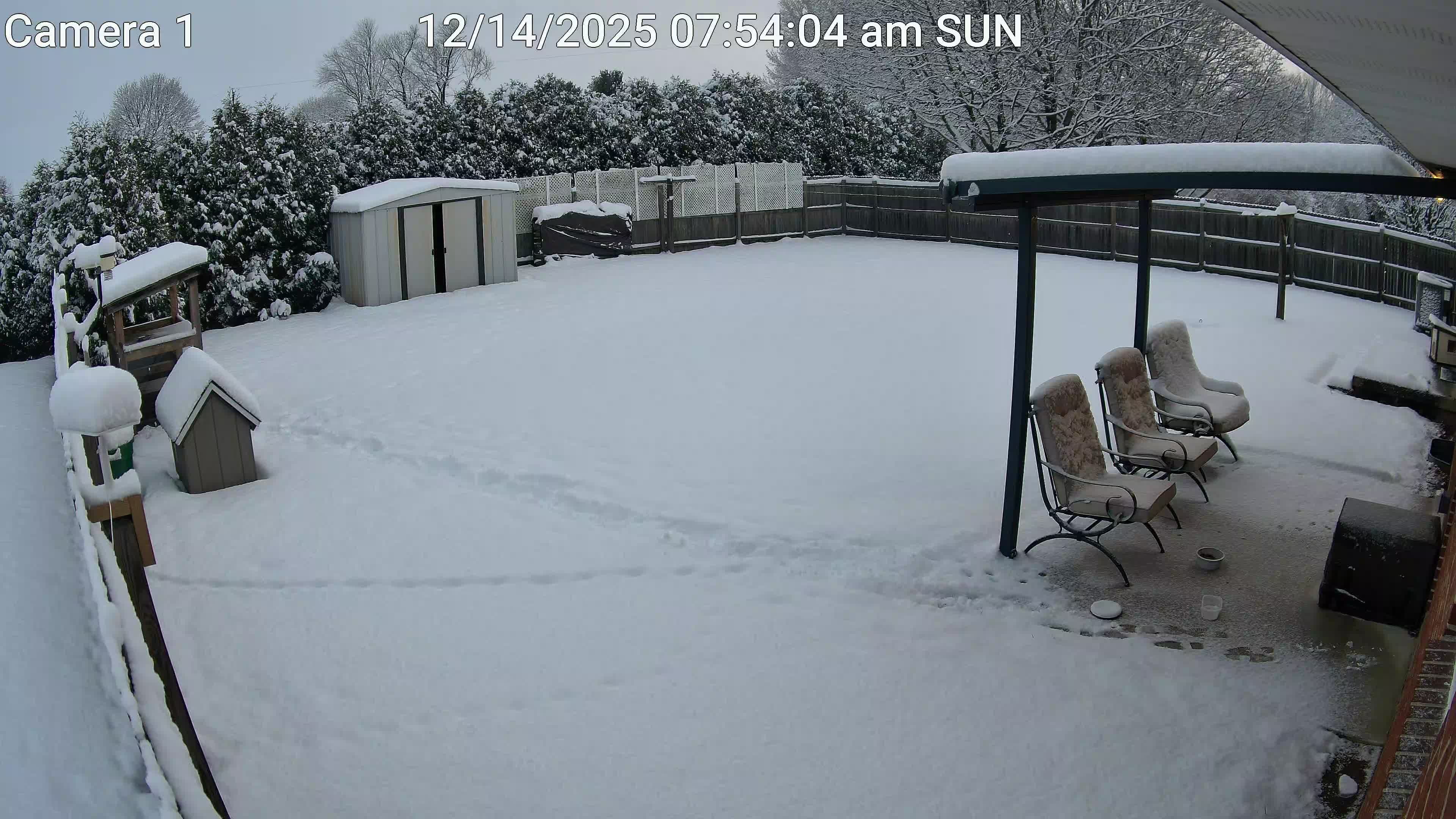
Saturday night/Sunday 12/13-12/14 Jawn
sibbley replied to Ralph Wiggum's topic in Philadelphia Region
Morning beauty! I saw a storm report on GRLevel3 that Showed 5 inches in Nazareth. Looks about right in the back yard.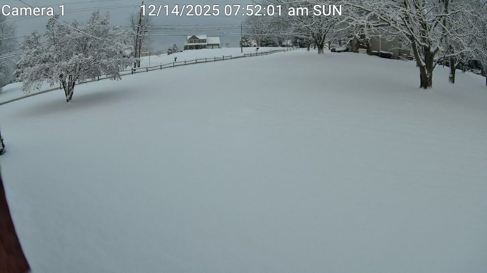

-
E PA/NJ/DE Winter 2025-26 Obs/Discussion
sibbley replied to LVblizzard's topic in Philadelphia Region
Nice little burst over about an hour. Still coming down.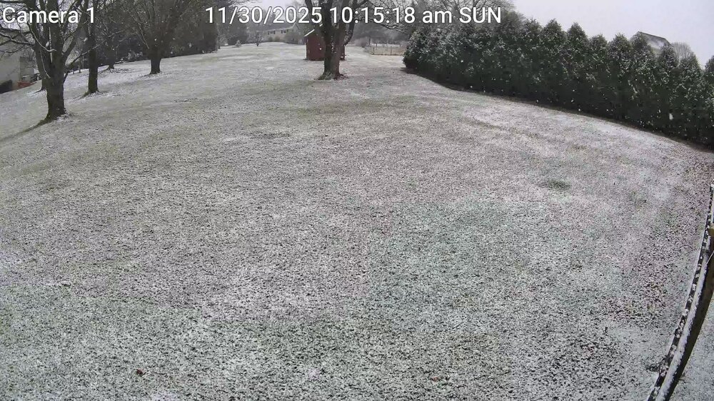
-
E PA/NJ/DE Winter 2025-26 Obs/Discussion
sibbley replied to LVblizzard's topic in Philadelphia Region
-
E PA/NJ/DE Winter 2025-26 Obs/Discussion
sibbley replied to LVblizzard's topic in Philadelphia Region
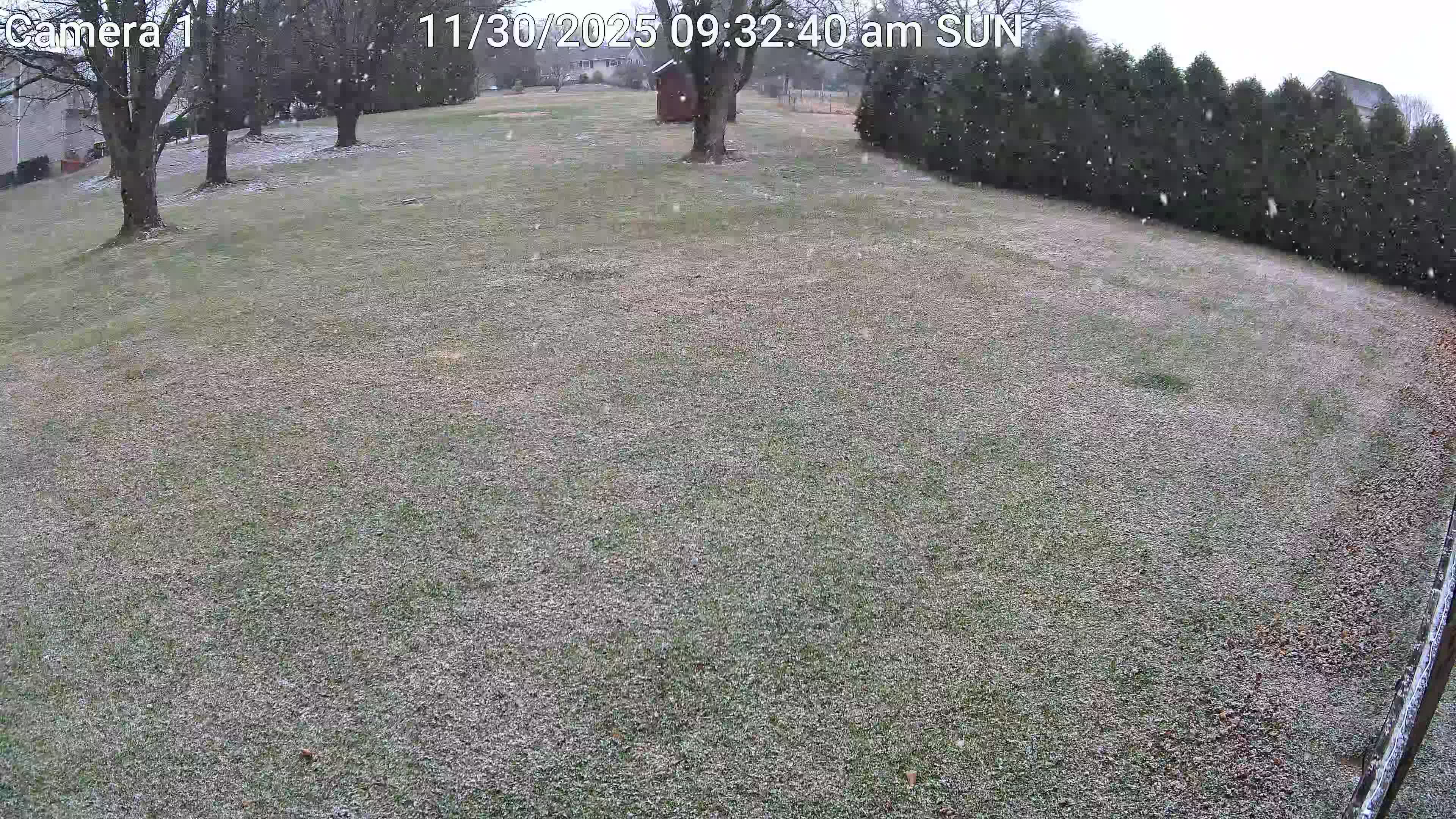
Light snow in Bushkill Township. Current Conditions 35.1 °F Feels Like 32.7 ° DEWPOINT 26.7 °F PRESSURE 30.09 in HUMIDITY 71 % -
February 15-16 Slop Fest/Rain/Wind OBS
sibbley replied to Mikeymac5306's topic in Philadelphia Region
Road and driveway covered. Steady 28F with light snow still falling.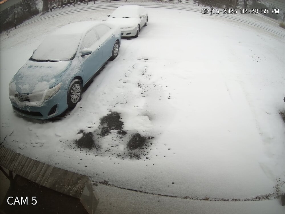
-
E PA/NJ/DE Spring 2024 OBS/Discussion
sibbley replied to Hurricane Agnes's topic in Philadelphia Region
I was out metal detecting about 11:30 and got hit with a heavy sleet/windstorm. Lasted about 10 minutes. It was wicked, just like an afternoon thunderstorm on a summer day except cold! -
E PA/NJ/DE Winter 2023-2024 OBS/Discussion
sibbley replied to The Iceman's topic in Philadelphia Region
55.8 high today with .99 inch of rain. 1.43 since yesterday afternoon. Had a brief thunderstorm earlier this morning. -
I'd say we got about 3 inches in Bushkill Township (Nazareth).
-
Holy crap. I can't believe some of these totals. ...UPDATED SNOWFALL REPORTS AS OF 8 AM FOR FEBRUARY 17TH... ...Pennsylvania......Berks County...Lyons 12.0 in 0328 AM 02/17 Public Fleetwood 9.0 in 0602 AM 02/17 Trained Spotter Huffs Church 8.4 in 0723 AM 02/17 Trained Spotter Blandon 7.3 in 0215 AM 02/17 Trained Spotter Bern Twp 5.7 in 0145 AM 02/17 Trained Spotter Spring Twp 3.0 in 0625 AM 02/17 Public Reading Regional Airport 2.5 in 0700 AM 02/17 ASOS Union Twp 2.0 in 0706 AM 02/17 Trained Spotter 1 N Union Twp 1.8 in 0446 AM 02/17 Public ...Bucks County...1 ESE Kintnersville 13.0 in 0630 AM 02/17 Public Kintnersville 8.0 in 0212 AM 02/17 Public East Rockhill Twp 5.2 in 0645 AM 02/17 Trained Spotter Newtown 3.4 in 0719 AM 02/17 Public Jamison 3.0 in 0710 AM 02/17 Public 1 SSE Northampton Twp 2.8 in 0724 AM 02/17 NWS Employee 1 W Levittown 1.0 in 0227 AM 02/17 Trained Spotter ...Carbon County...Jim Thorpe 3.0 in 0645 AM 02/17 Trained Spotter ...Chester County...Berwyn 4.8 in 0720 AM 02/17 Public Oxford 3.5 in 0700 AM 02/17 Public Jennersville 3.4 in 0640 AM 02/17 Public West Caln Twp 3.1 in 0700 AM 02/17 Trained Spotter 2 WSW West Sadsbury Twp 3.0 in 0650 AM 02/17 Trained Spotter East Nantmeal Twp 2.5 in 0400 AM 02/17 Trained Spotter ...Delaware County...Morton 3.4 in 0520 AM 02/17 Trained Spotter Boothwyn 3.2 in 0429 AM 02/17 Trained Spotter Aston Twp. 3.1 in 0530 AM 02/17 Public ...Lehigh County...Center Valley 13.8 in 0419 AM 02/17 Trained Spotter Macungie 13.7 in 0357 AM 02/17 Trained Spotter 1 S Allentown 12.1 in 0720 AM 02/17 Public 2 ENE Ancient Oaks 12.0 in 0410 AM 02/17 Cocorahs Upper Saucon Twp 8.0 in 0156 AM 02/17 Public 1 WSW Vera Cruz 8.0 in 0600 AM 02/17 Public Allentown 7.8 in 0653 AM 02/17 Trained Spotter Lehigh Valley International 5.7 in 0700 AM 02/17 ASOS Whitehall Twp 4.5 in 0700 AM 02/17 Trained Spotter ...Montgomery County...Pennsburg 5.0 in 0454 AM 02/17 Public New Hanover Twp 3.0 in 0645 AM 02/17 Trained Spotter 1 E Willow Grove 2.3 in 0541 AM 02/17 Trained Spotter Norristown 1.0 in 0200 AM 02/17 Trained Spotter ...Northampton County...Hellertown 11.8 in 0406 AM 02/17 Trained Spotter North Catasauqua 4.8 in 0530 AM 02/17 Trained Spotter ...Philadelphia County...Northeast Philadelphia 3.5 in 0700 AM 02/17 Trained Spotter Somerton 3.1 in 0545 AM 02/17 Trained Spotter Belmont 3.0 in 0445 AM 02/17 Public Philadelphia Intl Airport 2.3 in 0700 AM 02/17 ASOS
-
According to a trained spotter, we got 11" in Bushkill Township (Nazareth). Snow is over. Time for cleanup.
-
E PA/NJ/DE Winter 2023-2024 OBS/Discussion
sibbley replied to The Iceman's topic in Philadelphia Region
Was out metal detecting and my phone started blowing up. To my surprise, a watch for 4-8 inches in Northampton County. -
1 inch or so in Nazareth area. 22F light snow.
-
At 8:22PM NWS issued a WSW for Lehigh and Northampton counties. Here at 9PM, a look at radar indicates we are into freezing rain, then rain @32F. Looks to be over by 11PM.
-
Crazy, how things can be so different over just a mile or so. I'm just Northwest in Bushkill Township. Have had rain since about 7:45. Lucky if we have 4 inches. I can still see my septic lid in the back yard. It's about 5 inches off ground level. Just about 32F here. Snow is sliding off the hood of the cars.
-
Snow started about 1PM. Spent most of the day since the snow began about 25F. Now up to 30F. Maybe about three inches so far.
-
Nazareth an hour ago...