

Malacka11
-
Posts
2,236 -
Joined
-
Last visited
Content Type
Profiles
Blogs
Forums
American Weather
Media Demo
Store
Gallery
Posts posted by Malacka11
-
-
It would be great if we could finesse our way back to something especially this close out suddenly
-
30 minutes ago, sbnwx85 said:
Love the optimism. You can tell it's early in the season.
True but also smooth-brained optimism is kind of my schtick because I refuse to let some clouds dictate my disposition like that. Last year cooked me though not gonna lie.
Also real shit I saw the Icon had already come in with something fairly decent so I thought I'd shoot my shot
-
 1
1
-
 1
1
-
-
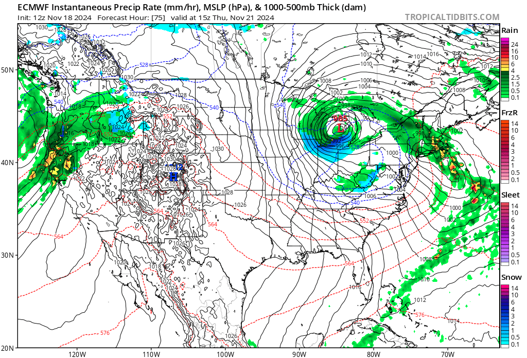
I think full hope in the Thxgiving storm will be restored w tonight's runs
-
 1
1
-
-
29 minutes ago, michsnowfreak said:
Ah ok. Trended away from here lol. But it is nice to see RELATIVE consistency with the models days out. Hopefully a sign!
Yeah, it'll be fun to see how things hold together for what hopefully stays a legit chance around Thanksgiving
-
 1
1
-
-
20 minutes ago, michsnowfreak said:
Just curious, what trend are you alluding to? That the models dont lose a system?
That, as well as it trending very well for mby and the ceiling slightly creeping up too, at least locally.
-
Also hoping this first event is setting a trend and not just burning through our luck here in chi-land
-
Between the Euro updates, the new gif reactions, and actually having shit to watch before mid January this winter is already off to a good start in the gradebooks
-
1
-
 1
1
-
 1
1
-
-
Love to see (with my exceedingly amateur eyes) that maybe if there's an event or two somewhere in the subforum over the next few weeks, it's at least possible that there will be a little more cold air to work with than last year's screw over events
-
29 minutes ago, Frog Town said:
Not often you see a dry slot and warm tongue with this orientation!!
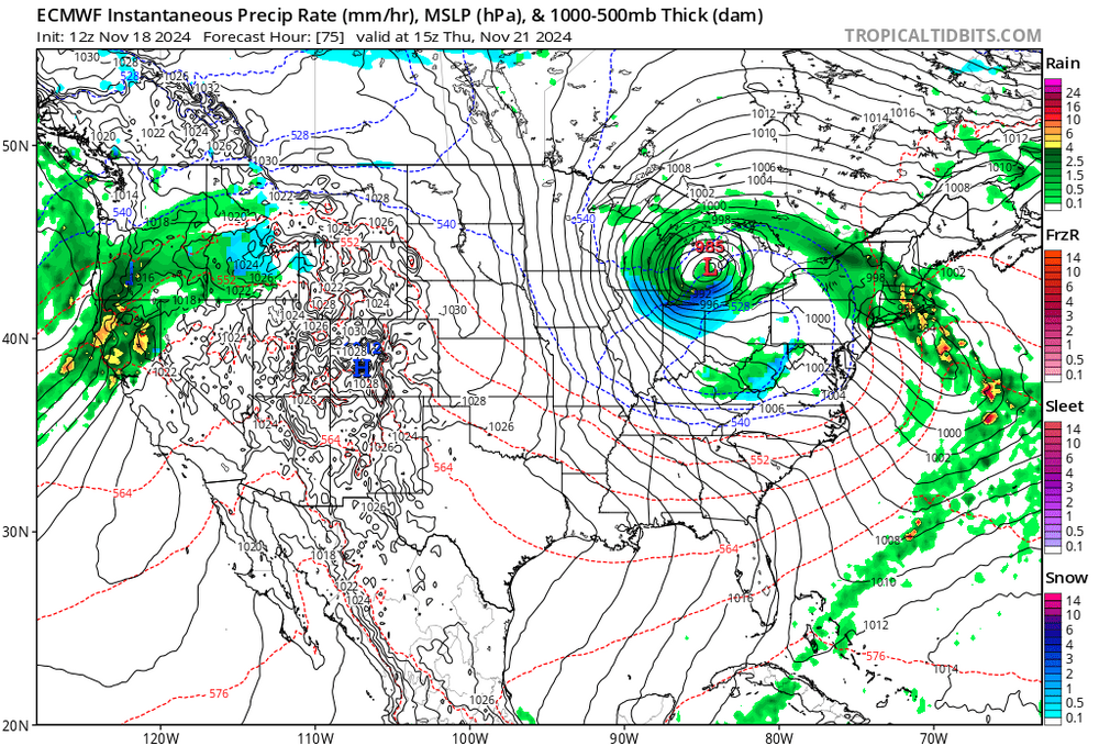
Seeing the Euro in TT's precip type view is like something out of one of those deja vu/dream moments where you think you're losing it. Can't believe the day has actually arrived
-
1
-
3
-
-
We did end the last winter with the revelation that the Euro comes out somewhat quicker now, right? Or am I losing my marbles?
-
-
As long as it doesn't mean we can lock in fuck all for DJF, sounds good to me
-
I appreciate ma nature for one more round of thunder and lightning to close out 2024, the drought kind of caught me off guard
-
2
-
-
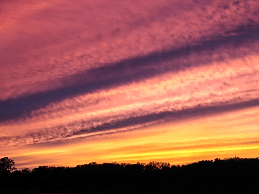
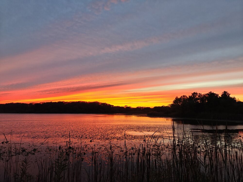
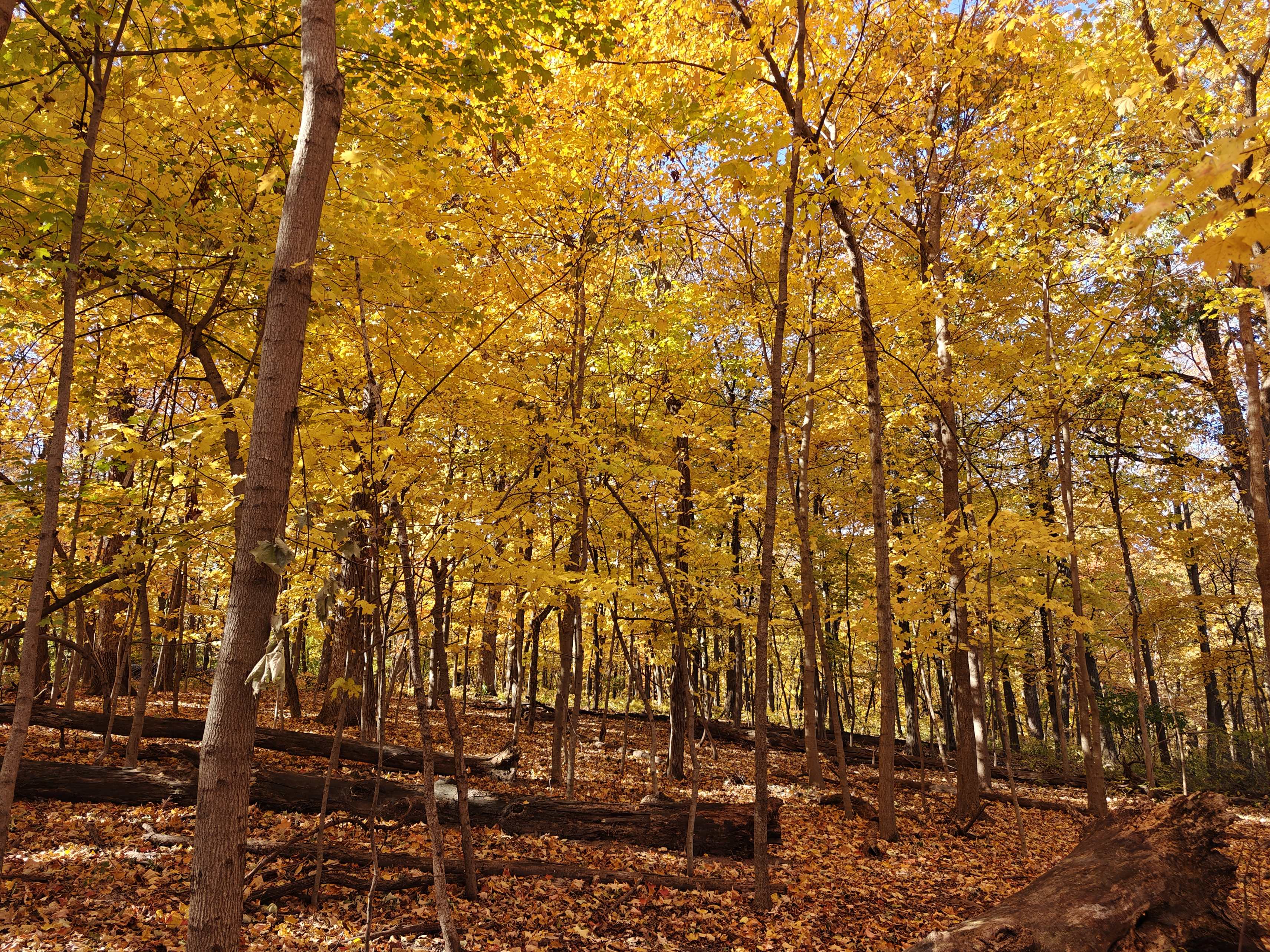
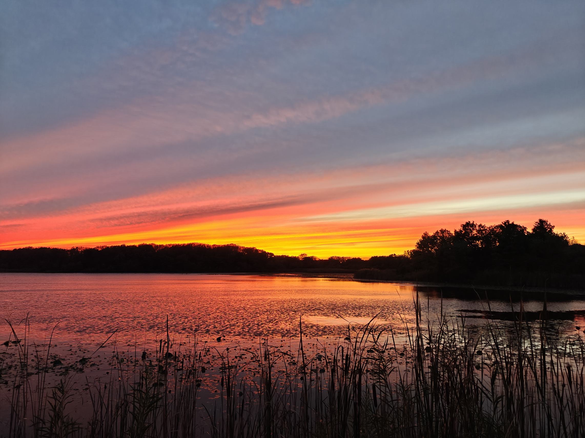
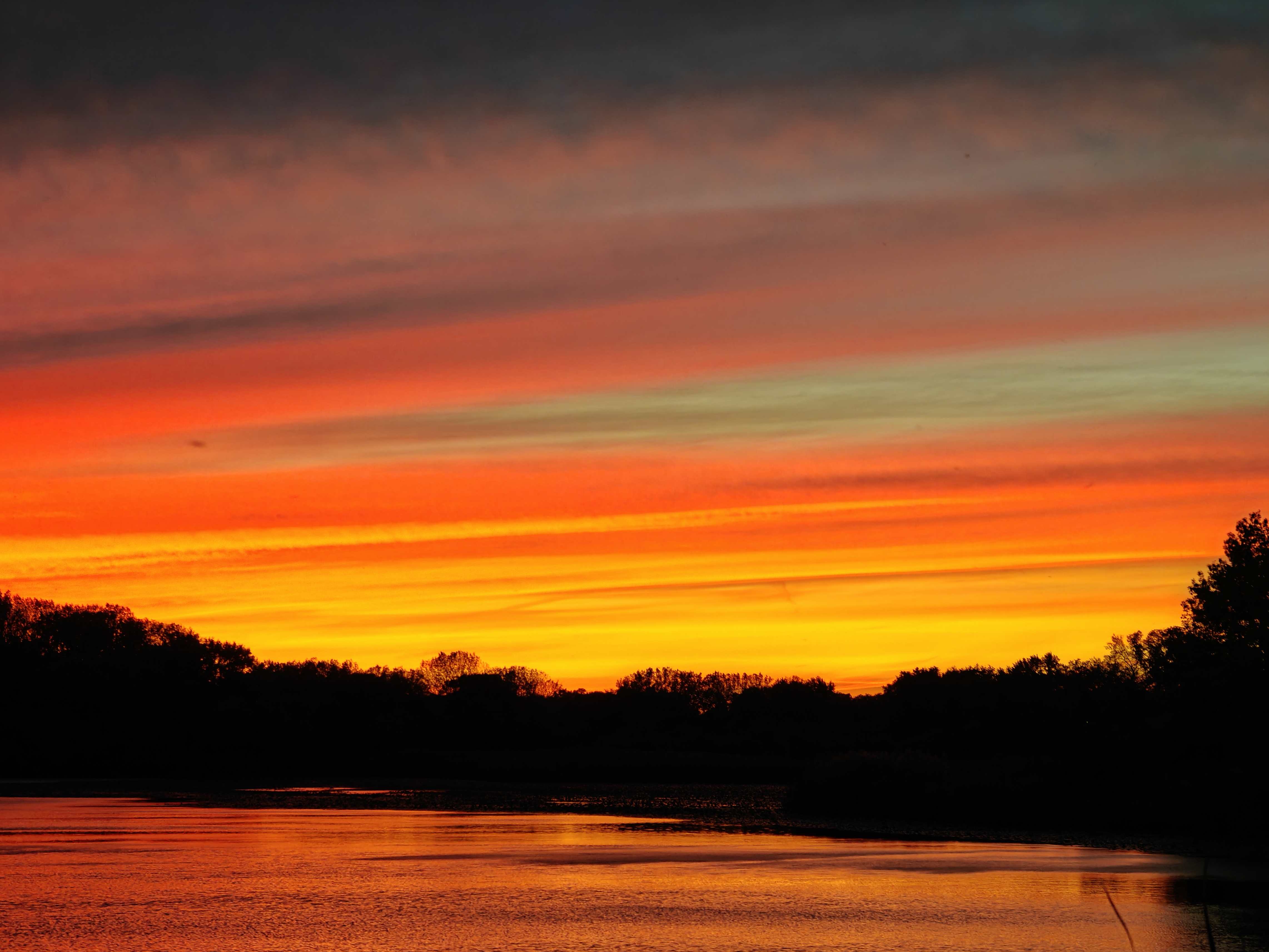
Very mellow yellow today

-
7
-
-
10 minutes ago, A-L-E-K said:
re: ladybugs and for the more u know file
i guess the october swarming, especially warm days after a first freeze is a thing
I feel so validated by all of this talk because the last week or so, whenever I take my dog for a walk in the forest preserve by my house, it smells overwhelmingly of ladybug, and I thought I was just losing it. I imagine there's probably just a big gathering somewhere close to the entrance that I haven't discovered
-
1
-
-
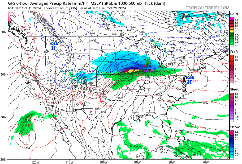
Well gang, here's the first legit model snow of the season.

-
3
-
1
-
-
3 hours ago, A-L-E-K said:
One of the more prolific lake effect rain events in memory
Big jelly
-
Seeing some wintery-looking systems show up in the extended is slowly starting to bring back the trauma of last year's Ls.
-
2
-
-
19 minutes ago, A-L-E-K said:
southcels stay mad
Wagons north?
-
1
-
-
Helene put on quite a show over here tonight, I imagine a lot of you got nice views as well


-
7
-
1
-
-
4 hours ago, Chicago Storm said:
Activity around here on Tuesday evening/night had prolific lightning production. It was probably a top 10 light show.
Ended up with a peak wind gust of 53MPH at ORD, with some blowing dirt/dust for awhile as well, as it has been dry and outflow winds were well ahead of any rain/t'storm activity.
Have to agree that was the best night lightning I think I've ever seen
-
1 hour ago, Torchageddon said:
I put this into ChatGPT 4:
"how many tornadoes occurred in Illinois during the month of July 2024?"
Pathetic. These AI Chat LLMs suck for weather queries. The point is for me not to have to dig for these stats if its connected to the web!
I'm not sure it's connected to the Web exactly like that. AI chatbots are just "fed" very large segments of Internet, but data that is that recent isn't something that I would expect a chatbot to have ingested yet. Last I saw, there's even a disclaimer that GPT's accuracy drops with recency and that stuff from the last year very likely will not be answered properly or at all. That said, idk if it's much better with old old weather data either simply due to obscurity.
-
Bout to get JDAMd by some GV cells filling in a few miles west. Can't remember the last good storm despite having a very nice and active year so far.
Excited to see if whatever line of storms that forms tomorrow evening around the WI border will be able to keep itself together long enough to reach MBY. Pretty much all CAMs show a similar evolution of the line shitting itself within a county before or after reaching MBY, so it'll be close either way.
-
6 hours ago, bowtie` said:
Always surprises me that CG's come in a variety of sizes. Just had a popcorn fart from a tiny cell over the house a minute or two ago. Sounded like someone shot a shotgun off in the alley behind the house. Baby bolt.
Happened to me a few times at the dog park the other day from a similar tiny pop up cell. I like your description, it's very accurate

Winter 2024-25 Medium/Long Range Discussion
in Lakes/Ohio Valley
Posted
GEFS looks a little better overall too. At least generally supportive of it maybe snowing for someone, which you got to be grateful for what you get these days