BhamParker
-
Posts
274 -
Joined
-
Last visited
Content Type
Profiles
Blogs
Forums
American Weather
Media Demo
Store
Gallery
Everything posted by BhamParker
-

2019/2020 Mountains and Foothills Fall/Winter Thread.
BhamParker replied to Tyler Penland's topic in Southeastern States
No snow up at the cabin in Maggie valley but man we are up in the clouds. Really hopeful that the ULL will give us some love tomorrow night! -
2019/2020 Mountains and Foothills Fall/Winter Thread.
BhamParker replied to Tyler Penland's topic in Southeastern States
-
2019/2020 Mountains and Foothills Fall/Winter Thread.
BhamParker replied to Tyler Penland's topic in Southeastern States
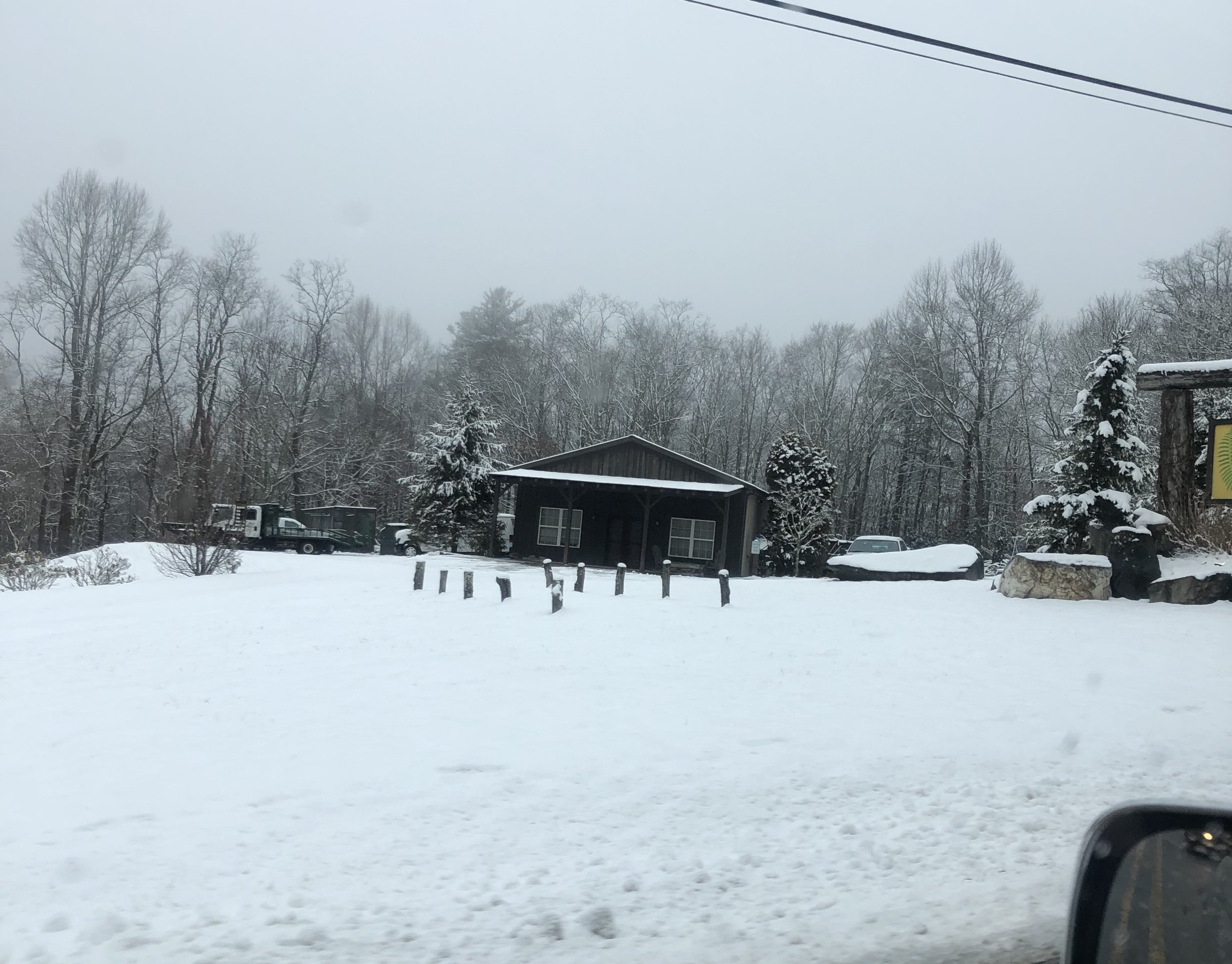
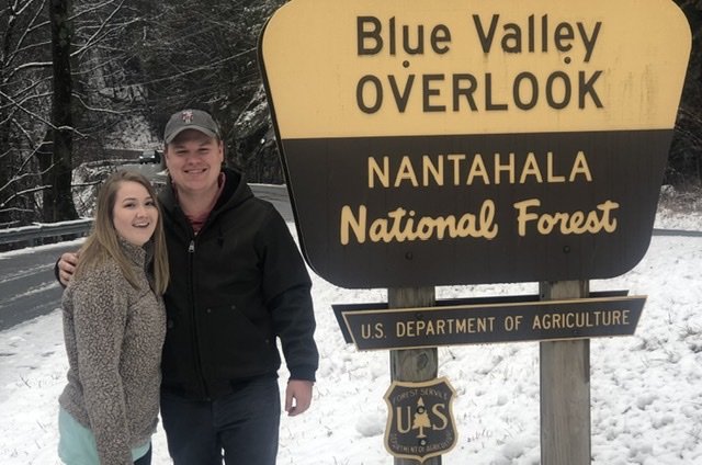
Highlands was beautiful!
-
2019/2020 Mountains and Foothills Fall/Winter Thread.
BhamParker replied to Tyler Penland's topic in Southeastern States
30 minutes out from highlands. Nice dusting in most of north Georgia. Should be close to the good stuff. -
2019/2020 Mountains and Foothills Fall/Winter Thread.
BhamParker replied to Tyler Penland's topic in Southeastern States
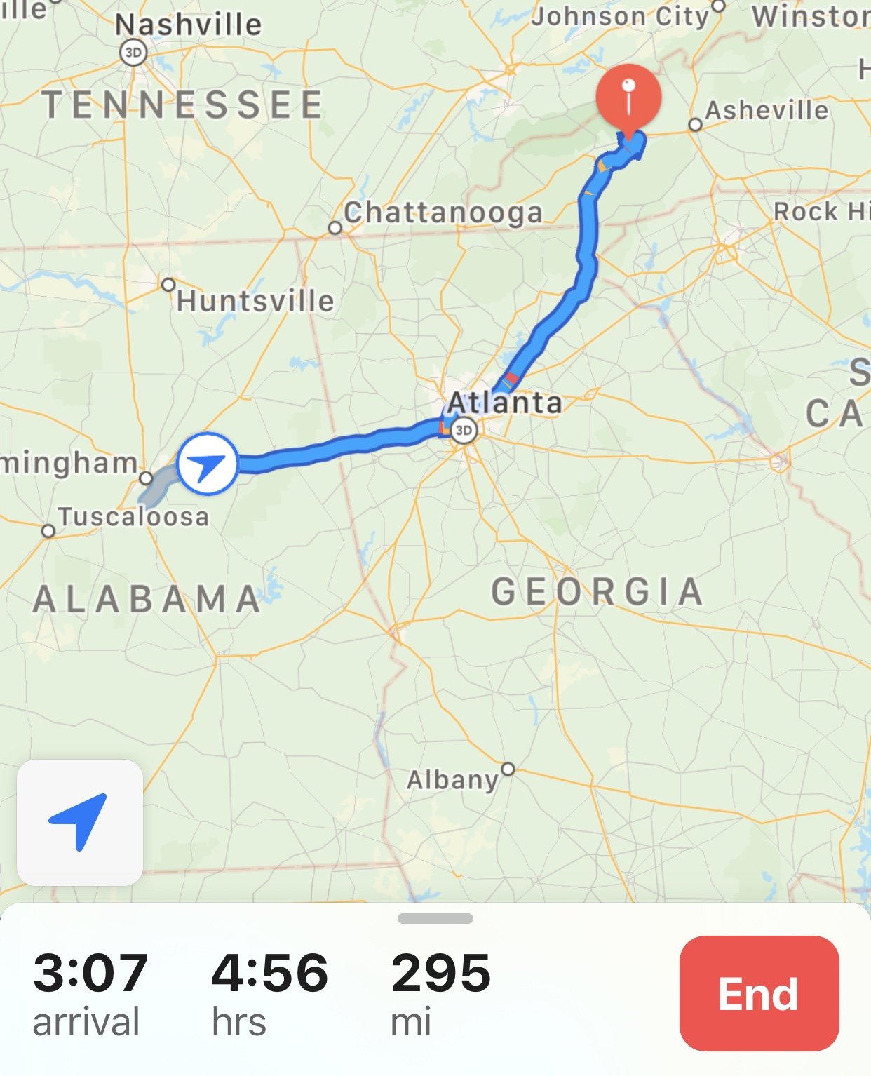
Just stopped in Gainesville. Hoping I’m close to some action. GPS is taking me 64 -
2019/2020 Mountains and Foothills Fall/Winter Thread.
BhamParker replied to Tyler Penland's topic in Southeastern States
In route! See you mountain folks soon!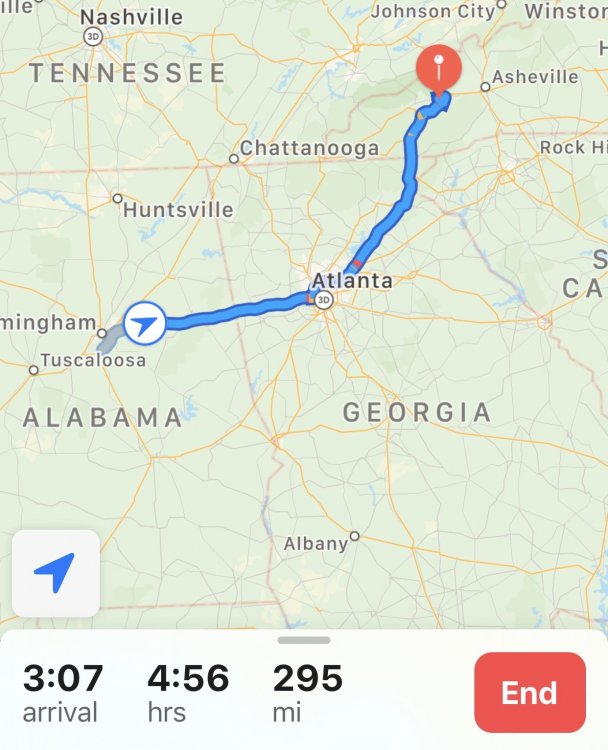
-
2019/2020 Mountains and Foothills Fall/Winter Thread.
BhamParker replied to Tyler Penland's topic in Southeastern States
Man I sure wish we were already there but won’t be arriving until 2:45-3:00. Hopefully it’ll be nice and pretty on the ride up! -
2019/2020 Mountains and Foothills Fall/Winter Thread.
BhamParker replied to Tyler Penland's topic in Southeastern States
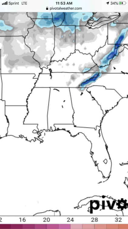
Leaving Birmingham now, trying to decide to drive through north Georgia or Chattanooga to Knoxville. Sure would love to see the snow on the way. I’m sure surface temps should be fine. -
2019/2020 Mountains and Foothills Fall/Winter Thread.
BhamParker replied to Tyler Penland's topic in Southeastern States
I am extremely nervous being on the western edge of the precip. Hoping Haywood county will do okay, but it sure would be nice for things to trend further west as we get closer to verification. We should be rolling into town around 3 tomorrow! -
2019/2020 Mountains and Foothills Fall/Winter Thread.
BhamParker replied to Tyler Penland's topic in Southeastern States
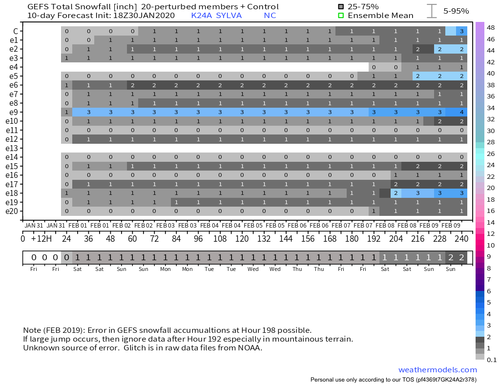
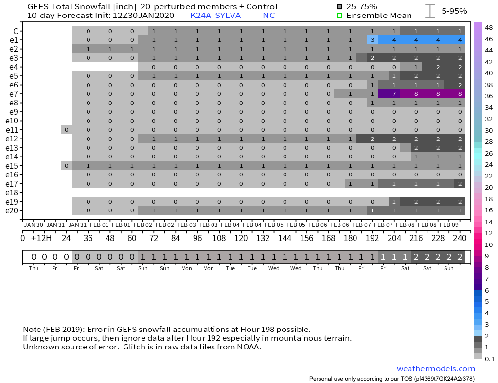
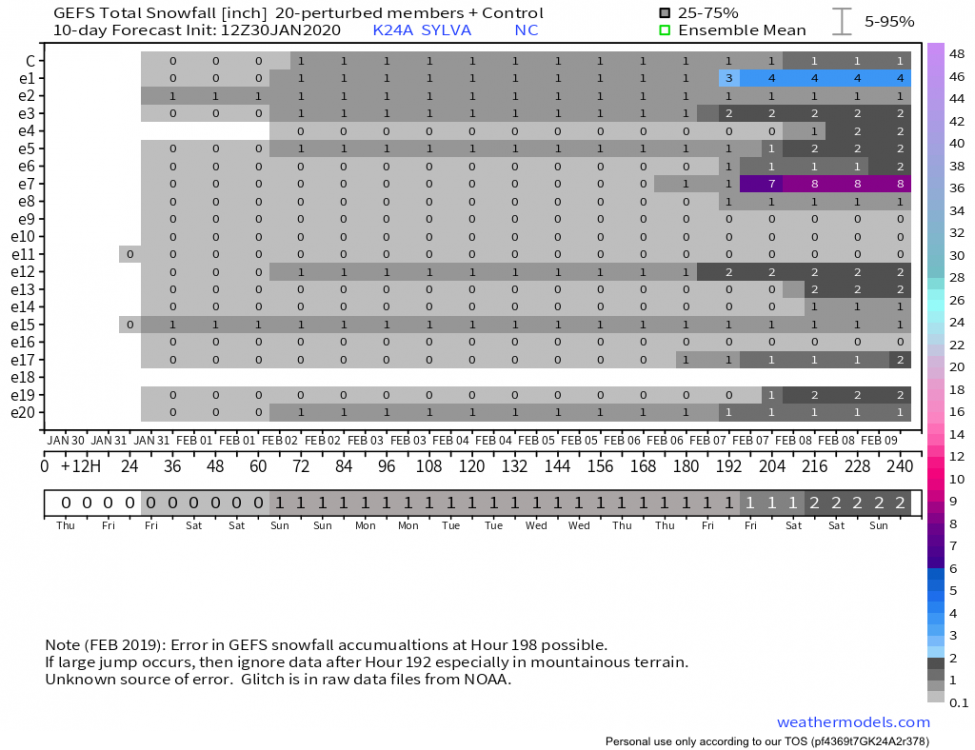
Large uptick on the 18z GEFS on the Sylva NC location.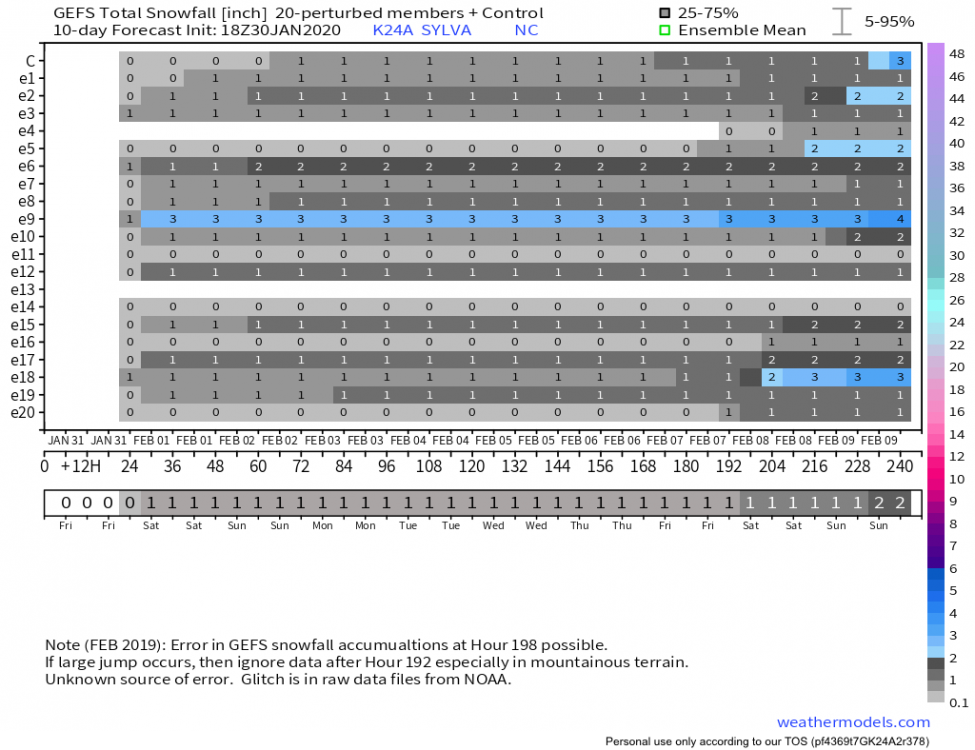
-
2019/2020 Mountains and Foothills Fall/Winter Thread.
BhamParker replied to Tyler Penland's topic in Southeastern States
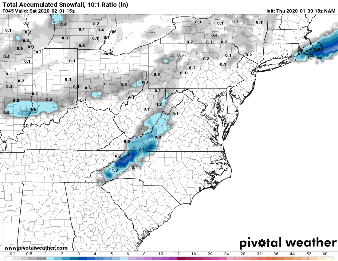
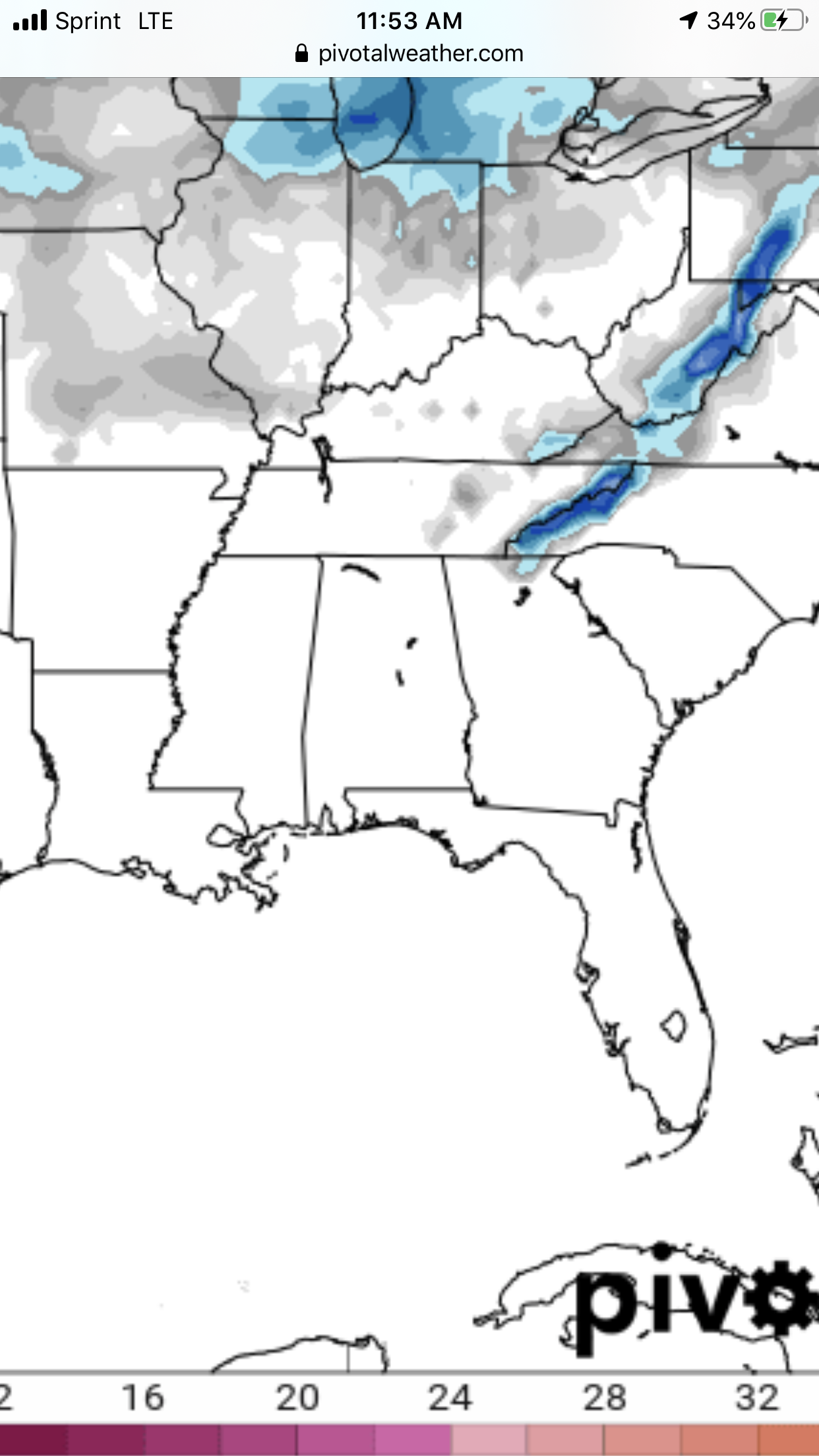
18z NAM looked alright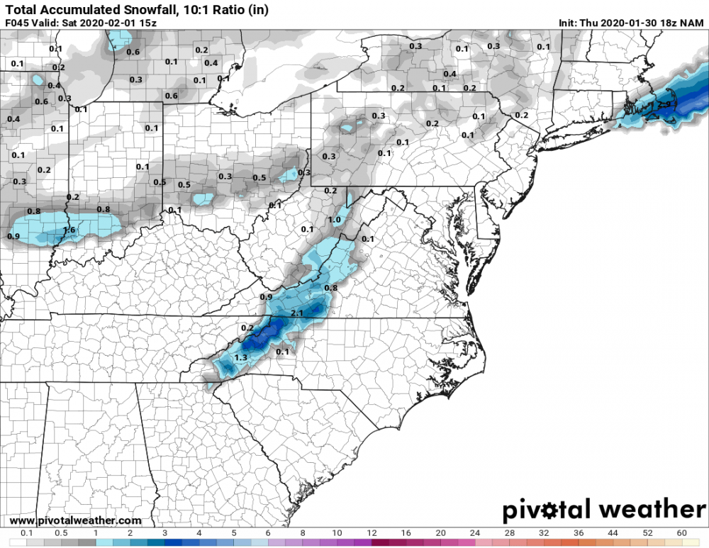
-
2019/2020 Mountains and Foothills Fall/Winter Thread.
BhamParker replied to Tyler Penland's topic in Southeastern States
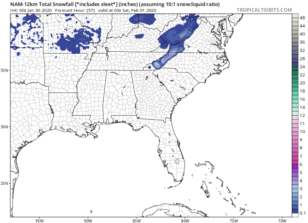
From the NWS Greenville-Spartanburg, SC Looks like for now they are saying 1-3 above about 4,000 feet. My place is 3,770, so itll be a close call for sure. Would love for the NAM to be miraculously right and precip extend much further NW than other models. .SHORT TERM /FRIDAY NIGHT THROUGH SUNDAY/... As of 230 PM Thursday: An upper shortwave will eject out of the digging longwave trough, crossing the Gulf states Friday and the Carolinas Friday night. This feature will induce weak cyclogenesis right along the northern Gulf Coast, and spread a precip shield across most, if not all, of the forecast area by early Friday evening. A weak wedge of high pressure will be in place as precip develops, but thicknesses only support any wintry precip in the highest elevations. Forecast soundings show no warm nose, so expect just an elevation-dependent rain/snow situation Friday night into early Saturday. The question is how low will snow levels be, and how much QPF. The NAM seems to be a wet outlier, so throwing that out, we only have a couple of tenths of an inch of QPF for most of the mountains 00z to 12z Saturday. This would result in 1-3" above about 4000 ft. Will continue to mention the HWO, but this looks sub-advisory level at this point. Otherwise, temps will be mainly in the mid 30s to lower 40s with most of the precip. The sfc low quickly zips on east of the Outer Banks during the day Saturday, but strong mid-level forcing will allow for another round of mainly scattered showers to cross the forecast area from the west. The 850 mb flow and temps don`t support much in the way of NW flow snow showers along the TN border, and thicknesses should be too warm for anything but rain east of the mountains. Going with highs near normal under mostly cloudy skies. Whatever NW flow snow shower activity we have may linger Saturday night, but should be over with by daybreak Sunday. Additional snow accums are expected to be very light. Lows will be slightly above normal. -
2019/2020 Mountains and Foothills Fall/Winter Thread.
BhamParker replied to Tyler Penland's topic in Southeastern States
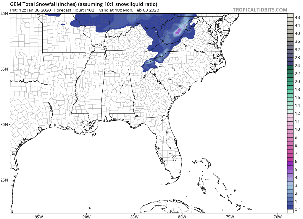
I know its the HRRR, but the 18z looks very NAM like. It has some higher elevation snowfall accumulations. -
2019/2020 Mountains and Foothills Fall/Winter Thread.
BhamParker replied to Tyler Penland's topic in Southeastern States
12z CMC wasn’t terrible for some backside action. I realize the NAM is probably wrong, but I sure hope moisture spreads more to the NW than most other models are figuring. I’ll hold on until the very end
-
2019/2020 Mountains and Foothills Fall/Winter Thread.
BhamParker replied to Tyler Penland's topic in Southeastern States
Hoping 3800 will be high enough for a couple inches. Anything more than that will be amazing in my eyes. I’m not from catalooche ski area and I’ll drive wherever I need to. -
2019/2020 Mountains and Foothills Fall/Winter Thread.
BhamParker replied to Tyler Penland's topic in Southeastern States
I won’t be able to sleep tonight and can’t wait to get to the mountains whether this thing busts or not. -
2019/2020 Mountains and Foothills Fall/Winter Thread.
BhamParker replied to Tyler Penland's topic in Southeastern States
I’m not from North Carolina but it appears to me the Maggie valley area is in a great spot on those maps. I’m feeling good being 3800 feet up in Haywood county. I need Met1985 to make me feel good about this! -
2019/2020 Mountains and Foothills Fall/Winter Thread.
BhamParker replied to Tyler Penland's topic in Southeastern States
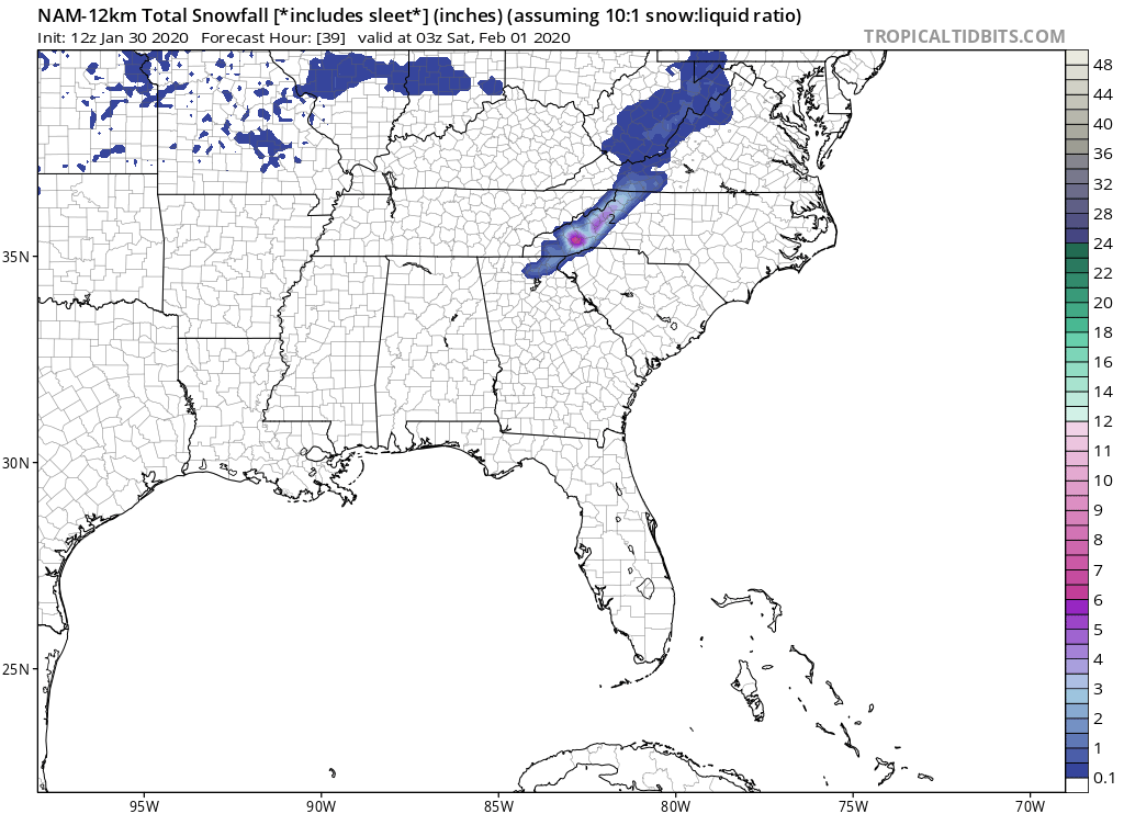
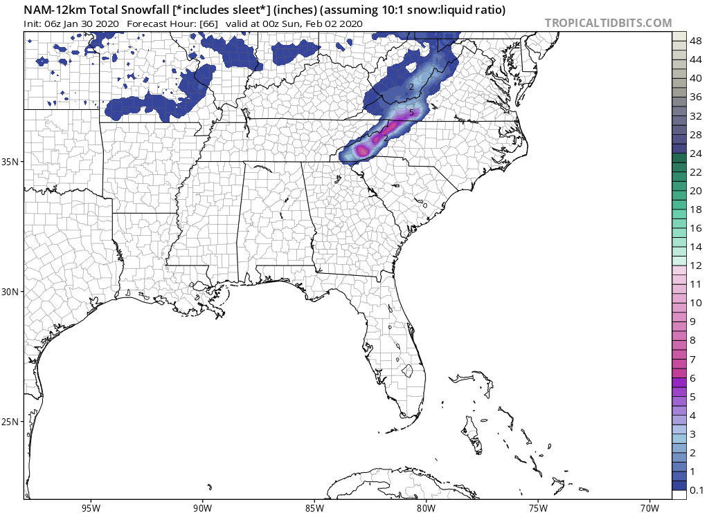
Looks like 12k NAM is also sticking to it’s guns with heavy snow for WNC mountains. It has skipped a few frames on tropical tidbits, so I can’t see it all. Out to 39 and still snowing.
-
2019/2020 Mountains and Foothills Fall/Winter Thread.
BhamParker replied to Tyler Penland's topic in Southeastern States
Goodness it just doesn’t stop!! What an overnight run of the NAM, 3KM also looks a lot alike. Sure would be something if the NAM won this thing.

-
2019/2020 Mountains and Foothills Fall/Winter Thread.
BhamParker replied to Tyler Penland's topic in Southeastern States
00z NAM holding serve out to 51 hours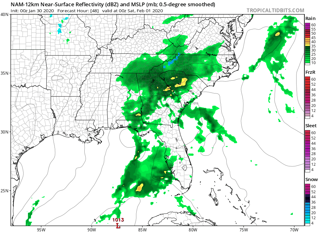
-
2019/2020 Mountains and Foothills Fall/Winter Thread.
BhamParker replied to Tyler Penland's topic in Southeastern States
The 18z NAM appears to be sticking to its guns. -
2019/2020 Mountains and Foothills Fall/Winter Thread.
BhamParker replied to Tyler Penland's topic in Southeastern States
Maybe we will get lucky and it can trend stronger. -
2019/2020 Mountains and Foothills Fall/Winter Thread.
BhamParker replied to Tyler Penland's topic in Southeastern States
Thats a big deal where I am from! -
2019/2020 Mountains and Foothills Fall/Winter Thread.
BhamParker replied to Tyler Penland's topic in Southeastern States
Just about every other model has some sort of wrap around snow and euro is clearly trending in at least in that direction. -
2019/2020 Mountains and Foothills Fall/Winter Thread.
BhamParker replied to Tyler Penland's topic in Southeastern States
It looks good for the wrap around I’m just happy that all models are starting to come around for the idea of accumulating snow on the ULL feature after the first wave this weekend. If we score anything at all on the first part, it would be a bonus.