

Shocker0
-
Posts
584 -
Joined
-
Last visited
Content Type
Profiles
Blogs
Forums
American Weather
Media Demo
Store
Gallery
Posts posted by Shocker0
-
-
36 minutes ago, Carvers Gap said:
Nah. This isn't Jan 17-18 at all. There have been a ton of storms to track so far this season. That was insanely dry weather back in 17-18. This pattern is nothing like that. The STJ is active. The cold is not as intense which allows storms to track at much higher latitudes. We just don't live at a latitude where it snows every week. The past two weeks have been a great run for many. Heck, IMBY, we probably have had less than most, but it has still been good. I like next week. Tuesday is a time frame to watch. I think this weekend is a whiff. Honestly, the storm doesn't seem to be getting itself together. Maybe that changes, but just seems anemic at this point. So, on to the next one. Tuesday looks like a minor system on the 12z GFS, and maybe something cooking right after that if the 0z Euro is correct. 12z GFS has that late week system as well.
Oh yeah, we've had a lot of snow in Crossville this year, I just meant that as of now the next couple of weeks look much colder than we've had in an extended period since 2018, but again the snow chances currently don't look high. Or if we do get snow, I'm afraid the pattern will flip immediately after and warm up again.
-
 2
2
-
-
10 minutes ago, PowellVolz said:
Yeah that would definitely be a punch in the gut. Lucky this pattern is just now going into a really good 500mb look and I think this isn’t our last GOM opportunity. There will also be wrinkles in the flow that only high res will pick up on less than 48 hours out that can easily drop a couple of inches with NW flow. I still don’t think Friday’s system is off the table.
.Yeah even just a small NW Flow event in these conditions and we could have snow-cover for several days. Hopefully something comes our way so we aren't wasting cold weather on just being cold.
-
1
-
-
I really hope we aren't about to have two weeks of frigid weather and 0 snowfall. Shades of January 2018, except this time there would be snow all around us.
-
3
-
-
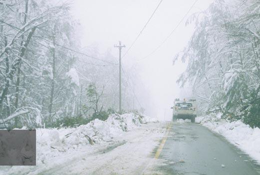
The only pics I can really find from the February 3, 1998 snowstorm that hit McCreary County, KY where I lived at the time (also hit some areas of the Plateau). I believe we were supposed to get 2-4" after a changeover from heavy rain. It changed over much earlier than expected due to dynamic cooling. Went to bed with a dusting and woke up to over 2 feet of the heaviest wet snow I've ever seen. We couldn't open our front door so we had to climb out a window and walk to my Aunt's house 1/3 mile down the road because she had a generator and we didn't. The whole walk (which wasn't easy with that much snow) you could hear trees popping everywhere and falling, so that was an added element of danger.
School was out for three weeks, power was out for two, and the National Guard was called in to help clean up because so many trees went down. I would love to find more pictures from it but it's a struggle unfortunately. It's probably the only snowfall I've been through that I didn't enjoy just because of how stressful it was on the family and not being able to go anywhere or have power for weeks.
OHX did a writeup on the storm (https://www.weather.gov/ohx/19980203). Check out the snow totals and notice how elevation played a huge factor just like in this weekend's snow. Williamsburg, KY, just 15 miles east of McCreary County, recorded 4.8" while FEMA.gov notes this for McCreary:
BACKGROUND
During early February 1998, McCreary County, Kentucky experienced a record snowfall event receiving up to 30 inches of snow. The heavy snow caused damage to overhead utility lines and left large amounts of debris on the roadways. As a result, FEMA-1207-DR-KY was declared. The severity of the snow combined with the remote mountainous terrain effectively stranded the county's emergency personnel and snow removal equipment. In response to this, the County Judge requested that citizens assist with the removal of downed trees and snow to facilitate bringing the county emergency resources back on line. The citizens of McCreary County responded to the request and voluntarily assisted in the debris removal.----------------
Jamestown, TN was also hit hard, receiving 21" of snow. OHX notes this: 1998- Snowstorm brings treacherous driving conditions, school closures, and widespread power outages to the Cumberland Plateau. Interstate 40 is closed at Monterey for 18 hours due to the heavy snow. Traffic is backed up for 13 miles. Winds gust to 50 mph at times during the snowstorm. Approximately 100,000 electric customers lose power. TEMA reports damages of about $5 million.
-
1
-
 1
1
-
-
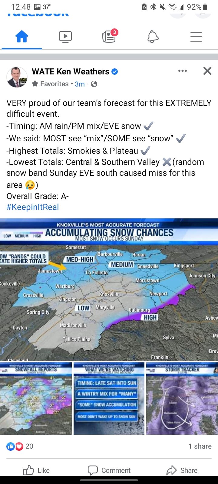
2 hours ago, PowellVolz said:
I’m still laughing at his “random band of snow” that kept him from giving himself an A grade. I mean… if you feel the need to go on social media and grade yourself…. It’s like the jokes tell themselves sometimes.
.I wish we had to option to assign our own grades in school

-
1
-
 2
2
-
-
12 hours ago, Runman292 said:
I saw something pretty funny on his facebook page during the day on Sunday. Someone asked him why MRX has higher snow totals forecast than WATE? He responded something like "I respect my collegues in Morristown, but I disagree with them and read the models differently." Along with his #NoHypeWeather and #KeepingitReal hashtags, you can see the arrogance. Something that really bothers me about WATE is their nonstop back patting when it comes to their "most accurate forecast in america" award that they won.
I think the #NoHypeWeather hashtag actually should be #WeSeverlyDownplayPossibleMajorStormsBecauseTheyJustDontHappenHereOftenSoWeAreGoingToIgnoreAllDataShowingOtherwiseAndPrayWeAreRight
-
2
-
-
3 hours ago, Runman292 said:
This is hilarious. WATE is giving themelves huge kudos for how they did with the forecast for this system. I definitely didn't think they got an A- when they whiffed big time in the central and southern valley.
This forecast works for like 80% of winter events in East Tennessee anyway so it's hard to be wrong especially when you make such general predictions lol.
-
2
-
-
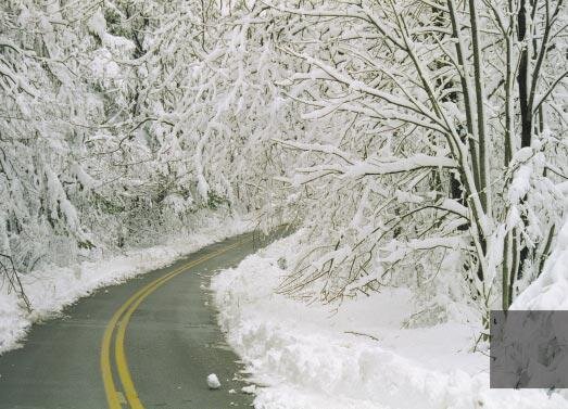
A few more pics from the snow taken today after the clipper did really well here and added a couple more inches. The next couple days will be sloppy with the melting and incoming rain but it's pretty for now:


-
3
-
-
The clipper seems to have overproduced here NW of Crossville, but those usually do here with the NW Flow. After cold rain most of the day yesterday it has turned into a decent snow event here and probably most of the forum area since some weren't supposed to get anything but flurries.
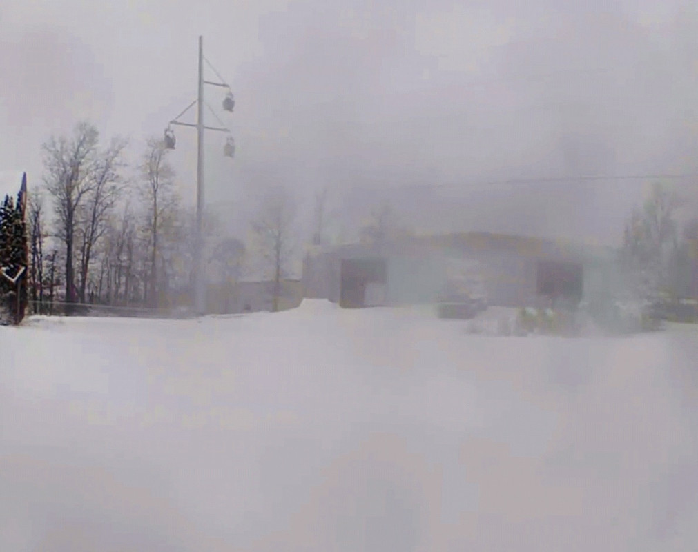
(Picture sucks but its from security cam with frozen water on it and i dont feel like going out yet lol)
-
4
-
-
This has become a decent snow here in Crossville and finally stuck to the trees which made it prettier. Took a few pics with the camera again just before dark.


-
13
-
1
-
-
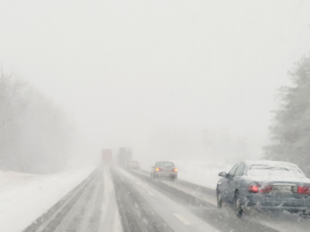
Had to go to Crossville and needless to say I40 isn't doing too hot
-
7
-
-
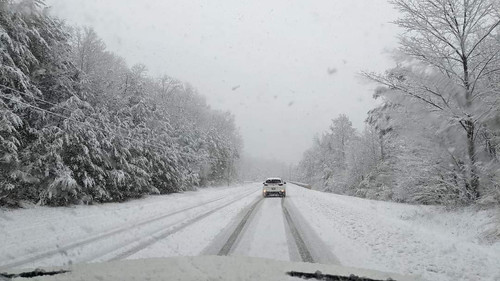
Longest pure snow we've had today. Hopefully no more switching with these rates
-
3
-
-
2 minutes ago, John1122 said:
Around 5-6 more hours per the HRRR. It's just clearing Nashville.
Hope so. With the pivot, I could see it actually snowing longer here than the south and east areas of us, where it switched over sooner. Maybe that was why it took longer here was that it pivoted quicker there and changed over. It's been coming down good the last 15min though.

-
5
-
-
Hardest it has snowed since early this morning here. Hopefully it does pivot or we only have a couple hours left.
-
3
-
-
2 minutes ago, John1122 said:
Mine was similar until a couple of hours ago and it's just been heavy snow since. It quickly covered the slush.
Yeah this is the longest it has snowed here. Don't wanna jinx it and say it won't change back over again, but seems encouraging. Just not sure how much we have left moving in.
-
3
-
-
5 minutes ago, John1122 said:
Western Campbell on I-75 at 2100 feet.
Yeah, thanks to the rain here, ours is an "ugly" snow compared to this lol. Nothing on the trees. Although in Fairfield Glade the trees look more like the above pic.
-
1
-
-
Almost all of this fell overnight. Somehow it has rained all day and most of the snow stayed on the ground even though it's been 33 degrees the whole time. Very slushy. We probably have had an inch of rain on top of the snow.

-
1
-
-
1 minute ago, John1122 said:
Western Campbell.
Ok lol. I was about to say if anything far Western Cumberland County looks bleaker than here did. Usually the areas that perform the best though.
-
My coworker on the Cumberland/White line at 1900ft has no snow on the ground. In every other system they do really well usually. The models did kinda show a warm nose hitting the entire White County almost all week and it must've been pretty accurate. And since I'm only 15 miles away it must've partially got to us as well. He said it just now started snowing there finally.
-
1
-
-
13 minutes ago, John1122 said:
I've officially reached satellite sweeping stage.
The difference between here and Crossville at 2000 is stark. I hate it for Shocker. I just saw a photo from around 2000 in Western CC and it's probably 5 inches.
Western Campbell County or Cumberland County? Because I am at 1980ft in Western CC so basically 2000. I mean it's white here and is snowing but it was raining when a lot of places were getting snow the past 3-4 hours here.
-
1
-
-
27 minutes ago, PowellVolz said:
I think there’s a fine line between being underneath the core dynamics but not too close to the L that the temps are warmer. I think maybe you are not benefiting from dynamic cooling like SE Tennessee is.
.The weird thing is that places north west east and south of me were all getting snow while it was raining here though lol. I can't explain it. It's snowing here now but the system doesn't look like it'll be sticking around here too much longer.
-
1
-
-
29 minutes ago, John1122 said:
An area 600 feet lower than me, but just to my southwest got 2 inches here this morning while I struggled to a sloppy mixed up inch. It's like there are pockets of random warmth in the atmosphere.
And then I saw a pic from Caryville Mountain where it was deeper than an outstretched hand. Just the weirdest system I can remember. It's snowing here again now, but no clue if it will decide to randomly go back to rain again like it has all day. We'll see.
-
1 minute ago, John1122 said:
This is the strangest event I've ever seen. The models just showed random slots of rain/mix/snow in unusual locations and I didn't believe it. They were right though.
Yeah it's really weird. And elevation definitely hasn't been the key factor either. Seems like the further south you are the better. Apparently the warm nose set right up over Western Cumberland County and random other spots and won't leave. I have no clue how the snow from this morning is still on the ground.
It's pouring snow in town according to WATE cameras too and they are 1850ft and further south.
-
2
-
-
Incredibly it is still managing to rain here at 2000ft elevation. Overrated as bleep here.
-
 2
2
-
Winter 2021/2022 January Thread
in Tennessee Valley
Posted
My buddy in Arkansas is in one of the very small white areas, so I'd say he's a big loser too lol.