

Shocker0
-
Posts
584 -
Joined
-
Last visited
Content Type
Profiles
Blogs
Forums
American Weather
Media Demo
Store
Gallery
Posts posted by Shocker0
-
-
Big hail at my house near Crossville just now

-
 6
6
-
-
We had a couple decent snow showers in Crossville yesterday. Chilly this morning.
Video: https://streamable.com/ldnno4-
3
-
-
2 hours ago, John1122 said:
Models have been bulls-eyeing your area for a few days now.
Yeah I've been seeing that, but surprised NWS agreed. Looks like the heaviest is expected to strattle the border of Cumberland/Putnam, which is typical here. Maybe the ground will turn white at least.
-
3
-
-
WWA for up to 3 inches of snow here in Cumberland County tonight. That'd be impressive
-
5
-
 2
2
-
-
My High NW of Crossville was 25 at 12pm. Now it's 21 and haven't seen the sun at all today, but all the snow on the roads is pretty much melted already. Maybe the sun angle thing is a bigger deal than I thought. But I don't remember February snows melting this quickly usually, especially with well below freezing all day
-
2
-
-
I just measured 1.5" and still snowing good. More than I expected here after the big snow last week underperformed.
Looking at cameras, Monterey looks to have 2"+ along with Jamestown. Crossville city limits only a dusting
-
2
-
 1
1
-
-
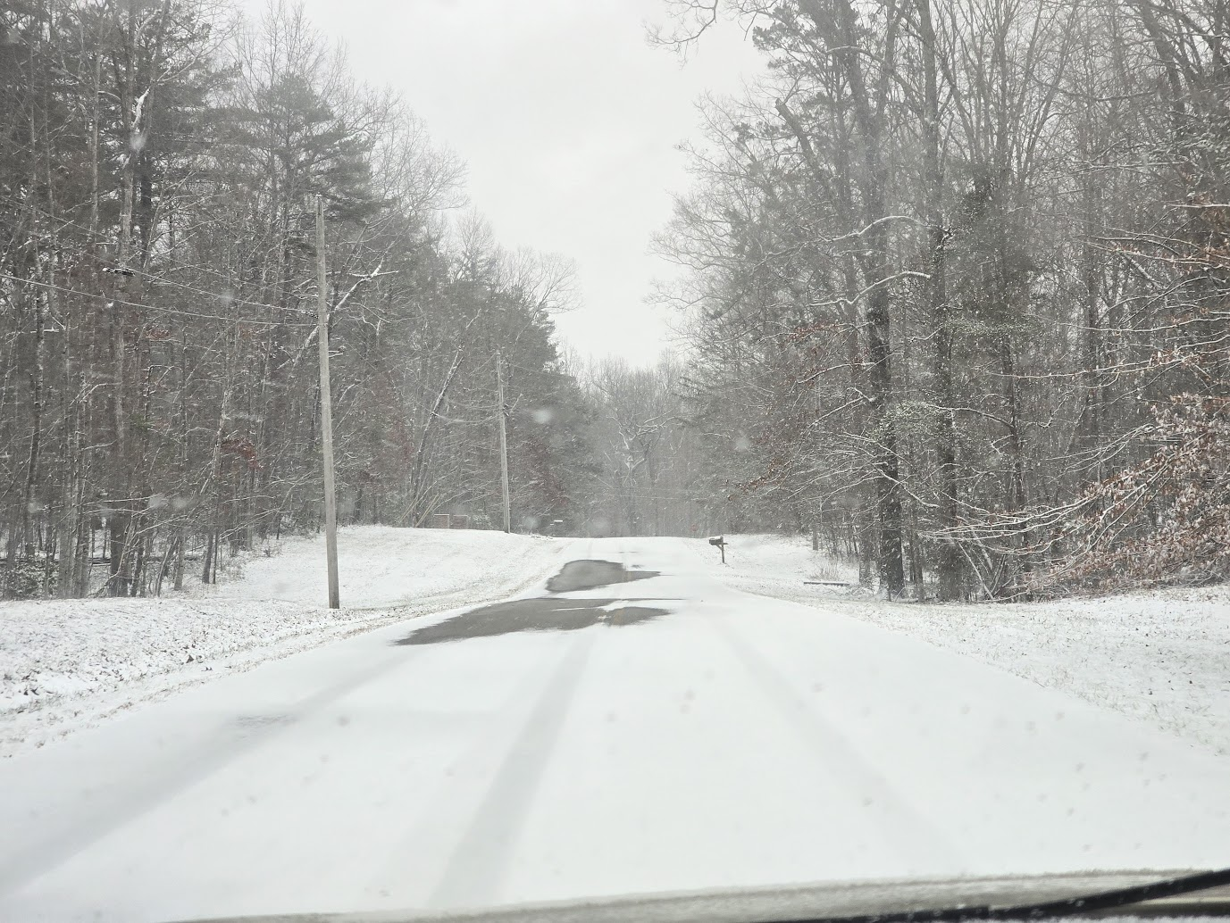
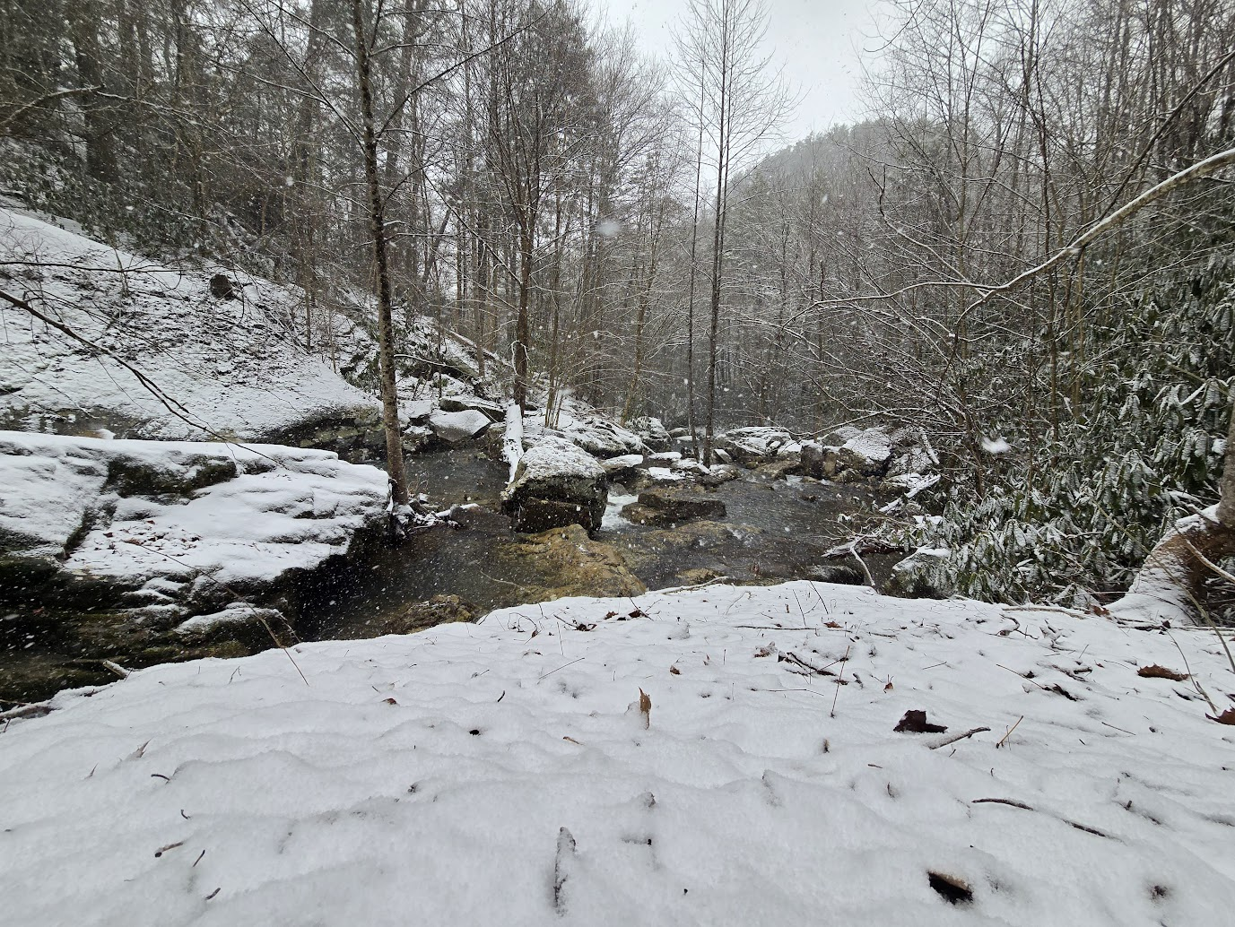
Went to visit a nearby waterfall earlier in the snow. The snow has really picked up here NW of Crossville the last hour. We are down to 22 degrees.

-
7
-
1
-
-
Back to snow suddenly NW of Crossville and heavier than it has been today.
-
3
-
2
-
-
Sleet and freezing rain mixture Northwest of Crossville
-
3
-
-
11 minutes ago, John1122 said:
@Holston_River_Rambler are you in the snow hole that has developed?
I was square in the middle of it NW of Crossville. The sun tried to peek out but it was still snowing a bit
-
2
-
-
30 minutes ago, Holston_River_Rambler said:
Tornado warning north of me near Sunbright.
I graduated school there and went to Church in Mill Creek. Crazy. Rare tornado at the foot of mountains. It's headed Johns way, hopefully it lifts.
-
2
-
-
On 1/27/2024 at 11:15 PM, dwagner88 said:
MRX messed up their event report for this. Officially KCHA got 1.7". MRX's report states that this is the most January snowfall for KCHA since 1996. They seem to have forgotten about the January 2011 snowstorm that brought nearly 8" to KCHA overnight. 1.7" being the largest event in 28 years is really sad. Even for here.
Did Chattanooga not end up with any snow in the February 12, 2014 system? I know areas just north of there got like 8"
Based on this they got a lot in that storm

-
On 1/11/2024 at 4:44 PM, John1122 said:
I've still got several papers from 1996! The "missing" and under reported snowfall amounts from that storm are legendary. To me, it ranks alongside the Blizzard of 1993 for local impacts. It was much worse than the blizzard on a state wide scale because it was a major winter storm for everyone. The Blizzard of '93 really cut off to a normal event beyond about Cookeville.
That report is waaaaaaaay off here. The 911 director at that time who submitted those reports to papers, quite literally didn't understand how to measure things. The same person reported that 10 inches fell during the Blizzard of 1993. Snowfall totals here were 16-18 inches. 16-20+ in Anderson and Union.
Here is a screenshot from the 1996 snow taken from one of my girlfriends home movies. This is in Oakdale, TN (Morgan County).
Looks super deep to me. I should have a higher res version tomorrow as this was a quick screengrab while converting it to digital format.

-
3
-
-
We do seem to have bottomed out at -6 here and have had a slow warmup overnight. It's currently up to 0 now
-
4
-
-
32 minutes ago, John1122 said:
That's impressive! You may land around -10 or -15. I'm down to -1.
Our low is showing 0, while places to our east are showing that they should be a little colder than us tonight, so I figure they expect it to stabilize or gradually get warmer. It is now -4, so seems to have tapered off and may not drop much more through the night.
Last night we got down to -2 and the forecast was around 5 I believe.
-
1
-
-
Our high was 10 today but it currently says -4. Doesn't sound like it could be right but it has been steadily dropping since 4pm. I can't see us getting much lower than this here in Crossville though with the warmer air filtering in early tomorrow. The hot water in my bathroom is frozen currently so hopefully that will unthaw without busting.
EDIT: Right after I posted, it went to -5 :O

-
3
-
-
14 here and has been snowing pretty hard for the last two hours or so! Blowing around a lot
-
3
-
-
Crossville a bit ago. Still raining and below freezing

-
4
-
-
We got up to 34 earlier in Crossville, but now it's 30 and freezing rain. It's slick already on top of the snow.
-
2
-
-
light sleet in Crossville in town about 45 minutes ago. Nothing now.
-
5
-
-
1 hour ago, ShawnEastTN said:
Should add I've made it to 25 and overcast conditions are either moving in or developing. Can't tell for sure, but it seems like it developed overhead rather than moved in from the west. Anyone on the plateau have overcast skies or sunshine?
It's been very cloudy here ever since I posted the 33 degree temp.
This is looking west

-
5
-
-
1 hour ago, ShawnEastTN said:
Yeah I believe the higher elevation actually works a bit in favor of warmer in this scenario at least initially. Lower points will trap shallow cold easier. Though with snowpack think everyone with it, will likely get the freezing rain in general.
I know in 2015 we had a massive ice storm here in Crossville while Knoxville and most places off the Plateau got snow. Just a past example. It was about 1.5 inches of ice here with no power for over a week, while other places got a foot of snow if I remember correctly.
It also occurred right after a frigid week of snow and below 0 temps.
-
2
-
-
We've warmed up really quick in Crossville! Already 33 degrees.
-
The highest I've got to is 19 (currently) and it was -8 this morning. We were supposed to be around 26 I believe.
-
2
-
TV Severe Weather2025-?
in Tennessee Valley
Posted