

OrdIowPitMsp
-
Posts
1,908 -
Joined
-
Last visited
Content Type
Profiles
Blogs
Forums
American Weather
Media Demo
Store
Gallery
Posts posted by OrdIowPitMsp
-
-
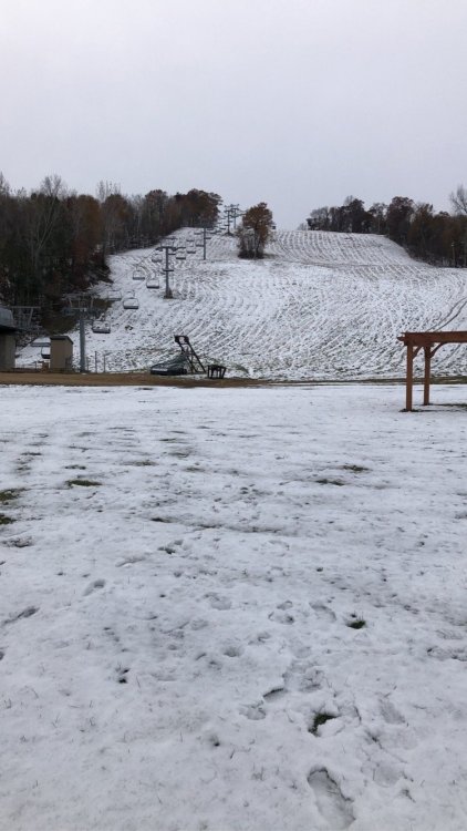
Will be skiing soon enough. Today is our 4th day in a row with snow otg which has to put us in the top spot or two for October.
I’ve lived in Minneapolis for a little less then five years and have already experienced the snowiest February, April and now October on record.
-
 6
6
-
-
Steady light snow this morning, even pockets of moderate showing up. Refreshing our October snowpack.
-
3 hours ago, Minnesota_storms said:
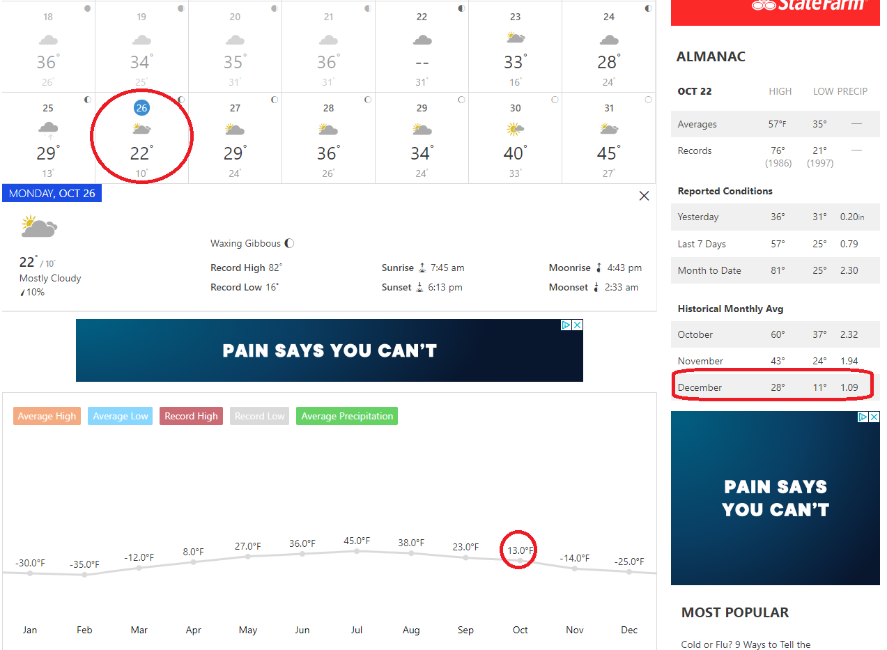
All time October lows may be broken in Minnesota next week with December weather.

Central and northern Minnesota will see single digit lows. Might have to start looking at record ice-in dates on some of the lakes.
-
Nice wintry mix this morning. Big snows up north. Deep cold (for October standards) coming this weekend. Single digit lows outside the metro area
-
2
-
-
Seems like a south trend in the models is developing this year. Yesterday’s storm was only supposed to put down 0-2” changing over to rain in Rochester but they stayed all snow and ended with more then 3”. Tomorrow’s event has also been bumping south. No weakening however
-
1 hour ago, michsnowfreak said:
At 7.9" its definitely possible. 9.2" on November 11 was our biggest event last winter. Ninas are so active i personally don't think it'll be MSP biggest storm, however in a different winter I could absolutely see a scenario where an 8" storm on Oct 20 that melts in a few days is the biggest event, 2 months before the winter solstice, but then winter ends up being a decent clipper winter where you have lots of snow fun but just don't quite eclipse that biggest storm.
If we can get a trough centered over the Great Plains then a big dog western lakes cutter should do the trick. Just gotta wait and see what Mother Nature throws at us. The northland is off to a very fast start with their 3rd significant storm bearing down tomorrow.
-
3
-
-
MSP finished with 7.9” at the midnight observation from yesterday’s event. 2nd heaviest October snowfall behind the infamous halloween blizzard of 91’
-
1
-
-
It still looks like we are south of the action according to the latest NWS thinking.
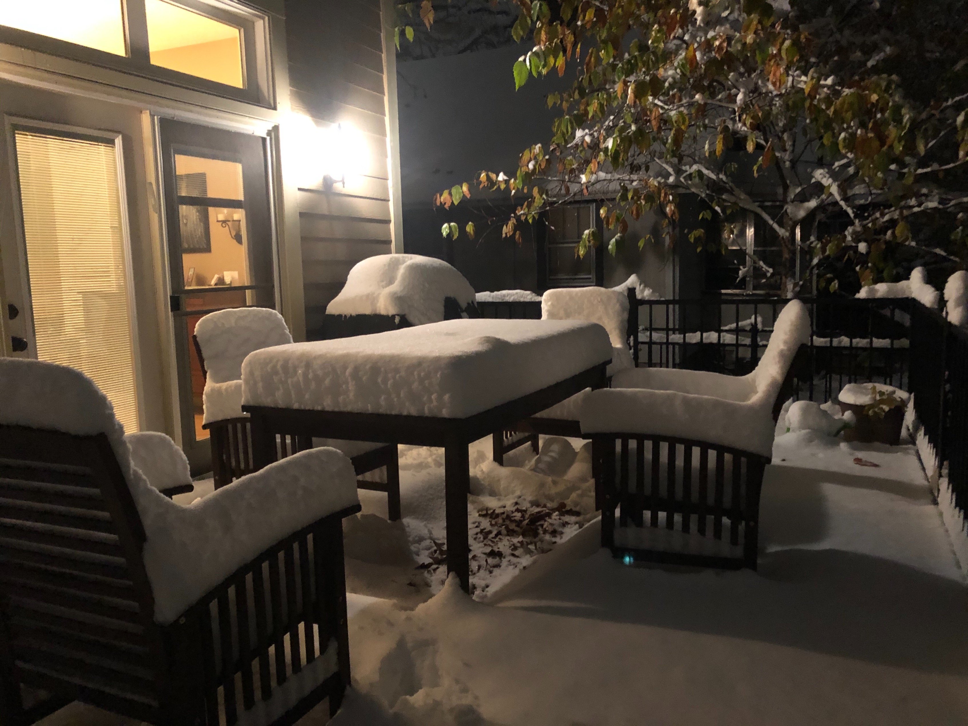
33F all night. Took the dog out at 5am and felt like it was raining with the amount of slush and snow dripping off the trees. Slopfest 2020

-
Just got home after a nightmare drive back from Rochester on US-52. Multiple spin outs.
Between compaction and melting I don’t think we will see this stay around for long. Lots of dripping off the garage. Thank goodness most trees are bare or this could have caused widespread tree damage.

-
9
-
-
1 hour ago, A-L-E-K said:
should be high quality in the twin cities now
Watch this be our biggest event of the year.
-
 2
2
-
-
MSP was reporting 1.1” at 1pm, I just facetime’d my wife and it looks like closing in on 3” on the deck.
-
2
-
-
....and just like that Winter Storm Warning for MSP. Wonder how many of those have been issued in October.
-
1
-
-
Bumped up totals in the cities to 5-7” we might not hit 40 over the next week with some highs below freezing. Building the snowpack early this year.
just wish I wasn’t down in Rochester...
-
1
-
-
1 hour ago, A-L-E-K said:
radar looks good^
Cities might end up in the bullseye. Going to be a few hours of heavy snow this afternoon.
-
Hi res models want to put down 6-8” in the twin cities. With compaction and a warm ground the official forecast of 2-5” seems more in line.
Figures I’m in Rochester MN for work this week where a cold rain/snow mix is expected.
-
First WWA of the season hoisted across much of Minnesota for tomorrow’s event. Not bad for October but obviously overshadowed by what occurred in Iowa today.

-
1
-
-
Brother sent me pics from downtown Des Moines. Everything besides the roads are covered.
-
October surprise for MSP on Tuesday. 2”-4” is more realistic and will be a good start to the season.

-
1
-
-
Snow squallin’ big fat cottonballs dumping from the sky!

-
8
-
-
First flakes of the season are falling imby right now. Low of 33 current temp 35
-
Whiff north and now south looking increasingly likely this weekend. Setting up a great trend early.

-
Hrrrr says no flakes for Minneapolis

-
Down to 34F this morning with frost, looks like the first widespread accumulating snow of the season this weekend in northern Minnesota.
-
First multi day streak of overnight freezes looks to occur here later this week.
P&C has rain and snow showers for Friday night and Saturday imby.


October 2020 General Discussion
in Lakes/Ohio Valley
Posted
Mood flakes most of the day totaled 0.4” bringing our monthly total up to 9.1”
High temp today of 29. Feels and looks like mid winter.