

OrdIowPitMsp
-
Posts
1,908 -
Joined
-
Last visited
Content Type
Profiles
Blogs
Forums
American Weather
Media Demo
Store
Gallery
Posts posted by OrdIowPitMsp
-
-
Tagged 50 briefly yesterday. Touch cooler today but the mid 40s and full sun still doing work on the snowpack. Down to 3" depth officially but lots of bare spots starting to show up.
-
46 and full sun today. Worked in a t-shirt during peak heating outdoors.
Starting to see a big difference in mostly bare south facing sun drenched lawns vs. deep snow cover on north facing shaded lawns.
-
 1
1
-
-
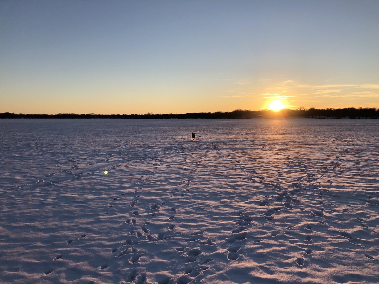
Fresh snow and a high temp in the low 20s today. Probably the last hurrah of “deep winter” around here. The pup is sure going to miss playing out on the frozen lake. With temps in the 40s this week the ice will be getting unsafe rather soon.

-
2
-
-
0.7” overnight to kick off the month. 5” snowdepth will probably dwindle to just a trace by the weeks end.
-
1.5” of slop to briefly freshen up the melting pack this morning. Sunny and 30 degrees to close out February. This month has now seen 5.9” of snow on an average of 7.5”
-
Local roads getting dicey from the slush we received overnight.

-
1
-
-
Posted in wrong thread before. Solid fat dendrites last few hours but marginal temps limiting accumulation. We’ve finally dropped from 37 when the snow started to 32 at 10am so things are starting to stick better. 6-8” reports in the narrow weenie band up by St. Cloud.

-
Woke up to a surprise WWA for overnight Saturday into Sunday morning. 2-4” from a thread the needle event. WSW to my southwest. Wasn’t expecting this system to be that dynamic. Will be nice to freshen that mangy ragged snowpack even if just for a few days.
-
2
-
-
Hopefully things improve up north for my spring trip to Lutsen.


-
Unless we see a big turnaround in March/April I’m more worried about low water levels then flooding up here.
-
Low of 24 and another day of slowly melting pack.
-
Right around freezing with light snow this morning. Coating on the roads creating very slippery conditions here.
-
Today was the first 40 degree day at MSP since the early morning hours of December 23rd before the pre Christmas blizzard hit.
-
1
-
-
5 hours ago, Hoosier said:
I don't think that's right. INL has 36.5" on the season (it's in the first post). It may be the case for that sliver of northern MN west of there.
Good catch @Hoosier it's more the Lake of the Woods region and Warroad further west that is really hurting.
-
23 minutes ago, BuffaloWeather said:
New York looks like its doing good but everyone in Upstate is well below normal aside from Binghamton and Albany.
Areas of east TX and LA have had more snow on the season then International Falls MN!
-
1
-
-
You can really see areas up north are struggling this year in the snow department.

-
1
-
-
Finished with 0.7” here and 1.2” at the NWS office.
-
Mood flakes with periods of -SN most of the day. Not adding up to a whole lot, but a solid 0.5" to freshen everything up before the melt begins tomorrow will be nice.
-
Not expecting more then a DAB+ here but maybe we can squeeze out a few tenths.
-
7 hours ago, hawkeye_wx said:
Overnight, a rabbit got over the protective fencing (deep snow) and shredded the bottom of my arborvitae.

 I began installing the fence each fall after rabbits ruined the original arborvitae during the record snow season of 2007-08. Unfortunately, the lower growth does not recover once rabbits eat it down.
Sorry to hear that. In 2018 when we got 39” in February squirrels used the deep snow to get into our house through the pvc sump pump vent normally 3.5’ off the ground. They wrecked havoc to our wooden window sills trying to chew their way out.
-
-2 here for the low. -8 to -10 just outside the metro.
-
Average February 2021 temperature in Minneapolis is 2.4F
No doubt this will rise in the coming days, but an impressive first 2/3 of the month.
-
Made it down to -1 here so below zero 13 of the past 14 days. Starting to notice it getting light at 6:30am when I get to the office.
-
Light snow/mood flakes all night and into the morning put down another 0.2" of fluff. Did keep temperatures in check and our first night above zero since February 4th. Nice dendrites look to be floating down all day.

Fall/Winter 2020/21 Banter Thread
in Lakes/Ohio Valley
Posted
Its still too soon for me to give this winter season a formal grade, since we still have 6+ weeks of measurable snow opportunities. Presently I'd say B-/B mostly hinging on the snowpack being able to stick around for going on 71 consecutive days now.
The record breaking October 20th storm of 7.9" was something else. Never did I expect to receive so much, so early, and at a 10-1 ratio to boot! An additional 0.8" two days later helped preserve snow cover for an unprecedented 8 days, while high temperatures never climbed out of the mid 30s and a few days staying below freezing entirely. October 2020 is the snowiest October on record in the Twin Cities. I skied twice in October this year within an hour of the Twin Cities.
November started very warm with numerous days in the low 70s until an 8.3" thumping over 3 days from the 10th-12th brought winter back. Unfortunately a few days in the 50s zapped the snow and while the rest of the month was seasonal temperature wise we saw no precipitation and ended the month with less total snowfall then October, and 8 days of total snow cover.
December was a dry dud until the 23rd which brought verified Blizzard Warnings and 8.7" of snow on 0.48" of water for an 18-1 ratio. The 2nd blizzard in the metro in the past 3 years. Classic midwest winter storm, nothing super memorable although outside the metro I'm sure the winds were something.
January was very warm by Minneapolis standards at 6.5 degrees above average, but still managed 7.8" of snow in multiple events, and the minimum snow depth for the month was 6" which was aided by well timed out small snowfalls.
Not much to say about February that hasn't already been shared. A historically long cold snap which brought us 10 straight days in the single digits or colder and 4 days with below zero high temperatures. Even with a few days in the 40s at the end of the month we still finished 9.1 degrees below average, on 5.9" of snow.
I can see this winter being bumped up to a B/B+ if we can get 1-2 more solid events coupled with a colder stretch to keep ice on the lakes and some snow cover. Presently we are at 44.9" of snowfall on the season which is only 2" above average to date, and with the current forecast we will probably fall behind average to date before our next event. Still some ice houses out on the lake but I imagine they will be gone soon too.