

OrdIowPitMsp
-
Posts
1,908 -
Joined
-
Last visited
Content Type
Profiles
Blogs
Forums
American Weather
Media Demo
Store
Gallery
Posts posted by OrdIowPitMsp
-
-
Snow/rain showers this afternoon, I was in the yard cleaning things up and was surprised to find ice and frost beneath areas that had thick leaf cover over the winter.
Looks like a coating to an inch overnight that’ll burn off rather quickly tomorrow. Pretty typical early April weather.
-
3 hours ago, michsnowfreak said:
Wow quite a storm!
https://www.dnr.state.mn.us/climate/journal/thunder-blizzard-april-13-16-2018.html
full write up from the DNR
-
12 hours ago, michsnowfreak said:
It appears that, at least based on long term models, April will end up on the cooler than average side. Though I'm sure with the usual ups and downs.
After a cold and often wintry April 2018, an interesting thing of note is that each of the past 3 april's have had advisory level snowfalls late in the month in our sub.
Apr 27/28, 2019- 3-5" of snow falls in Chicago's far NW burbs
Apr 17/18, 2020- 3-6" of snow falls from Detroit to Toledo
Apr 20/21, 2021- 3-6" of snow falls from Detroit to Toledo
Apr 2022...hold my beer????
You can add April 13-16 2018 - Minneapolis and central Minnesota 15-20” of snow, capping off the snowiest April on record with over 26” of snow.

-
 2
2
-
-
Overnight flurries/snow showers keeping it looking wintry around here.
-
2
-
-
Sleet/freezing rain/snow. It’s a mixed bag out here this morning. Ground is white with sleet. Trees are coated in ice. Springtime in Minnesota.
-
 1
1
-
-
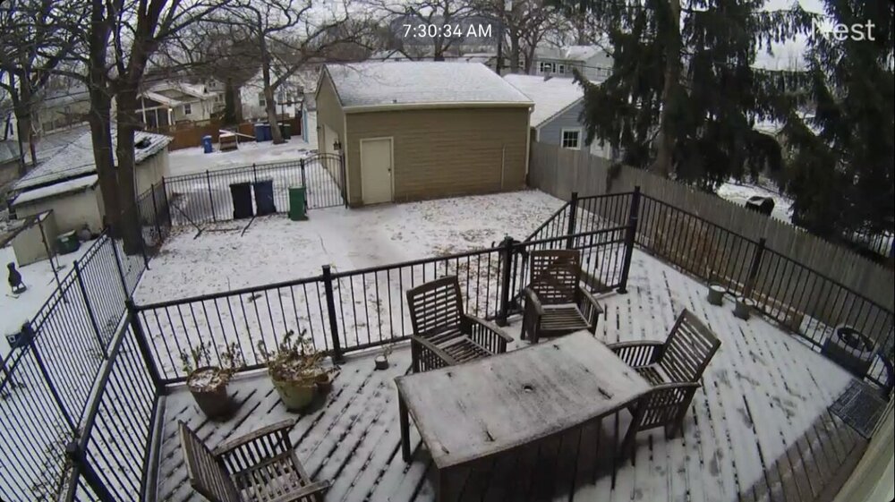
Overnight low of 37. Lots of ponding water on the frozen ground. Airport is reporting 1” snow depth, so the streak lives another day. Backyard glacier is quickly becoming more dog turd then snow.
-
3/15 is the first day above 50 this year in Minneapolis with a high of 52. Snow was melting off like crazy, lots of grassy spots showing up.
-
1
-
-
0.8” of snow this morning.
-
Rain/Snow mix this morning turned to steady snow with big fat flakes. Accumulating rather quickly on the roads.
-
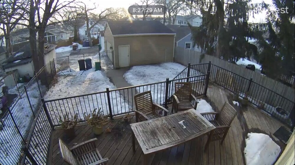
Low of -2 this morning. Should be our last jaunt below zero this season. Outside the metro temps fell into the -10s, pretty cold for March 12th.
3” of crusty snow hanging on. While total snow amounts have been pedestrian here, It’s been a great winter for snow cover.
-
1
-
-
Got down to 6 here this morning. Looks like a good chance of falling below zero in the city tomorrow and then the spring warmup begins.
-
1
-
-
Morning low of 8.
-
On 3/7/2022 at 12:25 PM, Chicago Storm said:

.Pretty scary how close this was to a near worst case scenario event for Des Moines.
-
1
-
-
Cold day by March 9th standards. High of 19, with a stiff NW breeze and full sun. The heat island will probably keep us above zero tonight but outlying areas will drop below.
-
6 hours ago, A-L-E-K said:
agree, time to get in early on that palm life while our climo is on the upswing
I’d start with a Magnolia but Palm isn’t far behind.
-
Paste Job

-
3
-
-
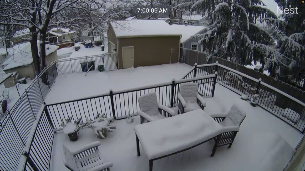
Officially 3.3” overnight. I was measuring closer to 4”-4.5” imby, there’s a stoat ice/slush layer on the bottom which will no doubt compact. Official snow depth at the airport back to 6”
With the condensed 2” crust glacier that survived the rain yesterday, and this new stuff on top, our snowpack now holds a ton of much needed moisture.
-
2
-
-
Well this turned out better then expected. What looked like a snowpack eating storm ended up adding to it.

-
1
-
-
THUNDERSLEET!
-
2
-
-
Brother in Des Moines just got one of those automated “take shelter” messages on his phone.
Edit: Sirens going off now
-
Crazy I paid $3.28 at Costco today. Even the stations downtown are in the $3.80 range, but I have no doubt $4 gas will be here soon.
My folks are snowbirds in SoCal and it’s approaching or maybe even over $5 there already.
-
Wow Minneapolis has been placed under a Winter Storm Warning for a glaze of ice and 2” of snow. Haven’t seen that one before.
Low track is going well SE of guidance. Kept us in the “cold” sector all day. Forecast high was 44 we haven’t made it above 35 and should see slowly falling temperatures moving forward.
-
Was out in the suburbs and the ice accretion on trees was substantially more then in the city.
HRRR wants to put a couple inches of snow down here overnight. We’ll see.
-
Light drizzle this morning. The end is nigh for our snowpack locally I’m afraid. Rains and high dews later today should do most of it in but we’ll see what the yard looks like tomorrow after the backend duster.
We’ve had snow otg for 70 consecutive days, it would have been 91 days if not for the 2 day melt just before Xmas. All good things must come to an end.


April 2022 General Discussion
in Lakes/Ohio Valley
Posted
Late season snow stats courtesy of the NWS. April 1893 must have been wild in St. Cloud.