OrdIowPitMsp
-
Posts
2,819 -
Joined
-
Last visited
About OrdIowPitMsp

Recent Profile Visitors
15,569 profile views


-
@Spartmanentetaining read today for sure. After a long stretch of boring weather it’s nice to have an active forecast discussion. Joe Strus wrote the afternoon discussion, he seems to be winter weenie.
-
1.53” of rain. Slow deep soak.
-
Mid 60s and steady stratiform rain all day, with over an inch so far. It had been over 3 weeks since we’ve seen any substantial precipitation here.
-
91 yesterday, same today. Hopefully that rain materializes tomorrow night into Friday. We need it badly.
-
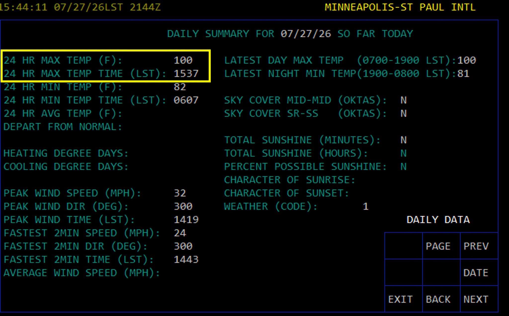
Triple digits in the Twin Cities! First 100 temp since 2022, every 4 years right on the climo norm

-
Can’t say I’m jealous of the destructive storms, but definitely jealous of the precipitation. My yard is crispy. Stay safe out there
-
Already 94 at MSP. Maybe today is the day we break 100
-
82/81 at MSP this morning. Here’s a tidbit from KMPX At 2 AM, the dew point at MSP climbed to 81. This has only happened on a few days in recorded history. Per the Minnesota State Climatology Office, an 81 degree dew point was measured on July 17, 2011; July 18, 2011; July 19, 2011; and July 30, 1999. The all-time record is 82 set back on July 19, 2011.
-
Dewpoint mixed out into the mid 60s so we had easy today even with a high of 98.
-
Should I post the weather observations from KSUX instead?
-
Rapid City, SD set their all time record high temperature at both its recording stations today with records going back to 1888. 112 at KRAP, 110 downtown.
-
Point had us up to 94 today, low stratus hung around a lot longer than expected and we briefly topped out at 86.
-
Yeah it’s snowpack or nothing for them as my understanding goes too. I was strictly referring to the fire situation.
-
73 yesterday. Mid 50s this morning. Excellent break from the heat. Can’t beat sleeping with the windows open.
-
At least the monsoon is showing up in Colorado, Arizona, New Mexico