

Hotair
-
Posts
540 -
Joined
-
Last visited
Content Type
Profiles
Blogs
Forums
American Weather
Media Demo
Store
Gallery
Posts posted by Hotair
-
-
That little eastward jog on the Sat loop has me a bit worried here in Tampa
-
 1
1
-
 1
1
-
-
Eye wall is clearing on sat. First time I see a respectable eye wall on Idalia.
-
Cuban weather radar indicates the eyewall of Idalia has closed off. Some RI is expected now. Storm is moving at a healthy 14 mph which is nearly 2x as fast as day prior. This is good as it limits the amount of uncertainty in the cone.
-
Jim Cantore arrived in Gainesville tonight and is headed to Cedar Key.
recall he was at Clearwater Beach last year when Ian made landfall in Ft. Myers
-
Radio Minas from Pinar Del Rio Cuba is reporting gusts of 73.9 mph and sustained at 56 mph.
-
 1
1
-
-
-
Even if the models prove accurate, Idalia’s strongest winds by far are in the SE quadrant presently. I can’t imagine a scenario where Tampa Bay region avoids seriously damaging surge as it moves toward the big bend or even Tallahassee
-
-
Operator on ham radio saying heavy rain, lightning and 50 mph gusts also some flooding in Pinar Del Rio Cuba. Power is off.
-
2
-
-
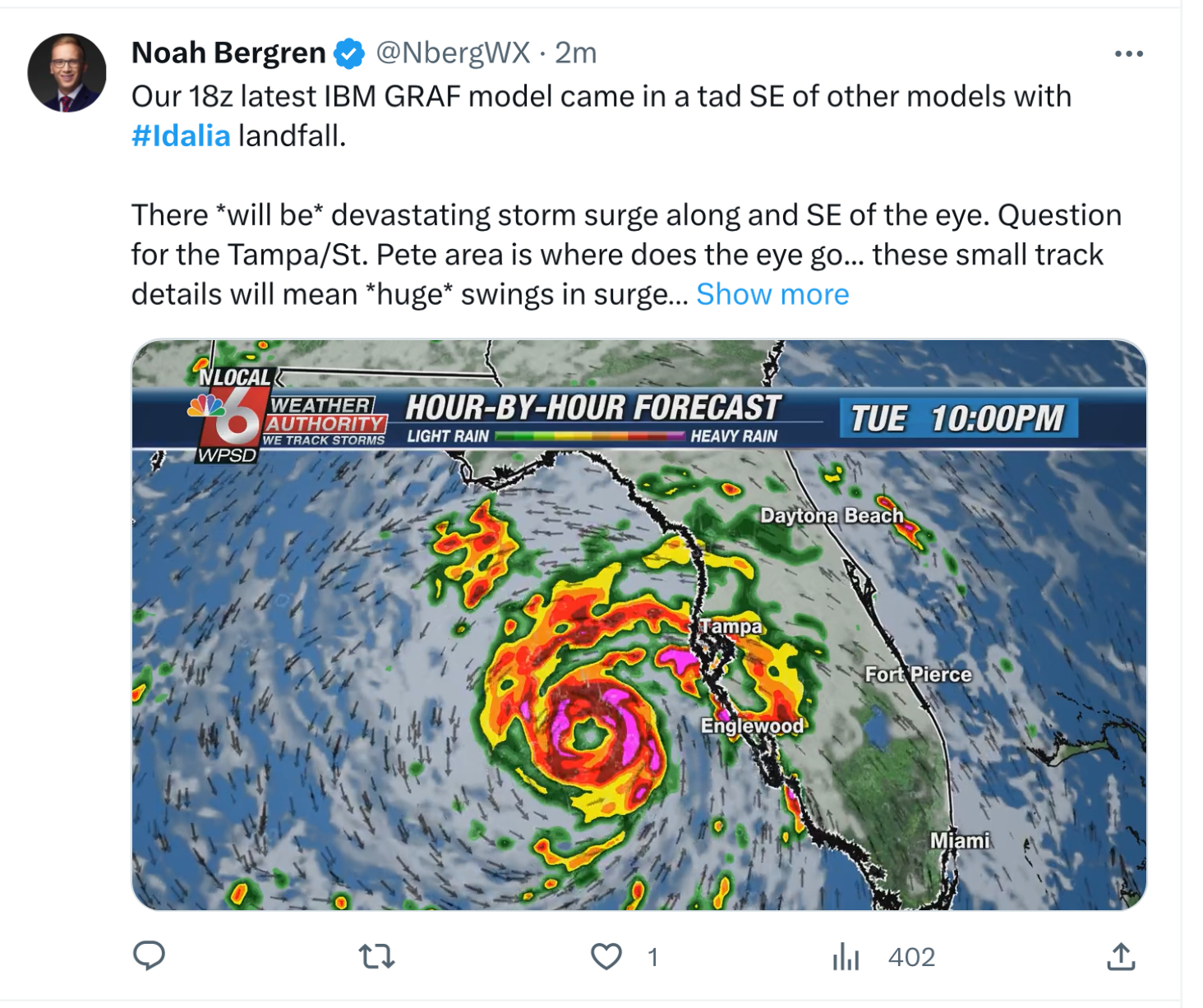
There’s lots of chatter now that latest models have shifted LF guidance about 30 miles West. But didn’t these runs initialize with a 20 to 30 mile westerly offset ?
-
1 minute ago, BYG Jacob said:

Pressure dropping like a rock
970s? Was this validated ? Wow was in the 990s less than an hour ago.
-
27 minutes ago, GaWx said:
You may be forgetting Easy of 1950, which hit Cedar Key as a cat 3.
You are absolutely correct. I stand corrected.
-
1
-
-
I’m aware of the Tampa bubble which has evaded hurricane landfalls in the region for many decades. I was not aware until tonight that the last major hurricane to hit the Big Bend was back in 1896! If Idalia slams into the region as a Cat 3 or 4 it will be the first time most of the current structures in that area get tested by a proper storm
-
1 minute ago, Nibor said:
This is about as bad a mentality to have at the threat of a major hurricane as could probably exist.
Exactly. People listening to tonight’s evening news trying to decide if they should follow evac orders certainly got a mixed message from the Mets here.
-
2
-
-
Can we take just a brief moment to acknowledge just how beautiful a cane that Franklin over in the Atlantic has become ? What an absolute beast!
-
7
-
2
-
-
Tampa TV Mets are downplaying this storm bigly. Saying this will be little more than a wind event for the area. I hope they are right in their bravado.
-
2
-
 1
1
-
4
-
-
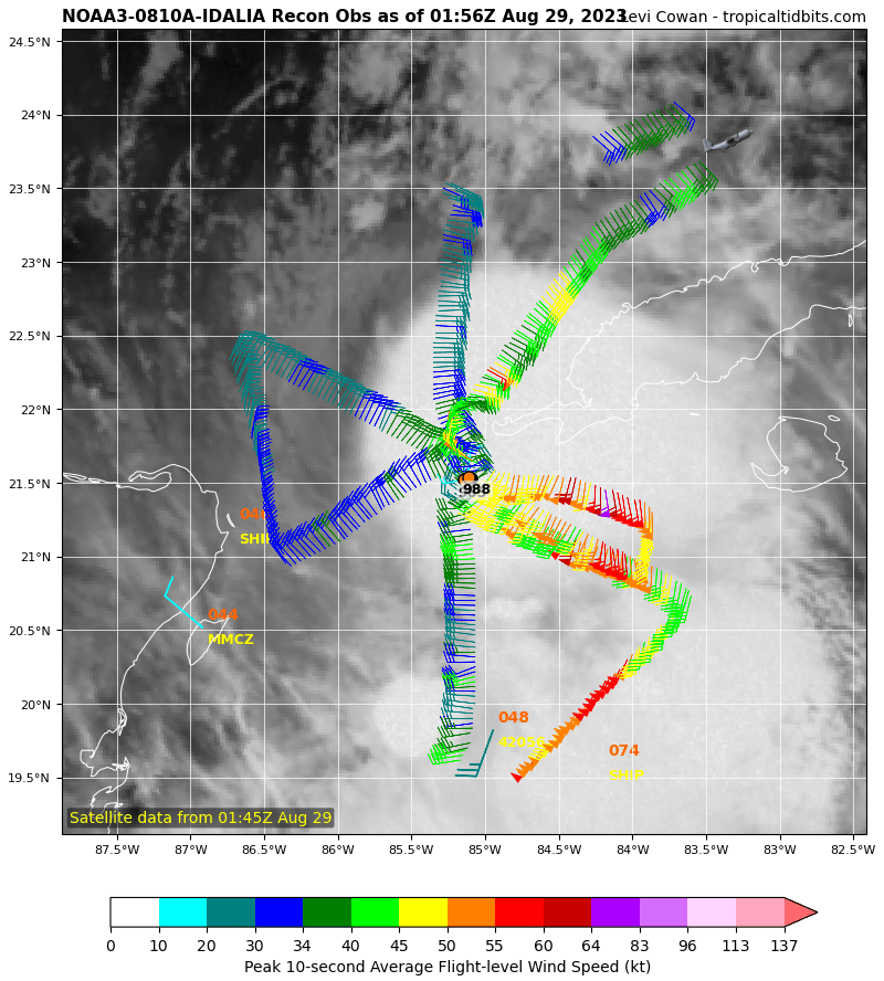
Found 983 mb on latest dropsonde Idalia may get a promotion as soon as the 8 pm advisory.
-
2
-
1
-
-
-
Satellite presentation now looks much better organized. Idalia could easily set records for RI given the hot waters in its path
-
4
-
-
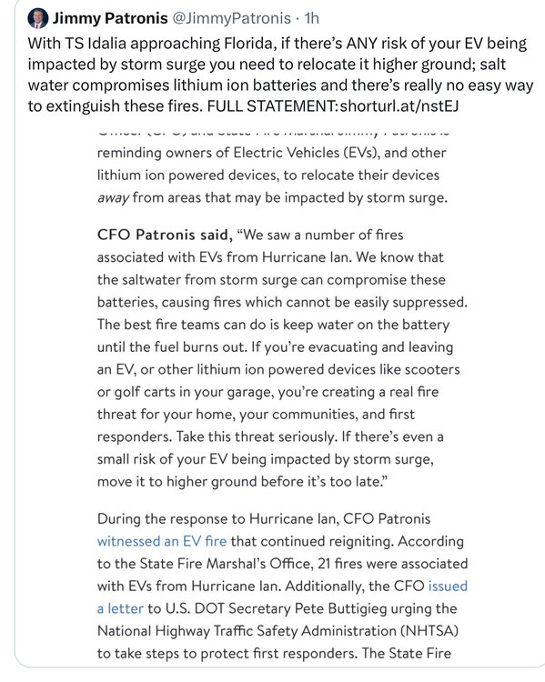
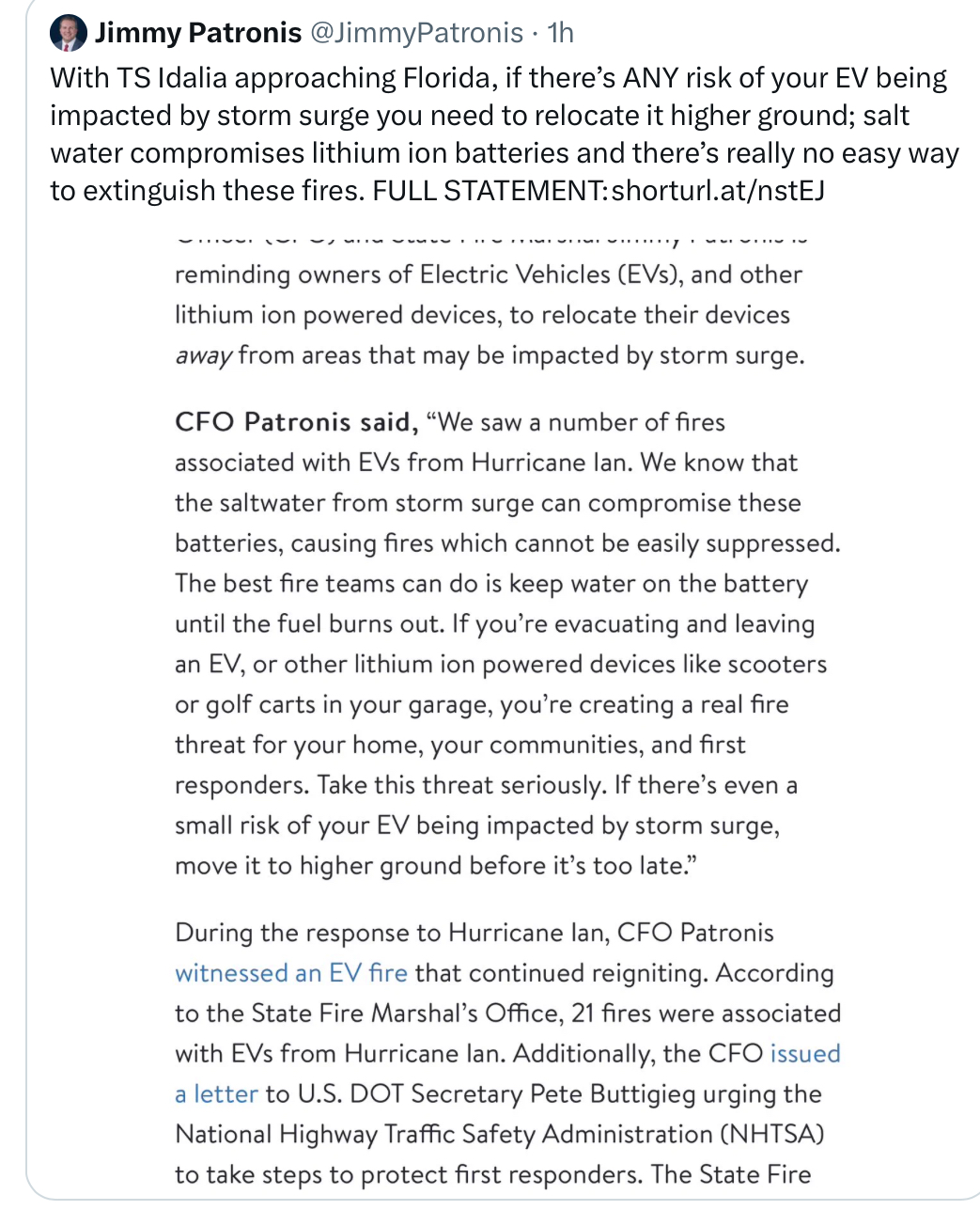
FL CFO reminds of the fire danger of leaving EVs at risk to storm surge. I just got back from my Clearwater beach condo and counted 7 teslas in the lower parking garage. I certainly hope they are moved by tomorrow. I almost wish they would all get towed if they haven’t been moved by 5 pm tomorrow
-
3
-
 2
2
-
-
Nice simulation of Gulfport FL flooding due to expected storm surge from Idalia
https://twitter.com/mikebettes/status/1696249278191083764?s=20
-
1
-
-
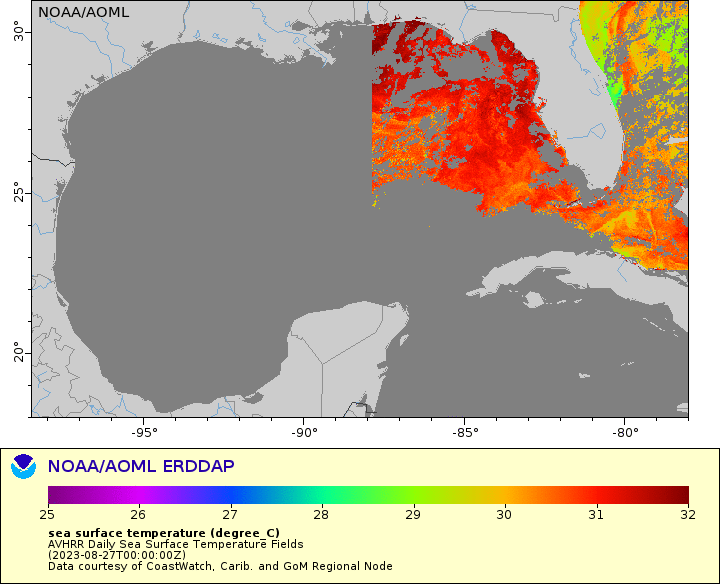
A glance at SST in the GoM shows nice 32+° water on the way to LF
-
1
-
-
Is it just me or has the northward motion stalled a bit in the last hour or so?
-
9 minutes ago, dbullsfan said:
I don’t know, seems like the Tampa bubble is in full effect her and this is gonna end up staying north and west
.Probably great for wind claims. Not so much for storm surge I don’t recall the last time we had 7 foot surge into the bay
-
1
-
Hurricane Idalia
in Tropical Headquarters
Posted
965 mb