

RVASnowLover
-
Posts
1,245 -
Joined
-
Last visited
Content Type
Profiles
Blogs
Forums
American Weather
Media Demo
Store
Gallery
Everything posted by RVASnowLover
-
I see that too. Hope its right
-
local mets are saying we will see a lull and then more precipitation later. That's a model bust because none of them had a dry slot
-
snow/sleet mix near willow law. come on temps...drop!!
-
all sleet here
-
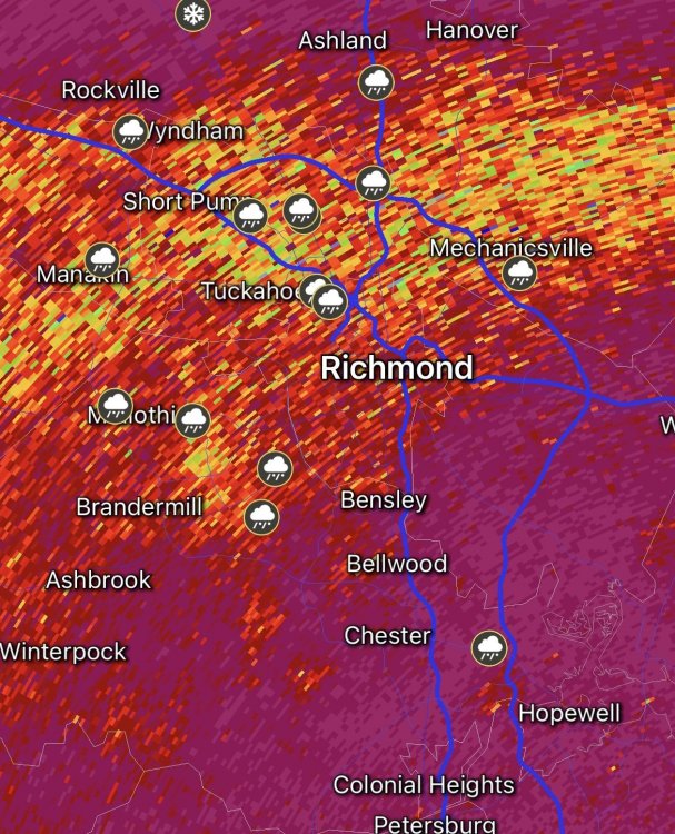
Current sleet line
-
sleet line is moving south on radar
-
rain/sleet mix in willow lawn
-
Were getting there slowly
-
3K nam with more snow than it had at 12z
-
Oh I agree. It may not mean anything at all to us. Just an observation
-
System looks a little more potent than what models were showing. Thunder and lightning down in NC
-
I’m not concerned about temps yet. We’re on track with that, maybe even a degree colder than forecast. Won’t get to 32 until after sunset
-
Be careful in that thread. They mainly talk about weather up in the DMV area. Yes the NAM has almost no ice for them. Still has ice for our area Saturday night
-
Other Hi-res models are showing this too so we’ll see
-
HRRR continues to increase totals. Either we’re in for a nice surprise or the HRRR is going to bust badly
-
1-3. I’ll post hit updated forecast when he does
-
Oh haha he’s a meteorologist with CBS6 in Richmond
-
Zach just said he’s looking to tweak his forecast for tonight based on the models. Trending better at the last minute
-
Meh
-
12z GFS still on for ice Saturday night.
-
Ice doesn’t look to be an issue here in the city until Saturday. Tonight should be a mainly snow event, maybe a little ice
-
Latest HRRR is pretty nice. 4” with Kuchera
-
Short term models are encouraging.
-
Wonder when they will issue an ice storm warning or advisory for that
-
Just looked at it. 3K wasn’t bad. About 3” here. 12k was much better but haven’t seen a Kuchera map for that one yet


