

RVASnowLover
-
Posts
1,245 -
Joined
-
Last visited
Content Type
Profiles
Blogs
Forums
American Weather
Media Demo
Store
Gallery
Everything posted by RVASnowLover
-
Let’s hope so
-
We’ve seen this before too. Doesn’t happen as often but it happens. Hampton Roads area gets crushed while we get fringed.
-
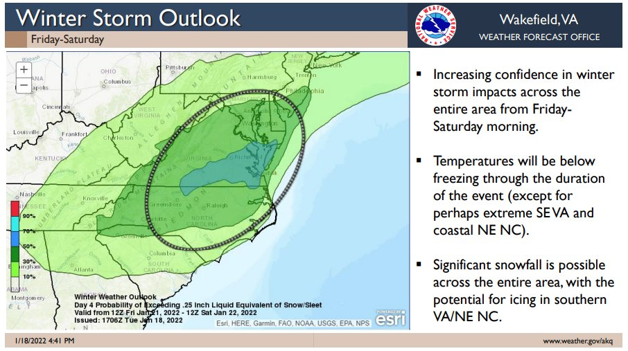
Jan 21 - 22 Weekend SE VA and Eastern Shore Snow
RVASnowLover replied to stormtracker's topic in Mid Atlantic
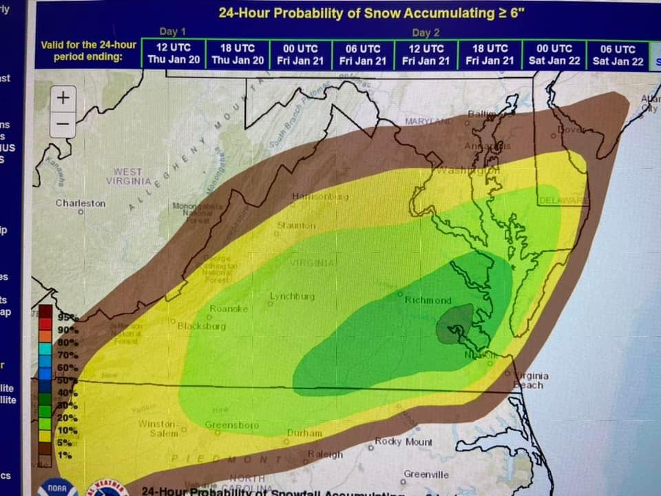
NAM is painful to look at for us in Richmond. A foot or more in SE VA. Around an inch here in Richmond. Brutal! -
12z NAM is painful to look at. Absolute crush job in SE VA. Don’t get much of anything here in Richmond
-
Courtesy of Tom Patton
-
Models look like they are converging on Hampton Roads jackpot. Don’t get me wrong, they kind of deserve it. They’ve got a lot of rain while at least got some. But it still sucks to be either too far north, south, east or west. See if we can get this thing to tick anymore northwest
-
I guess good thing GFS has been better than the euro because now GFS looks better than the euro
-
Euro was a Hampton Roads special
-
Nice, considering that’s probably using 10:1 ratio
-
Saw that they were better. Just curious as to what the snow mean was for us
-
Map?
-
See what the UK and Euro say
-
The snow maps didn’t look like much an improvement but overhead there was an improvement on the gfs
-
00z gfs is an improvement as well. Good trends so far
-
FWIW, 00z RGEM was an improvement
-
I would absolutely take this. Looks like a crush
-
Agree. Not throwing in the towel yet but as of now at least, this is looking like a Hampton Roads special and we get fringed. Things can change but as of now that’s how it’s looking
-
This!!
-
Yup. This might be a 757 special
-
18z euro is meh for RVA. Light event here. More significant in Hampton Roads. This might be one of those where HR gets hit hard while we get fringed. Seen that some before
-
-
Not awful. Just need a little more phasing.
-
Yup. NAM is not impressive for Thursday. Saturdays event looks interesting but hard to say
-
Hopefully we’ll see some improvements tonight
-
Will gladly take the euro. Just wish it had some support

