RVASnowLover
-
Posts
1,245 -
Joined
-
Last visited
Content Type
Profiles
Blogs
Forums
American Weather
Media Demo
Store
Gallery
Everything posted by RVASnowLover
-
I believe it’s about the same for Richmond. Better for Hampton Roads area
-
12z euro to the rescue. Crushes Hampton Roads. Sadly the euro is on its own
-
Gotta love those 180+ hours fantasy storms
-
Yes! Thankfully it’s only Tuesday afternoon. Plenty of time
-
Hope I’m wrong but fully expecting for the euro to not be good either
-
Canadian not good either. Holds vort back as well. Bad 12z trends after yesterday looked promising
-
So far vast differences between American models and foreign models. Will the euro cave to the gfs like it has been lately?
-
12z GFS took a step back. Weak
-
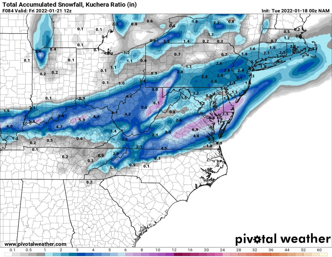
12z NAM hammers eastern NC. Does rev up Fridays event
-
Curious to see what the 12z globals show
-
Thursday’s “event” is about the cold air chasing precip and we all know how that usually goes around here
-
Thankfully it’s the NAM
-
Would be pretty impressive to get that much before the real “storm”
-
00z NAM. Not sure I’m buying the NAM. It hasn’t been great but here it is
-
Looked like a pretty big change on the 6z euro. See if it shows it again at 12z
-
And the cold is here to stay so whatever we do get will stick around for awhile
-
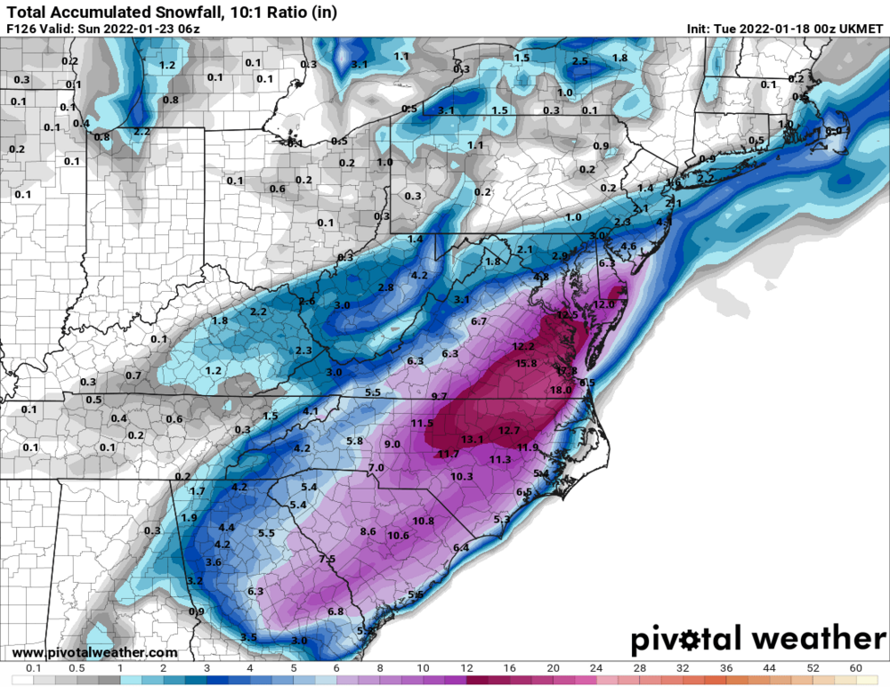
Euro crushes RVA. Euro is being consistent and other models have been moving towards the Euro. We’ll see. Always have to be cautiously optimistic around here
-
00z UK
-
Would be cool to get a light event before a big one. That doesn’t happen here.
-
Not sure I’m buying it but we’ll see. GFS took a big step towards the euro for Friday-Saturday. Hope the euro holds. Cautiously excited
-
Thursday also looks sneaky interesting
-
Friday night into Saturday looks very interesting. Too early for details but bares watching. The 12z euro was good
-
All rain now. On to the next threat which could be not far away
-
Sleet/freezing rain mix now
-
Sleet fest in the city