

Cobalt
-
Posts
4,865 -
Joined
-
Last visited
Content Type
Profiles
Blogs
Forums
American Weather
Media Demo
Store
Gallery
Posts posted by Cobalt
-
-
Incredibly stationary distribution of temp anomalies. Despite all of the shuffling in h5, the look over time remains the same.
How it started:
.thumb.png.3c7342a4f91d0f7be4a86ec4f0d4ab9f.png)
How it's going
Pessimism aside, even in some of our warmest recent Februaries (2017, 2018, 2022), a snow threat or two slipped into the scene, even if they were light events.
-
 1
1
-
-
Just now, rjvanals said:
18z Euro is nice for DC
About the best time to see a run like this take place.
-
8
-
-
Revenge of the fifth (of March 2013)
-
1
-
-
13 minutes ago, WinterWxLuvr said:
Every time the pattern has looked good on the ensembles it’s pretty much turned to crap. So why is it everyone just buys a bad looking pattern?
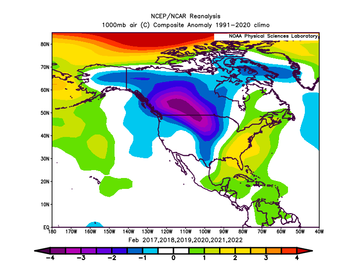
Persistence, going with the warmer/less favorable look has been pretty reliable so far this entire winter. As for February itself, we've seen the -PNA/SE Ridge look persist in 5 of the 6 past instances (Feb 2021 being the only exception due to a stoutly negative AO/NAO), and so it's not far-fetched to think that the guidance might end up pretty spot on with it showing basically that exact warm Feb look. Remains to be seen. As for attempting to be more optimistic, even our warmest Februaries during that stretch (Feb 17, 18, and 20) had at least 1 or more snow threats for NC/VA, so maybe we can get lucky. It's just hard to count on.
-
I spy a 2017, 2019, 2020, 2021, and 2022 on this list as well. All years from this recent stretch of futility, and all but one (2021) went on to have an AN February. If there was any wonder as to why we've been reliably snowless during this past 7 year stretch, reliable warmth is an easy culprit.
-
Just in time to ruin Spring
-
 1
1
-
 1
1
-
-
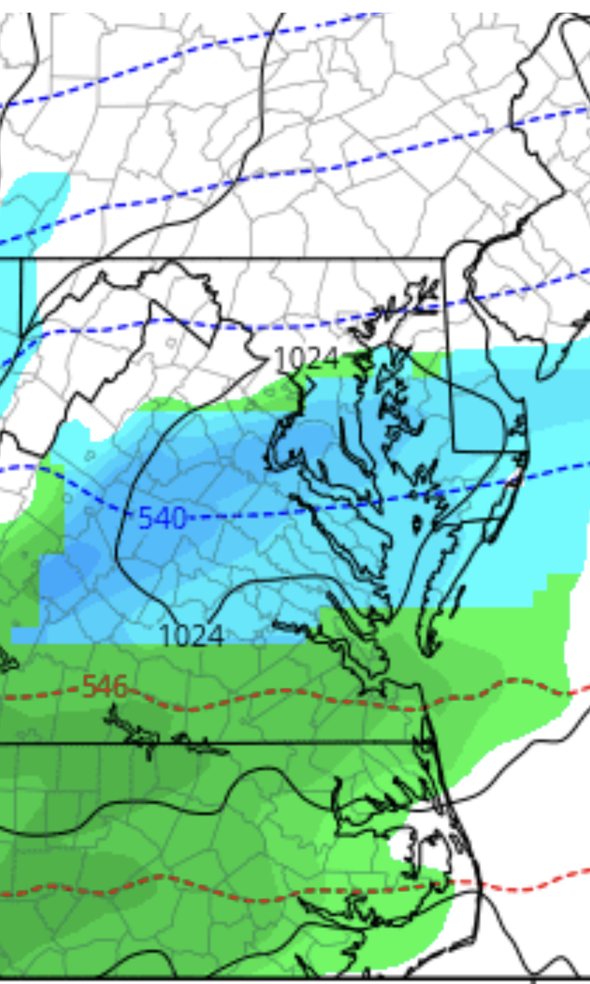
2 minutes ago, NorthArlington101 said:
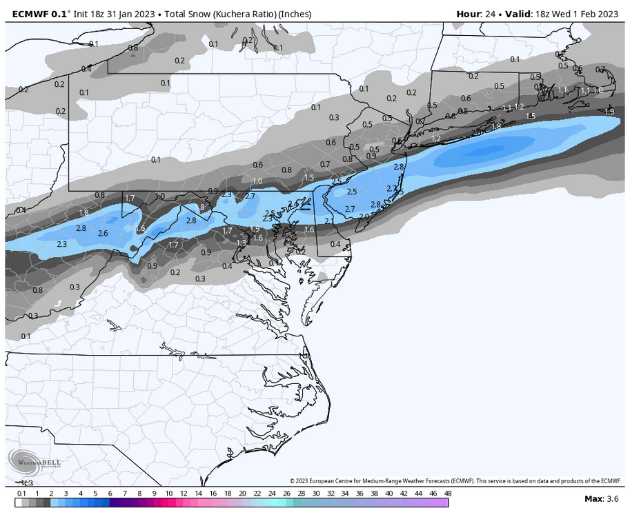
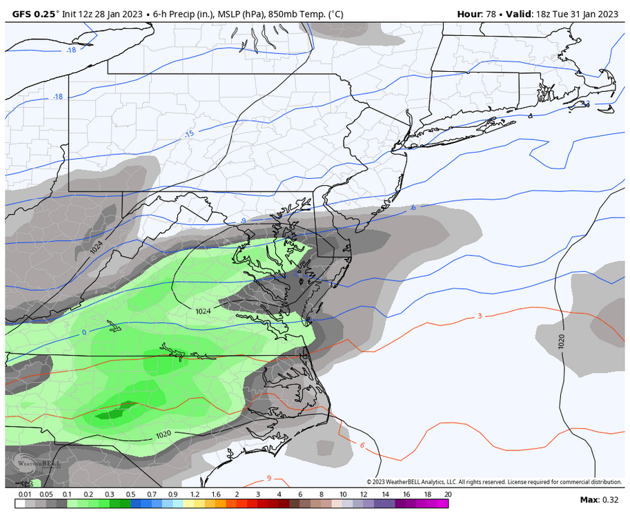
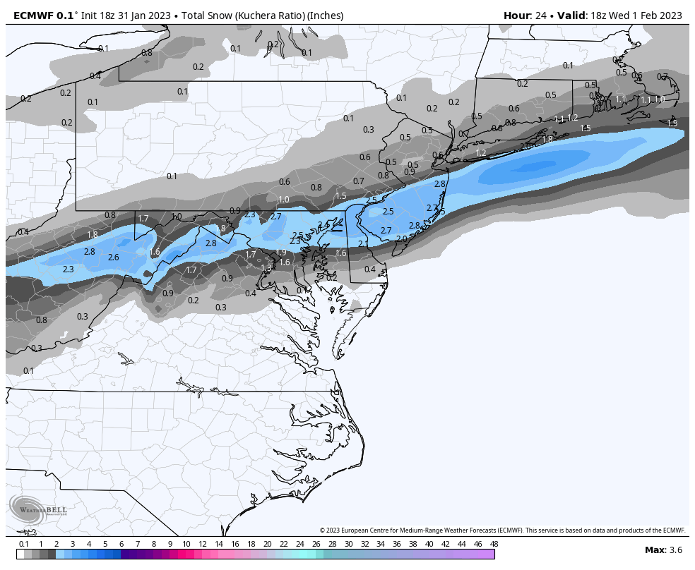
EURO looks better for Wednesday - don’t know if it’s gonna be enough but it looks more like a consolidated “storm”
A solid increase of about 0-2 millimeters worth of precipitation for southern areas compared to the previous run
.thumb.png.c83ce170c5409ef944a7098529716c5f.png)
-
 2
2
-
1
-
-
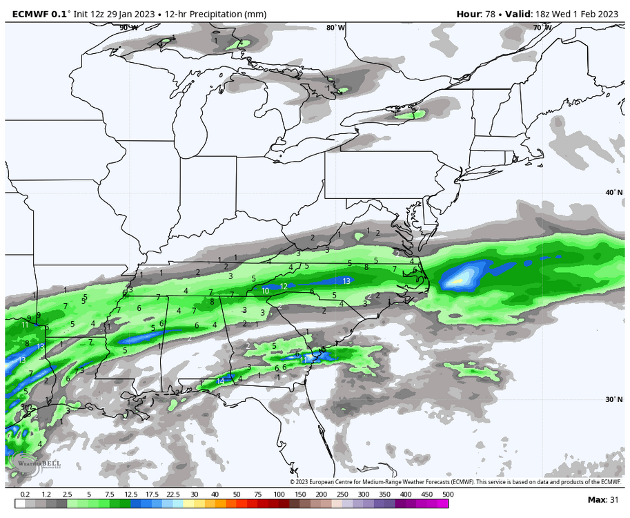
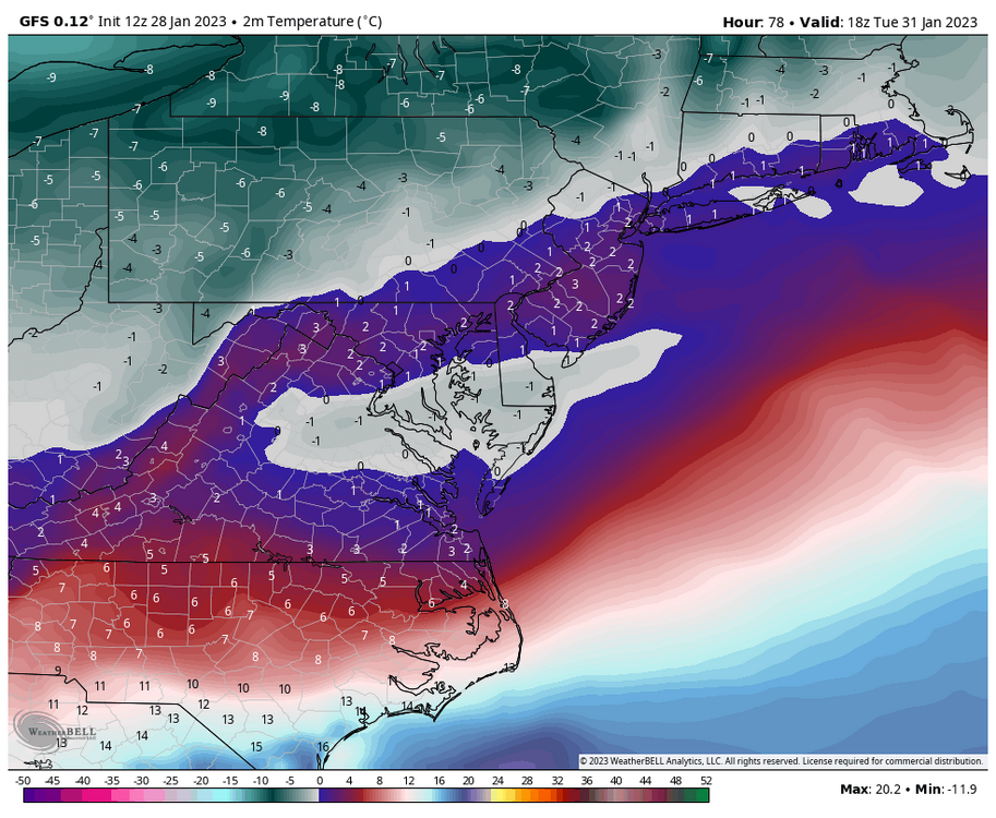
7 minutes ago, yoda said:
Nudge north on 12z GFS at 51 compared to 06z at 48 re snow
Curious as to if the GFS is keying in on the wrong wave entirely. It's been persistent in bringing a band of snow to the S part of our area near 18z Tuesday, meanwhile the rgem, ggem, and icon have been focusing more on 6z Wednesday. Interesting nonetheless
edit: GFS did nudge North with the Wednesday precip, but by just a small margin.
-
1
-
-
13 hours ago, Terpeast said:
Yep, and we will see another KU HECS here. But they won’t be every 3-7 years like from ‘79 through ‘16 anymore. Maybe more like once a decade. Twice if lucky.
15-16 felt like a preview into what "good" winters of the future will look like. Perhaps a 1 month stretch of BN temperatures, even sharp but brief cold shots like with what happened during Presidents' Day Weekend, but in the aggregate, an AN temperature winter with AN snowfall, hoisted up by 1-2 major snowfalls and very few of our bread and butter marginal events. Even just looking back at our recent 7 year snow drought, our "snowier" winters of the bunch have really only been snowy months, a 30 day or so stretch that was just cold enough to support a few decent snowfalls. January 2022 and 2019 come to mind when thinking of that.
-
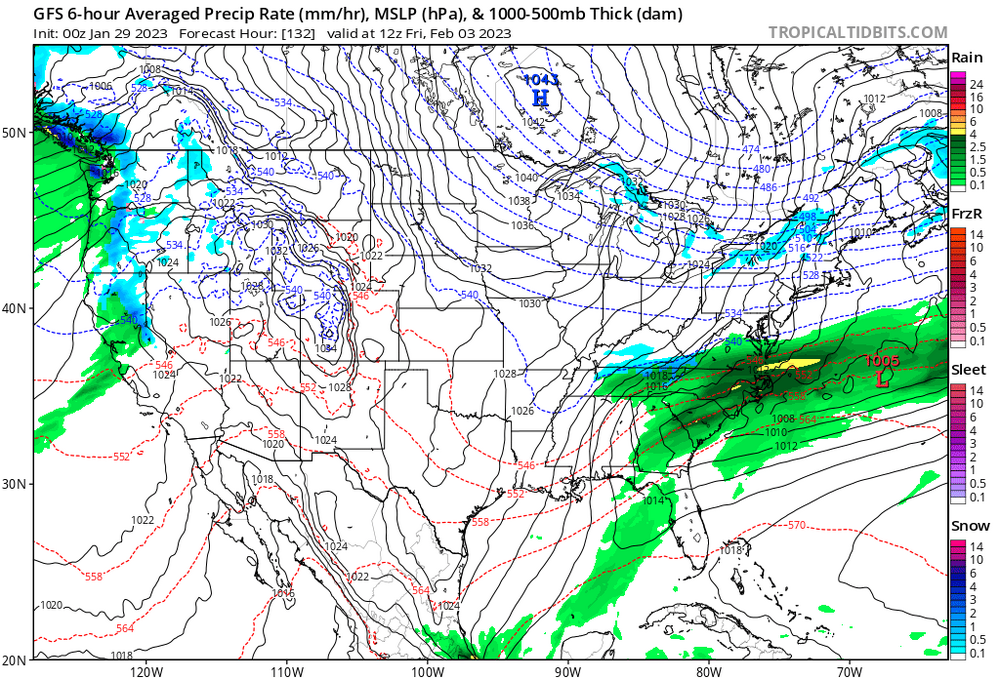
Just slightly off, might need a 1143mb high rather than an imperfect 1043 one.
In all seriousness, that's a 2 run improvement in terms of presented precip, and the 18z GEFS did have a few extra hits in there, so curious as to whether that improves as well.
-
1
-
1
-
-
16 minutes ago, LP08 said:

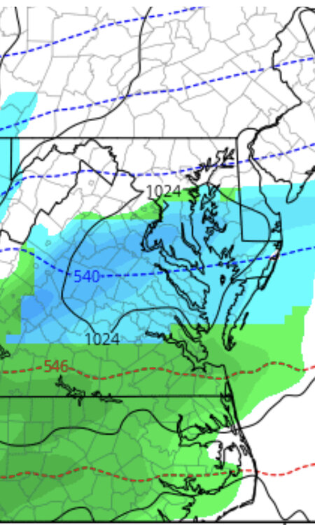
So close, but at least it's good to know that surface and 850 thermals and would suggest an actual shot of snow out of this as per the GFS depiction. Would like to see models juice this wave up as we enter range, as they've hinted off and on.

-
Surprised WW didn't post this, the EPS actually upped the ante on both waves, with a bit more of an emphasis on wave 2. Odd that none of the operationals have done much with the 1st wave lately, because the EPS and GEFS have been keeping it somewhat alive (I would separate the two but I am running out of upload space)

-
7
-
-
20 minutes ago, psuhoffman said:
You better hope next year isn't enso neutral...those are even worse. This is BWI snow data by esno the last 30 years.
Neutral Nina Nino Avg 13.1 Avg 17.2 Avg 28.6 Median 11.7 Median 14.4 Median 18.3 % above mean 12.5% % above mean 25% % above mean 44.4% 1994 17.3 1996 62.5 1995 8.2 1997 15.3 1999 15.2 1998 3.2 2002 2.3 2000 26.1 2003 58.1 2004 18.3 2001 8.7 2005 18 2013 8 2006 19.6 2007 11 2014 39 2008 8.5 2010 77 2017 3 2009 9.1 2015 28.7 2020 1.8 2011 14.4 2016 35.1 2012 1.8 2019 18.3 2018 15.4 2021 10.9 2022 14.4 13-14 sticks out to me as the one major anomaly on that list.. why did that winter end up so uncharacteristic at h500 and at the surface? Was it purely a fluke or the fact that the base state was already in transition to a more Nino look as followed with 14-15?
-
Now's the time of the year to start playing the game: Where In The World is DC Being Outsnowed? This time around it wasn't hard to find an unassuming location.
-
1
-
-
3 minutes ago, Terpeast said:
I would have never guessed there would have been temp issues here.
It was really at onset with poor ratios and some rain/sleet before snow took over. Once the coastal got cranking things cooled off pretty nicely. Of course there were concerns at the fact that it was in the 60s the day prior, but we know how rates can overcome almost any surface temp issues.
-
2 minutes ago, Terpeast said:
And that one snuck up on us did it? I wasn’t here so I didn’t track. How long in advance did the models sniff this out?
GFS had been hinting at that storm for days, but it wasn't until 36hrs out that all the models latched onto a WSW event all the way into DC. Euro went from 0.1" -> 1" -> 7" for DC in a 2 run span from 12z on the 1st to 0z on the 2nd, and the GFS had been hammering home the idea of a narrow swath of 12" for some time as well. Nobody believed it due to massive temperature issues at onset, but crazily enough, it verified and then some. That two week stretch of winter weather is close to one of the better ones you could ask for in any winter, back home I recorded 13" in just 2 weeks from 3 separate events. It's unfortunate that winter fell off of a cliff after that coastal bomb in late January (and still seems to be in recovery to this day).
-
1
-
-
On 1/8/2023 at 3:38 PM, Cobalt said:
Would fit remarkably well with what we've seen ever since late Fall, with major -EPO spikes that precede a transient (albeit stout) colder regime in the Midwest/East, taking place every month or so. A similar tanking of the EPO happened close to the 15th back in November, another one near the 18th of December, and now it's plausible that a similar event will take place near the 20th-25th of this month.
So it looks like delayed, not denied on this tanking of the EPO, which begins close to the 25th, but peaks near the 27th-28th (so entering the short range).
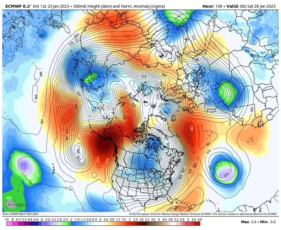
Impressive poleward ridging too. In fact, the Euro is so extensive with this ridging that it ends up intruding the AO domain near the end of the run, which is in clown range but has some decent ensemble support. Now I guess the question would be whether this EPO tank does what the previous two did not, which is produce snow potential in our area. Both the November 13th-20th and December 20th-27th periods saw average temperatures ~9-14F below average for all of the Mid Atlantic region, but the few events that took place during those stretches put us into the warmer sector of those systems. Hopeful that prime climo and that stout PV lobe can help get us on the board. I also recall reading that extreme November -EPO events were correlated with high latitude blocking returning later in the winter, so maybe we will see a return of that some time in mid-late February.
-
9
-
-
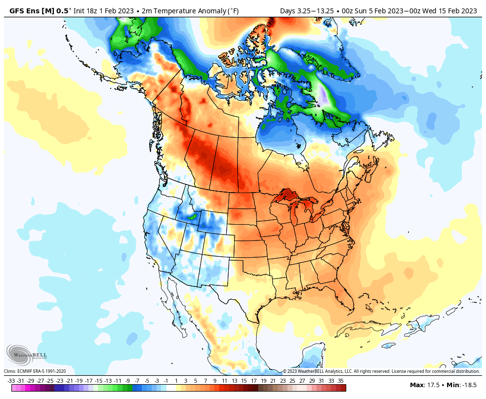
This certainly hasn't helped our prospects of snow recently. While the 97-02 snow drought didn't feature much of any notable cold in the CONUS during February, the recent 17-22 stretch has, it's just consistently been dumping into the Central and Western US, and the persistent SER has made it rather difficult to see any sustained cold in the East.
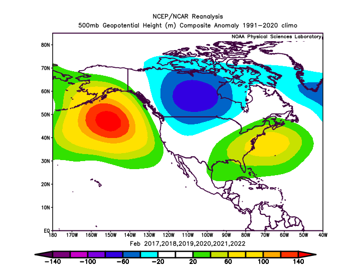
This has turned what was a snowy month (avg 5.0") into just an average of 1.1" over the past 6 Februaries at DCA. January (4.9" avg during that interval), and even March (1.3" avg) have presented substantially more snow threats during this period by a good margin. Whether something temporary, exacerbated by persistent Nina conditions, or a product of the bigger picture, it isn't good, and has contributed to our futility since the 2015-16 winter.
-
5
-
-
On 1/19/2023 at 5:37 PM, psuhoffman said:
We need the cold to have enough depth to resist when waves try to push the boundary north.
let me simplify this. We have always had 3 basic ways to get snow.
1) perfect track and a cold airmass
2) a wave attacking a cold airmass
3) a lucky perfect track in an otherwise crap pattern
I think it would be interesting to go back and categorize past snowfall events based on this criteria. From purely anecdotal evidence (and using what you've mentioned), it feels like 1 and 3 are happening less, but for whatever reason 2 might be happening more, or at least those events end up having more QPF than they used to. In just about every recent winter that has had at least some sustained cold (not just transient cold shots), those seem to follow. We got 1 or 2 of those last year, I can recall a few in 18-19, one in Feb 2016 (which dropped a surprise 8-12" in Stafford county), several back in 14-15, and so on. They're obviously not incredibly numerous, but I think those are events we're maximizing on more than we used to. They're replacing our bread and butter 3-6" events, and sometimes with more upside (like that one event in Feb 2015 after the brutal arctic shot where the track was awful but the cold was so entrenched that areas out near Leesburg got 10-14" before things warmed up enough). Of course the issue is that based on all of the data presented, none of that is enough to mitigate the loss of margins on the other two types of snow which in total likely add up to many more opportunities, but it is an interesting anecdote nonetheless.
-
1
-
-
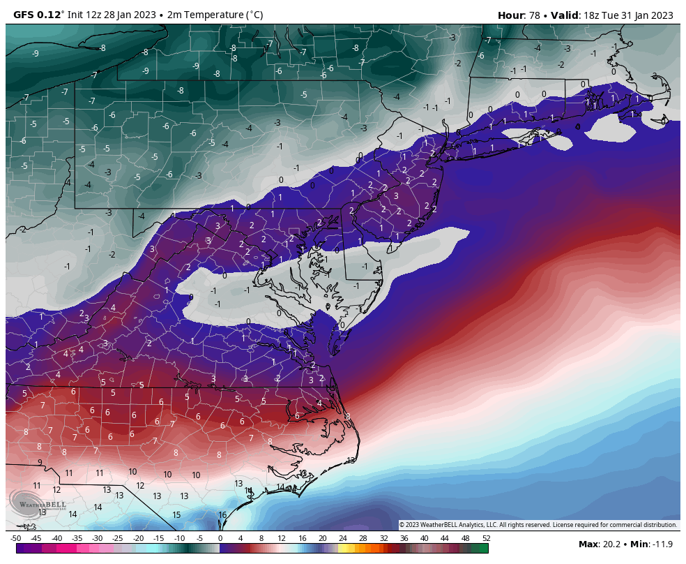
3 minutes ago, MN Transplant said:
DCA: +8.8
IAD: +9.7
BWI: +11.0
Dulles looks to be the only airport that will challenge its warmest January on record, having a current monthly average of 43.9F, which places it firmly ahead of Jan 2006's avg temperature of 41.8F. As for DCA, a record warm January has been a long time coming, with all of the other "wintry" (Nov-Mar) months having their warmest average temperatures recorded in the 21st century (Nov 2001, Dec 2015, February 2017, and March 2012). Baltimore's warmest January on record stands at an incredible 47.4F set in January 1932, which is +13.1 in current 1991-2020 norms.
-
1
-
-
On 10/20/2021 at 2:59 PM, Cobalt said:
This is of course in hopes that this upcoming winter may very well be the conclusion to our historic snow drought

-
2
-
-
9 minutes ago, psuhoffman said:
How easy you forget how depressed everyone was between Jan 2011 and Dec 2013. That was a long stretch without a snowstorm in DC. At the time people talked about it as an all time low point. Hindsight and all lol.
I think March 5th 2013 was one of the ultimate lows that this region has endured in terms of winter snowfall. I gave those old storm threads a read a while back to see what went wrong, and that storm bust looks like one of the first times you and others had opened a discussion about us losing margins on snowfalls that involved airmasses that might've worked a decade or two prior to it. Considering that the high temperature had topped out in 50s all the way in Saranac Lake, NY on March 4th.. yeah that was not a favorable airmass, even in March climo lol. I suppose details like that were just lost in the moment of insane snow outputs. But of course that was the beginning of the end of that historic snow drought, and 10 years later.. here we are
It is actually crazy how relevant this post is a decade later. You, Bob, and others definitely called it.
-
1
-
-
3 hours ago, Rtd208 said:
I am well aware of March 1993. But other then a few rogue events winter is basically over for the most part. Plus you are fighting increasing daytime temperatures and sun angle by that point as well (yes I said it, sun angle).
In our most recent 30 year climo period at IAD, March was the snowiest month in a given winter season in 2018, 2017, 2014, 2013, 2009, 1999, 1994, and 1993. It's not incredibly uncommon for March to be relatively snowy for our general area, especially when compared to another month that is considered firmly in "winter" climo, December. If we're tracking in December, there's no reason not to track if things are favorable in March.
-
5
-
-
42 minutes ago, BristowWx said:
Jan 25th 2000 will never happen again as long as we live. You know this. Predicted car toppers don’t turn into MECS anymore.
Jan 3rd of last year is probably the closest we've been to a a reverse bust of that magnitude in some time, considering that the Euro had 1-3" for areas that would end up getting 8-14" just 36 hours later, but not on the same scale as a KU that snuck up 6-12hrs before onset.. that will never happen again.
.png.bb3ccd9a96646a99a45bb7de7362822d.png)
 '
'
.png.d031f984685e4f51e3f947dfc08251fe.png)


worst long term prediction ever ?
in Climate Change
Posted
Thanks to the Montreal Protocol in 1987, international collaboration enabled the phasing out of several chemicals that contributed to depleting the ozone layer.
And after phasing out these chemicals, the rate of increase in the ozone hole virtually diminished. Atmospheric ozone is set to return to 1980 levels by 2040-2060.
All this to say that the "doom and gloom" science prediction didn't verify because international collaboration favored immediate changes to prevent a long-term issue. Something we unfortunately haven't been able to do for AGW as of yet.