

SnowLover22
-
Posts
1,300 -
Joined
-
Last visited
Content Type
Profiles
Blogs
Forums
American Weather
Media Demo
Store
Gallery
Posts posted by SnowLover22
-
-
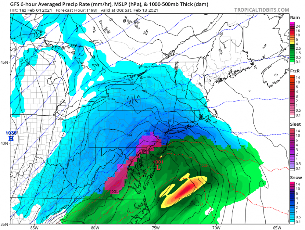
Yikes
Gfs says enjoy having no power for a while

-
enjoy? who likes ice skating? might be fun
-
 2
2
-
 5
5
-
 4
4
-
-
-
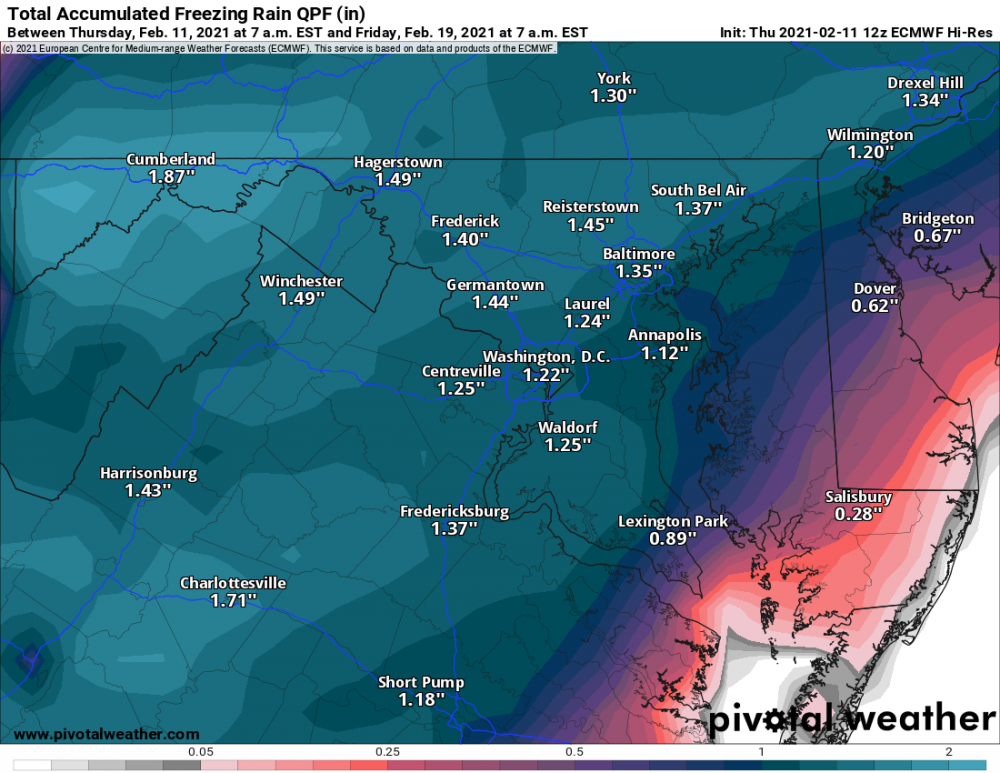
I heard the euro looks good for synoptic snows next week. Can anyone confirm?
-
-
Take a look at gfs day 8-9
Looks good for now.
For future runs, we want the low to be over Philadelphia for us. I think that is the best spot for our region.
-
29 minutes ago, wolfie09 said:
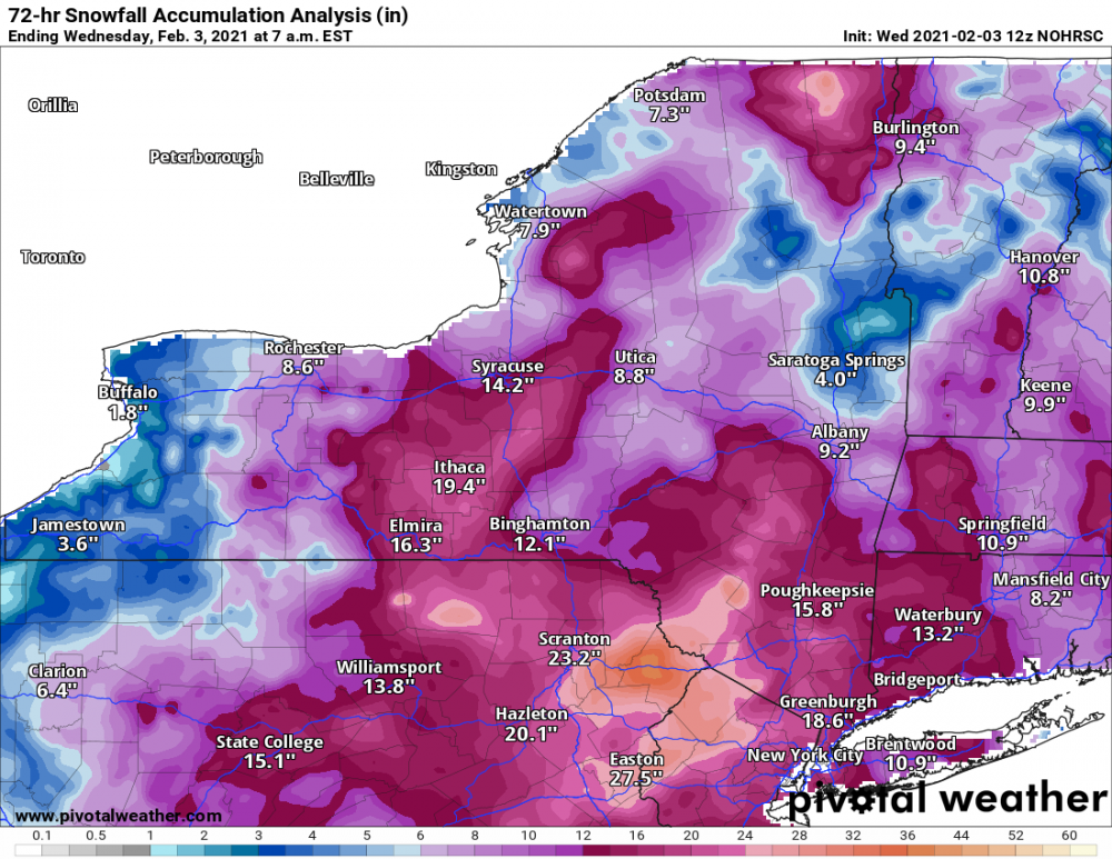
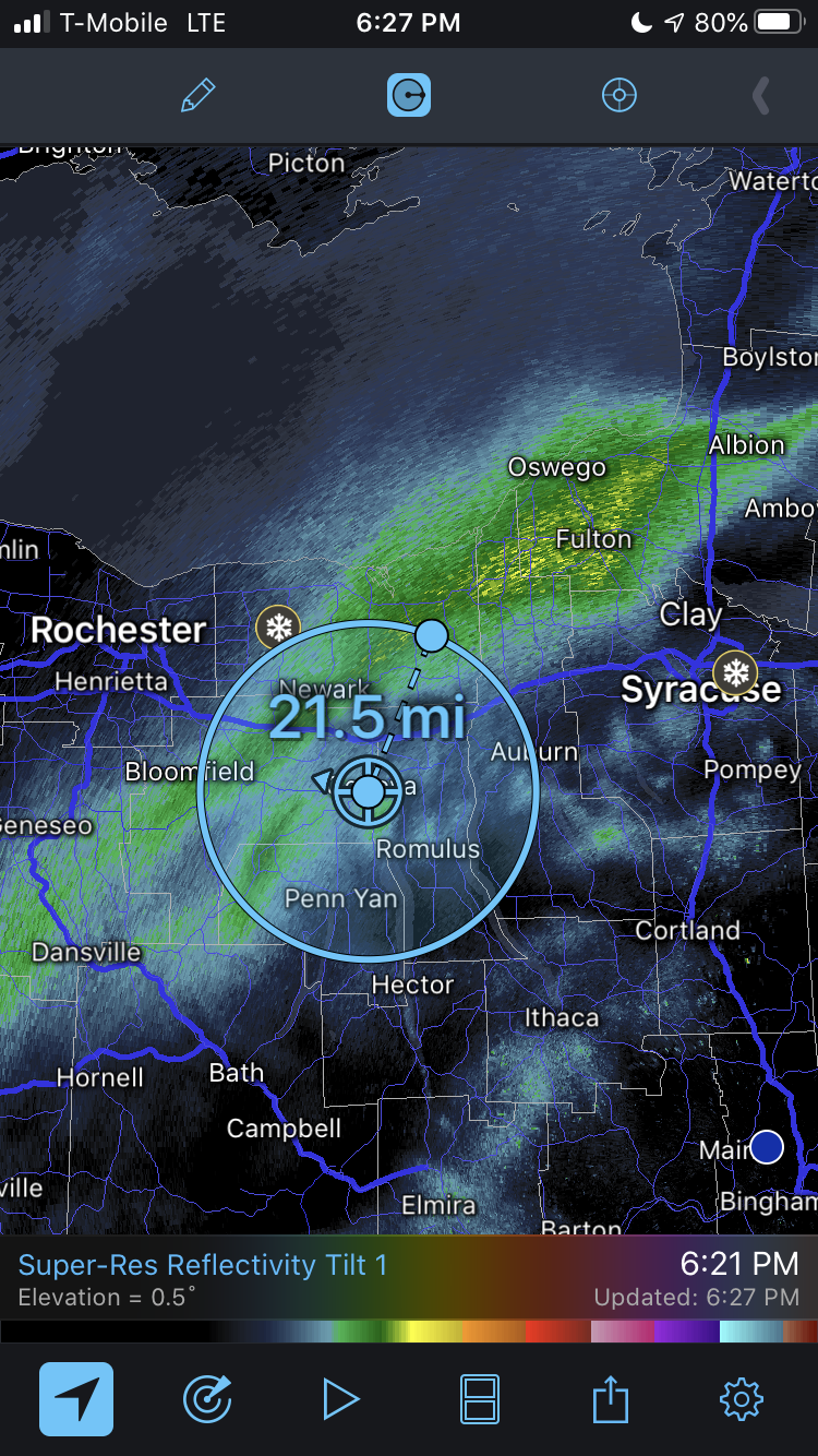
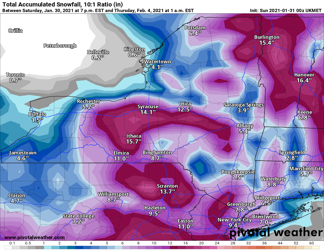
Majority of models did quite poorly in northern Oswego.. Highest reported total 15" in SE lacona..
.png.64ffc456fff926919897030749434474.png)
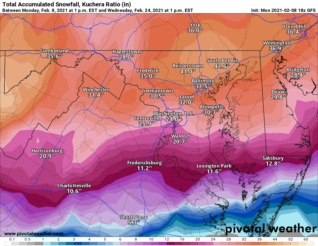
That map isn't accurate. The 10 inch measurement in Geneva is based off of a storm report at 12:40 AM. It did not stop snowing until 7:30 AM. The final total is closer to 14 inches.
-
@KamuSnow what is the storm total? I am not home right not so cannot measure. And I know you aren't too far from me.
-
15 minutes ago, rochesterdave said:
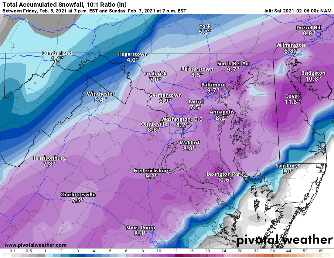
Kuchera totals were too low. Maybe a first?
I think ratios were higher than expected. Over 2 foot drifts in places here. I measured average depth at around 17 inches. I think 3 of those inches were snow depth before the storm if I remember correctly so 14 inch storm total.
-
Seems like a good storm overall. This map looks pretty accurate to me. Can anyone else confirm via ground observations?
-
I am guessing over a foot here in Geneva. I cannot measure accurately so am going off of storm reports. I am going to assume over 2 more inches fell between 12:40 AM and when the snow finally stopped at around 7 AM- 7:30 AM.
Quote...ONTARIO COUNTY... GENEVA 10.0 IN 1240 AM 02/03 TRAINED SPOTTER
-
5.5 inch snow total so far in Geneva. 2 from WAA, 3.5 inches so far from tonight.
-
5 minutes ago, tim123 said:
Its definitely a 15 to 1 type snow.


-
26 minutes ago, DeltaT13 said:
Coastal transfers simply do not work for WNY. The sooner you accept this the easier it becomes. I give you credit though, you held out hope longer than most. Respect.
Dude let it play out. NWS is saying 7 inches possible. I respect your opinion obviously but shouldn't we listen to the people at NWS?
-
14 minutes ago, TugHillMatt said:
Have you received anything yet? Just as I typed my last post, another subsidence zone appears to be forming here.
2 inches yesterday from the WAA.
-
Ugh.... seems like a bust
Edit: Nam still says 9 inches of snow. Not sure if I believe it.
-
I think my 5 inch forecast is going to bust badly. Already have 2.25 inches of snow. Currently snowing moderately. Temp is 27 F.
-
1
-
-
3 minutes ago, tim123 said:
Talk about a near perfect track for rochester. What euro showed would be a blizzard for rochester
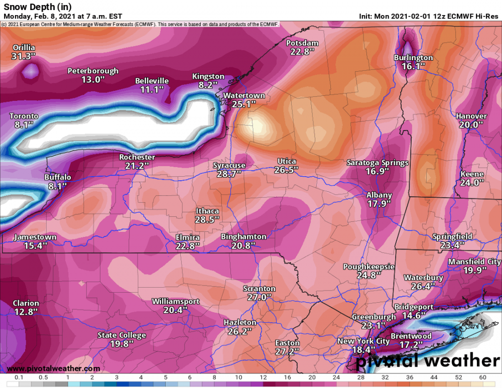
I want this to be true. Snow on the ground in 8-9 days. Forecasted snow depth.
-
8 minutes ago, Thinksnow18 said:
Agreed. Radar has plenty of moderate returns over basically the whole Niagara frontier, I can see 1-2” from this and that probably 1-2” more than I thought we’d get, now all bets are off as anything looks to be on the table.
Yup nowcasting time. Sad my 5 inch call is looking bad

-
1
-
-
I was getting ready to
 Just now, rochesterdave said:
RGEM basically the same. Subtle adjustments. Keeps us in the game for sure!
But I guess no need.
-
1
-
1
-
-
2 minutes ago, vortmax said:
This one is complex and will be yet another now cast event. I'm just thankful we have a relatively warm lake to our north.
Im expecting 5 inches of snow for Geneva NY. Anything more and will be pleased. More than 10 inches and will be shocked.
-
1
-
-
Dare I say advisory level snow seems to be a good bet

-
If any of the models are right and I get 15-20 inches Ill donate to this board.
-
1
-
1
-
-
yes please


Upstate/Eastern New York
in Upstate New York/Pennsylvania
Posted
dude you do not get to be jealous lmao. We missed out on the early Feb storm while places near you got over 2 feet and blizzard conditions.