

SnowLover22
-
Posts
1,300 -
Joined
-
Last visited
Content Type
Profiles
Blogs
Forums
American Weather
Media Demo
Store
Gallery
Posts posted by SnowLover22
-
-
20 minutes ago, WEATHER53 said:
Well right now with 100% snow cover within 15 miles of DCA its5-6 degrees warmer. Explain to me with that much deep snow cover how Any “heat island” element is existing
So much pressure was exerted over temps and snow totals post Snowmaggedon that snow totals have cleaned up and become more matching. The issue with the temps is very very likely the improper placement of the actual thermometer.
Should the airport total not be trusted then? At the very least the discrepancy seems weird.
-
31 minutes ago, WxUSAF said:
DCA updated to 6.9”. Highest of the 3 airports now.
Why does the airport always record lower than surrounding locations it seems like. Alexandria which is not that far recorded 9.2 inches. Somehow, a 4.2 mile difference= almost 3 inches difference in snow?
-
 1
1
-
-
Philly skyline drive through the city.
-
My brother who lives in Alexandria wants to know how much snow he can expect. It would be reasonable to tell him at least 5 inches?
-
1 minute ago, Birds~69 said:
We need more N jumps but Philly looks like a few inches...still time.
Still time for that. very important 6 gfs run for sure coming!
-
 1
1
-
-
I know it is the long range HRRR but looking at the 00z run at 20 hours. Energy seems to be held back more near Texas with there being less confluence to the Northeast.
Edit: ninja'd dammit.
-
1 minute ago, IronTy said:
GFS for both storms. Would be pretty epic.

This would be more snow than the last 2 winters combined for some areas.
-
3
-
-
1 minute ago, WinterWxLuvr said:
Not a good sounding guy but I don’t see that one being sleet
Below freezing at all levels. This is not a sleet sounding. If the gfs is to be believed. DC has a chance at seeing plowable snow.
-
2 hours ago, Ericjcrash said:
Haters will say it's photoshopped
because it is lmao but y'all already knew that.
-
 2
2
-
-
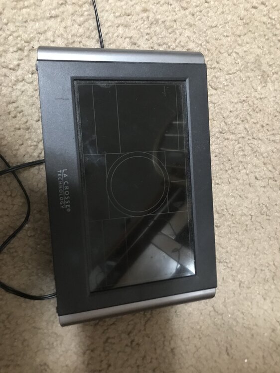
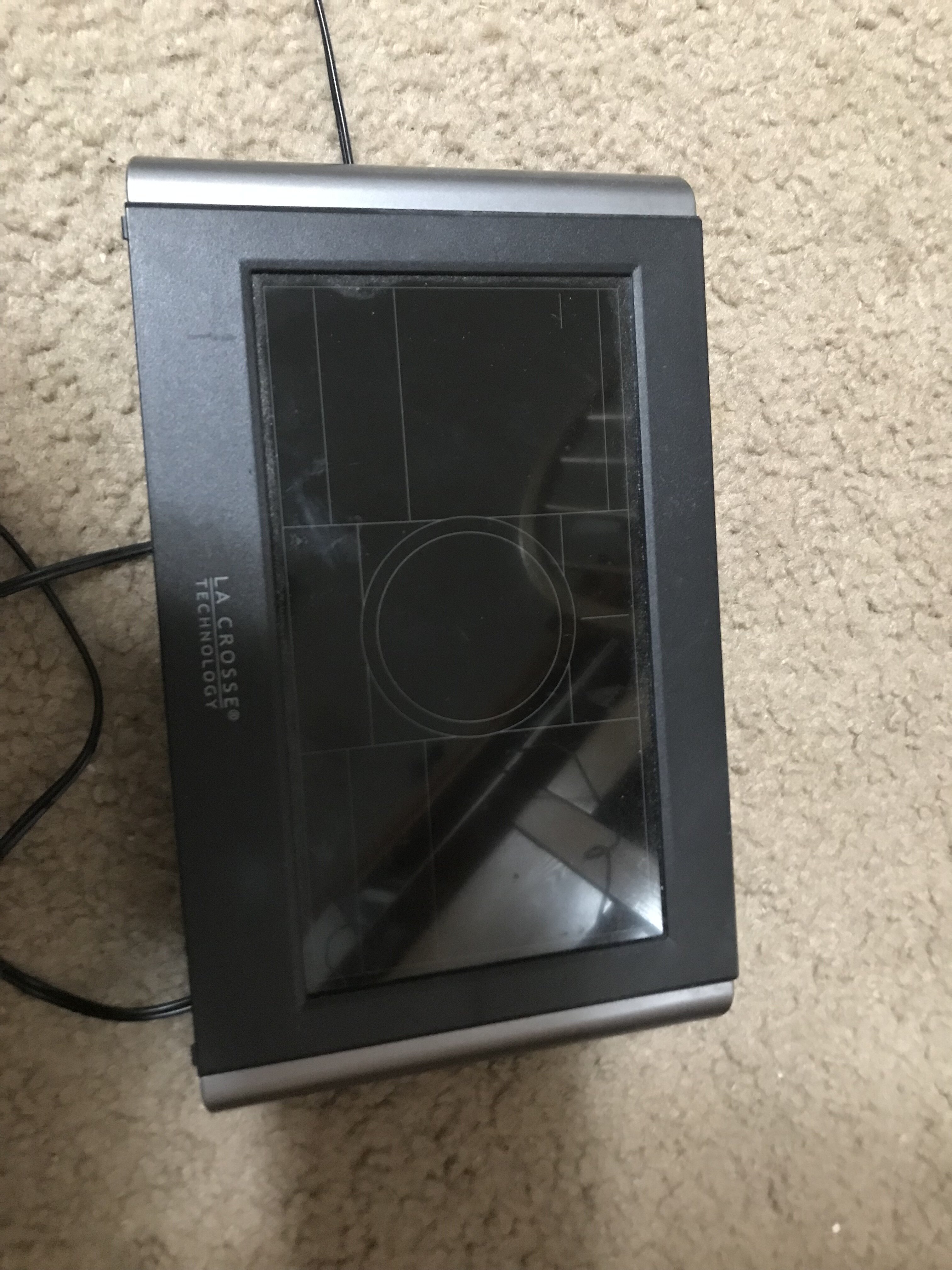
Here is a picture. A little bit dusty, haven't really used it in a while because it stopped working. Lasted me 2 years.
-
10 minutes ago, WxUSAF said:
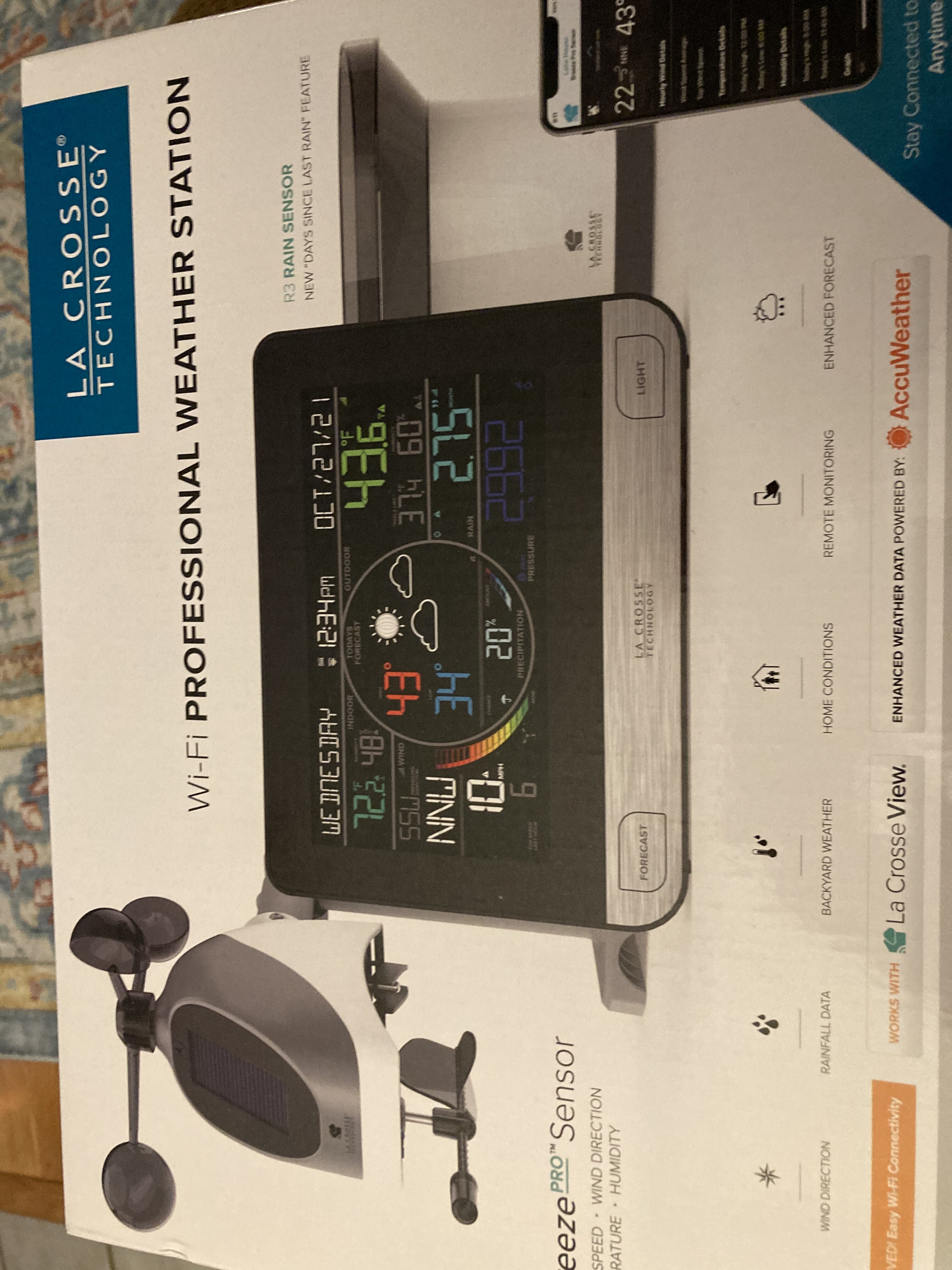
Mrs. WxUSAF got the family this PWS for Christmas. I’ve wanted a PWS for awhile, but never pulled the trigger in a Davis VP2 because they’re like $600. This one was obviously a lot less. I don’t care about wind too much because there’s nowhere I can mount it that would be clear enough. Anyone have personal experience with this unit or have recommendations/thoughts?
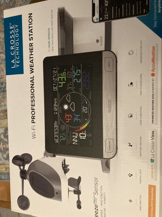
I also have a LA Crosse weather station but I think the model I have is not as nice. This looks a lot nicer but I don't know.
-
1
-
-
Has anyone actually ever gotten an exposure notification. My brother that lives in Alexandria did but turns out never got sick.
-
1 minute ago, HighStakes said:
Yeah, I got 2 weird messages this morning. I just deleted them and did not open either. I forgot to report them.
I assume the mods already know about it. Hopefully they ban the account.
-
1
-
-
Just now, NorthArlington101 said:
I got it three times - eventually just blocked the account.How do you block an account?
-
anyone else get a random NSFW message. Probably a bot I am guessing. I already reported the message.
-
4 minutes ago, frd said:
That should start to help shift things around.
Specifically in what way?
-
8 hours ago, Weather Will said:
WB overnight extended GEFS control sees some cold coming…

Maybe a good pattern just in time for my journey back to the states. Hopefully....
-
7 hours ago, psuhoffman said:
Lastly I would gladly suffer the same fate for what came next….
So if we could sign up for the year that followed but it meant crappy winter this year, you sign up for that?
-
3 minutes ago, Windspeed said:
Yeah, I'll reiterate wow here. Sam looks like it has reintensified this evening as it crossed over a +26 warm eddy within the Gulf Stream.

Wish we had recon certainty looks better than 100 mph.
-
2
-
-
16 minutes ago, SnoSki14 said:
I don't think we'll have to wait long for a Cat 2/3 with a solid eye making landfall near the NYC area.
Water Temperatures north of the gulf stream near the NYC area range from 21-24 C. Not sure what the average is but how soon would you expect an increase to 26 C(minimum requirement for TC).
-
1
-
-
7 minutes ago, jpeters3 said:
That's the eye dude.
Yup it is I clearly see it now. No evidence of a secondary wind maxima.
-
1 minute ago, jpeters3 said:
Also, recon did not find a secondary wind maxima, which suggest that the current intensity fluctuation is not the onset of an ERC.
What is this then?

-
4 minutes ago, WxWatcher007 said:
WE do...but will the NHC say it

I would think pressure data alone supports cat 5 considering they found 145-150 mph winds at 943mb. I think it is reasonable to assume the winds increased with the pressure drop before the wind field started to expand with the ERC causing the winds to decrease as the pressure gradient decreased. Anyways off to bed now already 1 in the morning.
-
1 minute ago, WxWatcher007 said:
Ugh. We need funding to have recon on demand.

Pressure is down to 932mb but winds do not support cat 5 maybe because of eyewall replacement cycle? Can it be inferred it was a cat 5 at one point or not enough data


NHC Hurricane Specialist Stacy Stewart Retires
in Tropical Headquarters
Posted
Stewart last ever discussion