

RDRY
-
Posts
731 -
Joined
-
Last visited
Content Type
Profiles
Blogs
Forums
American Weather
Media Demo
Store
Gallery
Posts posted by RDRY
-
-
1 minute ago, HIPPYVALLEY said:
That's a lot to ask for with that spacing. I don't disagree, just not high odds.
Long odds seem to be the only odds we got these days.
-
 1
1
-
-
22 minutes ago, STILL N OF PIKE said:
I don’t think it works that way
You want it to speed up to catch the energy from the first vort slow down and juice up the broad system. That’s my limited understanding
If that lead wave keeps de-amping, the trailing wave may gain enough space/dynamics to put down 2-5.
-
4 minutes ago, STILL N OF PIKE said:
What’s the benefit ? The pope returns to burn down the house ?
That, and the trailing shortwave maybe taking over.
-
1 minute ago, ORH_wxman said:
Trailing shortwave is more impressive than the front runner. If it ever sped up slightly, it would be a pretty good event.
Seems to be a lot of issues identifying how much integrity each vortmax is going to have.
1/5 dissipated into almost nothing. At least if 1/7 does the same, there's a benefit.
-
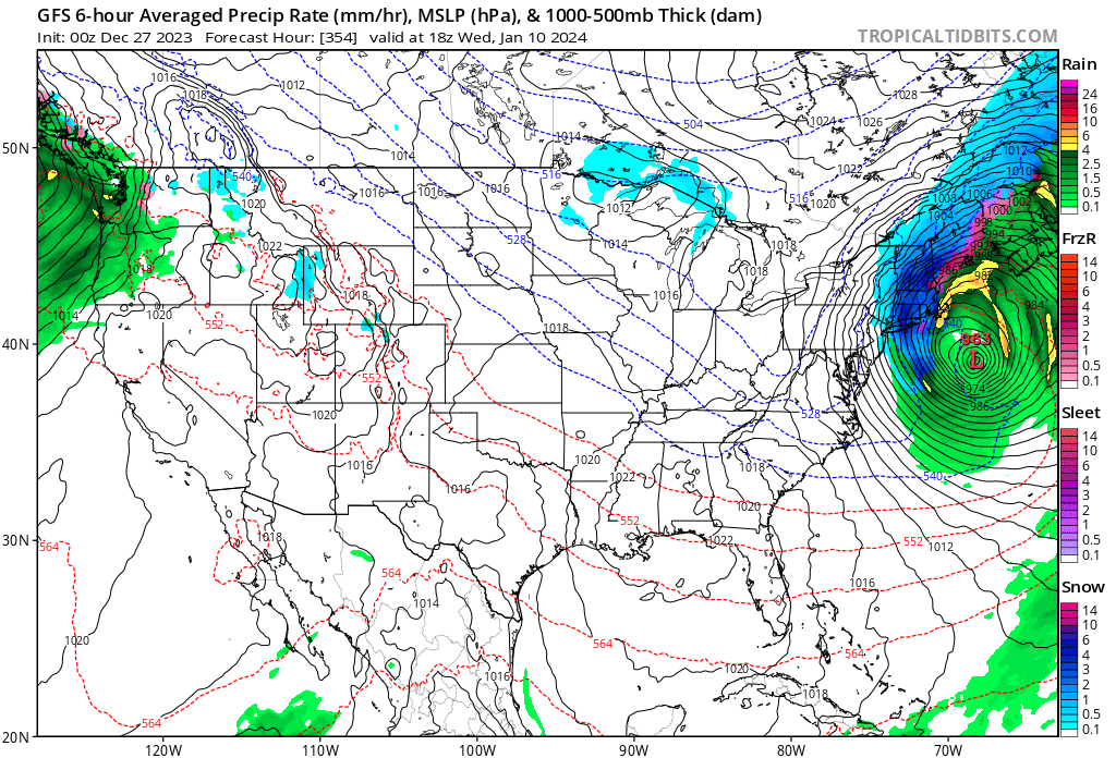
On the 10th, GFS really flummoxed with the surge of moisture into a very stubborn cold air mass. That evolution should be fun to watch.
-
1
-
-
No complaints with that Euro run -- GFS with its typical depiction at this lead time to a coastal.
-
1 hour ago, deathridge said:
Who’s ready to be buried in sweet sweet white stuff?


-
 2
2
-
-
Interesting how each successive system gains latitude, but outside of the first one rounding the bend late, these are west-to-east deals. At least there's finally an actual northern cold source -- the 850s are below freezing for the entire northeast almost the entire GFS run.
-
Has the Ukie vanished? I know it's barely a step up from the Nogaps, but the Brits might be getting offended.
-
7 minutes ago, mreaves said:
This tells me you're not here for the meteorology, only the results. And that's fine. I'll be the first to admit that I'm not all that into the science. Persistence isn't a method though.
I understand most of the teleconnections and follow them here with the charts. It's just an observation that the long-range models mostly seem to overplay their fluctuations, and they ultimately stay within a fairly confined range for most of our winters.
-
Persistence > teleconnections.
-
1
-
 2
2
-
-
34 minutes ago, MJO812 said:
Better looking 0z Runs so far
21,240 minutes to lock it in.

-
3
-
-
Merry Christmas, and a happy persistence new year.
-
Euro is fun. Perfect evolution, perfect track, near-perfect climo. Result ... rain into Canada.

-
1
-
1
-
-
12 minutes ago, klw said:
Nothing compared to long runs on Olympus Mons
Or parasailing in Jupiter's Red Spot.
-
Late December Canadian high pressure with barely-below-freezing 850s. Yikes.
-
GFS pops a secondary coastal and there's STILL no cold air available.

-
1 hour ago, FXWX said:
Folks should go and read David Ludlum New England Weather Book... Wonderful sections on the winters of the 1700/1800 time span... You will come across quotes from journals and diaries written back then complaining about the lack of cold and snow compared to past winters...
Colonial weenies.
-
1
-
-
26 minutes ago, ORH_wxman said:
Euro is a close miss for a follow up wave on Dec 6-7. So that’s one we may have to watch as well.
Still think 12/3-4 is a heavy lift for SNE big snow, but not so much for NNE.
Hope the Berks can sneak that one out. A near-shutout so far.
-
Upslope really kicking in western Mass. Classic big storm for this area.
-
1
-
-
Just getting pummeled in Lenox. Have to be closing in on 20.
-
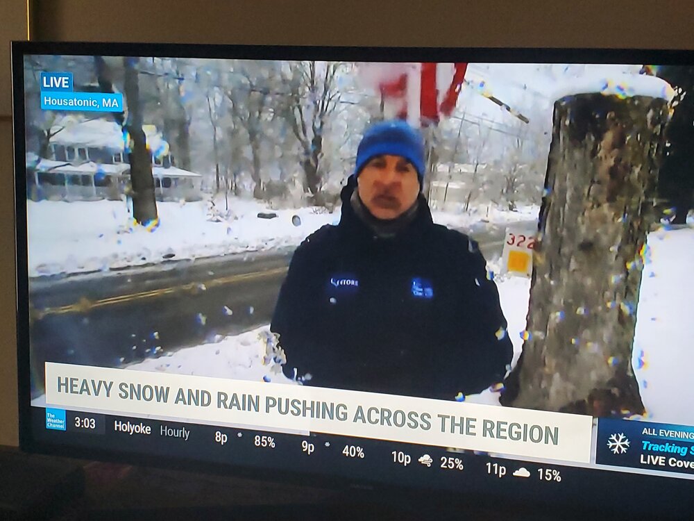
33 minutes ago, Ed, snow and hurricane fan said:
He has been in Housatonic with a big downed tree on car. ~15 inches where he is. Light-moderate with wet streets. Power out where he is.
Yup.
-
1
-
-
11 minutes ago, wxmanmitch said:
Jim Cantore has been in town. I don't know if he still is, but TWC was doing live reports from the center of town by the monument and town hall.
Ah. Too bad I have to work all day!
-
Up to about 14 in Lenox.
-
3
-

Monitoring first regional significant winter impact event. Magnitude likely tempered. At this time NE PA/SE NY and SNE primarily. Jan 7/8.
in New England
Posted