Thor
-
Posts
171 -
Joined
-
Last visited
Content Type
Profiles
Blogs
Forums
American Weather
Media Demo
Store
Gallery
Everything posted by Thor
-
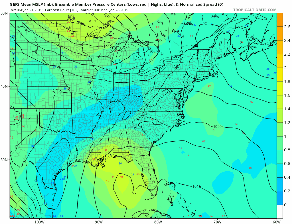
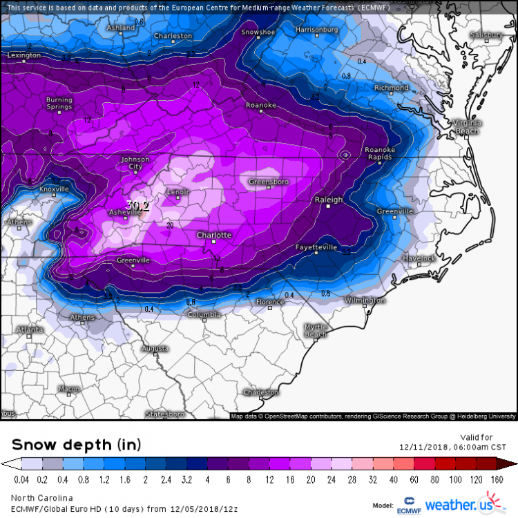
Not sure if everyone is still keeping an eye on the Coastal. But just for example this is the GEFS for the storm about to hit NE. So over the course of 6 model runs went from well out to sea to a pretty large event for them. Usually it seems to follow this pattern where two camps set up of LP's and then eventually they come back together over the corrected location. Luck hasn't been in our favor this year obviously but the NW trend is alive and well.
.thumb.gif.12e7eceec99c6f50d51d5162c4716e94.gif)
-
Haha Snow seems to follow you around this year. For us SE of Raleigh and the coastal plains we would love to see the suppression continue for about another 3 days. GEFS seems to be tightening some today

-
Is pure snow the kind that isn't yellow? Because I'm guessing in Florida there's not a whole lot of "pure" anything. So he may have a point haha
-
Living in Johnston and working in Durham is punishment on many levels the hours of commuting every day and them getting 10+"s while I get rain every storm. Time to move.
-
Sref is picking up on some Monday morning snow this run. This has been the model showing the least the whole time.
-
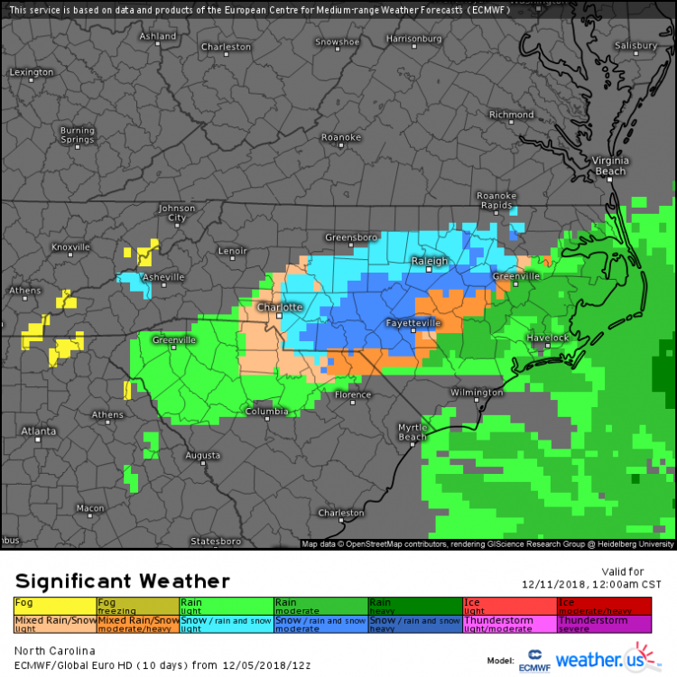
Also kind of doubt the precipitation minimum showing up over NE NC on the Ukie, haven't seen that on many models
-
I shall break this precip wall with mine hammer, but i doubt precip extent shown I think the big take is much colder look
-
1039 HP

-
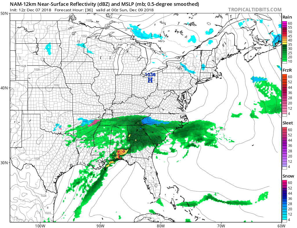
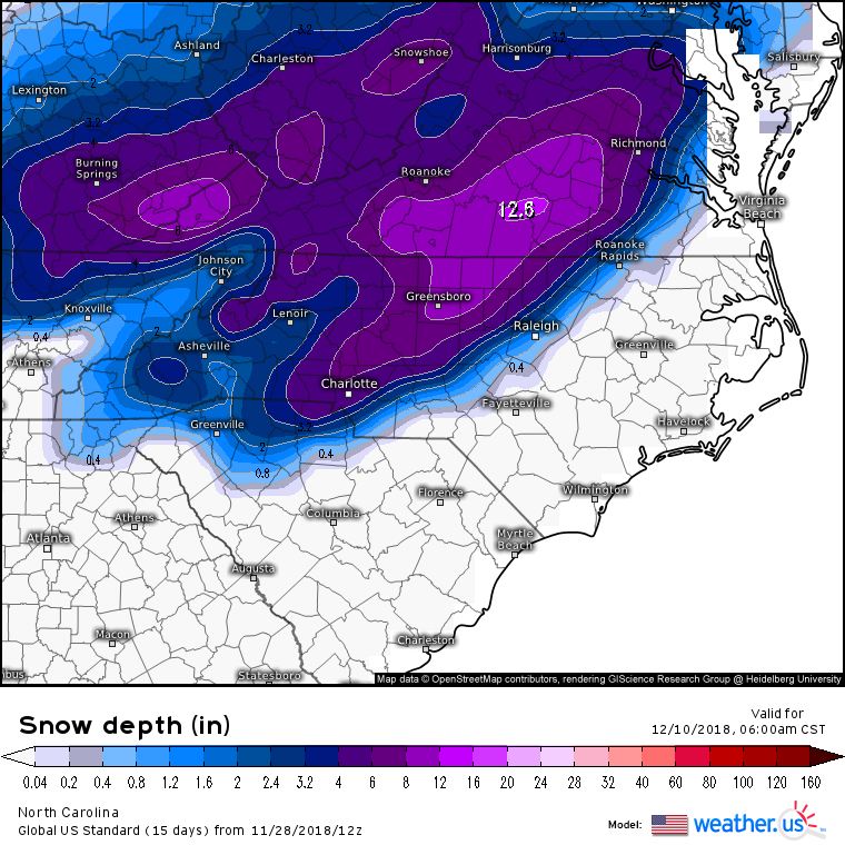
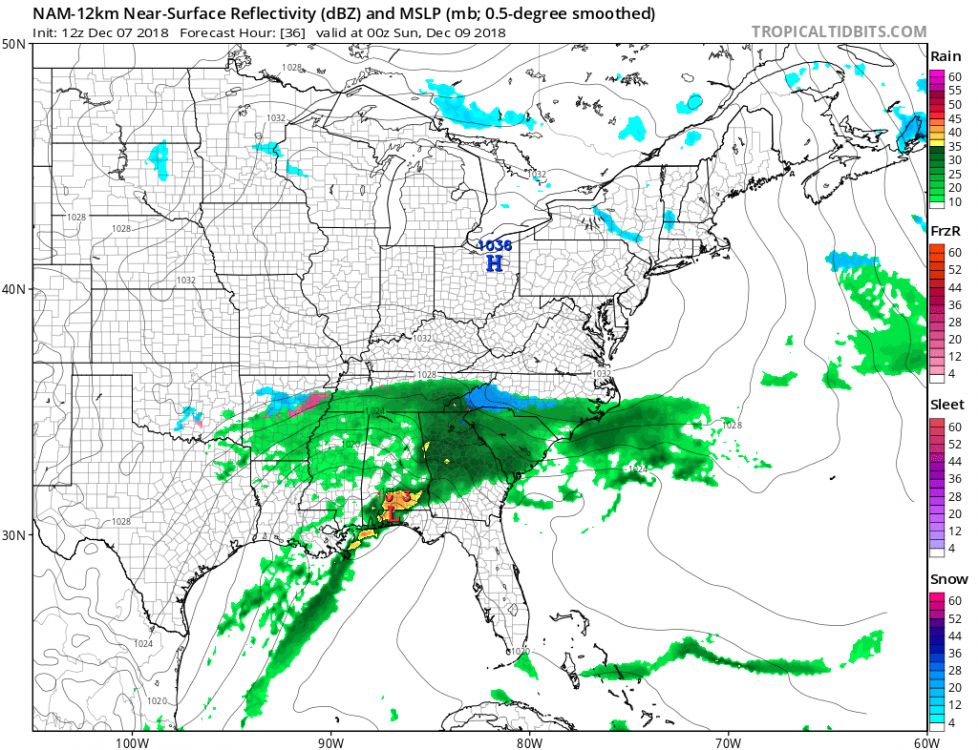
Pretty amazing wall the moisture is hitting on 12z nam
-
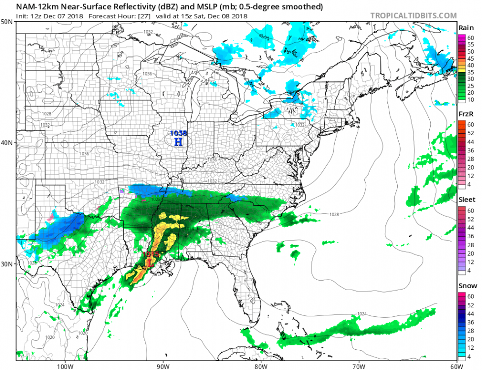
Looks a bit colder with 850s and DPs on the 12z NAM so far
-
I vote for field trips the snowiest places we can find. Being on the edge is always the most frustrating thing and Upstate, Clt, Rdu are always on the edge. Makes it so hard to enjoy snow(when it happens) because your always waiting for the shoe to drop.
-
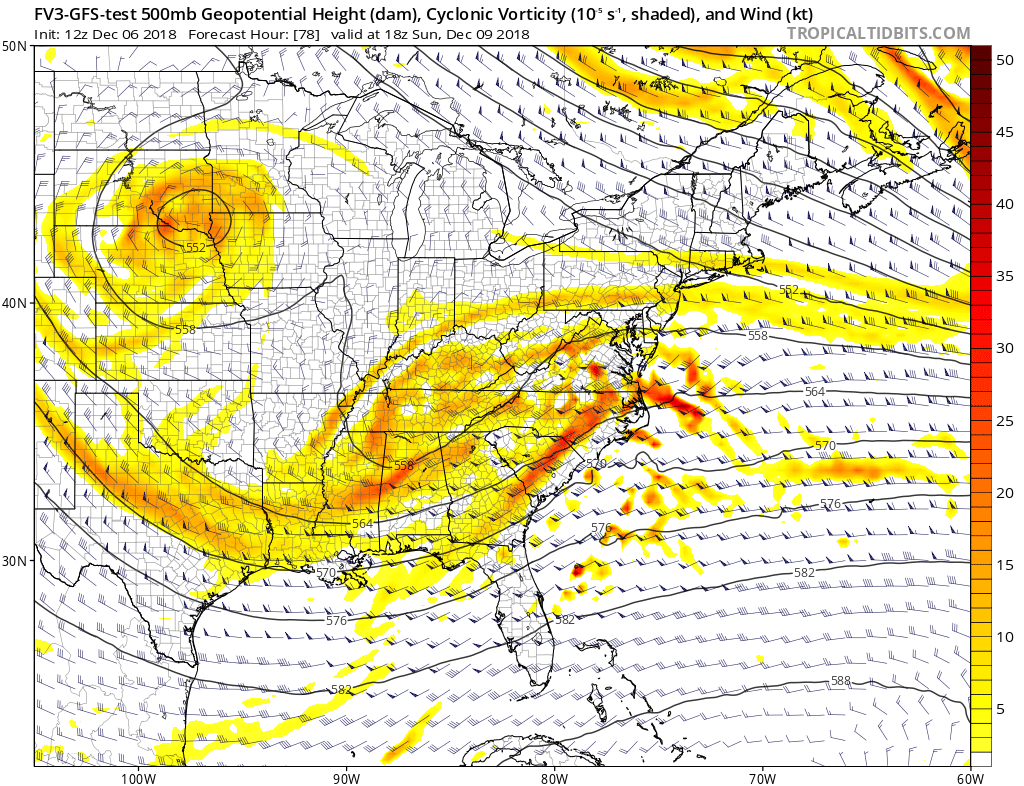
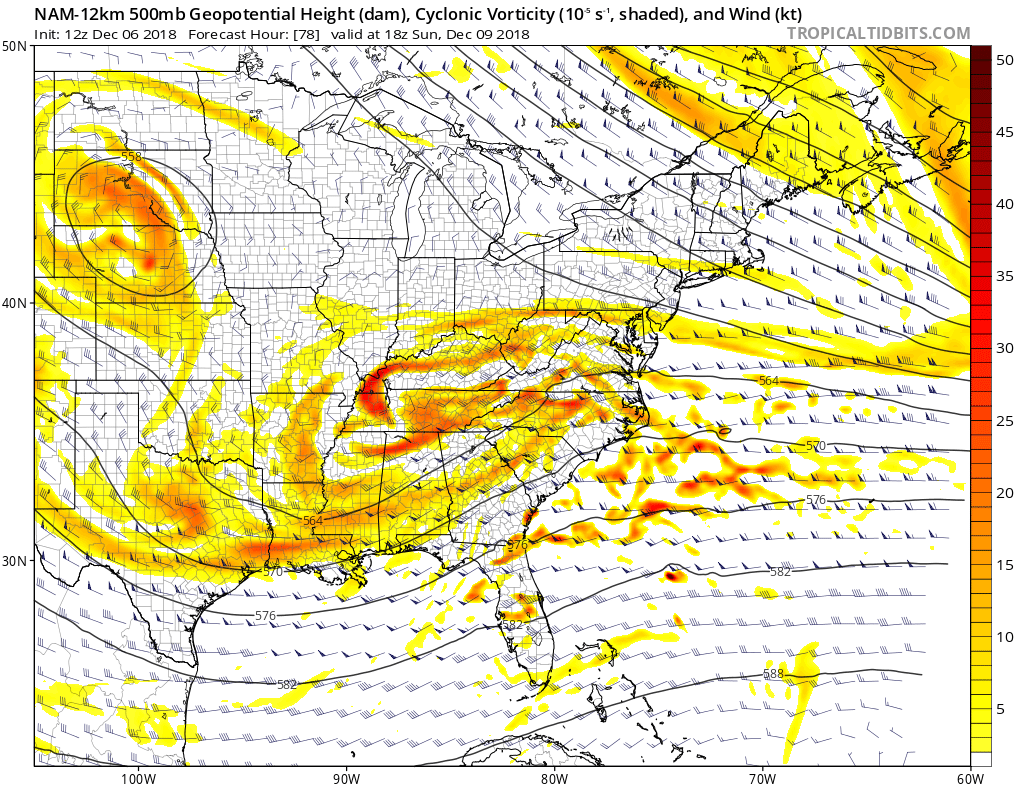
You can see the differences at 500 pretty well, between Nam and FV3. Temp profiles don't mean much when the setup is different.


-
The upstate is home to some of the biggest whiners in the SE. But everyone should know better at this point but still do not. Based on the SREF plumes the GFS won't be pretty either so this may become the main board. But maybe we need a sub board about whining about whiners.
-
Very long duration possible, bring your laptops home
-
Obviously caveats
-
We can say what we want about the models but the below GFS run was from a week ago. Pretty good all things considered.
-
Basically the models showing the weaker highs have more North movement still. So pretty much the same thing we have been tracking for the last week. I'll be watching the short range models more today to see how the high is developing out west.
-
Looks like the 6Z Navgem did as well
-
Been seeing a lot of members on ensembles for the last few days showing that swath out toward Greenville nc. I'm guessing an OP will show one sometime overnight or tomorrow.
-
Was up in the MA for that year, that was the first of three 18" plus storms that year. This is really setting up to be a great season for that area, especially when you consider the snow they had mid November.
-
from crankywxguy

-
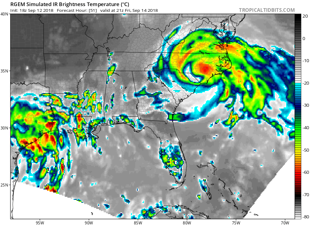
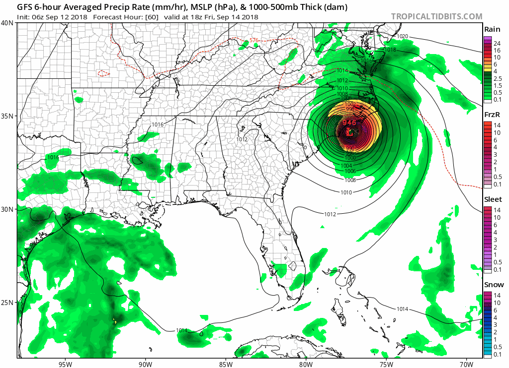
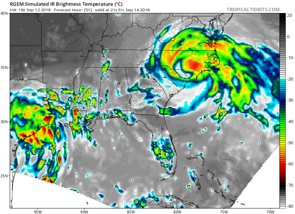
Lot of moisture, rainfall looks impressive on the north side of the storm

-
Seems like people are forgetting how big the storm is and after landfall much of the precipitation decouples from the circulation, usually traveling North...but either way impacts can be very far from the low pressure center.
-
Error at this range is around 50 miles...this a trend map FYI


.gif.6f7ae81a1ab444c621ea794a3399139c.gif)