

AMZ8990
-
Posts
1,167 -
Joined
-
Last visited
Content Type
Profiles
Blogs
Forums
American Weather
Media Demo
Store
Gallery
Posts posted by AMZ8990
-
-
6 hours ago, Holston_River_Rambler said:
@AMZ8990 is the 6z RGEM winner:

6z GFS seemed to take a really nice energy pass:
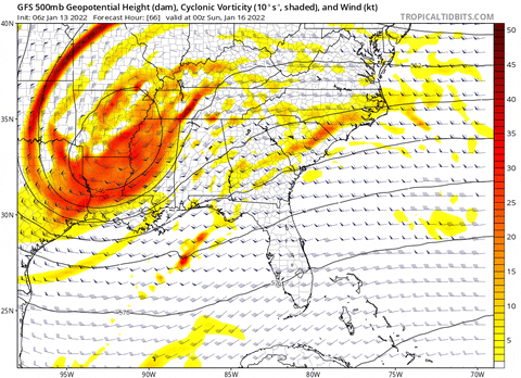
and we get a 999 low just south of Atlanta, but the 850 low still makes a run at the eastern valley. However, the 850 low has been trending SE the past 4 runs:
if we could get that 850 low to round the Apps, that would be nice. But as it stands this AM, on the GFS at least, that is ne Bueno for areas that would get downsloping from the Apps and be impacted by a piece of the low trying to slide up the eastern valley.
6z GEFS looks like it tries to have a few members be straight up Miller As, but the majority are still these Miller B messes:
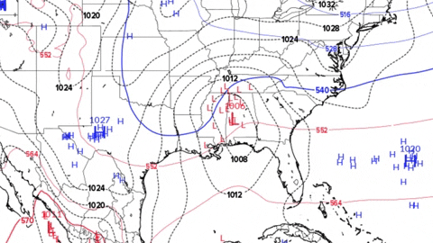
but like Tellico said last night, those members don't quite get the precip back over the Apps.
6z NAM looks like it is a little further south than the GFS, but still sends some energy up the valley.
Appreciate that, buddy!
-
 1
1
-
-
I Had thunder and lighting on Sunday at my house. Here recently that’s meant a lock for an incoming snow in the area. We will see if that holds true again this time, personally I think it will. And for the record, the Euro did outstanding with the last storm.
-
2
-
-
15 hours ago, Holston_River_Rambler said:
We need to try and squeeze out a thunder clap or two over the mts as this heads east tonight:
You know, just for fun....
Had it this morning on my way into work in Collierville, lots of lightning on a morning drive is always fun to see. Wouldn’t surprise me if some of you guys see the same later today. Rain is torrential also
-
3
-
-
Had some thunder and lighting this morning on my way into work in Collierville. Rain is coming down HEAVY now. It’s Gonna be a gully washer for a lot of people as this system moves across the state today.
-
1
-
-
21 minutes ago, Carvers Gap said:
System looks like it is moving faster than modeled. Which model actually lines up with the look of the storm right now?
For MBY seems like the euro did the best job sniffing out where the rain snow line would set up. Pretty impressive honestly
-
1
-
-
8 minutes ago, jaxjagman said:
Just started

I think your in a good spot, Jax.
-
8 minutes ago, jaxjagman said:
Still alot of precip in Ark

Modes act like they want to bulk that precipitation up once it crosses the Mississippi River too. Hopefully it continues to build like the models show and we can have more areas see some snowfall.
-
1
-
-
Just now, PowellVolz said:
That seems to line up with the GFS I believe
.Gfs was too far south with the snow line In southwest Tn. Had us in the 1-2 range. I’d bump the southern edge up 30miles north at the least
-
 1
1
-
-
6 minutes ago, PowellVolz said:
Jackson Tn

.25 miles south of Jackson and there is no snow at all. Cutoff line is steep as advertised. I hate situations like that
-
1
-
-
If Your In central Tn the radar looks really good for you guys. Just some light freezing rain so far on the southwest side of the state.
-
1
-
-
10 hours ago, John1122 said:
It's absolutely pouring here. We are going to have flooding with snow on it if we actually get the change over and get anything. After watching the MRX video, not sure if I actually get anything frozen or not really.
Roads are pretty hazardous this morning in hardeman county. Lots of ice patches and snow on the highways/ side roads. I’m surprised it stuck so well to the roads honestly
-
1
-
-
4 minutes ago, tnweathernut said:
Is this your back yard? If so, that’s AWESOME!! Congrats….
Front yard, and yeah man it is awesome! Definitely over achieved here
-
4
-
-
5 minutes ago, Carvers Gap said:
That is a score, man!!!
I agree brother, definitely makes for a great Sunday afternoon!
-
1
-
-
-
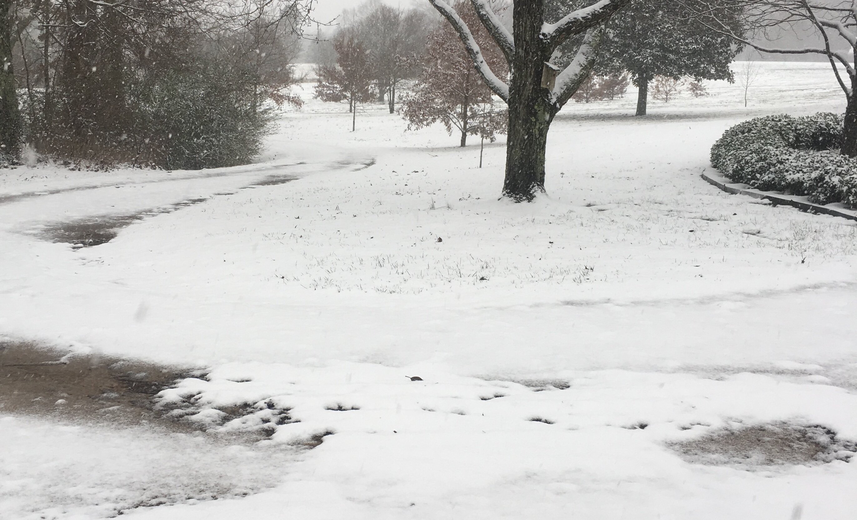
Large flakes coming down now in bolivar at a moderate rate. Looks like we will have a few hours of this.
-
3
-
 2
2
-
-
1 minute ago, Holston_River_Rambler said:
Although, the 15z HRRR upped amounts near @AMZ8990

Thanks Houston. Light to steady rain mixing in with some sleet right now in bolivar.
-
2
-
-
Memphis Int'l Airport officially reached 79° before the rain hit yesterday, tying the ALL-TIME January high temperature record, last set in 2002. It also breaks the daily record by 3°. And the next day snow is rolling through Memphis with temps in the low 30’s. Just short of a 50 degree swing in 24 hours, really Impressive stuff.
-
2
-
-
The wind chills on the back side of this system are pretty stout as you can tell by the map posted above.
-
-
8 minutes ago, TellicoWx said:
Good luck to you guys out west...basically nowcast time for yall. Alot of "surprise snow" and "did not expect this" tweets coming out of AR. Radar looks decent setting up between Memphis and Pine Bluff.
Fayetteville, Arkansas reporting anywhere from a dusting up to an inch around the city.
-
1
-
-
1 minute ago, TellicoWx said:
Lots of 1/2" to 1" pics coming out of AR in areas where no accum was forecast this morning
The Bands setting up in Arkansas look decent honestly, moving a tad slower than anticipated as well. We will see how they do as they move across the Mississippi River though, as that’s were stuff usually falls apart for us in west Tn.
-
2
-
-
8 minutes ago, Kasper said:

Glad to see you posting, Kasper!
-
2
-
-
Should have snow falling in west Tennessee around 10am-11am this morning. I’ll let you guys know how it performs on the west side of the state once it starts. Hope everyone can score a nice Snow today/tonight.
-
4
-
-
Seems like a good consensus among models right now for us to get possibly our coldest air of the year coming into play around the 7th/8th of January. Single digit lows across the state on the CMC for Saturday the 8th. Definitely a strong signal for cold showing up
-
4
-

Jan 16-17th Boom or Bust
in Tennessee Valley
Posted