

AMZ8990
-
Posts
1,167 -
Joined
-
Last visited
Content Type
Profiles
Blogs
Forums
American Weather
Media Demo
Store
Gallery
Posts posted by AMZ8990
-
-
9 minutes ago, John1122 said:
I think you guys may have a week of winter weather you talking about for years after this.
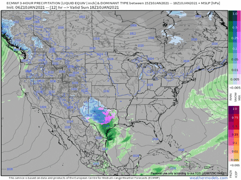
I hope so! Would be a once every 30 year type storm if it verifies. GFS
-
 2
2
-
-
Wind chill values may drop into the single digits along and north
of I-40 Friday morning and across much of the Mid-South Saturday
and Sunday mornings. Below zero wind chills are possible across
northern areas of the Mid-South Sunday morning.

Snow will be possible by early next week with accumulations
possible.
NWS Memphis already mentioning the Sunday thru Tuesday possible system in their hazardous weather outlook. They’re usually pretty bullish on these things so it’s somewhat note worth that they mention it.
-
1
-
-
10 minutes ago, Holston_River_Rambler said:
I think the 10km UKMET is going to be a sight to behold when it finishes its run out to hr 168, lol.
Here's how it looks at hr 120:

The magnitude of this is jaw dropping honestly. I realize it’s still a long way out but you don’t see scenarios like this on models everyday!
In regards to Holstons second post. The ice depiction is not something we’d want to see in this setup, the sheer duration of the event/events could lead to devastating outcomes if ice is involved.
-
47 minutes ago, John1122 said:
RGEM isn't backing off.

That would cause a lot of problems if it goes down as depicted here. Fingers crossed it doesn’t get that bad
-
14 minutes ago, Carvers Gap said:
Just now getting back in pocket. Couple of things:
1. Pattern looks REALLY good if you live in west and middle TN during the next 10 days.
2. The MJO for the EMON and EURO is a BIG improvement...let's hope we don't go with US modeling. If modeling trends towards the Euro, there are some big changes in store for modeling still yet to come.
I agree carver! Right now storm tracks are hammering the the dakotas, Nebraska, Iowa, northern Missouri, etc. it’s only a matter of time before that track moves south a bit, (hopefully). If and when it does, it could be a big time event for somewhere in our forum area. They were getting hammered day after day in Des Moines while I was up there, and central Missouri got pounded yesterday as I was on my way home, it was a very difficult drive to say the least. I say all that just to reiterate how much energy is flying around the lower 48 right now. Given the cold air in place to our north, we have a lot of variables in are favor to produce a good storm over the next 5-10 days.
-
4
-
-
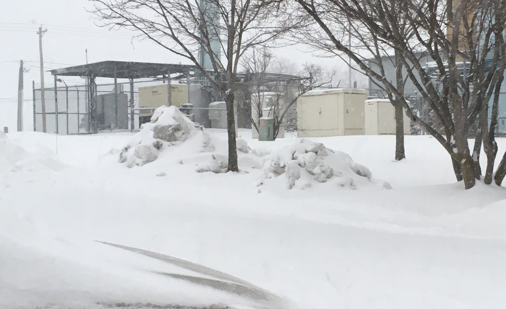
I’m still in Des Moines guys so I figured I would share a pic with y’all. Light snow most of the day today. Wind chill tonight is supposed to be around -30!!! Next 5-7 days are going be brutally cold as well, I’m gonna freeze my butt off!
-
14
-
-
9 hours ago, Carvers Gap said:
@AMZ8990, that right over your house?
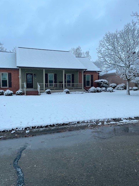
Almost, one county over to the east of the High would be my house.
-
3 hours ago, Carvers Gap said:
18z GFS is bringing the hammer to west TN with storm #2.
Lots of energy flying around the lower 48 that run. Pretty cool to see so many different systems modeled to come near or threw the forum. Gotta love all that potential!
-
1
-
 1
1
-
-
Had some lighting strikes in Hardeman county tonight, decent little cell pushed through around dinner. All rain now
-
7 hours ago, Daniel Boone said:
Got a Lt. dusting in JC. . Dusting at my home in Jonesville, Lee Co. VA but, just a couple miles north, 2 to 3" across Northern Lee as they got in somewhat on that south end of the large synoptic area that moved through KY. A shot from my home looking North . Stone Mtn. along Ky border snow covered.
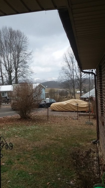
That’s an awesome view!
-
1
-
-
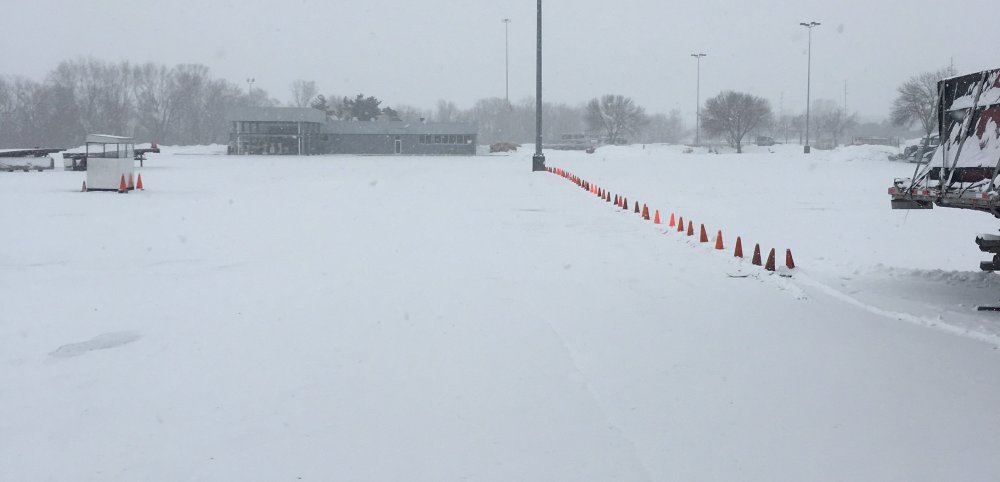
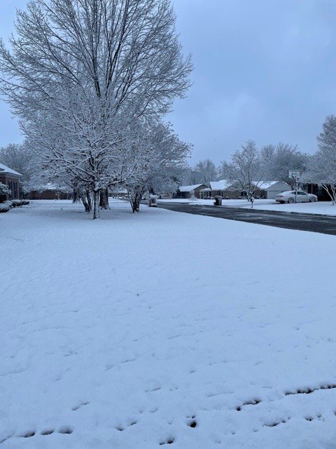
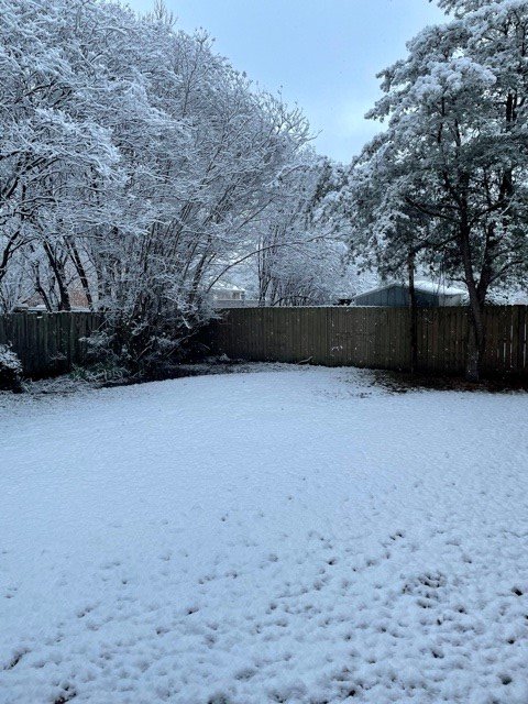
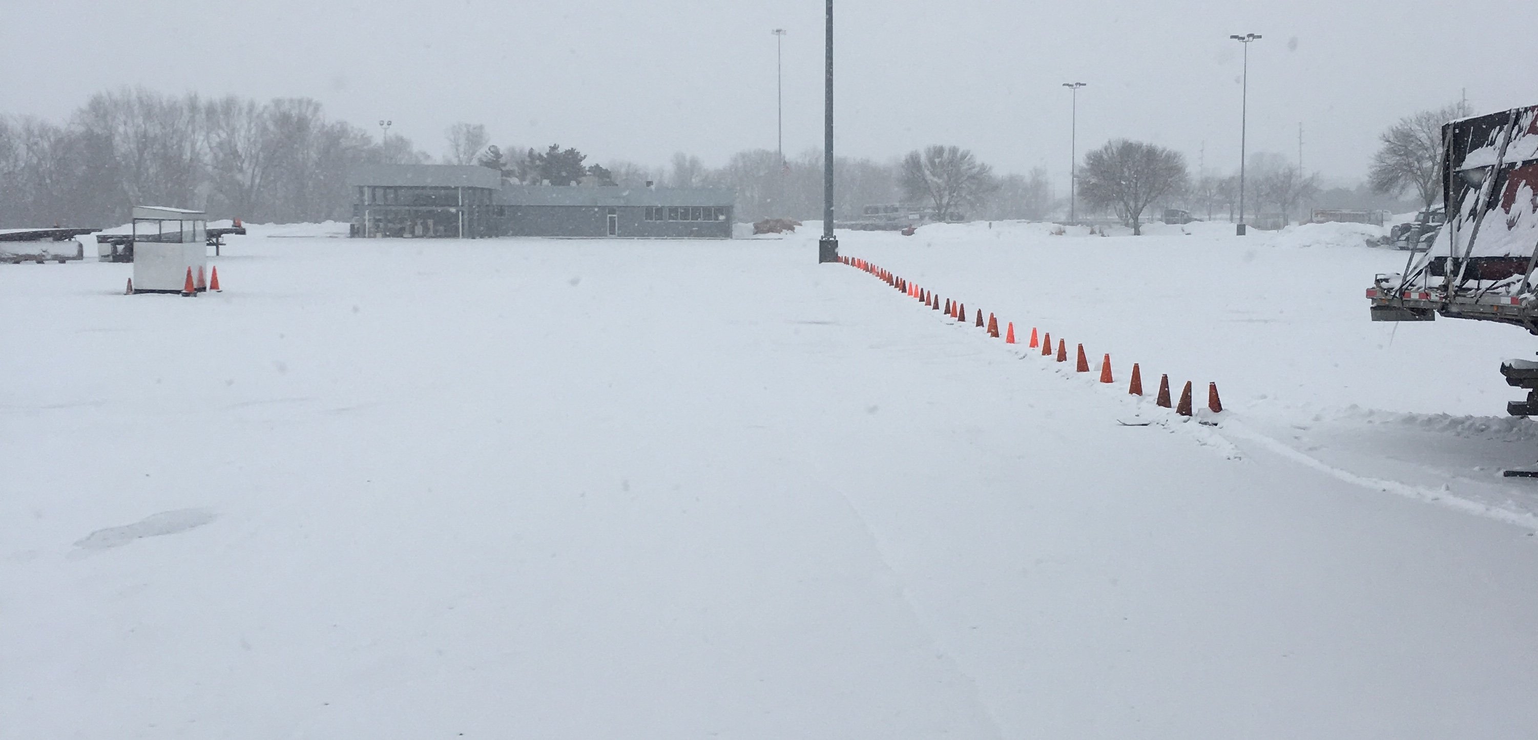
Picked up about 3 inches so far up here in Des Moines.
-
11
-
1
-
-
4 minutes ago, hawkeye_wx said:
Spotters in Lincoln, NE are about to go over a foot with heavy snow still parked over them.
2-3 on the ground in Des Moines atm.
-
1
-
-
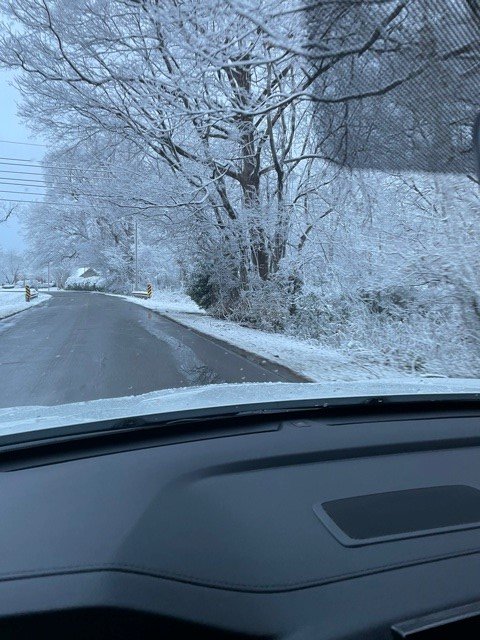
I’m heading up to Des Moines Iowa today for work guys, winter storm warning tomorrow in that area too. Calling for 8-12 inches, I’ll send you guys some pics if the storm pans out! I Hope the forum can score a storm or two while I’m gone!
-
7
-
-
2 hours ago, Holston_River_Rambler said:
I'm happy for the MA folks. It seems like they've had it worse than we have. Honestly nice to at least see some CAD patterns showing up. If they can break their drought, maybe it bodes well for others.
You NE TN and SW VA folks might get in on one of these too.
I agree. We complain about our back yard but those guys up north are actually in prime areas for snow and they’ve had a rougher go of it the last 2 years.
-
Wish i I was there
-
3
-
-
-
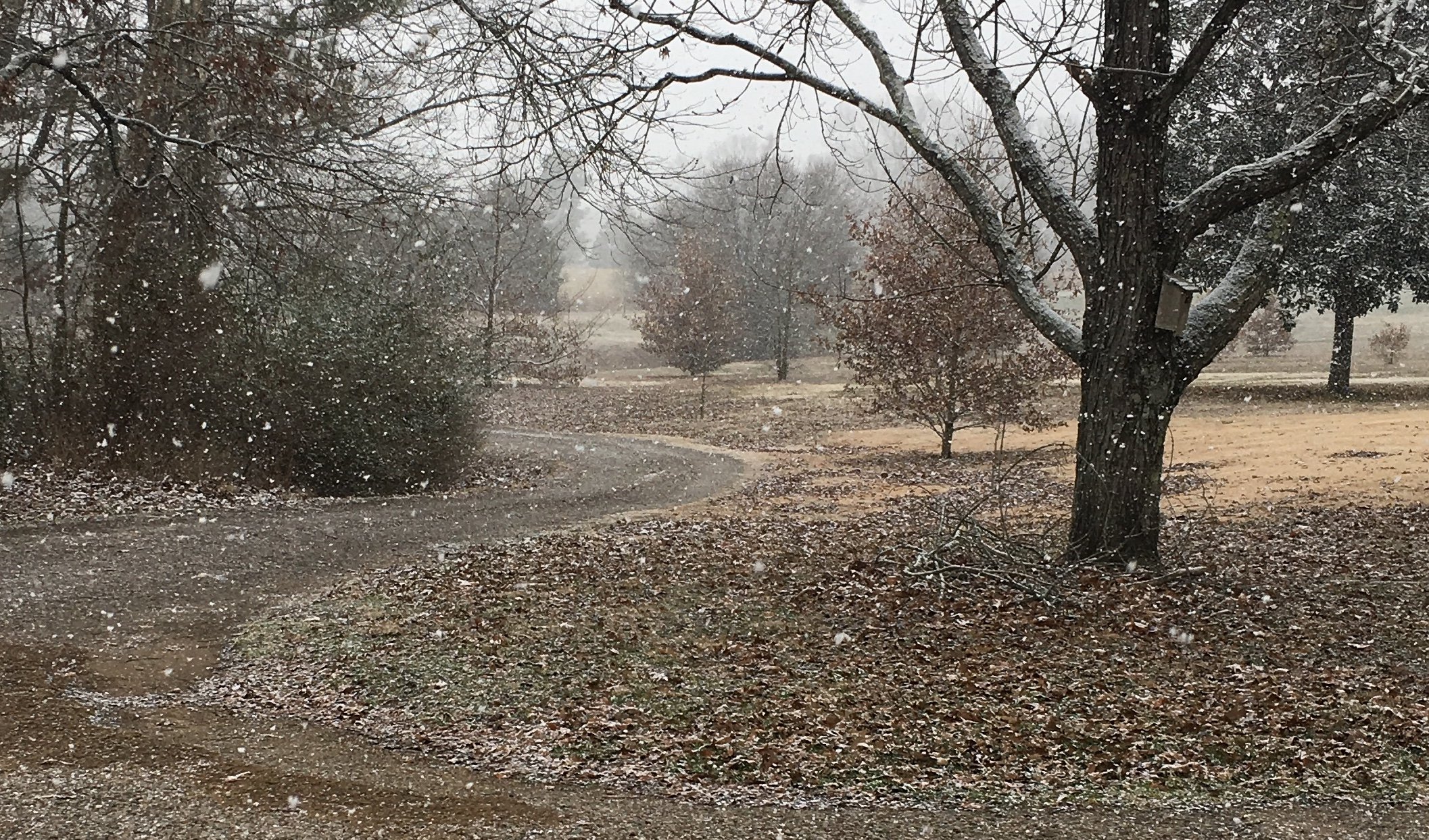
Nice band overhead right now, picking up some fatty flakes as a result!
-
4
-
-
42 minutes ago, PowellVolz said:
Was anyone else skeptical that a major storm would pull north out of the GOM and almost completely fall apart? I mean the computer mods can be as bad as our football program at times and you have to work hard to do that.
.
If it was rain you can guarantee it would of stayed together and dumped 3+ inches of rain on us all. Lmao. I’m afraid Mother Nature wasted a great opportunity with this one for our forum. That’s life though I guess
-
2
-
 2
2
-
-
30 minutes ago, david30 said:
Got a bit more here in NW MS than I was anticipating!
Wow!! That’s a nice surprise
-
1
-
-
13 minutes ago, Tobiewx said:
We have around a half inch here in north west Mississippi and still coming down pretty good.
I’ve got a good Dusting 40 miles north oF the Mississippi/Tennessee state line in Southwest TN.
-
5
-
-
1 hour ago, Holston_River_Rambler said:
6z Euro:

Good storm for Deep South folks, not expecting anything in MBY. I hope we can get more cold air in place before this storm track that’s embedded changes up on us.
-
40 minutes ago, Holston_River_Rambler said:
12 RGEM was a still about where it was overnight, but with a little more umph to it:

WRF-ArW looks pretty similar too in terms of storm track. Precip shield blossoms better as it moves north also. Take that with a huge grain of salt as it is the WRF though.
-
1
-
-
4 hours ago, John1122 said:
3k agrees, still snowing over west and even some of middle Tennessee at this point. It went for another 12 hours or so on the 12k.

Yeah, the NAM definitely likes this system right now. Good trends on their overnight models for north Ms and west TN. Saw where a winter storm watch is out in Shreveport LA, I’m sure it’s beem quite a while since that happened down there. NWS is creeping east north east with their watches and warnings so they must think what the models are showing has some credence
-
1
-
-
1 hour ago, John1122 said:
MRX event recap.
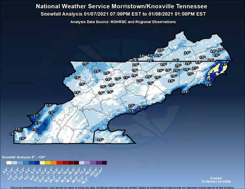
I wonder how @BlunderStorm did with this event

February/March 2021 - Frigid or Flop? Pattern/Longterm Forecast Thread.
in Tennessee Valley
Posted
Most definitely. Those are some down right frigid temps being depicted