

the_other_guy
-
Posts
2,920 -
Joined
-
Last visited
Content Type
Profiles
Blogs
Forums
American Weather
Media Demo
Store
Gallery
Posts posted by the_other_guy
-
-
56 minutes ago, SnoSki14 said:
On its face no December snowfall in a Nina is bad but we've seen a lot of things that we've never had before lately.
Maybe this could be the first time we see 30"+ after 0" in December in a Nina.
Depends what you are looking for to save winter.
Goose egg for Dec plus Sept thru Dec warmth doesnt lead to a good winter especially a Nina setup.
Does one 30 inch historic storm save winter? Like 2015
Or was 2015 a scary island of warmth, with almost no snow outside that storm? That 30 inches melted in one week…which was crazy.
-
10 minutes ago, RippleEffect said:
it's always 10 days from now!
Only in a bad pattern when you are desperately looking for a new pattern.
We had a very warm fall.
Nov eeked out a negative. That was with the new baseline and it was barely negative.
The latest guidance for the rest of December doesn’t look great. The fat lady hasn’t started singing yet but she’s warming up for December.
We have also gone into a very dry pattern…Which we haven’t had much of lately.
This isn’t how good winters start.
-
 3
3
-
-
Looks like another AN week ahead. Some days very much so.
Just a brutal month.
-
 1
1
-
-
Forsythia has buds on it…
-
1
-
 1
1
-
1
-
-
54F Beautiful. If you could lower the taxes it would be like living in the Carolinas. Still in shorts and a T.
I find it interesting that we’re not even in the warmest departures across the nation. I guess it could have been worse thus far.
Also of note, as I was flying over fly over country the past two days, There isn’t much snow anywhere… But if you’re going skiing in the Salt Lake City area Utah has been getting a good amount. That area and the eastern California are the only areas of snow cover observed
-
1
-
-
12 hours ago, Nibor said:
I'll be fine. I just don't wanna give it to anyone else. I know too many people who've lost family members.
Are you the guy from Astoria quoted on page 4 of the Daily News?
")
Feel better all kidding aside
-
You wonder how much longer skiing will be viable in the Catskills in this rapidly warming climate? Sad

-
2
-
-
1 hour ago, Nibor said:
I posted in banter but there’s still a fair amount of trees here in my neighborhood with leaves. Some have only recently started changing color.
youre living over a geothermal
-
4 hours ago, bluewave said:
Thursday and Friday will be our annual warm up within about 5 days of the solstice.
KEWR   GFSX MOS GUIDANCE  12/15/2021  1200 UTC
 FHR  24  36| 48  60| 72  84| 96 108|120 132|144 156|168 180|192
      THU 16| FRI 17| SAT 18| SUN 19| MON 20| TUE 21| WED 22|THU CLIMO
 N/X  46  62| 46  64| 40  44| 36  46| 25  39| 27  49| 32  45| 34 28 43
This is different. never cooled down. this year, the solstice will actually be the cool point in the month thus far.
-
1 minute ago, MJO812 said:
There is alot to be excited about.

Yes like the 15° swing from Westchester to Queens this morning. You could almost plant pansies for xmas
-
1
-
 1
1
-
-
10 minutes ago, Brian5671 said:
Fantasy land regardless of what it's showing....that's 10+ days out
Yeh. I dont get what is going on in this forum to be honest with you.
Long range guidance is iffy at best. Even if we want to take it for Gospel, the pattern depicted is marginal for larger storms.
I laugh when I read about clippers. Clippers are an Upper Midwest thing. They almost never produce for the NYC metro.
Only thing that is certain is that it is warm the next few days. Then it will cool down and still be AN.
Wash, rinse, repeat temp wise. December will end well above normal temperature wise… even with the new normal baeeline.
-
28F Below Freezing! Woohoo!
-
1
-
-
Beautiful weather out. No one is discussing it
50F Brilliant sunshine
-
Forget about eight days from now…beautifully warm out
55F
Busted every forecast for my area. Impressive to say the least
-
2
-
-
13 minutes ago, LibertyBell said:
a lot of people I've talked to aren't fazed by the mild December.
Isn't this how December always is now? Is what I'm getting
Then they go on to say that winter really begins in January, really January 20th (since we've gotten a lot of big snowstorms around that time.)
If you are waiting for winter on 1/20, you have a shit winter.
Plus, the last several years have featured 3 week shutout patterns…many of which occurred in January.
Even that frigid new years week a few years ago led to 2-3 weeks of AN
I think we need a really good pattern or we get nothing. It isnt as simple as winter start in later… Novembers have really been pretty good. unfortunately it’s a waste of November.
December has warmed dramatically
-
2
-
-
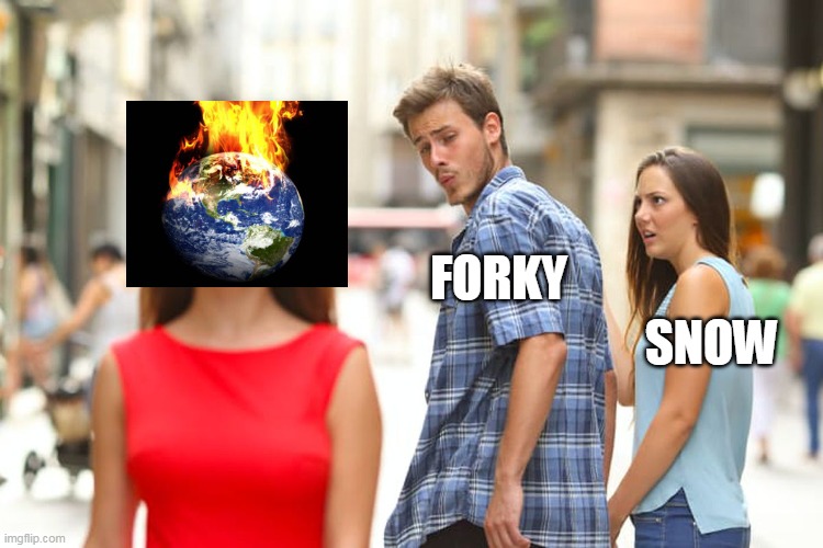
2 hours ago, forkyfork said:
the 90s outside of two great years were garbage
Quoting me again huh haha
The 80s were cold. 90s colder than this
You knew it was winter even with little snow
What we have now is a dying season
-
18 minutes ago, psv88 said:
Hahahahaha what a burn. Was going to come back to bite at some point
It’s stupid childish behavior.
The first instance I never said 2015 didn’t count… I said that because it was so high, it skewed the decade average and a median would show a better picture of decade wide trends.
Today I pointed out that we had a record week in December and this week isn’t going to be anywhere close to it despite posters yearning for a headline.
Both very valid points.
But you two guys pretend that you are in junior high school reading a Snaps books and throwing around emojis.
I don’t get burned or feel burned when I present factual information.
-
1
-
-
Here are the High Temps for NYC from this week in 2015
61 66 66 66 68 52 59
Lets cut the sensationalist garbage already.
It’s warm enough without the exaggerations needed.
-
2
-
-
sultry in Charleston this morning already 63F. Yesterday was downright cool and today its going to be hot on the east coast

-
57 minutes ago, CIK62 said:
Just for my information:
Does anyone know for what reason Fireworks are being shot off near the Statue of Liberty at 6:30pm for 2 minutes and again right now at 6:55pm.
I can see,hear and feel them here in CI, 9.5mi. away? Thanks.
Celebrate another mask mandate? Yea! Boom!
-
4
-
-
15 minutes ago, Nibor said:

-
2
-
-
17 minutes ago, bluewave said:
By that logic, the first week of December in 1976 wasn’t really the 2nd coldest on record at Newark. There was only one record cold day out of 7 when the low dropped to 9°. None of the other days had lows in the single digits. So you can see where your line of reasoning leads to.
You have issues when people try to engage you with a counterpoint
He makes valid points; so do you.
There is a new normal. He is saying, it’s not all that many days above normal. You are looking at the historical perspective of every week being in a top 10 because we are warmer now than 120 years of records prior to this point.
His counterpoint (not failed reasoning) is that running around like chicken little every year it is warm is bizarre when it is the new normal. We have another poster that keeps referencing old baselines vs the new baseline with “nowadays.”
It is good to have a historical perspective, but it is also fair to point out that the baseline as changed and the temps aren’t all that unusual. In a weather based forum vs a climate based forum, it is important to at least acknowledge what he is saying
-
4
-
-
25 minutes ago, MJO812 said:
What makes you think the whole month will be warm?
I’m not saying the whole month will be warm… I am saying that between now and the 21st it’s going to be above normal just about every day.
Unless it shoots up to 80 on the solstice, Any above normal reading around that day is gonna look like the next two weeks
-
49 minutes ago, LibertyBell said:
meh 60s and sunny is a lot better than 40s and rain, I say keep it warm until it can actually snow around here
Hey there are skiers on here and 40’s work better than 60s

December 2021
in New York City Metro
Posted
Running +5. Quite warm pattern. barring one off stuff, NYC doesnt get snow with +5
Edit: And correcting warmer we get closer. Nyc now closing in on 50 for xmas. A few days ago, it was near freezing