
LibertyBell
-
Posts
45,064 -
Joined
About LibertyBell

- Birthday September 15
Recent Profile Visitors
20,776 profile views


-
Many el ninos in this list but the only hot summer years were 1991 and 1993 and 2010 and 2011. 1991 was exceptionally hot even with an el nino.
-
You guys need to forget the forecasts and remember some rules about fall and by extension winter weather in the northeast. It won't be completely sunny unless a cold front comes through. If it's going to be mild or even warm it will most likely be cloudy. 80 is low hanging fruit for early October it can be 80 right now with cloudy skies. That said a few peaks of sunshine are definitely possible even when it's warm just dont expect wall to wall sunshine. But our usual fall pattern is mild or warm and cloudy/rainy and sunny and cool to cold. We'll have sunny and cool weather Saturday and again next week. But remember that mild or warm and cloudy/rainy and sunny and cool/cold pattern because that will repeat itself ad infinitum from now through the winter. Dont expect wall to wall sunshine until a cold front passes through.
-
If you remember that storm you know how much more historic it was, large parts of NYC and coastal new jersey were underwater I'd never seen such a thing before and not again until Sandy. I'd argue it was worse than Sandy because it lasted for three days and the precipitation was much more prolonged and much heavier. I wonder how I would have done in this storm at my current location. I know it would be all snow but how much? The snowicane was all snow here. The Octoblizzard was 20 inches of a very heavy wet snow here just before Halloween.
-

Strong Nor'Easter/Hybrid Storm Late September 2026
LibertyBell replied to Rjay's topic in New York City Metro
I corresponded with him on X and you can see our exchange there. The jist of it is this storm was more impactful in Suffolk County in terms of rainfall but in every other metric December 1992 far exceeded it (10.5 ft storm surge vs this storm only 3.5 ft). December 1992 had widespread hurricane force gusts from LGA (77) to Cape May (81). -
Note where the loop happened offshore that was the meat of the storm not the beginning part which was over land. This most recent much less intense storm retrograde right into central NJ which is why it would be rain in winter. You need a Benchmark track for snow at the coast. This was a hugger. Storm surge with December 1992 was 10.5 feet with this storm it was 3.5 feet.
-
2026-2027 Record-breaking El Nino
LibertyBell replied to Stormchaserchuck1's topic in Weather Forecasting and Discussion
In many ways the December 1992 storm was much more historic in coastal impacts. Parts of all 5 boroughs of New York City were underwater as was a large part of the Jersey Shore. It lasted for three days. Snow in NW NJ and NE PA of 10 to 20 inches but the real story was the 10.5 foot storm surge that almost matched Donna and was only exceeded by Sandy. But in some ways that historic storm even exceeded Sandy. People were trapped in office buildings (my dear dad being one of them, he was trapped on the 49th story of an office building when the power went out and had to walk down the stairs) and our entire fence was blown down. That has never happened since. By comparison this most recent noreaster only had a 3.5 foot surge. Area of 70+ mph gusts was also much larger with that storm the whole area from LGA (77) to Cape May (81) gusted over hurricane force. -
2026-2027 Record-breaking El Nino
LibertyBell replied to Stormchaserchuck1's topic in Weather Forecasting and Discussion
The summer of 1983 behaved like a la Nina though from June through September with the endless historic heat. I see the same thing for next summer. Same reason as 2015-16 with the Kara block added in? Did we have such a block in February 1983 too? -
2026-2027 Record-breaking El Nino
LibertyBell replied to Stormchaserchuck1's topic in Weather Forecasting and Discussion
Did you mean December 1992 Chris? That storm was far more historic than this one. Like 1983 it won't stop a historic hot summer for next year. Yes but 1983 had an exceptional endless hot summer from June through September so the el nino did not make the summer cooler. 1982-83 and 2015-16 had some similarities. If anything it would be less snow than 1997-98 as that late March event was a complete fluke and the airports got less snow. 2001-02 had even less snow. At the coast latitude doesn't really matter unless you're north of 42N you have the potential to be completely shut out of snow. Both 1982-83 and 2015-16 were far better for snow than 1997-98 was with much more late season blocking. In April 1983 JFK had their latest snowfall on record. -
Wednesday too 3 days 80 to 85. Two or three days Wednesday through Friday. No December 1992 stalled just to the east of Delaware for two days. Winds gusted to hurricane force with very heavy rain and temperatures fell into the upper 30s here. Heavy snow from Sparta NJ west and north. Over one foot of snow there and up to three feet in PA. On the third day the storm stalled again this time just south of Cape Cod and we all switched to snow and it snowed all day with temperatures just below freezing about an inch or two of snow. We had gusty winds for 5 days here in total. This storm made landfall on the NJ coast no way it would be snow in the winter. You need a track near Cape cod not to change over to rain in the coastal areas. Chris is this for average temperature over the entire year? Does the Lake Harmony temperature and coop record only go back to 2020?
-
Strong Nor'Easter/Hybrid Storm Late September 2026
LibertyBell replied to Rjay's topic in New York City Metro
Not historic but major If Noreasters were rated on a 5 point scale this would be a major a Cat 3. Both Sandy and December 1992 would rate a 5 that's historic. Yes a 3 of 5. December 1992 and Sandy would be 5 out of 5. Possibly but again not historic Except for a few months last year there was never a real drought. I'm not going to use inflated averages to justify a drought. Summers are normally drier. And once this awful el nino ends we'll return to our hotter and drier summers next year. That last part is incorrect. December 1992 was far more historic than this storm on every metric. I'd put this third far behind both Sandy and December 1992. If you go farther back, to 1960, add Donna 1960 and Ash Wednesday 1962 to that list. There were sharks in people's driveways! December 1992 had a longer period of gusty winds than either here. FIVE DAYS in total! Correct a 3 out of 5. Yes but not historic. -
It's long overstayed its welcome Naming storms just isn't an objective scientific process. We blame the weather channel for their silly naming scheme but the NHC can be criticized too. Plenty of storms in years like 2005 and 2020 that would not have been named in the 50s and 60s and prior years. I'm sure 1933 would have had a lot more. It's a lot like snowfall measuring. Oh and there was an intentionally not named hurricane during the Perfect Storm October 1991 and that December 1994 storm should have been named too. That one was far stronger than this one. I think Chris posted a video with Dr. Joe Sobel in it? It would have been all rain at the coast just like December 1992 was but much less impact than that historic storm. Stadium effect? I wonder if it behaved like the eye of a hurricane? Landfall location near Tom's River? Well now it's just tedious and boring. This thing has long overstayed its welcome and become tedious and boring. I can't wait until humans control the weather and kick these things out. Still got rain here, sometimes heavy. It's a hybrid. These kinds of storms don't belong in September they should not happen before late October. Tony from that satellite image it looks like the center crossed farther south between Atlantic City and Tom's River. So all snowfall, rainfall and temperature records from before 1999 are suspect? Well damn they were just saying how today's rainfall record is from Hurricane Gloria in 1985. 6 inches of rain in a storm that moved quickly and tracked further to the east than this one. What about temperature records from very cold winters like 1993-94 and very hot summers like 1980, 1983 1988, 1991, 1993, 1995, 1999? And those snowfall records from 1987 1988, 1993 1994 and 1996?
-
Yes the night they dropped to 39 was on my birthday =/ I'm still upset with that although it did warm up into the 70s here that day with clear blue skies and I saw two bald eagles that day. My low was 39.6. Some interesting years in that list. Both 1933 and 2002 are on the highest minimums list but both had historic winters. Meanwhile our TV mets keep insisting that the only months above normal this year were March and April. It's just the overnight low so no big deal. If the highs were in the mid 80s that would be a big deal. I wish this noreaster had waited until late October, thats a more appropriate time for it. Plus it can snow then. I uploaded the images to social media and then resaved them onto my phone it's the only way I know how to resize them on my phone I'll post more here . She slept in that flower bed overnight and woke up around noon wagged her tail at me and sauntered off. A late sleeper lol. Thanks Chris. Yes it's probably pretty close to MPO and Lake Harmony those other places are much lower in elevation. Temperatures seem to match too. Nearest moderate sized town with an airport is Lehighton 9.6 miles away but much lower in elevation. In July they hit 101 on back to back days just like Allentown did but I was around 93-94 similar to Mount Pocono although I'm halfway between Mount Pocono and Allentown. My more southerly location at high elevation is an advantage during strong el ninos this area got 30 inches during the January 2016 blockbuster in which both Allentown and JFK got over 30 inches. I-80 was the cut off point for the higher totals. Do you have a chart for local coops that measured snow during January 2016 maybe even Lake Harmony Chris? Thanks! PS I was mapping elevation on my property using an app called Gaia GPS. It's very useful it showed me two areas on my property where rain water pools because the elevation there is slightly less. According to the USGS maps I looked at the front of my property is around 1525 feet and the back is around 1535 feet but some smoothing must be involved . There are two markers on their maps one shows an elevation of 1507 feet right by the lake and another shows 1542 feet a ways behind my property. But my property has several dips and rises. GAIA GPS told me the elevation near my front door is the highest on the property at around 1575 feet while it's only 1505 feet at the bottom of my driveway near the wooden gate. I know for sure that my entire property is over 1500 feet though because the lake level itself is at 1495 feet.
.thumb.jpeg.aa39b892b2b36dc25acfc1e38e5d17d8.jpeg)
.thumb.jpeg.06f7cd828d795d127724f184c78f07e3.jpeg)
.thumb.jpeg.63e9f69f5ad516685b033c5fbca3d205.jpeg)
.thumb.jpeg.53b5bb8f7fb946cc3b76315b2b454441.jpeg)
-
Strong Nor'Easter/Hybrid Storm Late September 2026
LibertyBell replied to Rjay's topic in New York City Metro
51 mph gust at MPO elevation trumps coastal location. Almost an inch here. It's not been too bad though as the rain has been spread out over a long time. That 51mph gust surprised me though. -
Strong Nor'Easter/Hybrid Storm Late September 2026
LibertyBell replied to Rjay's topic in New York City Metro
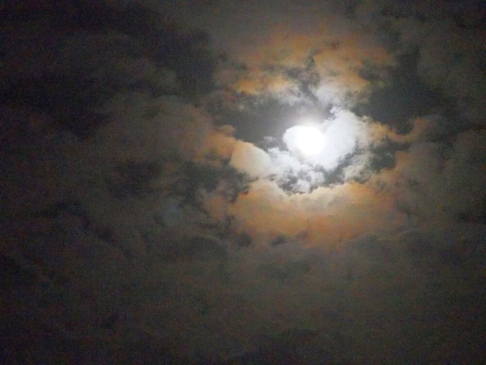
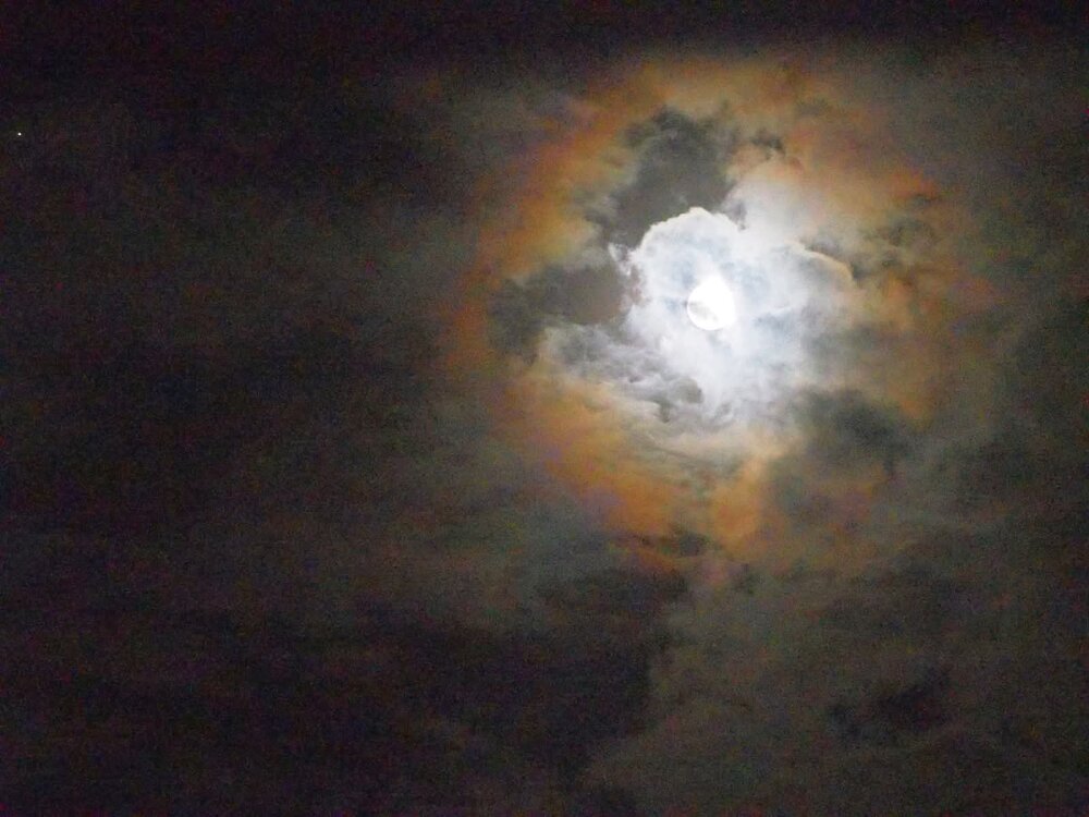
It gets even more interesting tomorrow is the Harvest Moon the best Full Moon of the entire year and one which often shows a rainbow halo and has the largest tides of the entire year. Tomorrow is also the date when the sunrise and sunset times are exactly 12 hours apart . Aside from the monk parakeets these skies and rainbows are what I miss most about Long Island . Yes if you like rainy noreasters . This would be rain even in the middle of winter aside from elevated areas. Like December 1994? Do you remember the noreaster with a hurricane like eye that backed into JFK airport with storm force winds in December 1994? We had mixed precipitation here in the Poconos with that. If it got to 10 feet that would be near historic. Aside from 1993-94 and 1995-96 the 90s were full of rainy noreasters just like this one. Yep lots of rain. Very difficult to get snow with this kind of track even in the middle of winter. December 1994? Expecting 40 plus mph winds up here. How can we rank these? I know it won't get to December 1992 levels that was a once in a lifetime noreaster. Is there a way to do a combination ranking both including and listing duration, rainfall totals, highest wind speeds, lowest pressure and surge? Yes I wasnt around for Donna but December 1992 was the worst I've ever seen here. It's not because it's a hybrid system it all has to do with the blocking high to the north. Like with all other kinds of storms it's always the High that determines the path a storm takes. -
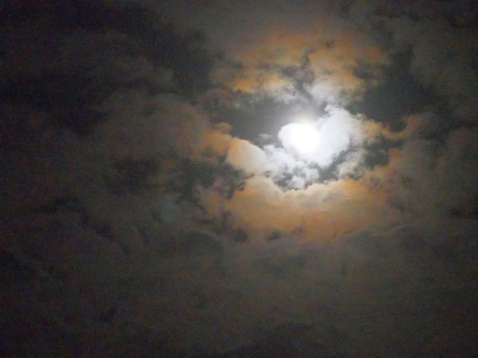
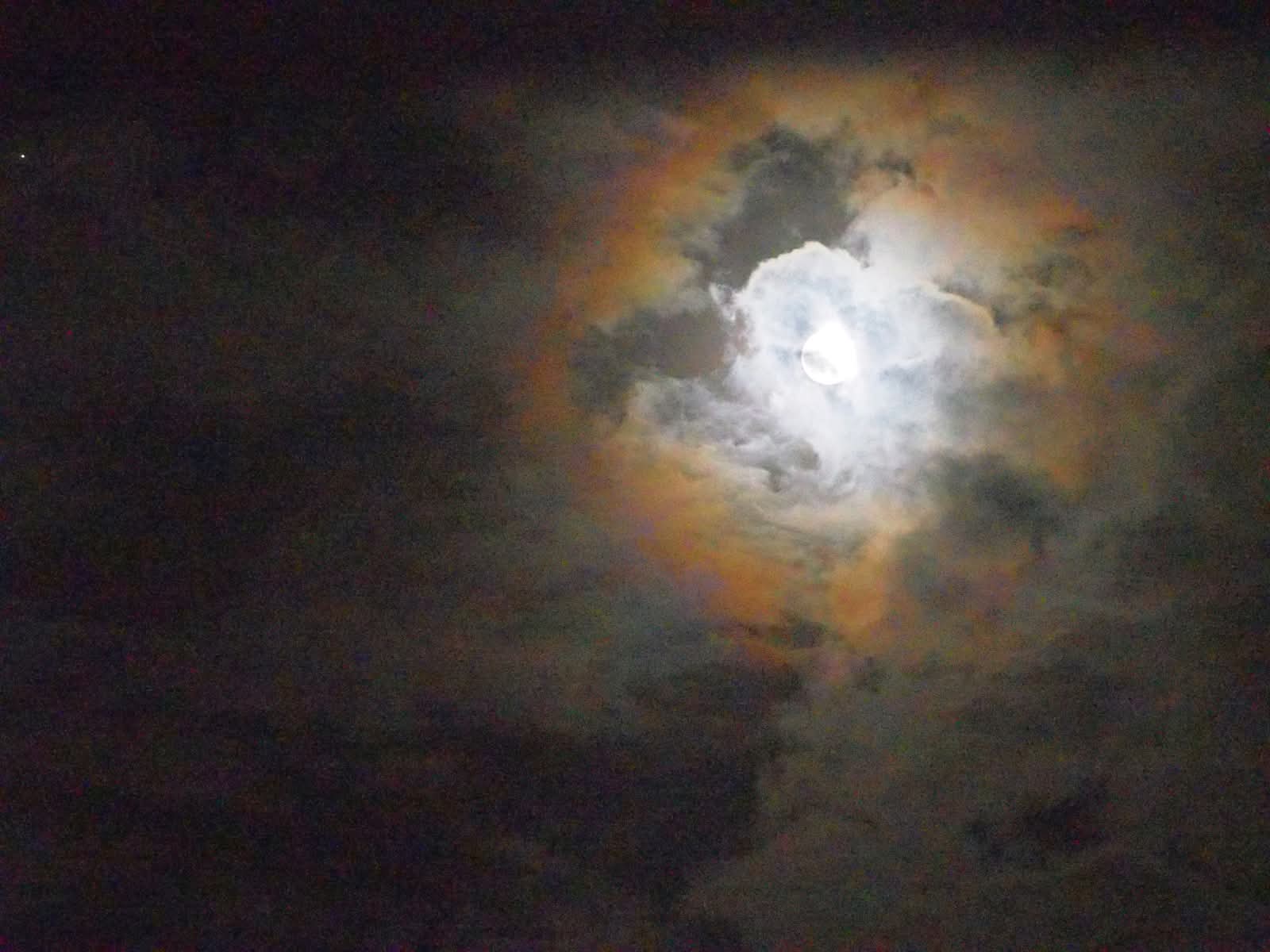
I unfortunately did not see this beautiful sunset or the rainbow out here, besides the monk parakeets those are the other two things I miss out here. This was the coldest morning so far this season here my sensors read 38.5, 39.2 and 39.6 all bunched together and all experienced a curious drop in temperatures between 7:30 and 7:40 am to the morning lows and started rising again after 8 am to the afternoon high of 69 degrees. I noticed that while Scranton also had a low of 38, that Mount Pocono only got down to 48, is that because it's northeast of here and had more clouds? Speaking of which dont miss the Harvest Moon tonight it's the best Full Moon of the year and produces the largest tides. It often seems to have a rainbow halo around it, which I saw last night around 1 am. Around 1 inch of rain is expected here beginning tomorrow afternoon and lasting into Monday with 40 mph winds. If this storm had happened in the winter it would have been a coastal rain event with perhaps snow out here.

.jpeg.82d462acacc640d89225cc3b7cb3cad5.jpeg)
.jpeg.2d992ed49a3ef3cac50000805e5eb4d9.jpeg)
.jpeg.bf9390c34dd647c6e5bd123cc11ef700.jpeg)
.jpeg.451c7b9213750381234a82c3861a9a8f.jpeg)