
CoalCityWxMan
-
Posts
677 -
Joined
-
Last visited
Content Type
Profiles
Blogs
Forums
American Weather
Media Demo
Store
Gallery
Posts posted by CoalCityWxMan
-
-
1 minute ago, Chicago Storm said:
18z Euro...

Mind sharing a snow map?

-
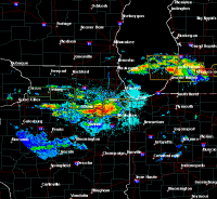
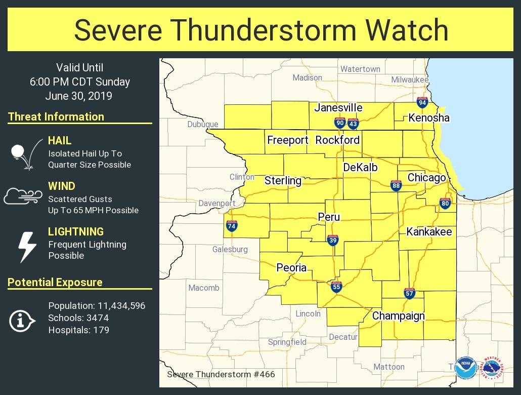
Tor warning in N IL west of Rochelle. Seems like it’s trying to latch on the boundary
-
87/81 at 9:50 AM. Not ideal
-
IKK just gusted to 57mph under one of those cells
-
There we go

-
3 minutes ago, Indystorm said:
And I'm wondering if SPC is leaning heavily upon it because they don't currently anticipate a new watch to the se. I would be watching the instability gradient.
Quite a significant one at that

-
 1
1
-
-
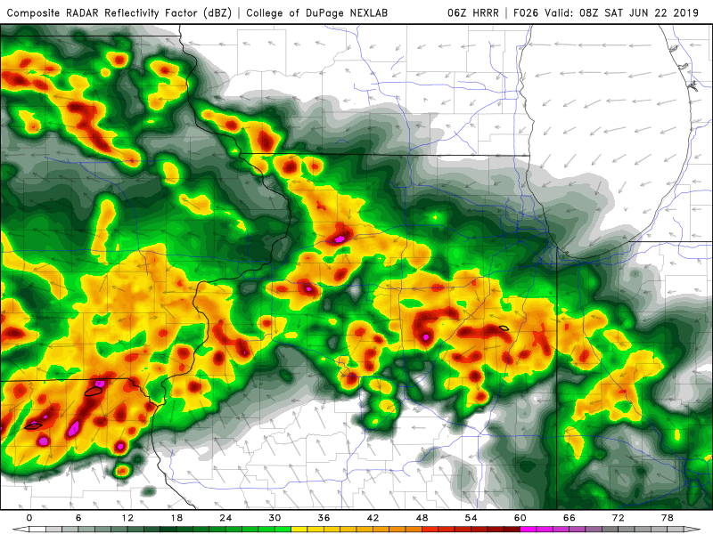
The hrrr doesn’t have a clue. Completely dissipates the mcs in Wisconsin in the next hour
-
Slight risk extended further south with new update
-
This would be a problem..
-
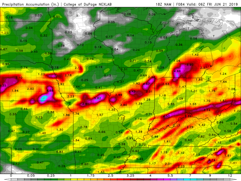
1 hour ago, janetjanet998 said:
DVN just issued a flood watch for SE portions..I suspect ILX will expand more north to inlcude me and LOT will isssue south of I-80
just like a winter system..
.but instead of inches of snow inches of rain
edit: ILX did expand watch a row of counties north but not Peoria yet
Does feel like kind of a winter-type system. The hrrr & other hi-res models have been consistently hinting at widespread 1-2”+ amounts with isolated significant amounts across much of IL south of I-80, could be the type of event where some areas get slammed
-
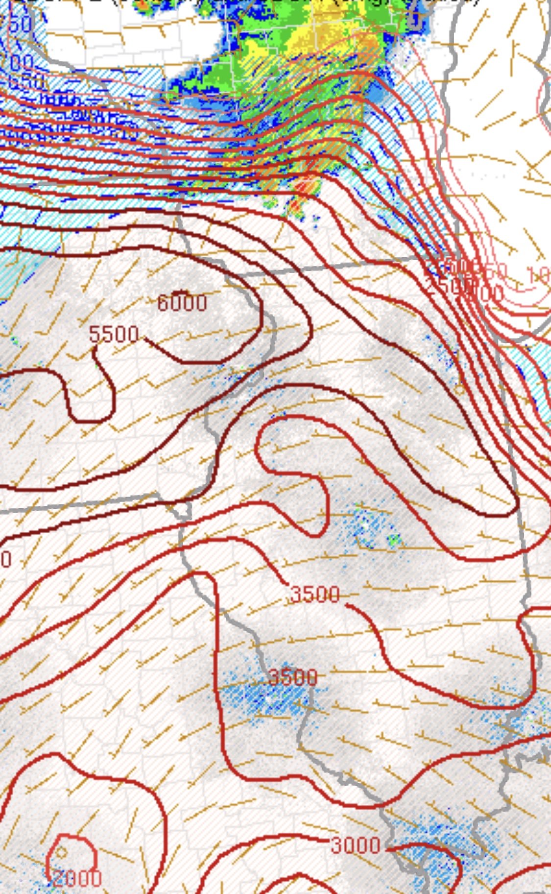
18z NAM portrays the narrow deformation band potential.
-
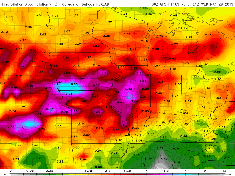
7 minutes ago, Hoosier said:
So about that Wednesday system.
Could be interesting, if that defo-band of rain ends up forming on the NW flank of the system some models have been hinting at could see there being some fairly significant rain
-
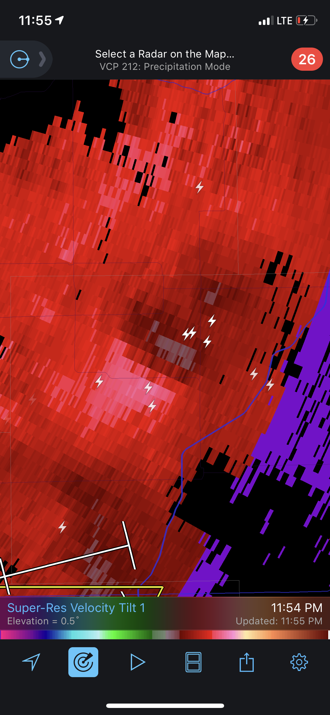
1 minute ago, Hoosier said:
Definitely some broad rotation in that cell.
Warning does mention possible tornado
-
That cluster that just blew up near the Quad Cities looks like it *could* grow upscale into some sort of MCS as time passes
-
Storm with a pretty healthy hail core moving into the center of the metro
-
3 minutes ago, janetjanet998 said:
12z GFS still very wet later next week with that cut off low ejecting out and sucking up huge amounts of tropical moisture
also poorly modeled heavy warm core rains often fall on the North and NW flanks..sort of like a TROWAL .and it is expected to almost stall
Seems like these sorts of scenarios give this region its heaviest rains, could be bad if it plays out as modeled.
-
1 minute ago, janetjanet998 said:
need to watch the cell over NE IL too..looking better and almost surface based I think
edit: now T-storm warned
Yeah it does. Will be over populated areas for the rest of its lifespan, will have to watch it closely
-
Buckle up, today could be interesting
-
1
-
-
Yikes. Hope everyone in Iowa city is taking cover.
-
Just now, King James said:
Sun just came out near IKK. Wife called me to bring a hair tie to dinner because it’s getting humid. Definitely a change the last hour
Yup, highest dews of the year so far. Feels kinda nice. Has that “juicy” feel to it where this morning it felt chilly.
-
1
-
-
nervous for Lewistown.
-
52 minutes ago, Hoosier said:
Radar isn't much to look at but it has gotten surprisingly gusty in the showers currently moving through.
There are some weird mini meso low type things that have been embedded in this complex, paying close attention to radar features/velocity. Have had 2 of such features pass through here tonight, measured a gust to 56 just about 20 minutes ago. This is what the one that came through earlier looked like on velocity.

-
2 hours ago, King James said:
I feel like things are already getting ugly. Just heard on the radio only 24% of IL corn crop is in (typically 98% is in) and only 9% of soy
You’re right, atleast half the fields around here haven’t been touched since harvest last year, and things are even worse elsewhere in the Midwest. I honestly don’t know what farmers are going to do
-
Just in the next week. Things might start getting ugly
Here comes winter -- October 28-November 1 Snowstorm Potential
in Lakes/Ohio Valley
Posted
Mother of god...if only.