
Mrwolf1972
-
Posts
936 -
Joined
-
Last visited
Content Type
Profiles
Blogs
Forums
American Weather
Media Demo
Store
Gallery
Everything posted by Mrwolf1972
-

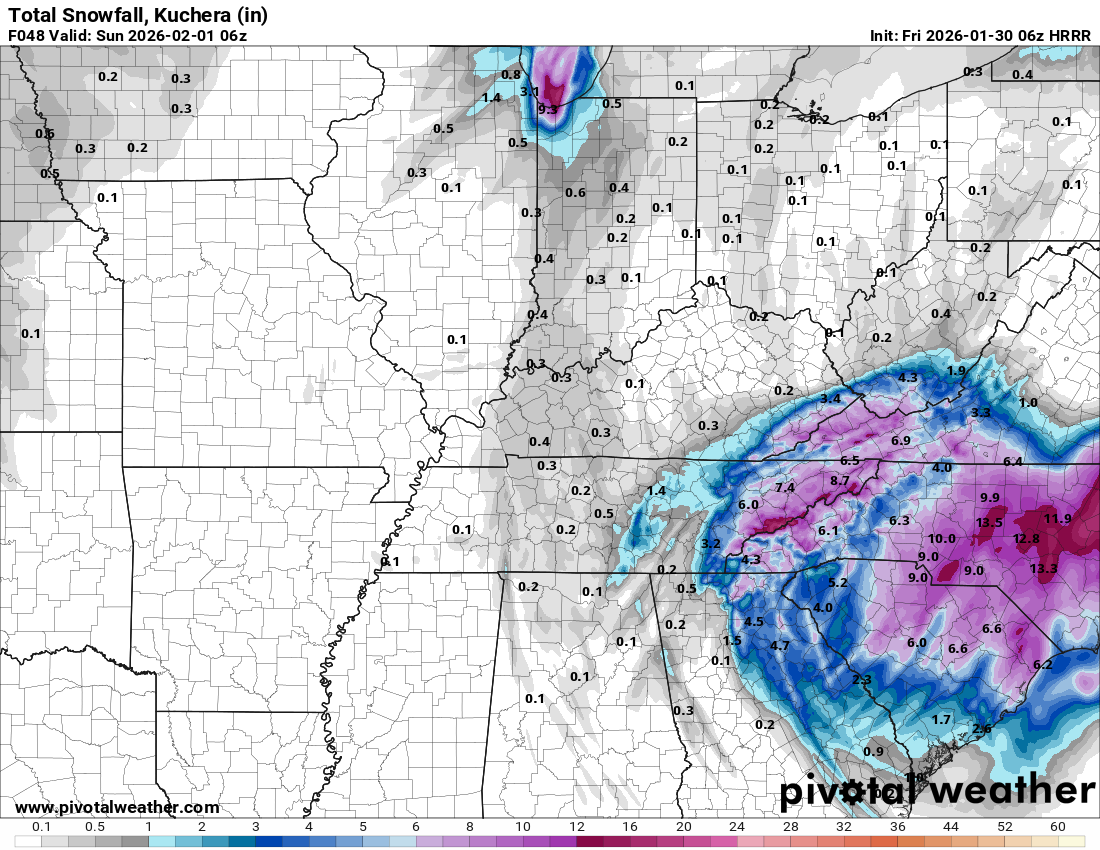
Jan 30th-February 1st 2026 Arctic Blast/ULL Snow OBS Thread.
Mrwolf1972 replied to John1122's topic in Tennessee Valley
This storm is slower to build for such a big event they have been calling for. -
Jan 30th-February 1st 2026 Arctic Blast/ULL Snow OBS Thread.
Mrwolf1972 replied to John1122's topic in Tennessee Valley
Patiently waiting for the backfill -
Jan 30th-February 1st 2026 Arctic Blast/ULL Snow OBS Thread.
Mrwolf1972 replied to John1122's topic in Tennessee Valley
Snow in south east loudon 30 degrees my weather app just jumped to 4-6 inches was 2-4 -
But top is nam 06 and bottom is nam 3k 06 see the difference
.thumb.png.2a456ad71fc0be9e1e65b34ec040ac72.png)
.thumb.png.6190443fd6a5ab54679632ca3af58b51.png)
-
It was early in model run thats why I edited my post
-
So if the model says 3 or 4 we double that possibly right since its a dry snow?
-
Hrr 06

-
Nam 06 only hitting knox north Edit looks better on 3k
-
Loudon added to wsw 2-4 inches
- 782 replies
-
- 1
-

-
- extreme cold
- snow
- (and 1 more)
-
18z nam
.thumb.png.cf75683341dd6766b0c5ce88d9f56b29.png)
-
29 and freezing rain now
-
29 and sleet in loudon
-
This storm looks nothing like the models we have been watching or am I not seeing something
- 618 replies
-
- 1
-
-
- observations
- obs thread
- (and 1 more)
-
So we are waiting on what's back out west before we get anything measurable in loudon
- 618 replies
-
- 1
-
-
- observations
- obs thread
- (and 1 more)
-
Barley anything in loudon holding at 29 seems like it comes close then falls apart any ideas why.
-
Yes
.thumb.png.646aaa20456922ae768aff22e2432a19.png)
-
Hrr at 24 just put lp in middle tn
-
What happens if it goes up NC side will it change much
-
Loudon and knox County bullseye for ice
.thumb.png.e3d71b05fb59fd138491a23d5803a7c3.png)
-
Hrr is holding the temps at 31 a long time for cental valley
-
Supposed to have like 3 inches of rain high winds wont dry that up quickly the temps are gonna drop quickly too.
-
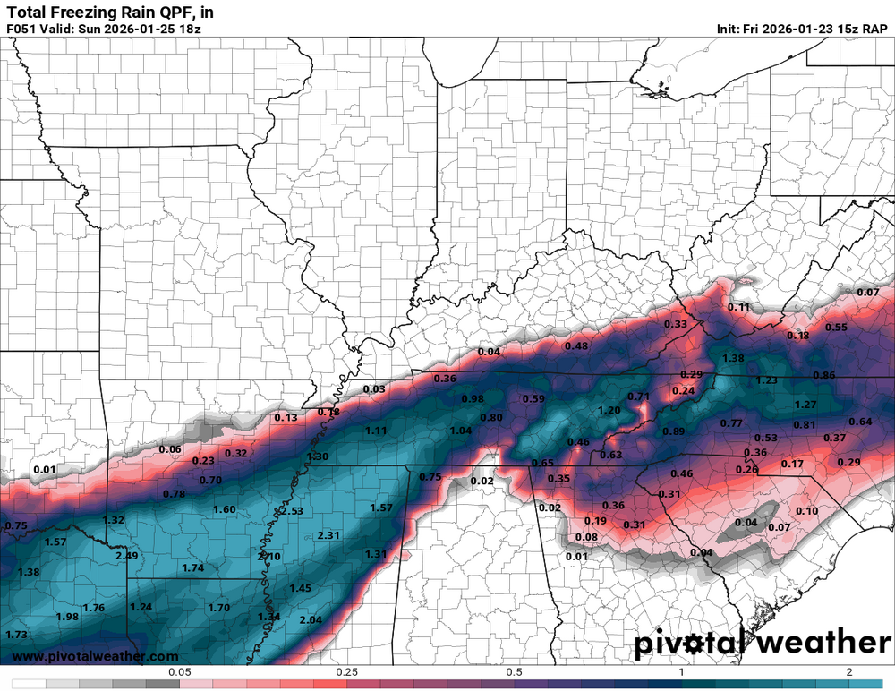
High res models are high on freezing rain totals half to 3/4
-
Over inch ice
-
How reliable is the RAP
.png.fa791c28b2952ea2f64fed882fa18295.png)
.png.adf831ef692a6ea484c0c48477178be9.png)
.png.cb1304cdfe4c0196a1651fc6a93ad6b1.png)
.png.82d780cced8e32aa8a777bfbe20f1383.png)

.png.711d2a9f8ec5863f4db60fdf00a884b1.png)
