
LaGrangewx
-
Posts
399 -
Joined
-
Last visited
Content Type
Profiles
Blogs
Forums
American Weather
Media Demo
Store
Gallery
Posts posted by LaGrangewx
-
-
55 minutes ago, ORH_wxman said:
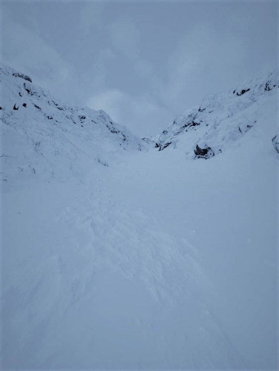
Agree with Scooter on the wind at Cannon. It is awful there...every single time I’ve been in that peak it’s brutal. The terrain is amazing but the wind definitely has a detrimental effect on coverage.
I think that’s part of their snowfall issues too. Like look at MWN. There’s a zero percent chance they average “only” 260” of snow if we could theoretically catch all the snow that falls there. But we can’t and it blows off into the ravines. Cannon isn’t the best snow spot anyway, but likely a higher percentage of their snowfall just gets nuked off the mountain face by wind than other mountains...and that mountain face is so exposed too where the trails are. Not many sheltered spots for it to collect.
Was wondering what makes Cannon not great for snowfall? Shadowing to the east? Looks like they could get decent Nw upslope though
-
6 minutes ago, jculligan said:
This can obviously vary from one year to the next, but in a "typical" year I find that the best skiing on Mount Washington tends to line up around April 1st. That seems to be the time when you can maximize your potential for a top-to-bottom run from the summit down to Pinkham Notch. However...there have certainly been years (the last two in particular) when early April has featured conditions more representative of mid winter...which means you need to have avalanche education/tools OR be willing to deal with heavily scoured/icy conditions that don't soften up over the course of the day. If you wait until the mid April timeframe, the snowpack tends to become more isothermal (lower avalanche risk) and the skiing can be quite good in the ravine...but you start to run the risk of the Sherburne Trail melting out, which requires a bit of a hike to get back to the car.
So I guess it all depends on exactly what you are looking for. If you're just looking to ski the ravine but you're ok with the possibility of hiking the last 1-2 miles back to Pinkham...anytime from mid April to early May is probably when you'd want to target. But for a full summit-to-Pinkham run, April 1st to April 15th is what I would recommend.
Awesome really appreciate the detail. Main goal would be to ski a safer and softer Ravine so will probably aim for that mid to late April time frame. I’ll keep an eye on the avalanche website and any detailed trip reports on the forum.
-
12 minutes ago, backedgeapproaching said:
Just was curious and went back to look at those March 2018 storms. Woodford reported 100" on the nose in 13-14 days..lol. So 5-6ft OTG certainly seems right in line with compaction.
Yup I believe they had a few small events in between the big ones as well. Crazy stretch. I remember a picture I saw and found it again on twitter just now. Apparently it was near Stratton around that time. I don’t know if it was on the backside where I drove through or potentially on the opposite side of the mountain on that 2600’ ridge that’s been discussed in here. Either way that picture looks like it could fool me if someone said it was Mammoth Lakes.
-
 1
1
-
-
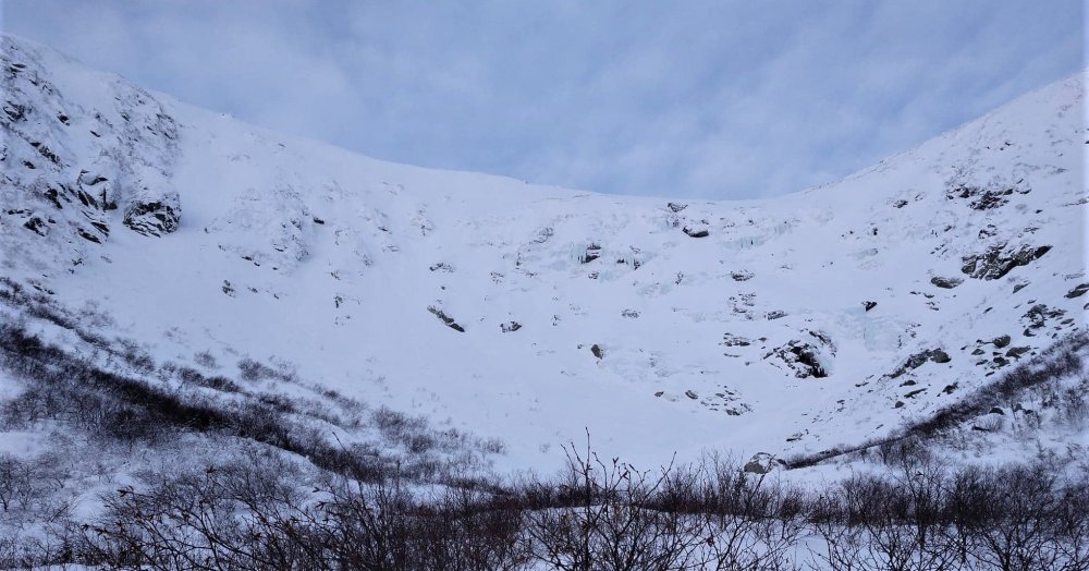
7 minutes ago, jculligan said:
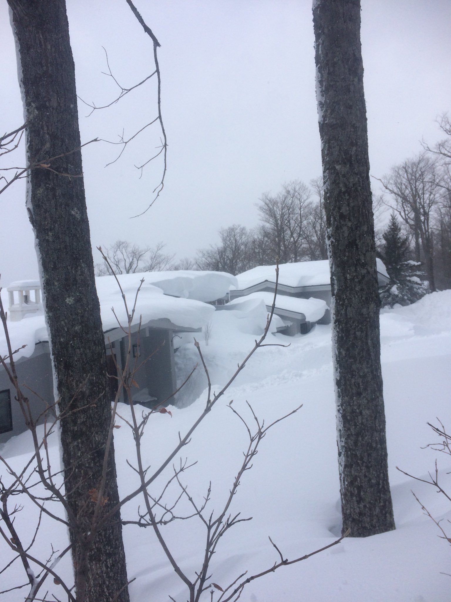
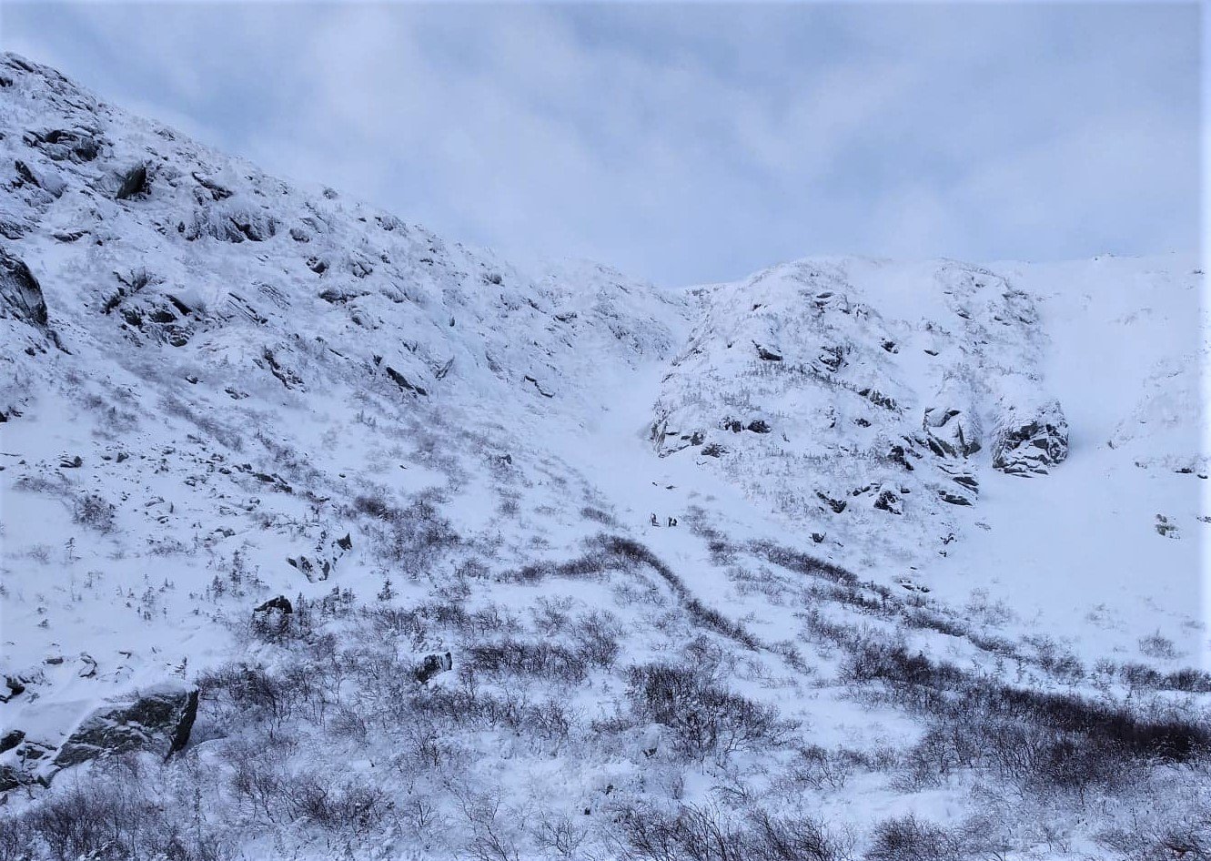
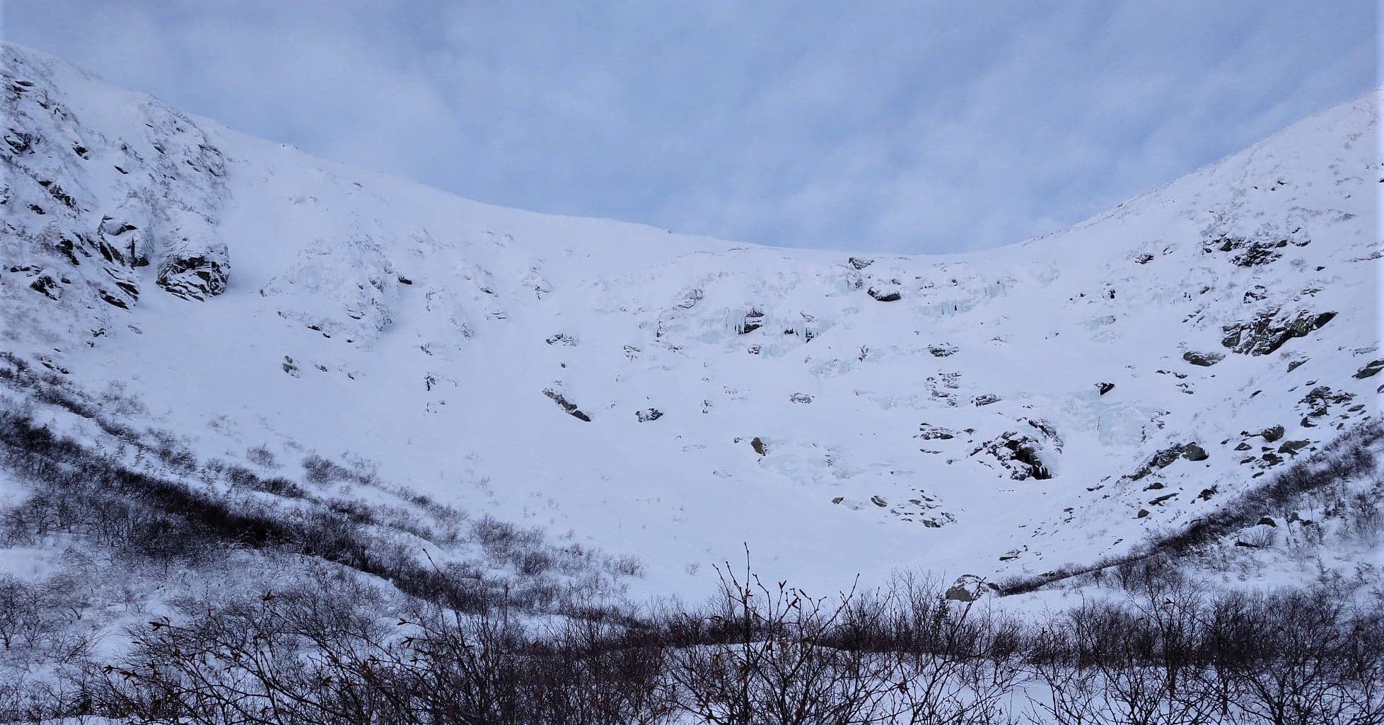
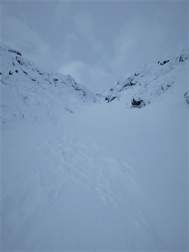
Tagged my first big mountain objective today. Skinned from Pinkham Notch to the floor of Tuckerman Ravine, then booted up Left Gully...which is an east-facing couloir on the west side of the ravine. Things are rapidly filling in, and I was able to ski in/ski out without having to carry the skis once. Considering the lean start to the year, Left Gully skied exceptionally well with only a few scoured sections higher up as is typically the case. Interestingly enough...I have never waited so long to ski the Sherburne Trail before, but this is the earliest I have ever skied the ravine.

Wow. You have some incredible pics from the last few days. I was planning on making my first trip to Tuckerman this spring with a couple buddies. Was planning on left gully as well from what I have read. I was wondering when you would recommend the ideal spring conditions would be? Mid to late April? I guess I’m wondering if there is a time, where the most stable snowpack in the Ravine lines up with full coverage of the Sherburne Trail to the bottom.
-
27.1 inch depth reported at Lake Colden ~2800ft as of 2 days ago in the ADK High Peaks. Pretty impressive and on par with Hermit Lake on Mount Washington even though its 1000' lower. Widespread ~15-20+" depths basically across entire ADK now. They look like they will be cashing in well with upslope/lake effect the next 2 days as well. I know Whiteface had 6+ fluff yesterday caught a lake streamer I think. Had a friend there who said it was great. They were in pretty bad shape just a week ago.
-
10 minutes ago, jculligan said:
Definitely need another synoptic event south of Crawford and Pinkham Notches. We managed a half inch imby this morning, but for the most part we still have the death crust leftover from last weekend with a little dust on top of it here in Jackson. The Doublehead ski trail behind my house is not very enjoyable at the moment, and this area just doesn't get the upslope. Amazing what a different world it is just 20 minutes north right now.
Was looking at the MW avalanche site. The manual Obs site from Hermit lake Now has a 37 inch depth. That’s pretty sweet hopefully it keeps shooting up. I think the snotel says it’s at 3750 a little bit down the trail and has about 31-32”. Awesome pics looked like a great tour. As of Monday Chimney pond, Came in with 18” depth I believe. The Adirondack backcountry updates will come tomorrow I’m interested to see what Lake Colden is reporting. They had 11.5” before this significant storm cycle and have caught some lake effect. They’re also reporting depth from a few additional spots around the ADK This year which is cool. Old forge and snowmobile country has cashed in on lake effect all in all this system was generous to all the areas that desperately needed snow. Hopefully deep winter is here and rolls on in the mountains.
-
9 hours ago, backedgeapproaching said:
Stratton can do OK in upslope, I really don't think they are on the same level as Woodford and Glastenbury. Stratton will struggle a little more in blocked flow upslope while Glastenbury/Woodford clean up, they also clean up unblocked as well. I've been up there a few times after upslope events and never seems like "wow, they got crushed". Synoptic storms, yes, they do really well normally as would be expected.
Interesting about the snow making contamination-could be a factor.
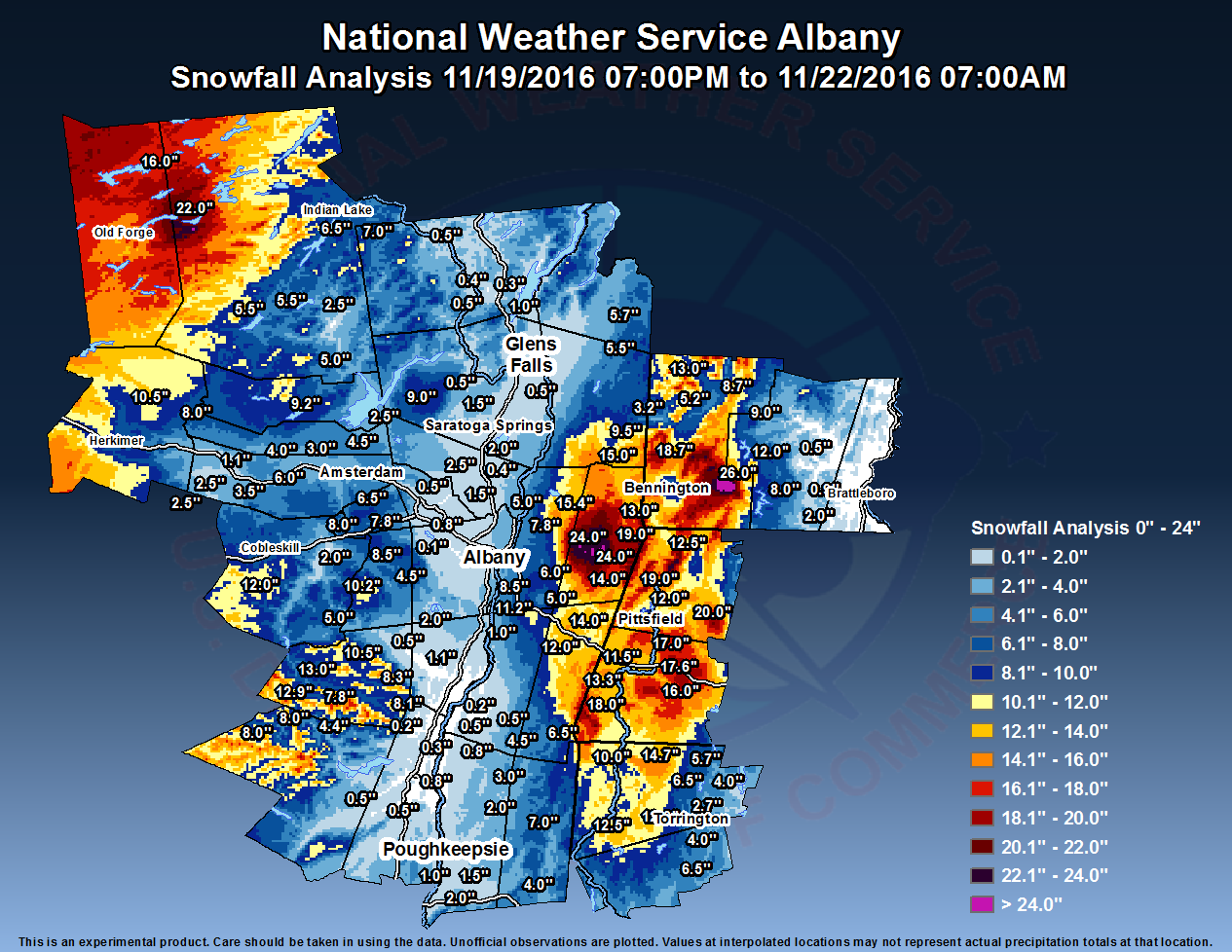
Here is an example of the Nov 2016 upslope storm I was talking about. This was purely upslope IIRC, but also a very blocked flow one too I believe. Woodford had 26", Stratton area 9" looking at that map. (ALY has the Woodford area shaded too far east on the map--they always do for some reason-so bump that really dark shading over west a bit.)
Sweet conversation I always love learning more about that region as it one of the coolest micro-climates in the area. I mentioned a few weeks back about the Woodford snowmobile club Having some trails back into the higher Glastenbury terrain. I Remember I skied Stratton on March 14th 2018. It was a phenomenal day and snow depths were very impressive throughout the whole region. This day in particular I remember the Northwest flow upslope was supposed to be cranking in the area... but not at Stratton. Lighter snow all day but not significant accumulations. I took the weenie drive home to New York down through Woodford instead of Manchester. I came down the Southeast side of Stratton. Beautiful homes in there. I reached rt-100 and the 2400’ section before dipping down to mount snow base area and they had some crazy piles near that pass and excavators plowing driveways but their still wasn’t much upslope snow. The snow pack decreases as you head down towards mount snow and then Wilmington. Once I got to Rt-9, passing through Searsburg and reached woodford, no surprise the snow was cranking. It happened so suddenly. I remember my friend and I passed the empty prospect mountain parking lot and turned around to go have some fun and spin a few donuts lol. Half of it was plowed but the other half probably had 3+ft of snow just from the recent storm. We of course managed to beach the Jeep in it for a few minutes while it was almost a white out. Fun times. The snow pack in that area was awesome probably the most I’ve ever seen in a northeast residential area 5-6ft easy. Also you mentioned how mesos always jackpot that area and I would like to believe that as accurate as it is so consistent and shows the sharp eastern cutoff. So long story short I really don’t think it would be a stretch to say that the 3000-3800 area on Glastenbury averages significantly more snow than both Stratton and Mount Snow which seem to be just a few miles too Far East for the best snows based on what you see in Woodford. Others who live in that region have great input about the terrain and microclimates and I always appreciate their great input. That place truly has to be one of the snowiest live-able places in New England and definitely the snowiest that is fairly close to the coast. They’re positioned so well for monster storms and seem to get huge dumps more frequently than basically anywhere. A few 2 foot storms every year and a 3 foot+ storm or better every other year. Truly a weenie heaven that place is.
-
1
-
-
6 hours ago, qg_omega said:
10 inches at Gore of heavy leg burning snow, will see how much more tonight. I didn’t notice much difference from 1500 to 3500 feet
Was at the Cabin in Thurman at 1425’ for the last 3 days. There was about 4-5” of crusty pack when I arrived Thursday. Skied Gore Thursday and Friday with nice machine groomed conditions. Woke up today to some heavy snow. Drove all the way to Speculator to ski Oak mountain because Gore was sold out. It was interesting. On the way The highest point of Rt 8 around 1900’ near Eleventh Mountain, the snow became very grainy, hitting my windshield, but quickly turned back to big flakes as I went down a bit in elevation. It was dumping in speculator when I got to Oak they reported 10” and that was accurate for sure. Dense powder Skied very well. On the drive home the lighter precipitation showed just how marginal the setup was. It flipped between big flakes light snow and light rain a few times depending on elevation. Made it back to the cabin and I estimated about 8” all snow no mix. It was dense and wet. I’d say the town of Warrensburg about 7-10 miles away and lower elevation had half of what I had at the cabin up the hill. I was looking at the reports from Warren County Ny and they seem a bit misleading and underdone for the higher terrain as the highest report is 4”. The snow totals in the higher elevation hills seem to be a bit closer to the 10” reported at Gore and Oak. Overall beautiful scenery in the mountains today. It was an awesome drive and day to ski.
-
1
-
-
9 minutes ago, qg_omega said:
No, that’s a classic track for the dacks, it’s a Gore jackpot track on the NAM and RGEM.
Heading up to Gore for Thursday, Friday but they’re sold out for the weekend. Thinking of trying to hit Oak Mountain for some runs on Saturday. Agreed forecast looks great as of now for Saturday. Looking more and more like 6+ really hoping it holds.
-
1 hour ago, J.Spin said:
I haven’t heard of specific shadowing of Great Lakes moisture anywhere along the spine of the Greens, and I know the Southern Greens can catch some nice snowfall with the right flow (I think that snow that backedge reported on the other day might have been from the lakes?)
With respect to Adirondack-based shadowing up here in the north, the thoughts about the Northern Greens doing notably better than the Central Greens on northwest flow has always made sense. If you look at the image below, you can see that NW winds just skirt past the Adirondacks to hit the Northern Greens, but the Central and Southern Greens would be shadowed. For reference on the relief map, if you look at the northern part of the Green Mountains, you’ll see two big stripes of green cutting through them. The top one is the Lamoille Valley, and the second one down is the Winooski Valley, which marks the boundary between the Northern and Central Greens.
I’ve just always been surprised that we can still catch that Lake Ontario moisture on the 255-260° wind that brings it here into the Northern Greens. That wind has to pass right over the Adirondacks, and even the High Peaks area for the more southern parts of the Northern Greens. It’s as if the more rounded shape of the Adirondacks range lets the moisture get around the peaks easily, but the Greens don’t let much of it pass because they form a long spine and there’s just nowhere for the air to go but up.

I know Whiteface can do extremely well with certain lake effect connections. Gore on the other hand almost never gets In on it as it seems to have trouble getting past the mountains west of Indian lake. I think the high peaks region actually gets a lot of lake effect and snow in general it’s just not documented well. So I don’t think the greens necessarily steal the adk snow rather than its impressive that they still cash in while the Adk’s are getting some as well. Also from that map it’s so evident how the northern greens have incredible topography for NW upslope. It must be like every nor’easter Has to be treated as a 2 part storm up there
-
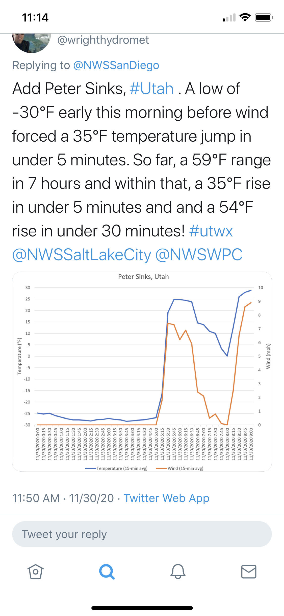
1 hour ago, Juliancolton said:
That stuff is one of the most fascinating aspects of wx for me. One of these days I'll make the pilgrimage to Peter Sinks in Utah. https://en.wikipedia.org/wiki/Peter_Sinks
I hadn’t heard of that place until I saw this a few weeks ago.

-
1 hour ago, Juliancolton said:
I didn't get a chance to upload these screenshots when they were current on Friday night into Saturday morning, but I thought this was really cool. From the moment the BL decoupled until mixing resumed, I was running exactly 10 degrees colder than the air strip 1.7 miles away and 125 feet higher in elevation. Both stations are properly sited, and this pattern repeats often on clear nights, but I've never seen such a big difference. Just a razor-thin inversion with that perfect snowcover. Screenshots at 1:30 and 7:30 am.


Drove home from skiing that night and the car thermometer was jumping all over the place I was confused. When I was in Columbia county I noticed It would fluctuate like 10 degrees within a few miles. Pretty neat.
-
2
-
-
23 hours ago, gravitylover said:
Berkshire East too. I want to do a tour of places like those and Upstate NY is filled with them. It won't happen this year but it needs to happen soon. Another good sized area popped onto my radar this year, Bristol, and with all the extra time I ended up going down the google maps rabbit hole and sorta laid out a trip. If you could hit it on the right weather cycle there are some pretty kickass powder areas around NY like Bristol or McCauley that fly under the radar even better than the New England areas other than a couple. Pico is great, totally gets you that high peaks experience but at this point you'd be more likely to find me at Middlebury Snow Bowl, another one of those killer powder hills.
McCauley has to get some crazy lake effect dumps. I’m hopefully planning a trip to Tuckerman’s Ravine this spring. Hiked up Mount Washington this summer and realized I need to go back for the skiing experience
-
1 hour ago, backedgeapproaching said:
This shows the Dendrite/Gene area relative minimum for big events(at least to the rest of NE). This map will look different now obviously. The second tweet
Cool map. I’ve seen his maps before. He does some pretty accurate post event analysis. Shows my areas max of about 2 feet pretty well.
-
17 minutes ago, gravitylover said:
I love that place.
Me too. There and Pico Mountain are both great alternatives to the corporate resorts and offer that traditional skiing experience for an affordable price.
-
skied Magic Mountain up in Vermont yesterday, it was opening day for the upper mountain and by noon they had dropped the ropes on everything. The snowfall increased a bit as I drove up through columbia county but by the time I got to Manchester Vt the depths were very impressive. It was beautiful up there after the fresh snowfall and cold temps since. Settled powder depth on the hill was around 24-30" and I had waist deep first tracks on a few runs. Overall Incredible day
-
2
-
-
10 minutes ago, wxeyeNH said:
I am always skeptical of these crazy totals. I did see the twitter video of the guy (was it in S VT?) that posted is 36" yard stick disappearing. Seemed legit. Since Danbury NH is only 2 towns SW of me I decided to take a ride there this morning. The 48" was reported 2.2 ESE of town center. I drove to a location within 1 mile of that. At 1030am this morning I took a few measurements in flat areas that would have been sheltered from yesterday's sun. I measured 24". A guy across the road saw me out there and came over to talk to me. He said that he measured 40" after the storm and that there was a ton of settling yesterday. I totally agree since I saw that I lost 9" of settling of my 24" pack. So 40" seems accurate. 48" is too high unless the observer cleared the snowboard every 6 hours. The weight of 4 feet of snow is must be substantial especially a 15F dry snowfall.
Here is a picture from Danbury that I took on my trip. Remember this is after a day after 100% sunshine.

That report of 48” must of came from near ragged mountain. Regardless of the accuracy at 2000ft there they must have been crushed
-
I just looked at 2 different reports from Ludlow. 44”at 930am was at 1800ft and 41” at 10am. I checked the radar loop and snowed till At least 2pm in that area. You’d expect even higher storm totals then the final measurements If those were accurate. Were those reports tossed for some reason?
-
3 hours ago, backedgeapproaching said:
Honestly, it was such a short window of heavy snow you mostly likely only had time for 1 clear. Someone probably could have had 46-48" I think possibly. I think the CO-OPs measure in a 24 hour window and clear their board at that time, so the Peru VT CO-OP probably cleared at 7am (or whatever obs time is?) and then had a fresh board for post 7am snowfall (someone can correct me if Im wrong about the Co-op clears?) So the 44.8" they had was with 1 clear most likely.
You’re definitely right that the window of snowfall was perfect to get high reports with the clearing. This reminds me of an intense lake effect snowfall just Incredible in a short window. What are the rules regarding clearing? I thought it was ok to clear every 6 hours but has that changed now? Does it vary for Nws, Coop, or CoCoRaHS?
-
2 hours ago, backedgeapproaching said:
Crazy to think I got 32" and was fringed by the meat of the mega band by 3-4 miles. Took a tour one town to the north of me where the big totals were and found 31-32" settled depth at 11am this morning! This was in East Dorset in the valley at 730ft, not some 2k east slope spot. No question they had 39-40" OTG with no clears.
Went to Magic today and the snow on the drive up from NY was incredible once you hit Manchester. Do you think a favorable location probably had 50” if they cleared?
-
Skied Magic mountain today. Untouched since they opened upper mountain today. Settle powder was at least 2 feet id guess. Incredible skiing for basically one storm this season
-
58 minutes ago, IrishRob17 said:
Well that didn’t go as expected...1.35” melted down giving me around a 8:1 ratio. I know I had crappy flakes, some resembling tiny styrofoam balls, but I wasn’t expecting a ratio that low. I know I dumped it after Monday’s event. I’m melting down a core sample off one of my snow boards now to see what I get there. Anyone else calculating ratios?
I saw a 1.61 in Poughkeepsie. If I had 9 or 10 to 1 ratio that adds up to about what I measured
-
 1
1
-
-
Did the kuchera maps even underestimate this lol
-
27 minutes ago, powderfreak said:
Yeah I mean those rates are the only way to get like 41” of depth in 11 hours. They had bare ground at midnight. At some point it had to be like a foot an hour.
Im blown away, I’ve never seen anything like that.
12am... bare ground
11am... 41” depth.

Outside of lake effect I don’t know If something like that has happened. Valentine’s Day 2007 potentially? That was a bit longer duration tho wasn’t it?


January 16 2021 - Inland runner Rain/Snow/Wind
in New England
Posted
Nws Albany claimed they reported 12” at noon and then 22” at 5pm. The initial 12” has to count 2-3 days? The 10” this afternoon seems a little high but maybe plausible they were getting hammered on radar.